Croatia's Environmental Affairs in 2021: New Nature Park, Progress in Waste Sorting
ZAGREB, Jan 2021 - Croatia's environmental affairs in 2021 were marked by the declaration of Dinara as the 12th nature park and the awarding of the status of UNESCO designated site to the Mura-Drava-Danube Biosphere Reserve.
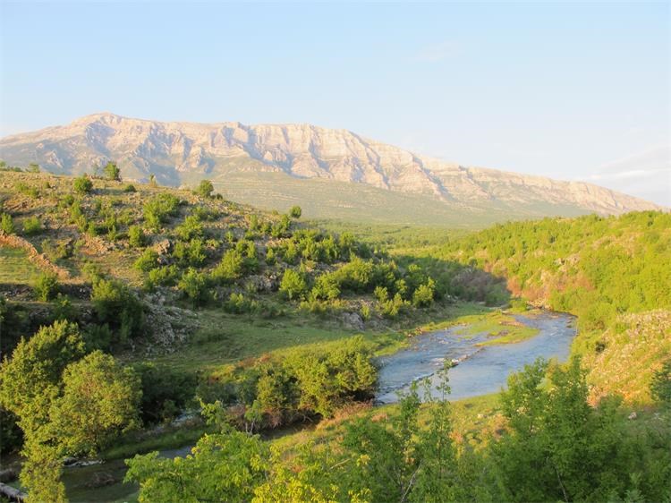
On 5 February, the Croatian parliament unanimously adopted a law declaring Mount Dinara the 12th nature park in Croatia. The nature park encompasses Croatia's section of Mount Dinara as well as Mt Troglav and Mt Kamešnica, the upper course of the Cetina River and the Hrvatačko, Paško, and Vrličko karst fields. It extends over two counties - Split-Dalmatia and Šibenik-Knin -- measuring almost 63,000 hectares in area. Dinara is part of the Dinaric Alps, also commonly known as the Dinarides, a mountain range in Southern and Southeastern Europe.
On 15 September, UNESCO's international coordinating council designated the transboundary biosphere reserve which stretches along the Drava, Mura, and Danube Rivers as the first biosphere reserve extending through five countries: Austria, Slovenia, Croatia, Hungary, and Serbia. The Mura, Drava, and Danube Rivers form a 700-kilometer-long green belt, also known as the Amazon of Europe, connecting almost a million hectares of unique terrain with significant natural and cultural heritage, becoming the first five-country biosphere reserve in the world.
Legislative activities in environment protection
In July, the Croatian parliament passed a law banning the use of plastic carrier bags that are between 15 and 50 microns thick as of 1 January 2022, while other types of plastic bags will be phased out in the coming period.
A project aimed at better management of plastic waste has begun, and the first comprehensive national statistical survey on food waste was conducted.
The Ministry of Economy and Sustainable Development said that a strong positive trend of waste separation, collection, and recycling continued.
The waste sorting rate in 2020 was 41%, rising by 15 percentage points since 2016. Of the total municipal waste, 56% was landfilled and 34% recovered, which is an increase of 13 percentage points compared with 2016.
Prelog among best towns in Europe in sustainable waste management, Šibenik builds Bikarac waste management plant
In mid-December, the Zero Waste Europe network published new best sustainable waste management practices in Europe, including those in the northern Croatian town of Prelog and 11 neighboring municipalities.
Prelog, the first Croatian town to adopt a zero-waste strategy, and 11 neighboring municipalities (Belica, Donja Dubrava, Donji Vidovec, Sveta Marija, Goričan, Donji Kraljevec, Kotoriba, Dekanovec, Domašinec, Martijanec, Podturen), improved their result in total waste sorting from 57.25% in 2019 to 65.23% in 2020.
On 21 December, the City of Šibenik's waste management center began a test run of the HRK 245 million Bikarac waste management plant, with Economy and Sustainable Development Minister Tomislav Ćorić praising Šibenik for setting an example to other cities on how to resolve the issue of waste management. Currently, about 73,000 tonnes of waste is delivered to Bikarac with more than 40,000 tonnes of municipal waste. The capacity of the mechanical-biological plant is to process about 70,000 tonnes of waste a year.
In June, Parliament adopted the national low carbon development strategy until 2030 with an outlook until 2050.
For more, check out our lifestyle section.
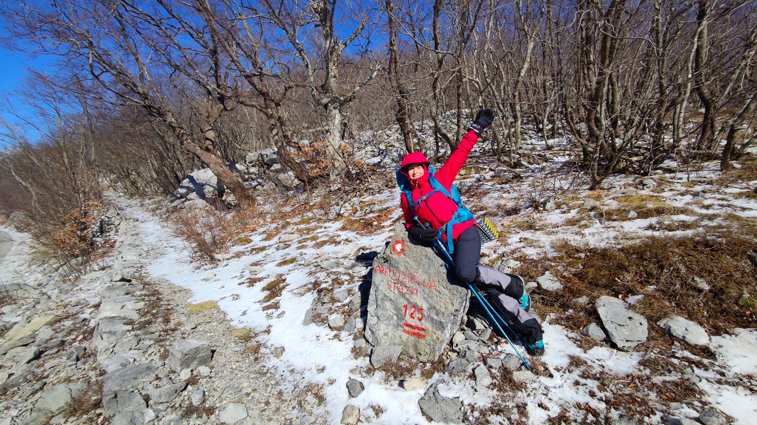
Croatian Couple Completed Via Adriatica Trail in 54 Days, Liked Dinara Most
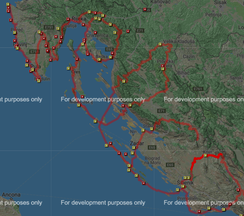
February 24, 2021 – TCN recently interviewed Josipa and Matija on their 1,100 kilometers long journey, and now this Croatian couple completed the Via Adriatica trail with success... but not without the headache of the demanding Croatian mountain regions and changeable and unpredictable weather conditions.
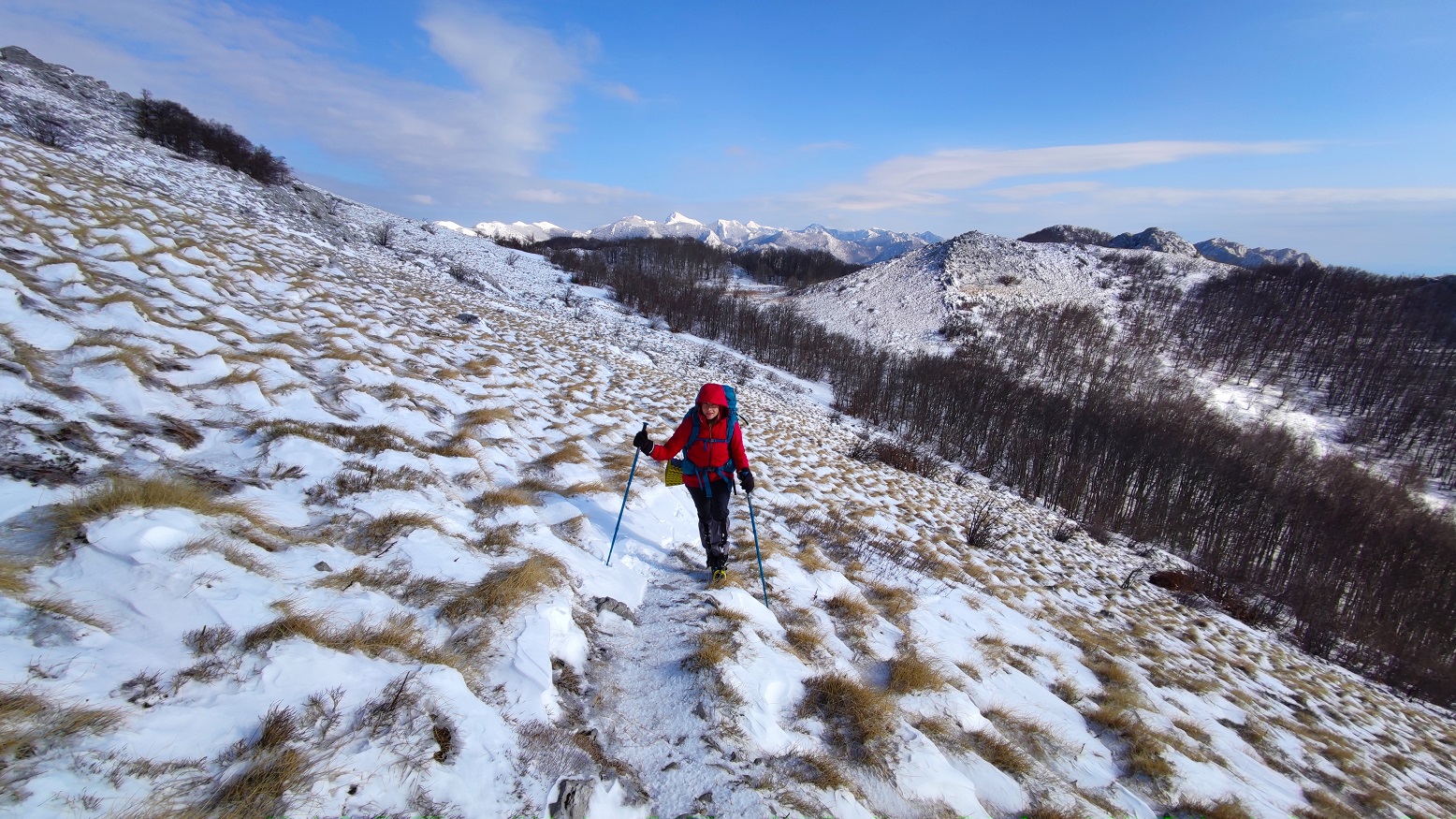
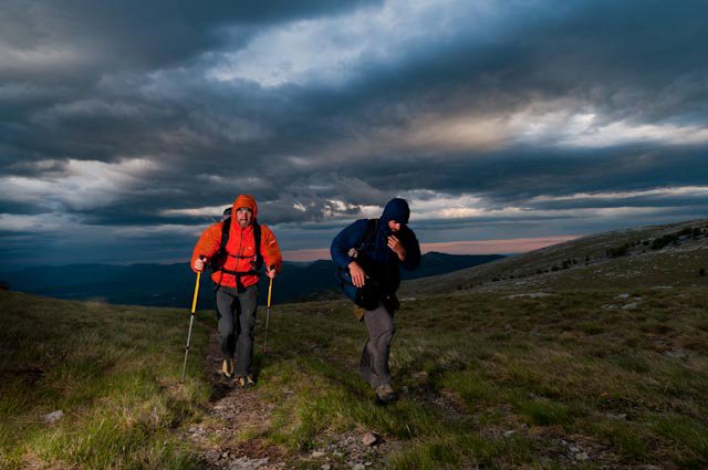
Josipa and Matija set off on the Via Adriatica trail on January 1, 2021, starting from Prevlaka, the southermost peninsula in Croatia. The last time we talked to them was one month ago when they were at Svilaja mountain, not even half of their journey. Yesterday, after 54 sunny, rainy, snowy, foggy, and windy days, this Croatian couple completed the Via Adriatica trail.
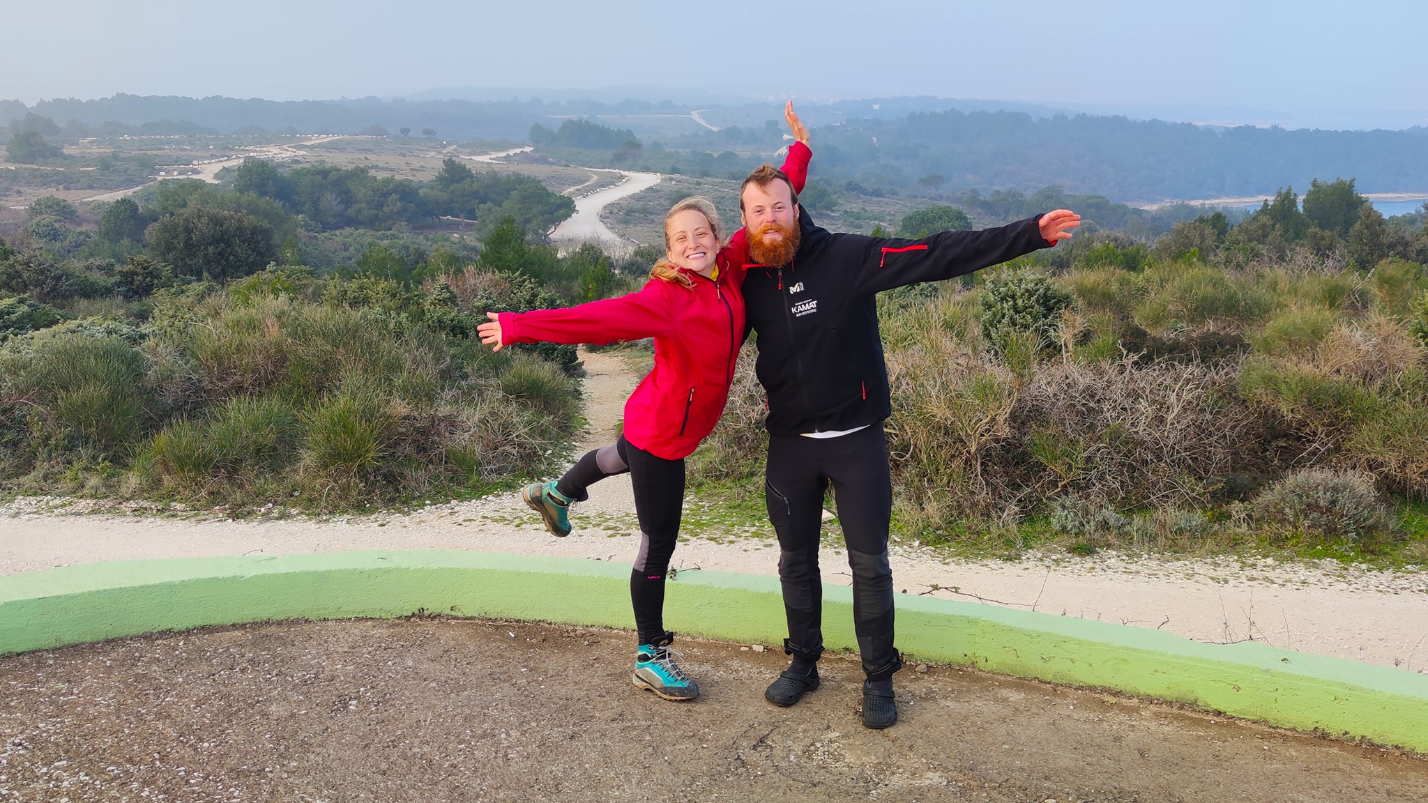
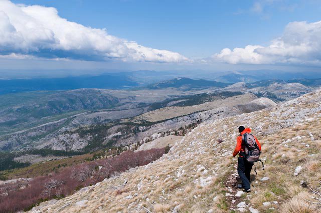
In the meantime, the Dinara mountain, a newly declared Croatian 12th National Park, amazed them the most, while Velebit mountain showed all of its natural power and broke them with snowstorms. However, after successfully overcoming all the climbs, peaks, sections, weather troubles, they finished their journey at Cape Kamenjak in Istria.
Lost in a minefield
Since Svilaja mountain, when we last heard from each other, the weather conditions created many problems for Josipa and Matija. First, due to the heavy rain, they could not move from the shelter for three days, and the weather forecast was getting worse and worse. They had to move on because there was no point in waiting anymore.
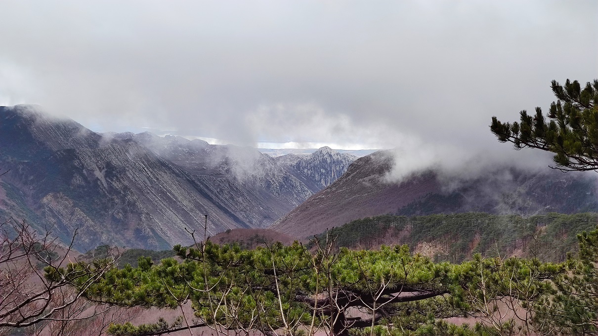
On the Dinara mountain, on the way to a shelter called "Vjetre s Dinare" ("Wind from Dinara" meaning Croatian stormy wind bura), they went through the fog, rain, icy rain, wind, and finally – through a minefield.
"We followed the markings, which at one point got lost because there was snow. It was a thick fog. We didn't see anything; the GPS didn't work either. So we went on our own about 200 meters. We saw a board in the distance, turned backward on us. We thought we would see something written on it, some marking! We climbed up, turned, and looked – 'caution, minefield, please don't pass this way.' I can't describe how we felt at that moment, without a trace, in the middle of nowhere. Besides, we were followed by a dog, a Turkish Kangal, which normally eats wolves," describes Josipa the moment when her whole life passed before her eyes.
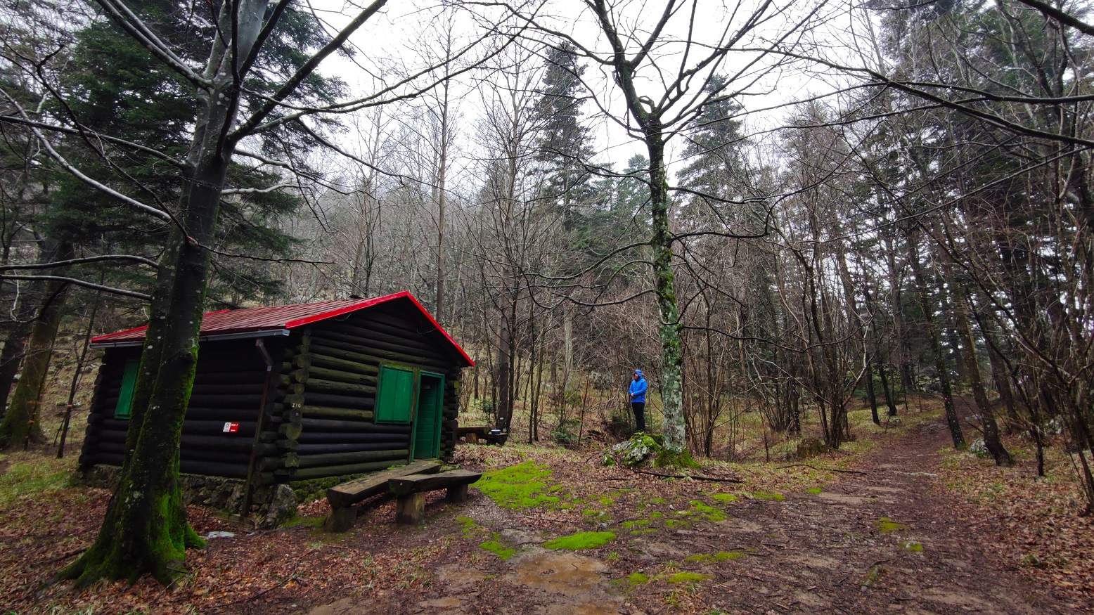
Still, they somehow managed to get to that "Wind from Dinara" shelter, apparently so named for a reason. However, that's where another struggle started – lighting a fire.
Real Himalayan conditions on Dinara
All the wood was wet, and Matthias struggled to light the stove. Due to the rain falling for the previous three days and over which the snow was falling, their boots were completely wet. Wood splitting and lighting a fire caused them many problems on the way, which, they admit, took a lot of energy and nerves.
"This whole heating situation was forcing us day after day to pick up bags and warm-up, so we went to bed around 7 pm every day," says Josipa.
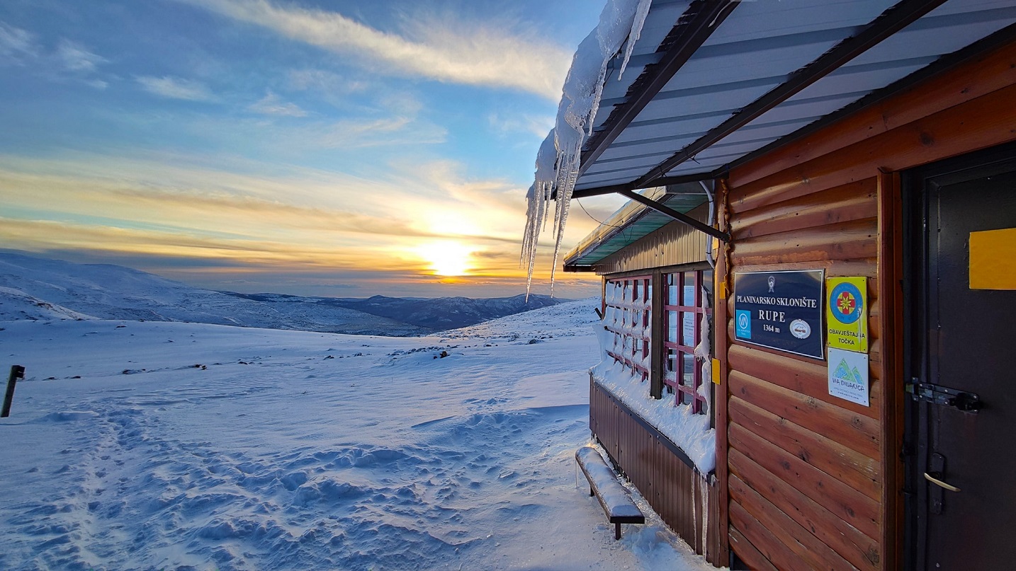
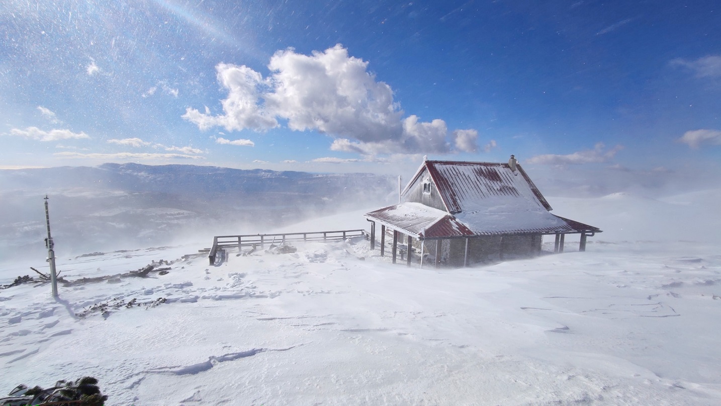
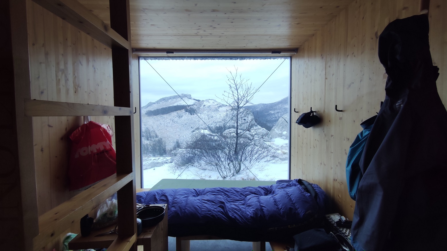
Mountain lodging Rupe on Dinara
On Dinara, they felt the power of the bura wind for the first time, which even extinguished the fire during one night in the shelter. All the smoke entered the small house, and all attempts to ignite the stove failed.
"It was freezing, minus 10 degrees Celsius, and the feeling reached minus 20 degrees with 110 km/h of gusts of wind. We experienced real Himalayan conditions on the Dinara," says Josipa.
Fortunately, they had warm sleeping bags with them – that were even too hot! Josipa and Matija couldn't believe that they were lying in a room while it's minus degrees while being hot in feathered bags. That's what it means for a mountaineer to have the right equipment. Still, they took advantage of those windy days to take photos and enjoy.
Mountain lodging Pume on Dinara
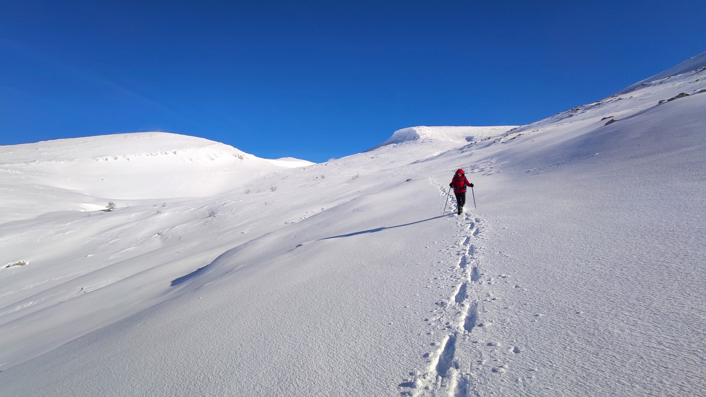
In the end, they had to leave the shelter and, despite a strong bura wind on which was difficult even to stand, let alone walk, they moved on. As the sun always comes after a storm, the weather finally calmed down, and it was beautiful.
Dinara – idyllic, fascinating, special, spacious, beautiful
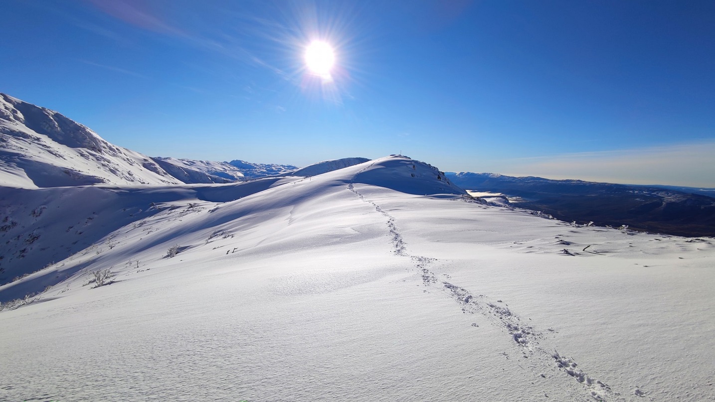
The path towards Lišanjski Peak, the highest peak of the southern Dinara, they say, is a magical place that cannot be described but must be experienced. It is also the furthest point from civilization on the entire route.
"You are in the middle of nowhere. There is nothing in sight, no city, no roads, and everything around you is white. Everything is full of white peaks and hills. Idyllic. If someone threw me here and asked where I was, I would certainly not say that I was in Croatia," says Josipa.
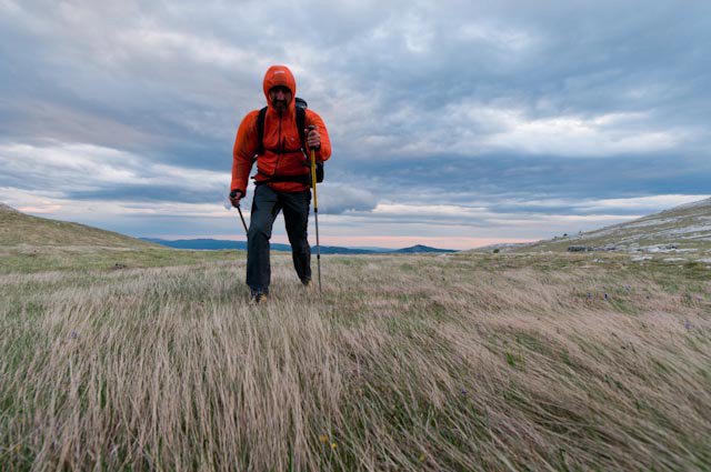
Josipa on Dinara
Matija on Dinara
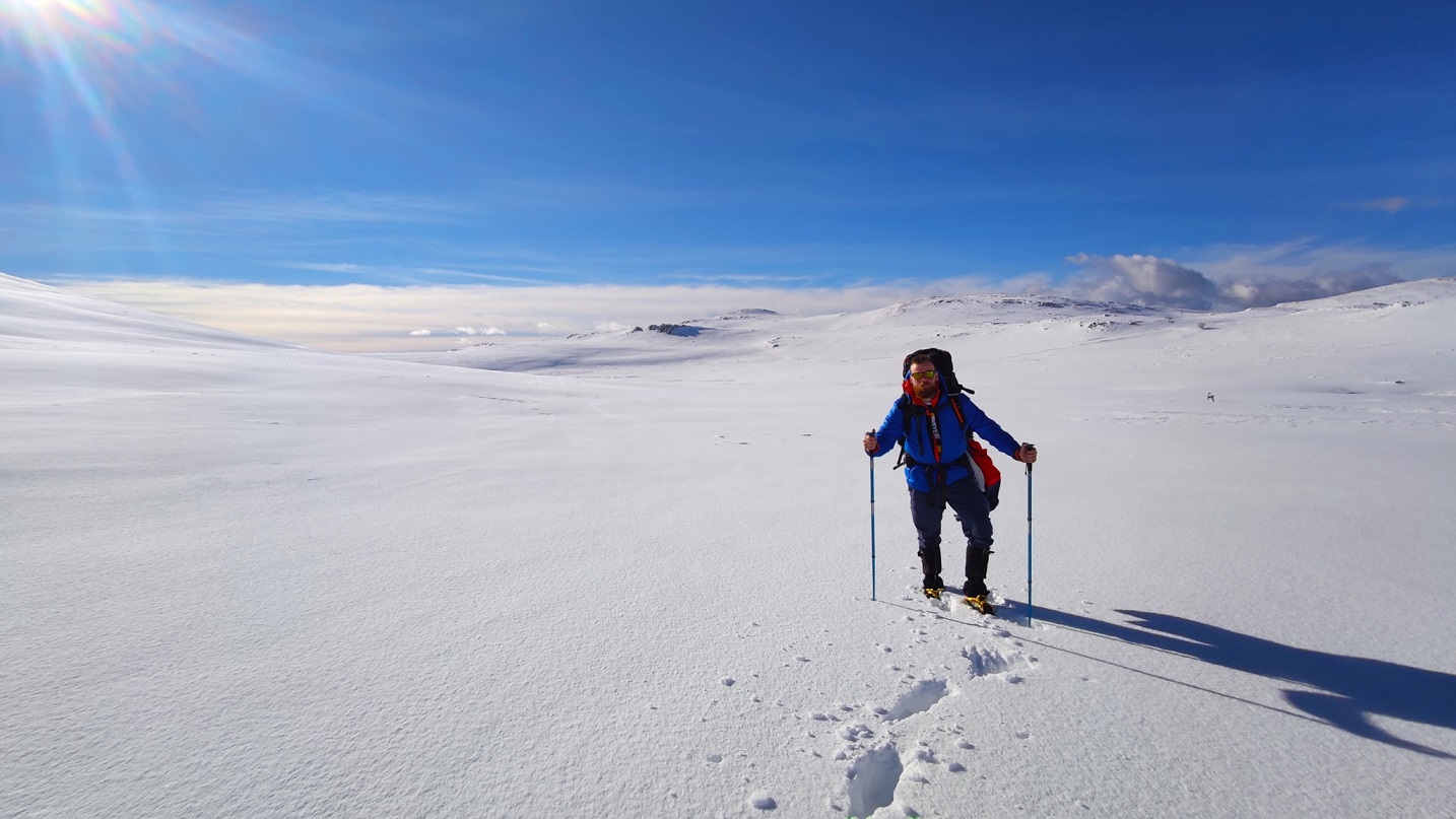
And Lišanjski Peak itself is fascinating – you can see Bosnia, Dinara, the Cetina River source. In those hours and 15 minutes of climbing, they saw many fresh traces of bears, but (fortunately) no bear jumped out in front of them.
That part of the trip was the most beautiful, they agree. The weather was good. They even walked in short sleeves, though the snow had not yet completely melted. This incredible experience will remain in their memory forever. And when they descended to the source of the Cetina, Lišanjski Peak seemed so far away. An exceptional experience, unique energy, and a special ambiance, they say.
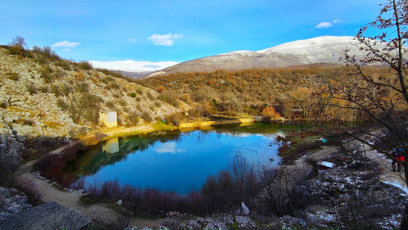
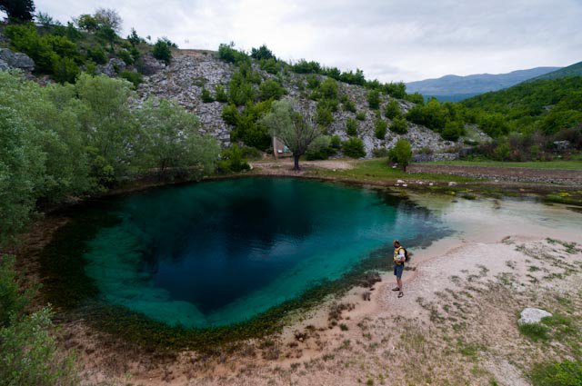
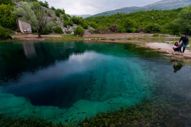
The source of Cetina River
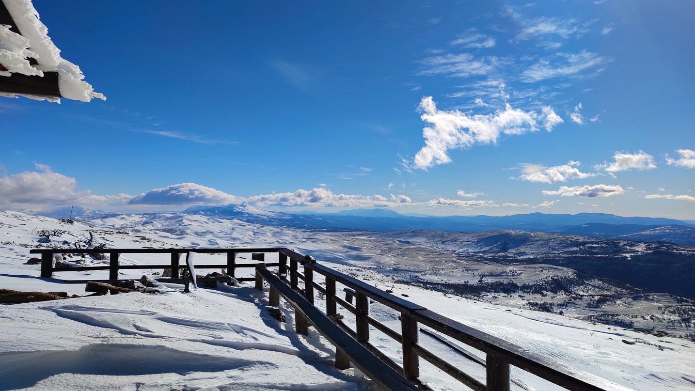
For Sinjal, the highest peak of Dinara and Croatia, they have no words. Now that they saw it under the snow, it seemed ten times more magical than in September when they first experienced it.
"We were standing up at the top, watching, and we couldn't believe where we had come. On one side, you see Biokovo that we passed. On the other side, you see Velebit that's waiting for us. We were proud of each other and ourselves. I get little chills when I think of that part," admits Josipa.
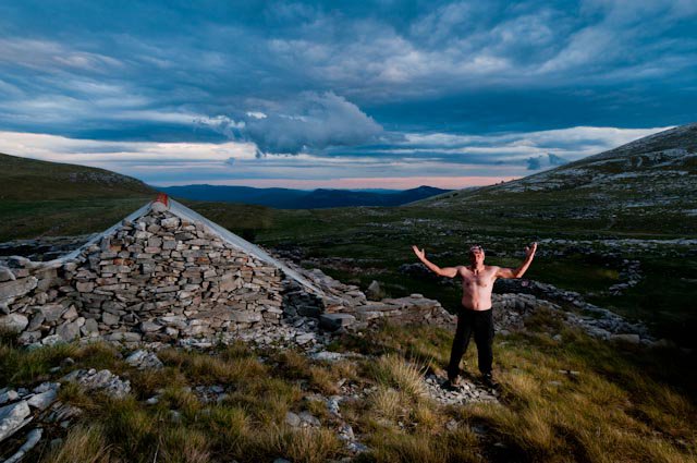
Dinara
Dinara
"Dinara is so spacious, so beautiful. Of all the mountains on this road, the Dinara has remained most etched in my heart and memory," says Josipa.
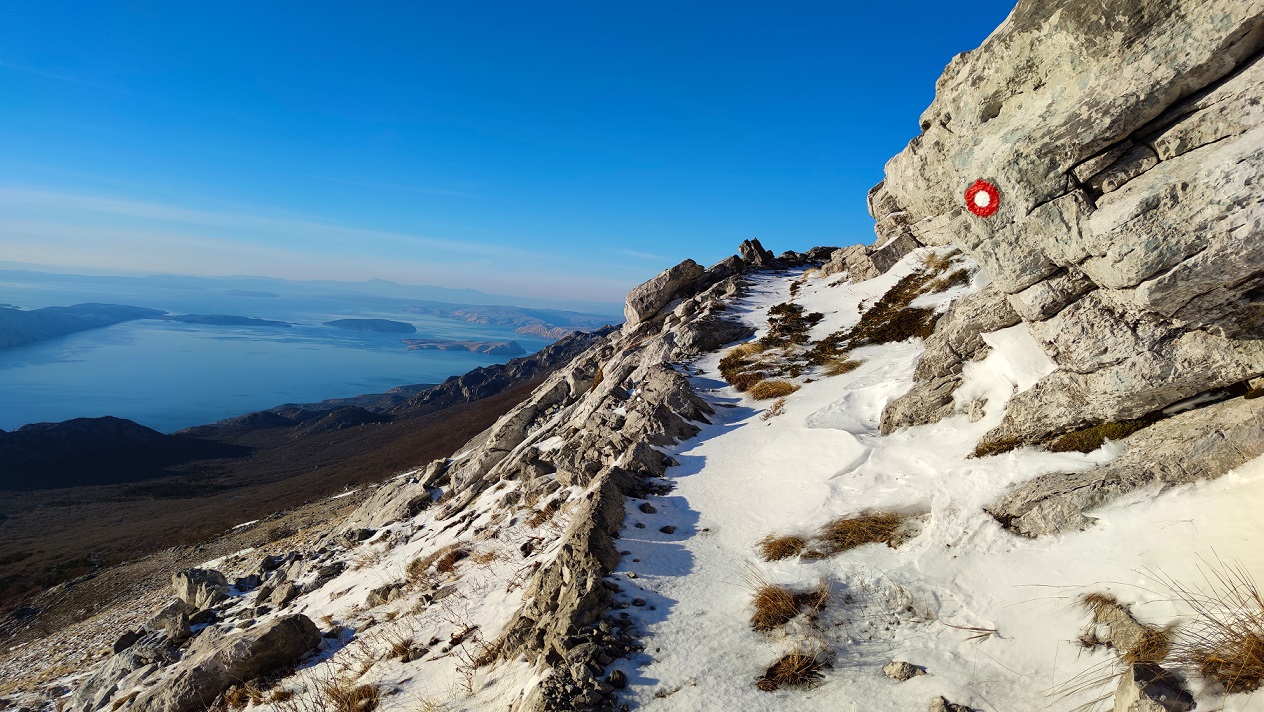
Velebit – almost giving up
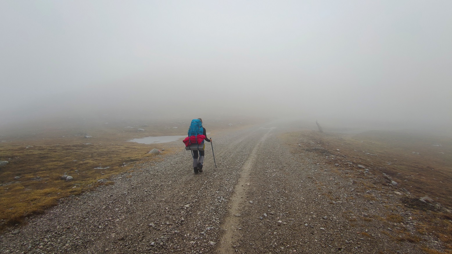
They walked an average of 25 to 30 kilometers a day to the Dinara, and since they came to Velebit, they had been moving like snails. The weather conditions did not allow them to move faster than 10 kilometers a day.
On Velebit, they again got in a minefield, more precisely a demined area, also due to fog. The fear from Dinara returned. Everything around them was white – down because of the snow, up because of the mist, or clouds in which they were. They were disoriented. Then they realized that it was too dangerous to continue the journey.
Apart from the weather – alternating rain, south wind, bura, minus – their problem was every arrival at the next shelter. There were tears in those moments, they admit.
Šugarska Duliba on Velebit
There were some challenging days along the via Via Adriatica trail for this Croatian couple
They could not continue in the rain, especially in the thunder, because it is common knowledge that many mountaineers die due to thunder. However, luck was on their side. One friend drew their attention to a shelter that was not marked on the map, making their journey and planning easier.
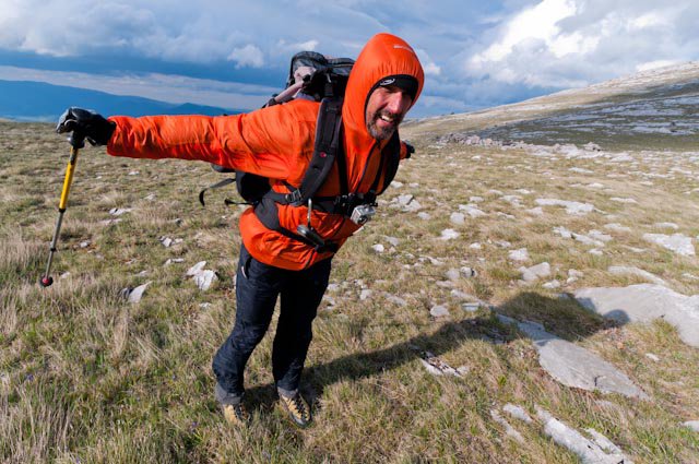
On Velebit, they experienced a storm of all storms, with bura gusts of 150 km/h. In places where it pounded them, they barely adhered to sticks, arms, and legs. In one part, the bura even lifted them off the ground.
Josipa on Velebit
"Right in front of Baške Oštarije, where a warm bed and meal was waiting for us, the bura was blowing so much that it lifted us off the ground. If we were a pound lighter, we would probably fly into the air," says Josipa, adding that bura and cold take the most energy.
On the famous Premužić trail, cut into the slope, they thought it would be easy. However, when the snow fell, everything froze, and the track did not exist. It cost them time, energy, and nerves. It was a mental and physical breakdown, a difficult period.
"When the weather is great, the terrain is a disaster, and when the terrain is great, the weather is a disaster. Eternal struggle on our path. We were both sad and disappointed after Velebit because of that. Biokovo and Dinara got along so well, then we came to Velebit, and we thought it would be great because it's familiar to us," says Josipa.
Josipa on Premužić trail on Velebit
Generous help from friends, family, and even strangers
Just before the end of the Via Adriatica trail, in Gorski Kotar, they could barely make their way through the fog, which is why they could not even enjoy the beautiful views. By then, they were slowly fed up, on the verge of giving up, but then, as always in life, friends jumped in. Unselfish support from friends, colleagues, but also strangers came from all sides and gave them extra wind in their backs so that they would not give up when there are already so many successfully traversed sections behind them.
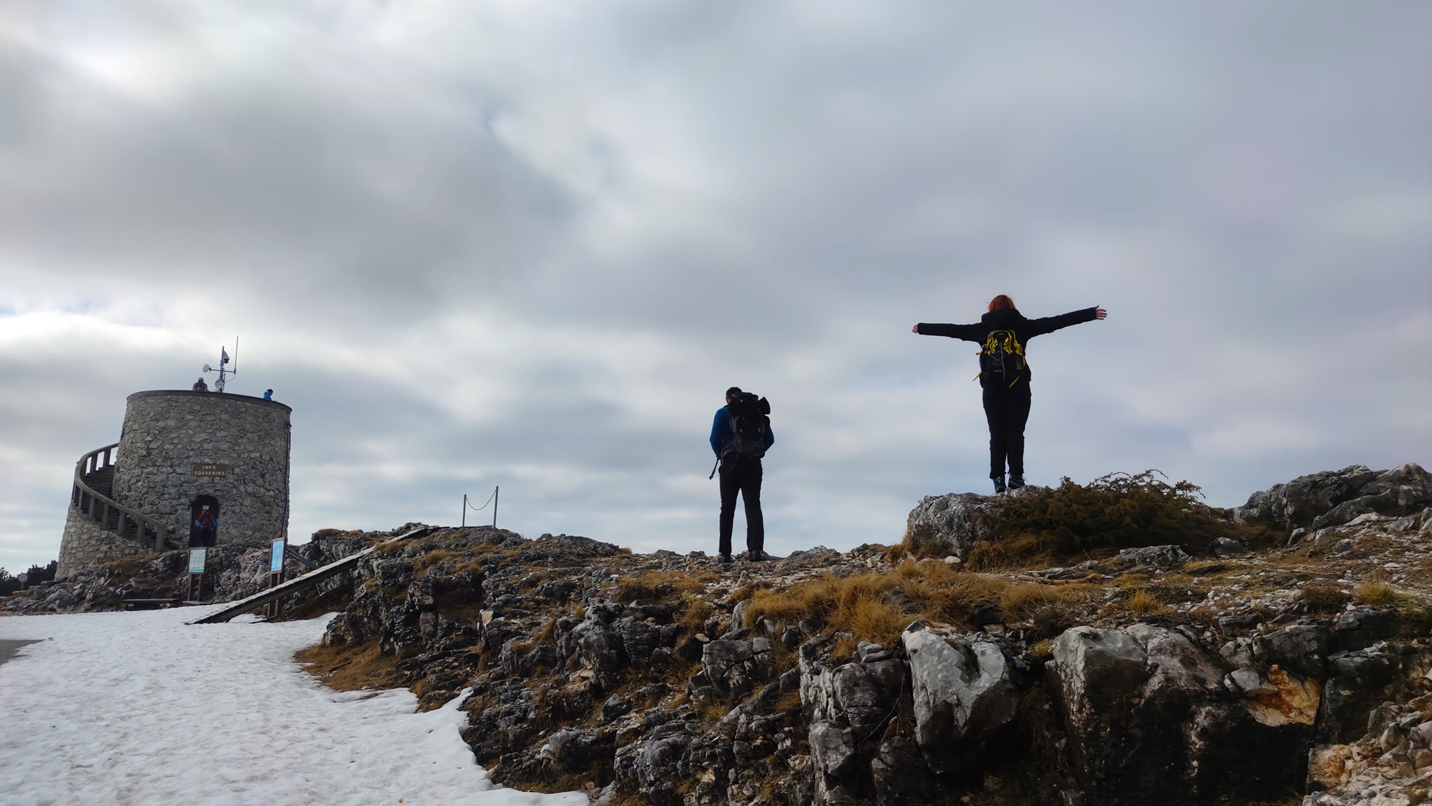
Josipa and Matija on Vojak – the highest peak of Učka mountain in Istria, at the very end of their journey
At Cape Kamenjak, their final destination, they were greeted by family but also by a few unknown people who were supporting them online. Friends couldn't welcome them because of work, but they're preparing a party on Saturday to frame and mark this whole story.
Although they hoped to finish the trail in mid-February, the weather proved to them to be patient and that sometimes things had to go according to nature's plan, not human's. They became patient with each other as well.
"When you spend so much time together, 0-24, you have to make some compromises. As a couple, we function very well, and we support each other when it is hardest," says Josipa.
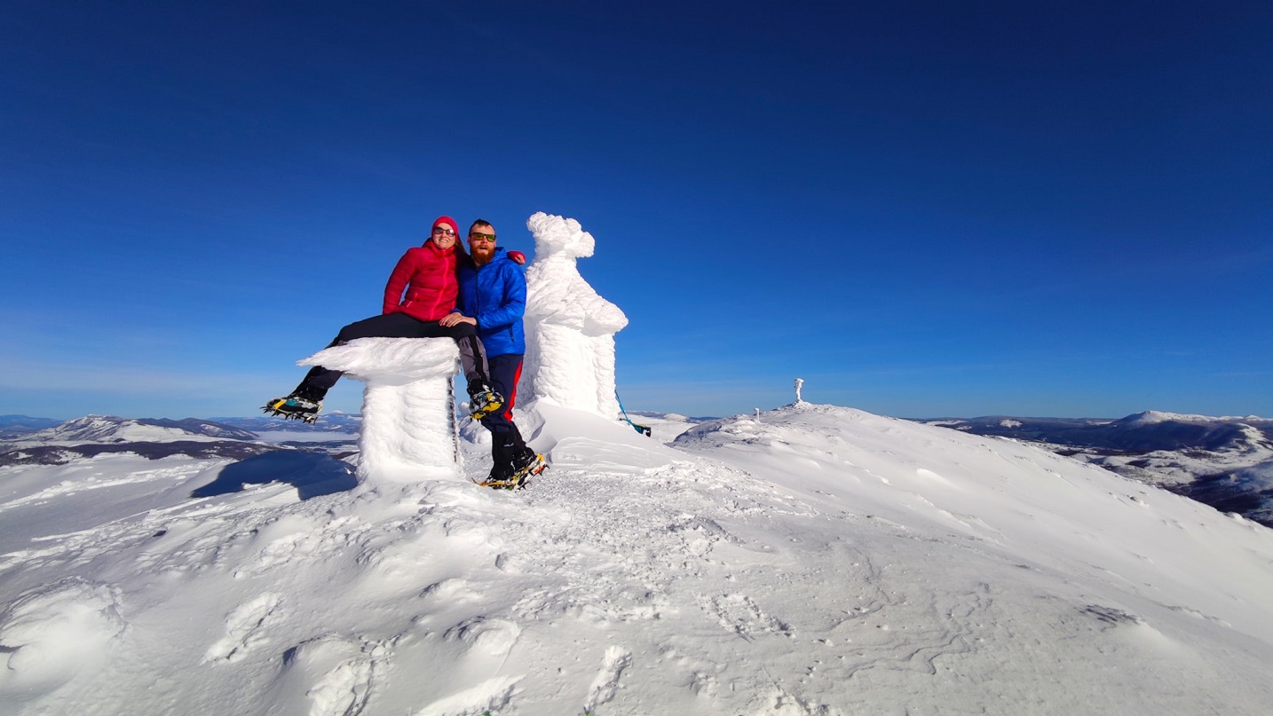
Josipa and Matija on the Sinjal Peak – highest peak of Dinara and whole of Croatia
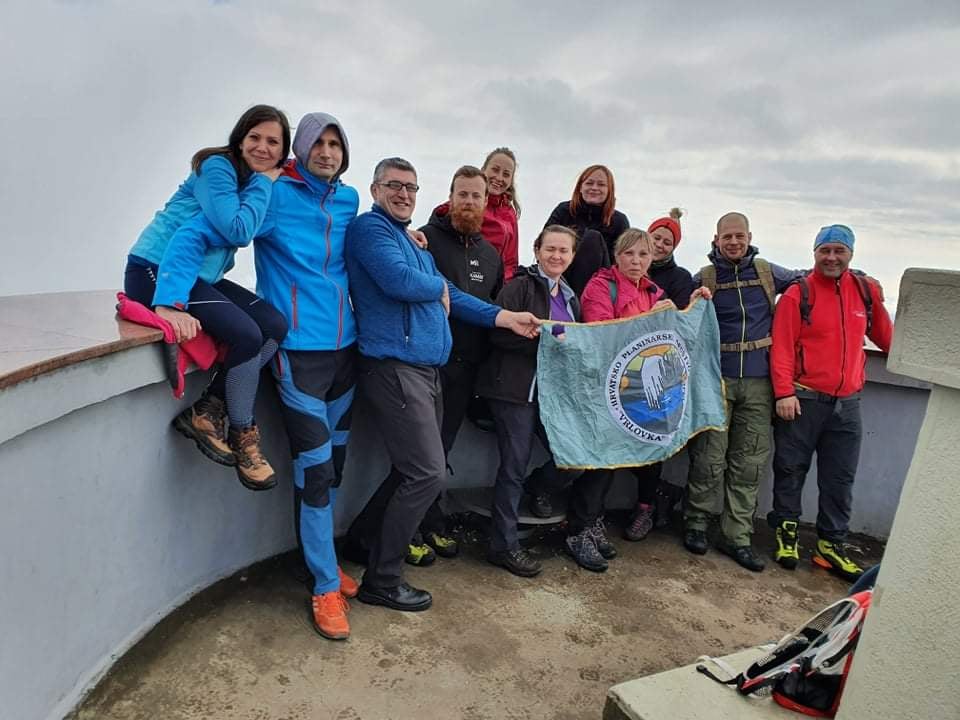
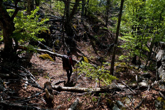
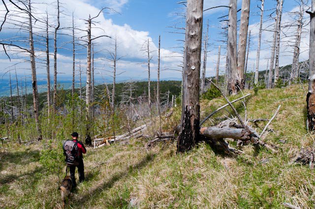
Except for roe deers and a few lynxes, they didn't see any wild animals along the way, only a multitude of wolves' and bears' traces, small and large. Also, they were mostly alone along the way, occasionally accompanied by a group of other mountaineers, as well as some beautiful and lovely dogs. However, as they say, they would not survive this trip without the generous help of their friends from Mountaineering Association Vrlovka, who would come and wait for them along the path to give them food and equipment. The fearless team of that mountaineering association even walked with them on Velebit's part while a strong bura wind was blowing, providing Josipa and Matija immense support.
'We wanted to promote the beauty of Croatia, Via Adriatica trail, and active lifestyle'
When asked whether they would dare to retake this path, they agree they wouldn't after all the troubles they faced along the way. But, if asked that question in a week or two, they would definitely say yes, but only under better weather conditions.
Winter has its charms, but it is also exhausting. It requires a lot of hiking equipment, and it is much more dangerous to go in winter than at any other time of year. If Josipa and Matija could choose, they would go in the spring or late fall. When in the mountains in Croatia, one should be humble and patient.
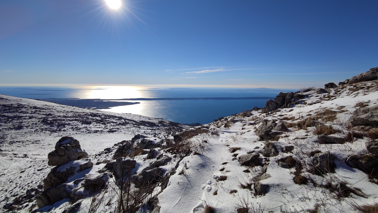
View of Croatian islands from Velebit
"Our goal was to promote the beauty of Croatia, to promote Via Adriatica, and to promote an active lifestyle, especially now at this time of the corona when we are all locked in our homes. I think that hiking is a wonderful hobby, both for the body and for the mind, whether in a company, in a couple, or alone," says Josipa.
Although Josipa and Matija are experienced mountaineers (Matija is even a member of the Croatian Mountain Rescue Service – HGSS), the tour was very demanding for them, both physically and mentally. Considering that they only got a chance to set off on Via Adriatica now, during winter, because Matija's work has been banned and Josipa is having a vacation, the winter conditions did not favor them. But regardless, they enjoyed the inexplicable natural beauties of Croatia and met many generous life-long acquaintances along the way.
"It's hard to describe all those feelings that go through your mind and heart along the way. To understand what we are talking about, it is the best to set out on such a journey on your own," advise Josipa and Matija.
All the photos are from interlocutors' private archives.
You can follow Josipa and Matija and their other hiking journeys on their Facebook page.
For the latest travel info, bookmark our main travel info article, which is updated daily.
Read the Croatian Travel Update in your language - now available in 24 languages.
Croatia Declares Mount Dinara 12th Croatian Nature Park!
February 5, 2021 – Croatia gets one more protected area as Mount Dinara becomes the 12th Croatian nature park.
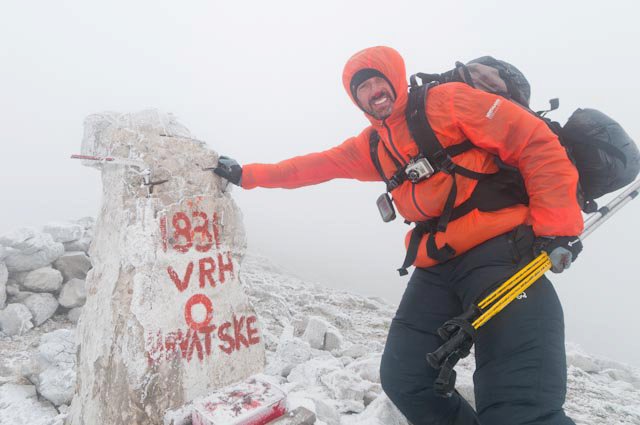
Today, the Croatian Parliament proclaimed the Mount Dinara Nature Park. The Park will encompass the area of the Dinara massif (Dinara, Troglav, and Kamešnica), the Cetina River's upper course, and the Hrvatačko, Paško, and Vrličko karst fields. The highest peak of Croatia – Sinjal (1831 m), is located in the Park, too. These mountains are part of the Dinaric Alps, also commonly known as Dinarides, a mountain range in Southern and Southeastern Europe.
As the Minister of Economy and Sustainable Development Tomislav Ćorić said, the Mount Dinara Nature Park proclamation is an important moment for nature protection in Croatia, reports the Ministry.
"Mount Dinara Nature Park has become the 12th nature park in Croatia. Together with eight national parks, we have completed a set of 20 protected areas in the categories of nature and national parks," said the Minister.
Source: Ministry of Economy and Sustainable Development
With an area of 63,052 ha, Mount Dinara Nature Park stretches through Šibenik-Knin and Split-Dalmatia counties. It is thus the second-largest nature park in Croatia, after Velebit Nature Park.
With the proclamation of Mount Dinara Nature Park, the share of protected areas in Croatia's land area, together with the area of the ecological network Natura 2000, makes 39 percent of Croatia's land area protected. There are 11 areas of the Natura 2000 ecological network in the Park area – two conservation areas important for birds and nine conservation areas important for species and habitat types.
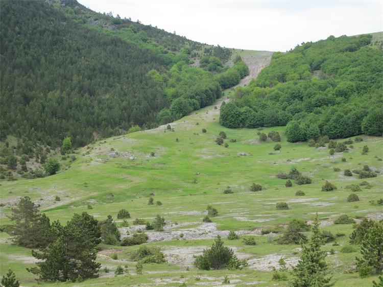
The Park area is rich in other values derived from the centuries-old tradition of human use of space – semi-natural habitats, indigenous breeds and varieties, and rich cultural and historical heritage. The Dinaric karst is a phenomenon recognized at the international level that covers a much wider area, and it was named after the Dinara as a type locality.
Source: Ministry of Economy and Sustainable Development
Over 1000 plant species live here, a fifth of the total Croatian flora, and 75 of them are national endemics. Also, over 20 endemic animal species live in this area, and due to the untouched vast complexes of forests and grasslands, it is essential for our large carnivores – wolves, bears, lynxes. High Dinaric grasslands are the most important locality in Croatia for the yellow mountain viper (Vipera ursinii macrops), an endemic Dinarides snake species.
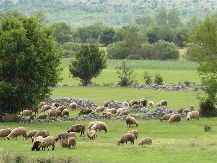
The protection of this area will have positive effects on nature conservation, but also the population and the economy of the wider region. The revitalization of extensive livestock is expected, as well as other traditional activities and new opportunities for sustainable use of space.
Source: Ministry of Economy and Sustainable Development
To read more news from Croatia, follow TCN's dedicated page.
Dinara to Become Newest Nature Park in Croatia
May 17, 2020 - There are currently 11 Nature Parks and 8 National Parks in Croatia, though that number could soon increase with the Dinara Nature Park.
Namely, HRTurizam reports that the Ministry of Environmental Protection and Energy sent the Proposal of the Law on the Proclamation of the Dinara Nature Park for consultation with the interested public through the e-Consultation portal.
This would thus protect the Dinara massif (Dinara, Troglav and Kamešnica), the source part and the upper course of the Cetina river and karst fields (Hrvatačko, Paško and Vrličko) along the Cetina in the category of a nature park.
Adopting the proposed law would create legal preconditions for the establishment of a public institution, adoption of the spatial plan of the area of special features and management plan of the Nature Park "Dinara" which would regulate, in more detail, the protection, improvement and use and management of this protected part of nature, points out the Ministry of Environmental Protection and Energy.
Visit Knin
The protection of the Dinara massif in the category of the nature park is of special interest to the Republic of Croatia to preserve the original natural values, rich geodiversity, wild species and endemics and the overall diversity of natural habitats such as water habitats of the Krka and Cetina rivers with their tributaries, wetlands, rocks and taps, forest and cave habitats and other natural values derived from the centuries-old tradition of human use of space, semi-natural habitats, indigenous breeds and varieties and rich cultural and historical heritage preserved in numerous archaeological finds and cultural and historical sites.
The consultation is open until June 1, 2020, on the e-Consulting portal.
Dinara is Croatia's highest peak - 1831 meters above sea level.
Although many do not know, there is a great interest of foreigners, who, as tourists, visit the Croatian coast in the summer to climb the Dinara.
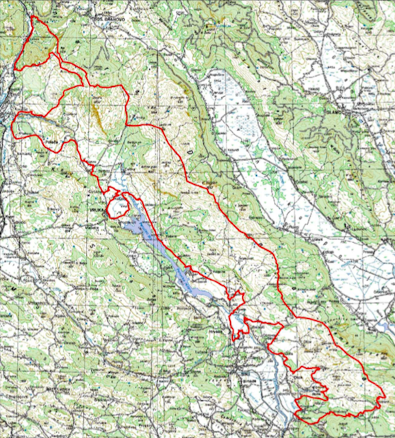
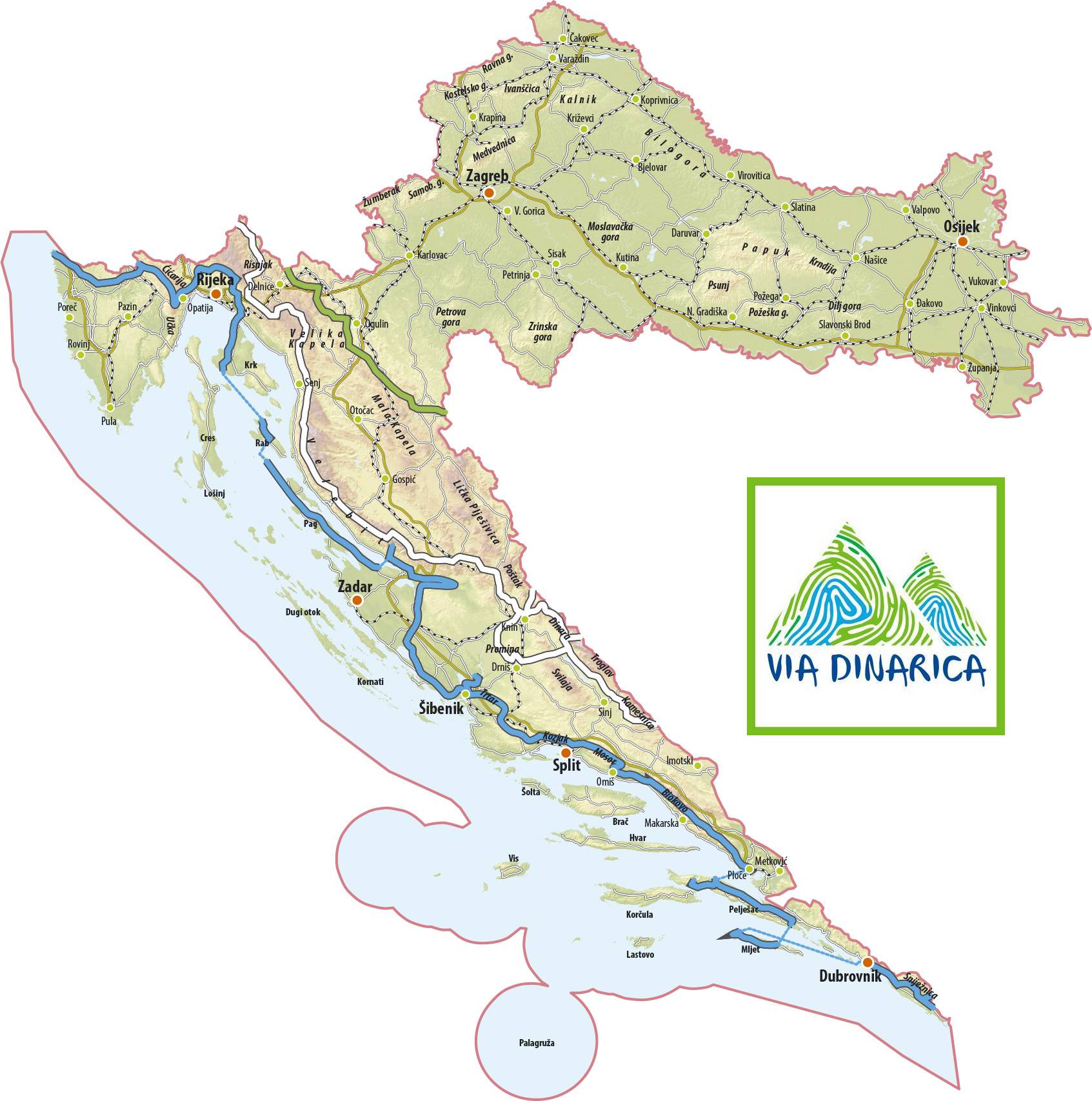
Via Dinarica, is a mega-mountain and hiking trail, which connects natural and cultural sights in the Dinarides, and is recognized as a great development opportunity and potential for Slovenia, Croatia, Montenegro, Serbia, Kosovo, and especially for Bosnia and Herzegovina.
Via Dinarica is a route intended for mountaineers, cyclists and other excursionists who visit the Dinarides as tourists, but at the same time, a platform for the development and improvement of living and working conditions for people living in the Dinarides. One of the basic goals of the project is, in addition to mountaineering activities, to promote the local economy and thus bring tourists closer to local food, accommodation, various services and the like.
Visit Knin
The Via Dinarica road consists of three main directions (corridors) - three parallel routes.
The blue line follows the Adriatic coast connecting the coastal series of the Dinara mountains, the white line covers the high Dinarides, and the green line the inner Dinarides. All three lines of the Via Dinarica corridor stretch along the Dinaric area of Croatia, and partially touch.
In Croatia, Via Dinarica visits six national parks (Risnjak, Northern Velebit, Paklenica, Plitvice Lakes, Krka, Mljet), four nature parks (Učka, Velebit, Vrana Lake, Biokovo) and two strict nature reserves (Bijele and Samarske stijene and Hajducki and Rozanski kukovi on Velebit).
In Croatia, the Dinaric mountains stretch parallel to the Adriatic Coast, which is an additional experience for all adventurers. You can find out more about Via Dinarica HERE
To read more about travel in Croatia, follow TCN's dedicated page.
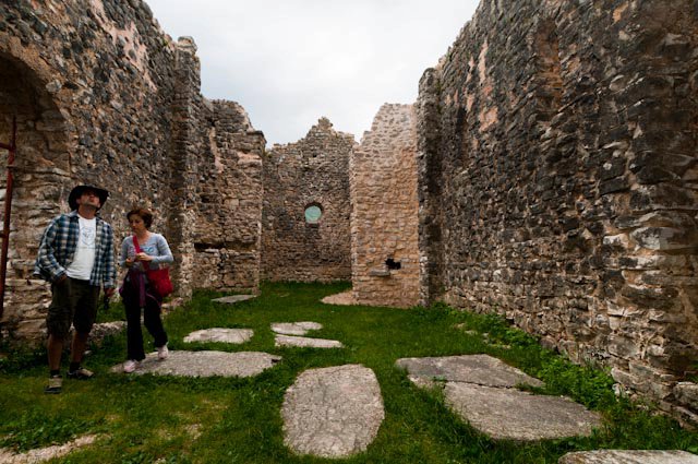
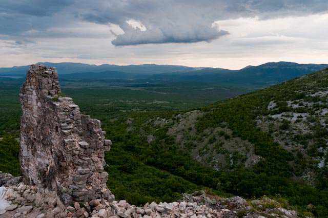
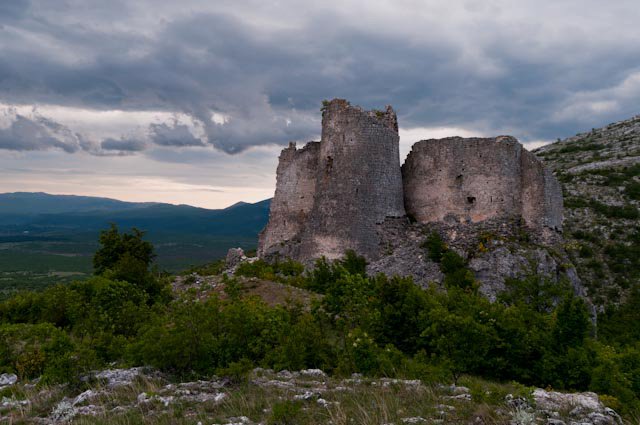
VIDEO: How Much Do You Know About Glavas Fort?
March 1, 2020 - Split photographer EdoStuff Aviation captures the Glavas fort ruin.
Dalmacija Danas writes that the Glavas fort is a ruin in the medieval and the early modern town of Glavas in Croatia.
The fort was built on a rock that dominates Pekas on the slope of Dinara, which descends towards the valley around the source of the Cetina River.
In addition to the defensive walls, some parts of the fort are also defended by inaccessible terrain, especially from the west, where the terrain plunges into a gorge. Today, the fortress is approached from the village of Glavas, some three hundred meters away. You can access it by a hiking trail from which you can take to climb to the top of Dinara.
Glavas fort got its present name only in the 17th century, as expected in the village of Glavas in the Municipality of Kijevo. From the north, it protected the area of the source of the Cetina River and the access through the highest peaks of Dinara and Unista from the direction of Livno and Glamoc fields in Bosnia and Herzegovina.
The route has been used since prehistoric times for the needs of local livestock and mountain grazing, but it is not yet clear whether any essential Roman roads went along this route into the area of the Livno Field. The location of the fort suggests that this is the point from which it is easiest to control a possible enemy penetrating behind Dinara in present-day Bosnia and Herzegovina. In prehistoric times, at the site of the fort, there was a hill fort to control this important point, which was confirmed by small findings during research.
Historical information about the Glavas fort reveals, first of all, its former name: on the famous map of Matea Pagana from the first half of the 16th century, it is called Dinaric. Even then, the Ottomans held it. The Glavas fort (Dinaric) at the end of the Middle Ages (in the 14th or 15th century) was owned by the Croatian noble clans of Čubranović, Mišljenović and Berislavić and there is no historical or archaeological evidence that it was built before that time. Medieval pottery and metal can be dated only from the 15th century. The Ottomans conquered the Glavas fort, apparently at the beginning of the 16th century, and held it continuously until the beginning of the 18th century, when it was abandoned and its decline began.
Check out the video of the Glavas Fort from Split photographer EdoStuff Aviation below.
To read more about lifestyle in Croatia, follow TCN’s dedicated page.
World's Biggest Welcome in Croatia: Day 35 - Dinara to Roški Slap (Foot, Bike, Canyoning)
April 27, 2019 - Putting Croatian adventure tourism on the map, with the biggest welcome in the world. Day 35 of this incredible 2011 adrenaline trip covering 2,500 km along the Croatian coast.
The World's Biggest Welcome, an ambitious adventure tourism project in 2011 in Croatia enters Day 35 of this 2019 appreciation of one of the finest tourism promotion projects ever in Croatia.
The plan? To showcase the diversity and fabulous offer of adventure tourism in Croatia by following a GPS route the length of the Croatian coast in the shape of the word 'Welcome' - thereby creating the biggest welcome in the world from a hospitable tourism country.
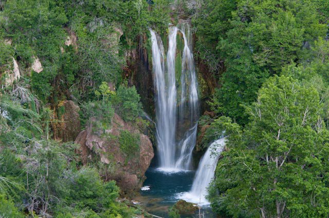
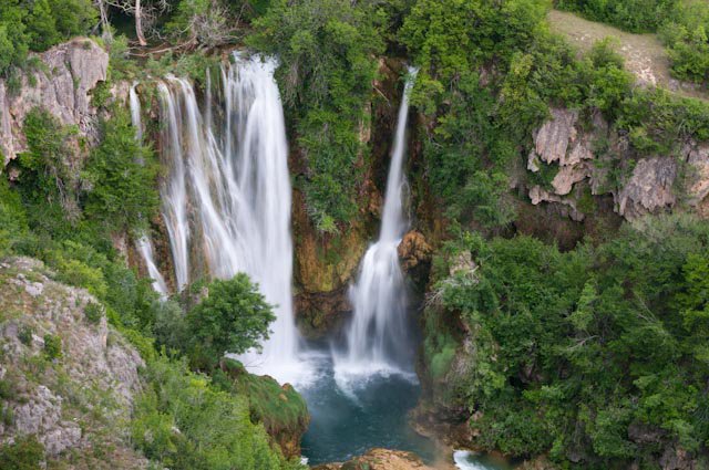
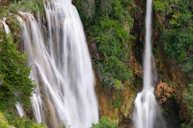
Day 35 moved from the Dinara to Roški slap (waterfall).
56 kilometres for the day: 6 km on foot from Dinara to the Krčić creek, followed by a 15 km bike ride from the Krčić creek to the Krka river, and 35 km canyoning from the Krka river to the Roški slap to begin forming the ‘O’ in ‘Welcome’.
Day 35 set off towards the highest peak of Croatia, Dinara.
Lacko was even accompanied by a stray dog!
The wind, however, was anything but light.
And it was so strong, it turned everything into ice.
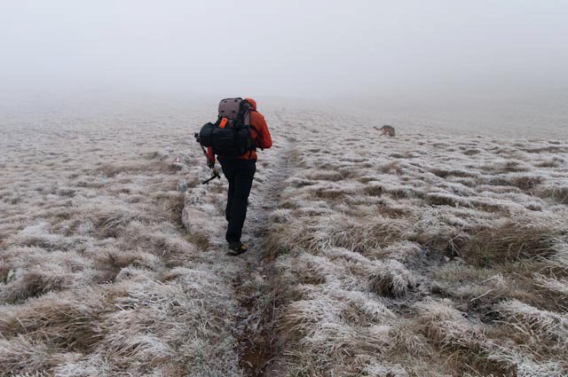
The visibility was worsening.
The wind even made it hard to move at some points.
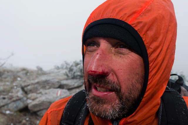
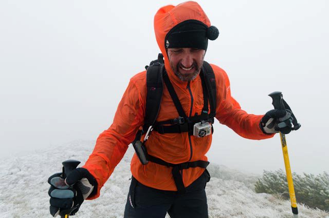
And it made their noses bleed.
They found a path where they could walk relatively normally.
And finally made it to the highest peak in Croatia. Lacko is holding on so he wouldn't get blown away. The group had to crawl on the ground for almost an hour, and couldn't even lift themselves to go on all fours. When they tried, they were blown away 2-3 meters!
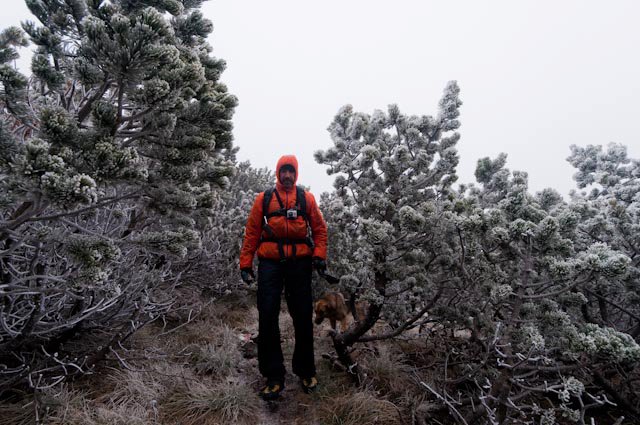
And back down they go.
The dog even survived the Dinara and continued following the group.
They made it to Krčić.
And where the Krčić creek and spring of river Krka meet.
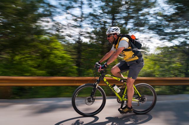
Lacko pedaling alongside the Krčić.
Through Knin and onto Krka.
The Krka river.
A key part of the project was promoting tourism, and the official website has details of the key places visited during the day.
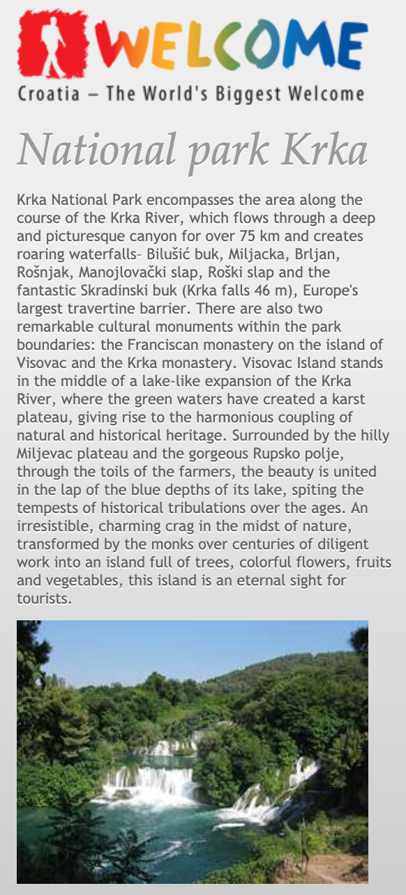
Krka National Park.
You can see the entire project on the Welcome website, as well as much more of Luka Tambaca's stunning photography on the Welcome Facebook page.
Tune in tomorrow for Day 36, as Lacko moves from Roški slap to Primošten.
To follow the whole project from the start, follow the dedicated TCN page.
World's Biggest Welcome in Croatia: Day 34 - Sinj to Dinara (Kayak, Bike, Foot)
April 26, 2019 - Putting Croatian adventure tourism on the map, with the biggest welcome in the world. Day 34 of this incredible 2011 adrenaline trip covering 2,500 km along the Croatian coast.
The World's Biggest Welcome, an ambitious adventure tourism project in 2011 in Croatia enters Day 34 of this 2019 appreciation of one of the finest tourism promotion projects ever in Croatia.
The plan? To showcase the diversity and fabulous offer of adventure tourism in Croatia by following a GPS route the length of the Croatian coast in the shape of the word 'Welcome' - thereby creating the biggest welcome in the world from a hospitable tourism country.
Day 34 moved from Sinj to the Dinara mountain.

59 kilometres for the day: 15 km bike ride from Sinj to Peručko Lake, followed by a 17 km kayak ride at Peručko Lake, 21 km bike ride from Peručko Lake to Glavaš, and 6 km on foot from Glavaš to Dinara to begin forming the ‘O’ in ‘Welcome’.
Day 34 began with Lacko pedaling from Sinj towards Peručko lake.
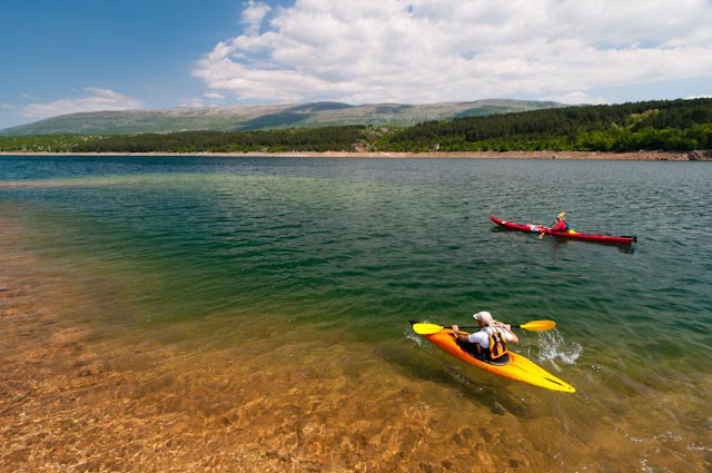
At Peručko lake, Lacko swapped his bike for a bright yellow kayak.
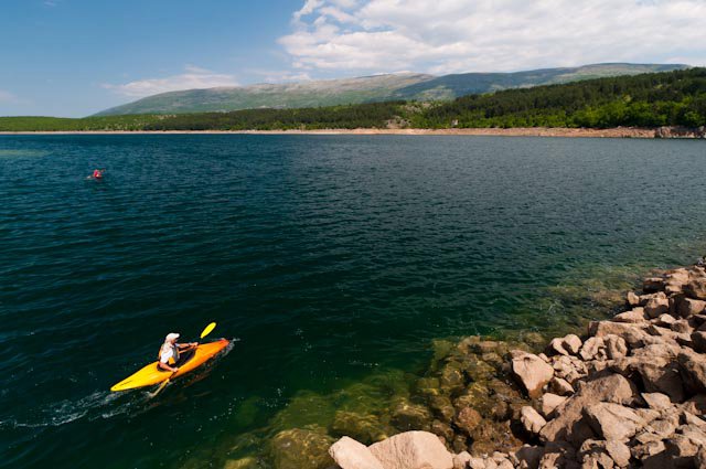
Lacko passing by a dam at Peručko lake.
Lacko checking out the agility of his small kayak.
Lacko swapping his kayak for a bike.
Riding to the bottom of the Dinara mountain.
The view over Dinara.
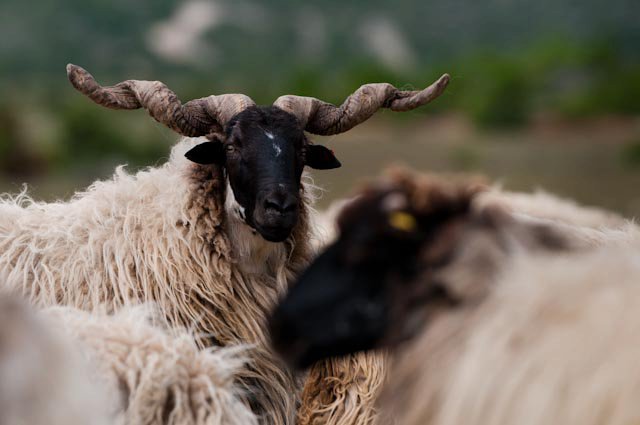
They came across rams.
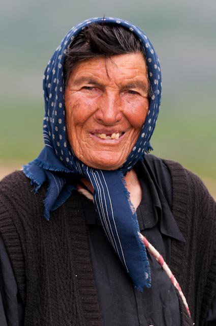
And a shepherdess named Boja.
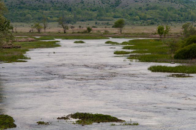
They made it to the Cetina.
And the Church of St. Spas.
Lacko at the source of the Cetina.
Gradina Glavaš.
To the top of Dinara!
Though the bura began to blow.
And coordinator Čedo waited for the crew near the shelter.
A key part of the project was promoting tourism, and the official website has details of the key places visited during the day. Lacko and his crew, however, did not pass any significant landmarks on Day 34.
You can see the entire project on the Welcome website, as well as much more of Luka Tambaca's stunning photography on the Welcome Facebook page.
Tune in tomorrow for Day 35, as Lacko moves from Dinara to the Roški waterfall.
To follow the whole project from the start, follow the dedicated TCN page.
Intangible Heritage of Croatia – Cheesecloth Cheese – Sir iz Mišine
December the 7th, 2018 - The intangible heritage of Croatia is complex and varied, so let us take a look at yet another one, which involves cheese. The preparation of cheesecloth cheese, locally called sir iz mišine, is a long tradition in Dalmatian inland, Dinara, Velebit, Lika, and the western Herzegovina area.
When the initial production of this piece of intangible heritage of Croatia first began isn't known, but even the ancient Illyrians prepared this type of sheep cheese. One of the theories says that production began when milk stored in sheep paunches accidentally started the fermentation process. This kind of milk had whey and cheese, which during that time, became a tradition to make.
.jpg)
The way of making the cheese hasn’t changed much from the beginning. Back then, the cheese was made from whole sheep milk but today it's done with skimmed sheep, goat, or cow milk too. It is preserved in sheep or goat paunches which gives it its typical smell and spicy flavour. It is usually produced during summer from extra sheep milk and it can be consumed from autumn onwards.
In order to make this cheese, one should follow several procedures. First, the paunch should be appropriately prepared, then the milking should be done and milk preparation should follow right after it. The whey should be prepared too. Making and preparing the sheep or goat paunch is important as it ensures good cheese making. The paunch should be properly washed, disinfected and dried from 15 to 30 days.
Knowledge and skill with regard to this craft is traditionally inherited from generation to generation. When everything is ready, the brewing process can start and the product can be stored in the paunches. Finally, the stored cheese needs to age, and then it is ready.
.jpg)
The brewing begins right after the milking and the brewing time depends on the temperature (ranges from 31-35°C to 35-40°C) and the strength of the whey. When the mixture forms a certain structure, the first layer is turned over to even up the temperature of the whole batch, then, it is cut into cubes and should rest until the whey turns into a greenish – yellow colour.
This cheese mass is then put in cloths and subsequently pressed.
After pressing the cheese, salt is added until there is enough cheese to be put into the paunch. If the paunch is filled with cheese one-time only, this ensures better quality. When the paunch is filled, the cheese is shredded and then crumbled. It is important to remove all the air from the paunch to ensure that it matures in controlled conditions (12-15°C). It takes 2-3 months to achieve its specific characteristics and to be ready for consumption.
.jpg)
To produce one kilogram of cheese, you'd need 7-8 litres of skimmed milk or 7-9 litres of fresh sheep or mixed sheep/cow milk. To produce 12 to 15 kg of cheese and 7-8 litres of slurry, you would need 100 litres of whole sheep's milk. The mature cheese is then taken out of the paunch and stored in low temperatures with the appropriate humidity and level of hygiene.
.jpg)
The area where this cheese is made is usually agricultural regions where you can find livestock like sheep, lambs, and goats. To keep this tradition going and in order to continue this type of cheese production, it is important to help to preserve small family businesses and agricultural estates which are involved in making it.
Nowadays, there are some differences in production as the sheep and milk used are different from the traditional type. In addition, technology is used to produce the cheese which makes it higher quality in the modern day.
Despite technology's influence, it is important to preserve most of the traditional ways of making the cheese active by passing down knowledge of this tradition. The final product is often a very rare find on markets and in stores but it can be found on agricultural estates and villages where they still make it.
.jpg)
Make sure to follow our lifestyle page for more information on the intangible heritage of Croatia and much more.
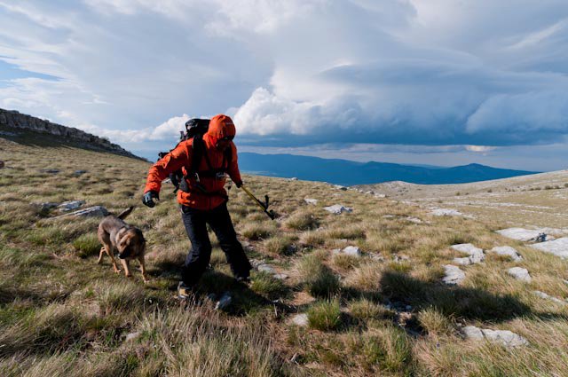
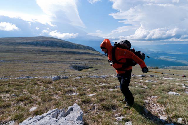
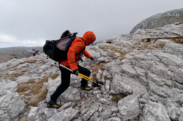
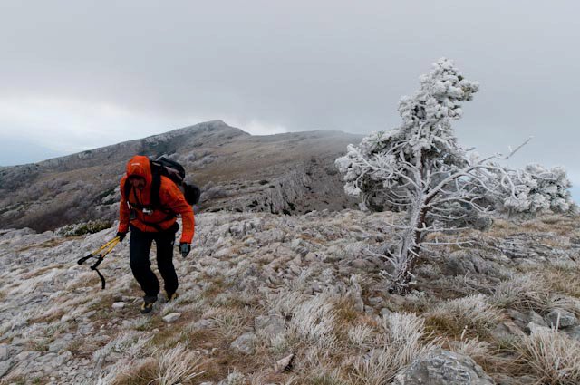
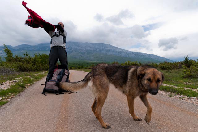
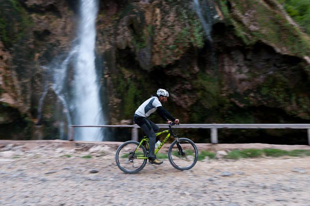
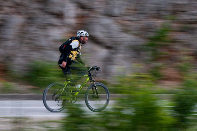
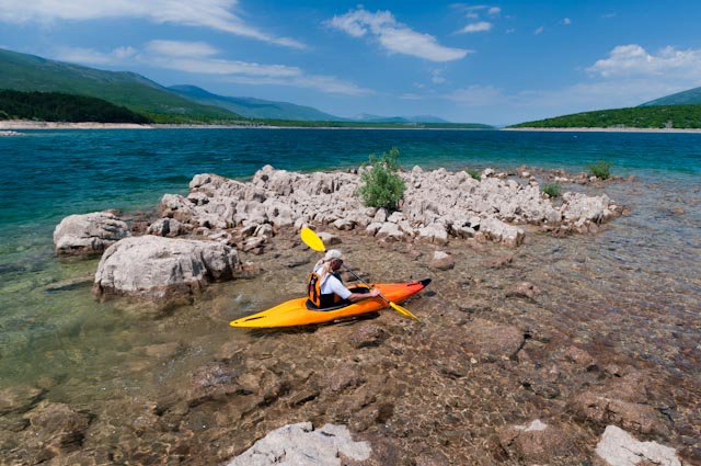
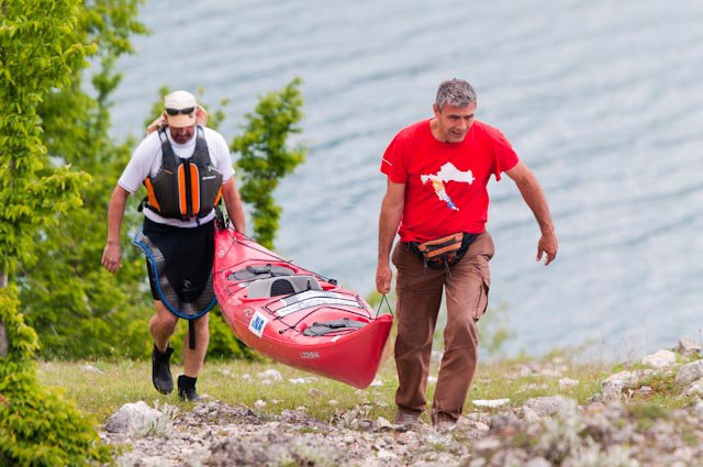
One Man and His Dog: Trail Running the Via Adriatica with Outdoors Croatia
Continuing our look at the adventure potential of Croatia through the one man and one dog team of Outdoors Croatia, this week's video takes us trail running on the Via Adriatica.
Have You Registered for Transdinara Yet?
TransDinara Marathon is an international three-day mountain-cycling (gradual, XCP) race which aims to bring together professional and recreational cyclists from the Croatian region in a safe manner. With a high level of technical organization and hospitality, some of the harshest Croatian territory awaits!