52 Thematic Hiking Trails in Split-Dalmatia County Were Presented
December 22, 2021 - Today, the Tourist Board of the Split-Dalmatia County (TZSD) presented 52 thematic hiking trails of the Split-Dalmatia County in the length of 327 kilometers on the coast, islands, and Zagora.
The 52 thematic hiking trails, which are a new tourist product, represent a step towards active tourism and new tourist content in the wake of the world's search for tourists for a longer stay in the open air with a thoughtful story and original offer, reports HrTurizam.hr. In order for guests to see exactly before they arrive in Central Dalmatia how they can actively relax and walk through attractive landscapes, all 52 thematic hiking trails are processed and presented in digital form and Google Street View with a picture of each of them, and through two brochures - thematic trails islands and other thematic trails of coastal Central Dalmatia.
"Local tourist boards have proposed trails that carry a story or interesting, so the trails are named. Our goal is to disperse tourist traffic throughout the year and in all parts of our county because Central Dalmatia has all the prerequisites for this. These thematic trails are additional content, especially for Google Street View, which is the first time in this way implemented in this tourist product. travel agencies the opportunity to stories of thematic paths formed in their creative tourism products, and TZ county will all follow active marketing in the international market in the coming months," said is Joško Stella, director of TZSD County.
By the way, all 52 thematic hiking trails are set on GoogleMaps as StartPoint, each is recorded as GoogleStreetView with Google's location. This information was put on the Strava application, which is the world's most used application for walkers, and on Alltrails, which is used by everyone who is engaged in active holidays.
Everything is also on TripAdvisor, and on the new website of the County Tourist Board, there will be descriptions, pictures, and links so that everyone can follow their every step on their mobile phone along the thematic path.
By the way, Split-Dalmatia County is the first region in Europe to introduce Google Sea view through a Google map, which will enable its users to view the complete sea route along the coast of this county.
For more, check out our lifestyle section.
Day Trips From Split: Mosor, A Hike With A Seaview
In those, parts of the year when dipping in the sea is suitable only for those who don't mind about the water temperature, another great solution for outdoor activity is hiking. And when we talk about hiking in Split, most people usually think about Mosor.
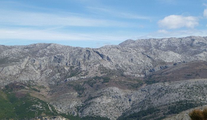
Mosor is a mountain overlooking Split from the east, the one you just can't miss when watching any Split panorama looking in that direction.
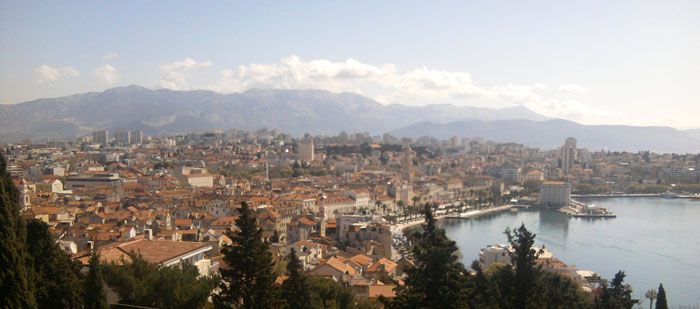
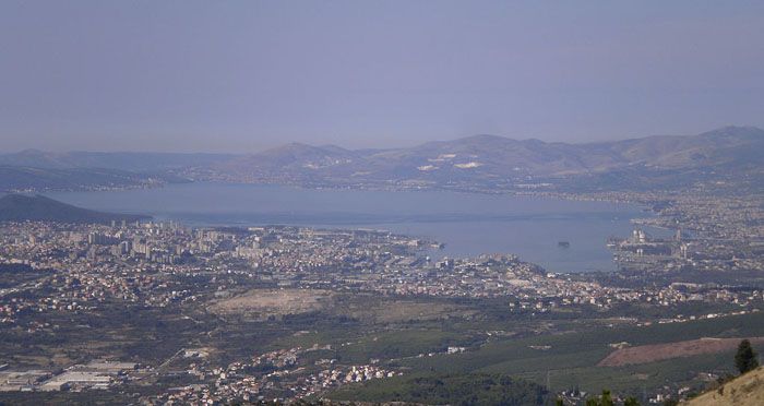
With such position, Mosor became a natural option for any hiking beginners, so that mountain turned into a one of the most popular destinations for day trips for people from Split, which is usually good recommendation for visitors, too. It's mostly rocky, and look almost threatening, but once when you get there you will see that all the paths are excelently marked, challenging enough to enjoy it as a hiking spot, and easy enough so whole family can go up there. The highest peak is Veliki Kabal, on altitude of 1,339 meters, but the most popular as a goal is Vickov Stup on 1,325 meters. Scenery is very diversified, with lots of cliffs, meadows, and caves, but what is probably the biggest bait for everyone going to Mosor is the view. When sky is clear, you can see all the way to the most distant Central Dalmatian islands, and whole Split and Kaštela are lying like on a palm.
The easiest way to reach Mosor is by car, driving from Split either to Žrnovnica or, even better, to village of Sitno Gornje as a starting point for a hike. Route to the latter is available here. If you don't have a car available, you can take a local bus number 28 that drives from Split to Sitno Gornje and Dubrava. Schedule available here.
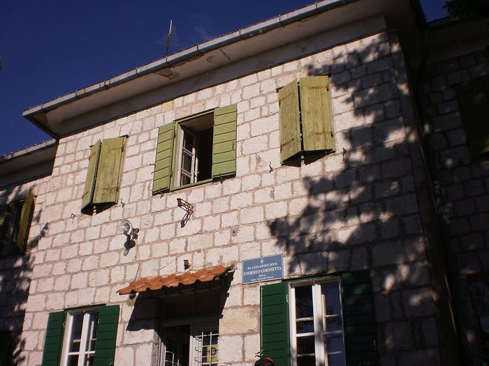
The most popular route is from Sitno Gornje to the top, with the first stop at the mountain hut Umberto Girometta. For less capable hikers, this building is usually the final destination. Hut is named after the founder of Split mountaineering. You can get a warm meal there, cooked at the spot, for reasonable price and in large portions. We tried it a lot of times, and it's a special experience, really good food. Also, there are rooms to sleep in, so day trip can turn into a weekend excursion.
Route to the hut is nicely marked, takes about 45 minutes, and is practically impossible to get lost, but always be careful of walking on rocks, for injuries. If something like that happens, call emergency number 112 for assistance. From Umberto Girometta's, after a break, you can take a hike to the top, either to Veliki Kabal, or to Vickov Stup, or even both. The latter solution is the most demanding, but also the most rewarding and challenging, here is the route for that one. Even if you don't bring this map with you, there are no problema for finding a right path, because of the markations - white with red circles - that will lead you all the way. Full route will last at least five hours. You can take a rest in a red shelter on Vickov stup, where you will also find a book to sign in, and a stamp. On Veliki Kabal you will see a big cross as a mark that you are on top, as well as sign-in book and a stamp.
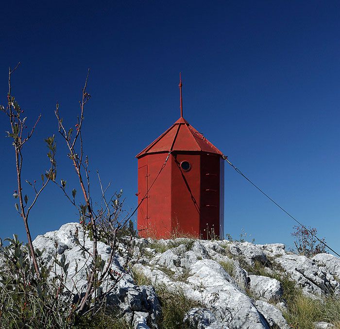
If not capable enough for both summits, our suggestion would be route from Umberto Girometta hut to Vickov Stup and back. And then you can have well deserved meal and a drink. There are several nice meadows around where you can rest in the clean air, or maybe even play some sports, if not too tired.
Mosor is suitable for a hike practically year-round, but we wouldn't suggest it if it's raining or - rarely - snowing. Bring water with you, and you can re-supply at the hut. If you like mountain food, you won't need any to carry on, except maybe some energy bar, or a sendwich or a can as a reserve. Also, don't forget to wear appropriate shoes, and back-up clothes if you get sweaty. It's never too many times to warn you about being careful, to be safe in the mountain you have to respect it. Of course, this is just one of the routes you can take in Mosor, but the most popular. You can also walk from Žrnovnica, which is much longer, or to take another route from Sitno Gornje toward the top, via another shelter called Lugarnica. Some of the basic informations are available in English here.
