VIDEO: Split Riva Flooded and More as Hurricane-Like Jugo Winds Rip Across Dalmatia
December 29, 2020 - A look at the Split Riva flooded as hurricane-like jugo winds ripped across Dalmatia on Monday night.
Jutarnji List reports that gusts of the stormy south wind jugo, which raged across the Adriatic on Monday, caused waves several meters high, due to which maritime traffic was partially suspended.
The famous Split Riva could not even be spared, as scenes of it flooded were shared all over local media. The waves even reached the walls of Diocletian's Palace. Fortunately, the winds weakened overnight.
Around 9 pm, the peak of wind strength in Dalmatia was recorded. The strongest gusts were measured at the Star Village Mosor, located in the city of Split, where jugo had gusts up to 140 km / h.
On Monday night, these hurricane-like winds created waves on the open sea up to six meters high in the central Dalmatia area. They were between two and four meters in the coastal area, flooding the waterfronts in even more coastal towns. The meteorological station on Marjan recorded hurricane gusts in the Split area for several hours, the State Hydrometeorological Institute in Split said.
Waves also flooded the waterfront in Kaštel Gomilica, where water entered a house in its eastern part. Firefighters intervened and pumped out water, Kaštel Gomilica reported from the DVD.
During the day, all catamaran and most ferry lines were interrupted, and due to wind gusts and several-meter-high waves, the ferry that was supposed to sail from Supetar to Split and return to Supetar was postponed last night, the head of Jadrolinija's agency in Split Jelena Ivulić confirmed.
All catamaran lines that connect Split with the central Dalmatian islands were interrupted on Monday due to unfavorable weather conditions at sea.
Ivulić stated that the ferry lines Split-Vela Luka-Lastovo, Trogir-Drvenik Mali-Drvenik Veli, Sumartin-Makarska, and Sucuraj-Drvenik were also interrupted due to bad weather.
On Tuesday, the Adriatic is expected to be partly cloudy with occasional rain, locally abundant. The interior is partly sunny and mostly dry. There may be sleet and snow in the highest mountains.
A moderate to strong southwest and south wind will blow, with occasional gusts of wind on the Adriatic, and will weaken towards the end of the day. The lowest air temperature on the coast and islands will be from 7 to 11, and the highest daily from 10 to 15 degrees Celsius.
Unstable and changeable weather is expected in the coming days and occasional rain, which may be more abundant in some places on Wednesday. The wind will be mostly weak to moderate southwest and northwest, and on Friday, the south wind will strengthen again.
To read more about news in Croatia, follow TCN's dedicated page.
VIDEO: Watch Dubrovnik Take a Battering by Stormy Jugo Wind
Dubrovnik is a place in Croatia that so many associate with gorgeous weather, calm seas and an enviable climate. While this is true during the warm (alright, agonisingly hot) summer months, autumn and the winter can bring with them some incredible weather, and the southeastern jugo wind, with all of its power, is just one of them.
As Morski writes on the 13th of November, 2019, owing to its location at the extreme southern tip of the country, the City of Dubrovnik has always been on the radar of some of the more violent jugo winds, or šilok, as the people of Dubrovnik sometimes call it.
They didn't construct such mighty walls for no reason, and while these giant structures were built from the 13th to the 17th centuries for defense purposes, as Dubrovnik was always under the watchful eye of the jealous Venetians, the walls also protected the city's inhabitants from the gigantic waves jugo winds often churn up and produce. For the sake of ease of reference when it comes to the size of these waves, they are 1,940 metres long, up to 25 metres high, 4-6 m thick when near the mainland, and up to 3 metres thick towards the sea.
The old people of Dubrovnik had a stipulation that they never convened and made any important decisions when jugo, or perhaps better to call it šilok when speaking about Dubrovnik, was blowing. People believed the adverse weather affected people mentally, and therefore they couldn't come to a rounded official decision on something when influenced by these mighty winds.
Two storm chasers and photographers from Dubrovnik, Boris Bašić and Daniel Pavlinović, took some utterly spectacular photos of the waves that literally spilled over the ancient city walls. dramatic waterspouts (pijavice) were recorded, and Bašić filmed the usually peaceful rocks (grebeni) located just in front of Lapad, through and over which strong waves in a sea churned up by jugo violently swept.
You haven't truly experienced jugo (šilok) until you have experienced it in Dubrovnik, if you'd like to see why, watch the video below:
Make sure to follow our dedicated lifestyle page for more.
VIDEOS: Stormy Jugo Wind Rips through Dalmatia, Chaos on Roads
November 13, 2019 - A stormy, hurricane-like jugo wind whirled along the coast from Tuesday morning, especially in Dalmatia, where 134 km per hour winds were recorded at the Marjan weather station.
By early Tuesday afternoon, the Split Public Fire Department (JVP) had a dozen interventions, mainly removing broken trees from roads or property. Their colleagues from the Volunteer Fire Company (DVD) Split and DVD Zrnovnica were on the ground answering calls.
The Civil Protection Directorate announced late Tuesday afternoon that about 15 vehicles were damaged by falling trees and branches and other objects. Given that, according to the forecast, even stronger winds were expected at the end of the day, citizens were advised to park their cars in protected areas, if possible, to avoid damage, to be cautious when driving, and monitor the weather. In the case of strong winds, citizens were advised not to leave their homes if they did not have to.
In addition to the storm in Split, the sea in Omis rose and flooded much of the coast and the town square. The same happened in Trogir, Ciovo, and Kastela, where the sea level had risen by several centimeters.
On Tuesday, 134 km per hour winds were measured at the Marjan weather station, which is one of the strongest impacts since official meteorological measurements were recorded. Namely, it is the third-highest officially recorded in Split in the last 60 years.
The strongest wind so far was measured on February 1, 1986, when it was 149 miles per hour.
"On Tuesday, the strongest southern wind in Croatia was measured in Dubrovnik at 142 km/h. This storm is linked to a deep cyclone centered over southern Italy and moving in an unusual northward direction and we can expect it to enter the Adriatic on Wednesday," said Rade Popadic, adding that this storm was one of the most pronounced in recent years.
On Wednesday morning, Split was were greeted by fierce thunderstorms and heavy rain. The streets of Split are flooded with traffic beginning to build.
Some say that the worst situation is at the entrance to Split, at Domovinskog Rata street, though traffic has also formed at Ulice Slobode and Poljicka. There are no traffic lights on Vukovarska Street, which has caused great difficulties for drivers.
Several maritime lines have been interrupted because of the wind, including:
Ferries: Brestova-Porozina, Lopar-Valbiska, Ubli-Vela Luka-Split, Stari Grad-Split, Vis-Split, Drvenik Veli-Drvenik Mali -Trogir, Rogač-Split, Zadar – Brbinj, Supetar-Split, Sumartin-Makarska, Sućuraj-Drvenik, Ploče-Trpanj, Orebić-Dominče, Prapratno-Sobra, Dubrovnik-Lopud-Suđurađ;
Boats: Zadar-Rivanj-Sestrunj-Zverinac-Božava-Brbinj, Korčula-Orebić, Šibenik-Zlarin-Prvić Luka-Šepurine-Vodice, Milna-Rogač-Split, Komiža-Biševo, Mali Lošinj-Unije-Susak, 415 Vrgada-Pakoštane-Biograd, Dubrovnik-Koločep-Lopud-Suđurađ, Zadar-Sali-Zaglav-Zadar,Zadar-Mali Iž-Veli Iž-Mala Rava-Rava;
Catamarans: Mali Lošinj-Cres-Rijeka, Lun-Tovarnele (Novalja )-Rab-Rijeka, Ubli-Vela Luka-Hvar-Split, Vis-Milna-Split, Jelsa-Bol-Split, Ist – Zapuntel – Brgulje – Molat – Zadar, Zadar-Sali-Zaglav-Bršanj-Zadar, Korčula-Hvar-Split, Vis-Split, Zadar-Premuda-Silba-Olib, Dubrovnik-Mljet-Lastovo, Žirje-Kaprije-Šibenik, Milna-Rogač-Split.
If you can, stay indoors today!
Sources: Slobodna Dalmacija, Dalmacija Danas
To read more about lifestyle in Croatia, follow TCN's dedicated page.
VIDEO: Watch Incredible Footage of Stormy Jugo Wind on Susac!
As Morski writes on the 12th of November, 2019, lighthouse keepers from Susac sent the portal a video taken this morning showing what they've been witnessing from their positions as the stormy jugo wind gives the land and the sea a thorough battering.
''Good morning, greetings from the Susac lighthouse,'' say the lighthouse keepers from Susac briefly, adding that in the afternoon, they're expecting orkansko jugo (an even stronger southeastern wind that ravages the Adriatic).
Indeed, if the stormy jugo looks like this on Susac, we can only imagine what it will look like when the waves climb over five, and sometimes even over metres in height, with incredibly strong gusts of south up to seventy knots, as forecasters have announced for this afternoon. Fortunately, lighthouses are very safe at about 100 metres above sea level, but sailors and other boaters are advised not to go out to sea at all.
It's worth recalling that owing to the stormy jugo that is currently giving parts of the coast a beating, a red meteo alarm has been activated for almost the whole of the Croatian Adriatic, which means that the weather is dangerous.
Owing to the adverse weather conditions which are for the most part expected to worsen before long, there have been maritime traffic alterations and interruptions. At the time of this article having been written, the interruptions at sea for ferry lines and other vessels are as follows:
Ferry lines: Sućuraj-Drvenik, Split-Vela Luka-Ubli, Šibenik-Zlarin-Kaprije-Žirje
Shipping lines: Zadar-Preko, Milna-Rogac-Split, Komiža-Biševo, Mali Losinj-Unije-Susak
Catamaran lines: Korčula-Hvar-Split, Ubli - Vela Luka - Hvar - Split, Vis-Split, Split-Bol-Jelsa, Zadar-Premuda-Silba-Olib, Dubrovnik-Mljet-Lastovo
Watch the video of the jugo throwing all of its strength at Susac here:
Make sure to follow our dedicated lifestyle page for much more. If you're interested in jugo, why not read this and give Total Croatia Sailing a follow.
Jugo: Strong Southern Wind in Central Dalmatia Causes Problems in Traffic
Due to the strong Southeastern wind, called Jugo, which has caused waves up to 2.5 meters high, numerous catamaran and ferry lines are not operating today.
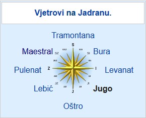
Jugo, the Southeastern wind, is a force of nature to be reckoned with in parts of Croatia that are close to the sea. It usually brings warm, humid air (unlike the wind it's often compared to, the well-known Föhn wind in the Alps, which is usually dry), and causes high and mighty waves in the Southern parts of Croatia. Well, today, on November 3rd, 2019, it has caused problems in the traffic almost everywhere.
Croatian Automotive Club (HAK) reported today that the ferry, boat and catamaran lines that are not operating are: Lopar-Valbiska ferry to Rab island, Prapratno-Sobra ferry to Mljet, 9604 catamaran line Ubli-Vela Luka-Hvar-Split, 9603 catamaran line Jelsa-Bol-Split, 9602 catamaran line Vis-Split, Komiža-Biševo catamaran line, Korčula-Hvar-Split catamaran line, Mali Lošinj-Cres-Rijeka catamaran line, Novalja-Rab-Rijeka catamaran line, 9807 catamaran line Dubrovnik-Šipan-Mljet, Korčula-Hvar-Split boat, 409 boat line Zadar-Preko, 310 boat line Mali Lošinj-Unije-Susak.
In addition to that, the A6 highway, connecting Rijeka and Zagreb, is also closed between Kikovica and Delnice, which is quite unusual as that section of the highway is most often closed because of the Nothern wind, the cool Bura. Jugo usually doesn't quiet down for three or four days, but the traffic situation will hopefully become more manageable soon.
Jugo has a major significance in the lives of people, in addition to often cutting their ties to the mainland. When it brings warm, humid air, it causes mood changes, generally, makes everything just a bit more complicated. The condition that you can often hear about in the Dalmatia is "južina," the state of the atmosphere (and mind), which occurs during the Jugo winds. During the Dubrovnik Republic, Jugo was considered to be an extenuating circumstance for murder, and no significant decisions were made in the Senate during the južina.
Today, however, some people don't seem to mind the strong winds, as witnessed by our own Paul Bradbury:
Zadar Waterfront Heavily Damaged by Stormy Sea!
The weather in Dalmatia has been wreaking havoc, and while things have calmed down significantly now, for many boats and indeed permanent structures, the damage has already been done. The Zadar waterfront (riva) is just one casualty which needs quick action.
As eZadar writes on the 31st of October, 2018, a model for the repair and reconstruction of parts of the now damaged Zadar waterfront is being searched for by the Ministry of Maritime Affairs, Transport and Infrastructure.
In order to determine the real extent of the damage caused by Dalmatia's recent bout of extremely wild weather and to go forward with a proper plan for the repair of the Zadar waterfront, Josip Bilaver, assistant to Oleg Butković, the Minister of Sea, Transport and Infrastructure, arrived in the popular Dalmatian city of Zadar and together with the heads of departments of the City of Zadar, he visited the damaged waterfront and the jetty area which suffered the greatest extent of Mother Nature's damage.
After an expert analysis of the damage to the structure, a concrete plan for its repair and reconstruction involving the City of Zadar, the wider Zadar County, and the aforementioned Ministry will be drawn up and implemented as soon as possible.
As the Zadar waterfront now unfortunately requires complete reconstruction, which is an extremely demanding task and a great financial burden that the city really didn't need, Assistant Minister Bilaver has put forward the idea of financing the complete reconstruction through a joint project of the City, the Ministry of Maritime Affairs, Transport and Infrastructure, and the Ministry of Regional Development and European Union funds, by applying for help from the cohesion funds. In this way, it would be possible to find the means for the complete repair and reconstruction of the Zadar waterfront, which would be carried out in several phases so as to limit any potential issues.
Want to keep up with news from across the country, be it about business, current events, sport or yet more wild weather? Make sure to stay up to date with our news page.
Weather in Croatia: Palagruža Records Highest Waves Since 2004!
The weather in Croatia is typically viewed as sunny, dry and calm, and even impossibly hot by most who visit in the summer months.
But just what happens when bura, jugo, and all other types of Adriatic winds decide to strike the coast? Conditions get suddenly worse, and a once calm, deep blue Adriatic sea becomes like something from the mid-Atlantic Ocean, sometimes even causing damage to the shoreline and to buildings. The sometimes dramatic turn of the weather in Croatia can therefore be a rather strange thing to witness for those who simply assume that because of the country's geographical position, that the warm summer climate is a constant one.
There are many types of winds in Croatia, all have their own sources, come from different directions, and typically occur at different times of year, and of course, we have articles dedicated to three of the main ones, click here, here, and here if you'd like to read more about them.
Palagruža is a location most people visiting the country have never heard of, it is Croatia's most remote lighthouse island, and when the wind blows and the sea becomes stormy, viewing Mother Nature's power from here is quite the experience indeed.
As Morski writes on the 30th of October, 2018, according to data taken from the State Meteorological Institute, at 20:00 last night, conditions on the sea worsened drastically and massive waves with a height of seven metres were recorded, meaning that the waves last night were the highest since back in 2004 according to that measuring station's records.
Palagruža's lighthouse keeper Vojislav Šain told Dalmacija Danas that Palagruža is completely cut off from the world, but that he doesn't particularly care about that because he has naturally become accustomed to living in such isolation on this extremely remote Croatian island.
He continued by saying that the waves were very high, but that it didn't actually rain much, and that storms from the Italian coast were moving ever closer.
Want to find out more about potentially dangerous conditions on the Adriatic and just what to watch out for when sailing in Croatia? Click here and follow Total Croatia Sailing.
Korčula Island Cut Off from the Mainland because of "Jugo"
A strong jugo wind like this one doesn't happen often (luckily), so when it does it's worth mentioning.
Sometimes you really gotta trust the weather forecast, no matter how many times before you were angry with them for having missed this or that weather event. These days we see one of those occasions taking place.
Korčula island is quite close to the mainland, and it rarely happens that none of the boat, ferry of catamaran islands connecting it to Pelješac or Split are operational. But, a strong "jugo" wind that we've been experiencing in the last couple of days has succeeded at just that: not single one of the regular lines connecting Korčula to mainland Croatia is currently operating, and the weather forecast for the night and tomorrow early morning are not giving us much hope that things are going to get much better anytime soon.
This is a video taken today by Smiljana Matijaca of Cukarin fame, posted on her Facebook profile, showing you how it's possible for such a short ferry line, like Dominče - Orebić (or the Korčula - Orebić boat line) to be brought to a halt because of the strong wind:
Hopefully, jugo (the south-eastern wind, bringing humid and usually warm air, which usually means rain also) will subside tomorrow, and traffic to and from Korčula will be restored. And, once in a while when a situation like this happens, one can only hope that everyone will be safe on Korčula this night, and that no emergency medical services will be needed. And, unborn babies of Korčula, could you please wait for a day and not decide to be born tonight, please? Thanks.
Sailing in Croatia: The Adriatic Alphabet - J Is For...
Continuing with our alphabet series, we look to the letter J with a tribute to several islands and artists on April 16, 2018