Did You Know About the 300 Kilometre-Long Slavonia Hiking Trail?
November 28, 2022 - The Slavonia hiking trail is an interesting story that started on July 27, 1957. The trail is the oldest and longest hiking trail in Croatia.
As written by the Turističke Priče portal, the trail is 300 kilometers long, and you can hike it in one piece or separately through a total of 5 sections. For the whole trip in one piece, even a well-prepared hiker must account for nine days or 85 hours of walking, and not many can boast of having crossed it.
This interesting route has a circular shape with 31 mandatory and four optional checkpoints, and includes Papuk, Psunj, Krndija, Požeška, and Dilj gora.
The 300-kilometer trail through the Slavonian mountains is divided into five sections
"Psunj": mountain lodge Petrov vrh - mountain lodge Strmac
"Požeška gora": mountain lodge Strmac – Komorica
"Dilj gora": Komorica - mountain lodge Borovik
"Krndija": mountain lodge Borovik - mountain lodge Jankovac
"Papuk": mountain lodge Jankovac - mountain lodge Petrov vrh
Stamps as proof of visit to the Slavonia trail
To acquire the Badge of the Slavonia Trail, hikers have to go through all the mandatory control points, where they will find stamps that they can use as proof of having passed through each of them. In case a stamp cannot be found, a photo of the hiker at the checkpoint will be needed. It is recommended to visit the checkpoints in 5 two-day trips. The stamps are located in the corresponding boxes at the checkpoints or in the hiking facilities that the trail passes by.
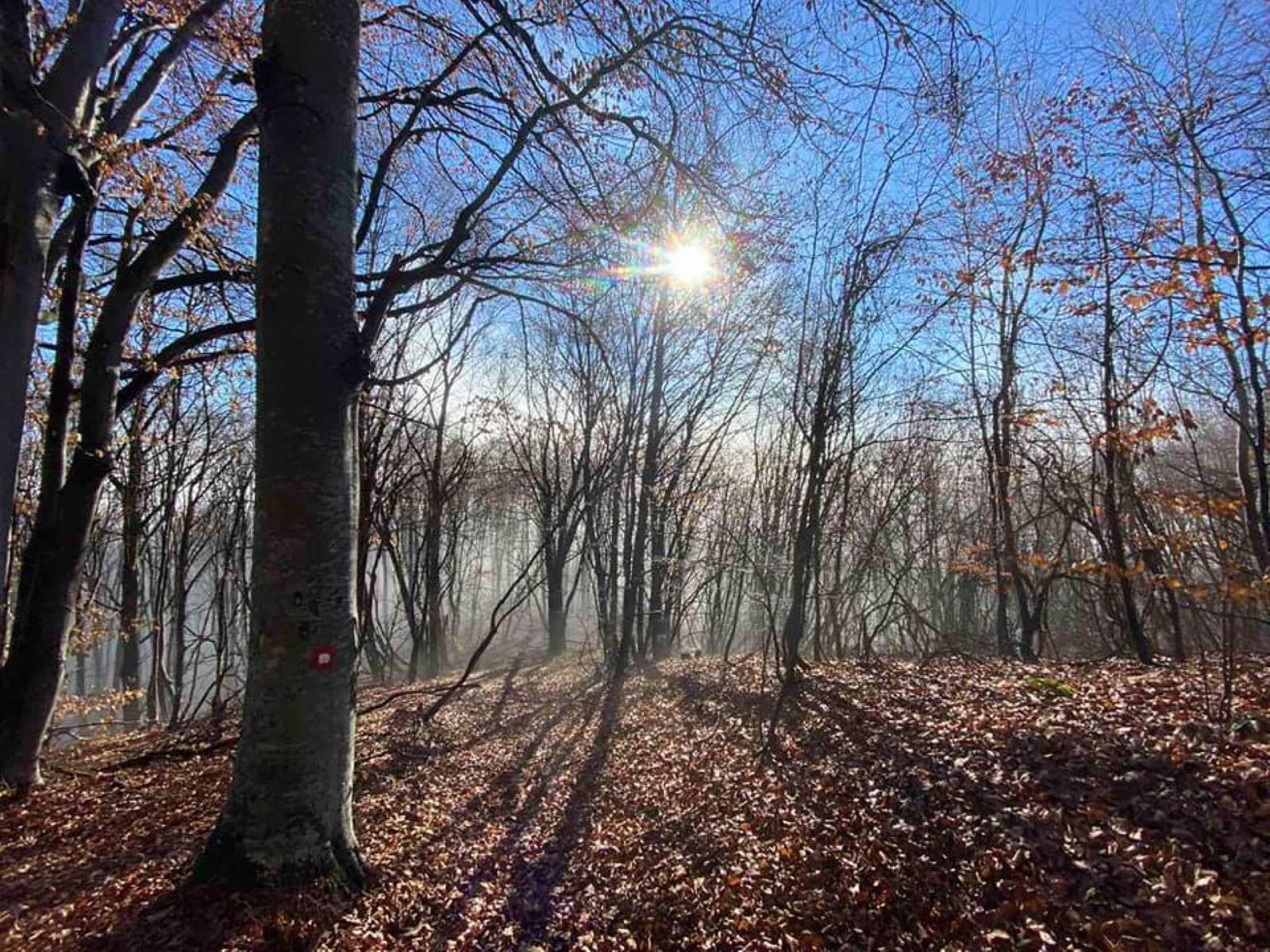
Photo: Dorian Dražić-Karalić
The Slavonia hiking trail can be visited in unlimited time and in any chosen direction. The hike is done at own risk with compliance with the rules of safe hiking and staying in the mountains, recommended by the Croatian Mountaineering Society.
To date, more than 150 hiking trails have been opened in Croatia, which vary in difficulty and duration. Usually, they allow hikers to get to know the most valuable hiking checkpoints on a mountain or in the region by taking the most accessible or attractive routes. Numerous hiking trails allow a choice of interesting hiking checkpoints according to a condition or criterion determined by the trail organiser.
On the official website of the Croatian Mountaineering Association, you can find information on all hiking trails opened in Croatia so far, regardless of their status. Detailed information on registered hiking trails is available in the Mountaineering Trails Register, which is managed by the HPS Mountaineering Trails Commission, according to the Croatian Mountaineering Association.
For more, make sure to check out our dedicated Travel section.
PHOTOS: Beautiful Locations of Active Šibenik's Sports and Recreation
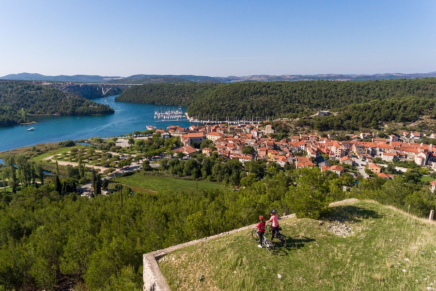
September 22, 2021 – From cycling and kayaking to hiking and an epic zip line, see the fantastic natural landscape that holds active Šibenik's thrilling offer.
When temperatures ease off, the Croatian coast welcomes a whole different type of guest. Spring, Autumn and Winter is the favourite time for sports enthusiasts and fitness fans to visit. And, few places on the Mediterranean have an offer complete like active Šibenik.
Outside of the peak season, the stunning nature that surrounds Šibenik is free from the bustle of visitors. Cyclists and runners speed by unobstructed. Maybe they'll pass a couple of hikers enjoying the same trails and spectacular views?
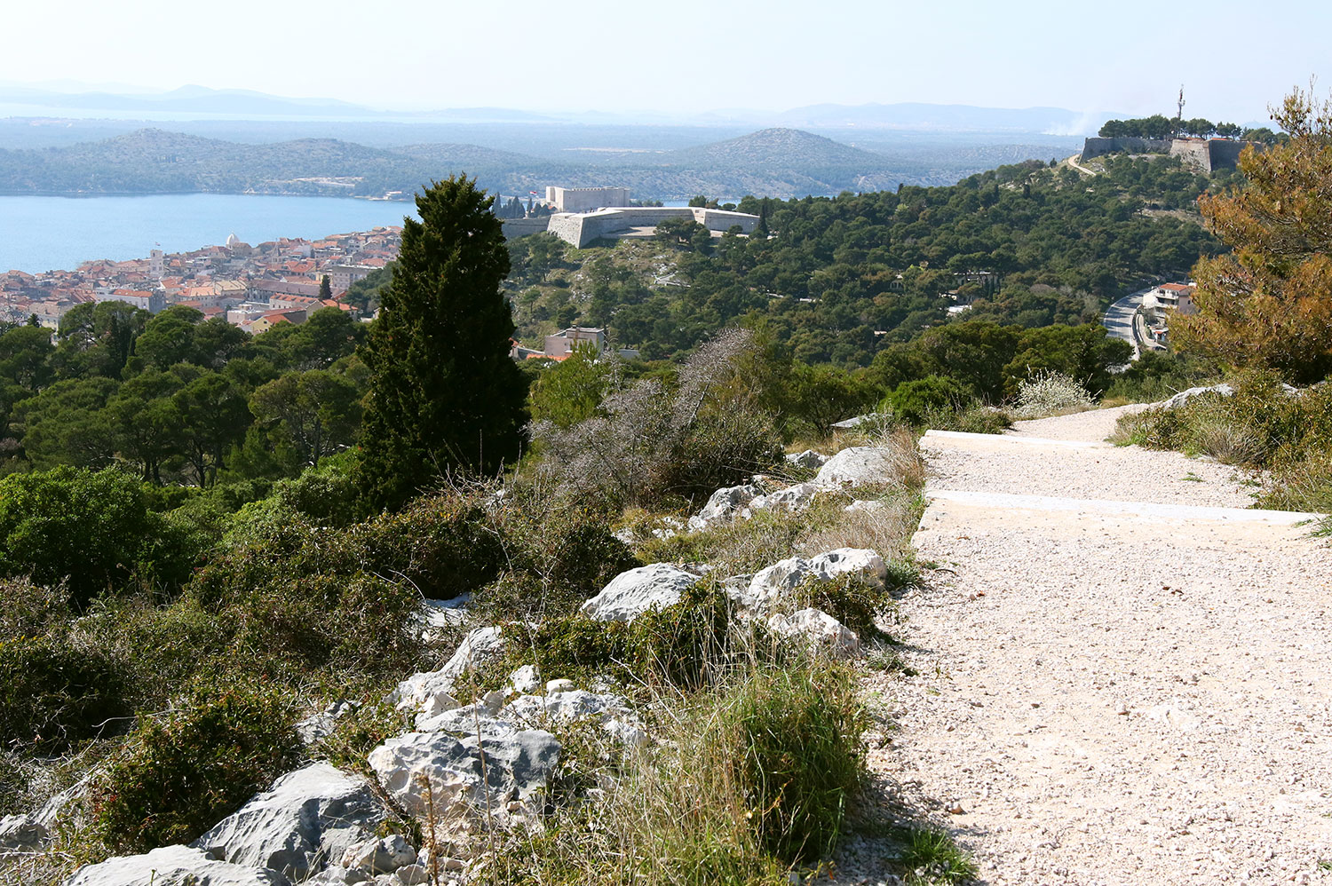
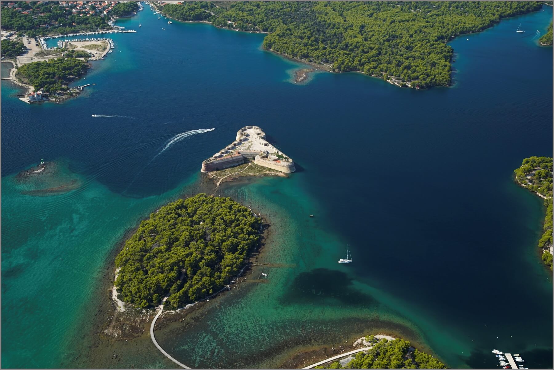 St Anthony's channel, St Nicholas Fortress and the cycle and walking path that reaches it via an island © Šibenik Tourist Board
In the evenings, during their rest time, active Šibenik's guests have the city's best hotels, restaurants and charming Old Town almost to themselves. They share the cafe, bar and restaurant terraces only with Šibenik residents, relaxing once more now the city is returned to them.
Key to Šibenik's year-round appeal for fitness and sport fans is the city's unique landscape. No place in Croatia has natural assets like Šibenik. It is surrounded on all sides by a remarkable and startlingly varied topography.
Firstly, between Šibenik city harbour and the open Adriatic is a long waterway – St. Anthony's Channel. It is bordered on either side by two huge stretches of wild nature. Then, at the rear of the town, elevated up from sea level and next to Barone Fortress, the area of Šubićevac. Here, the entrance to the vast Šubićevac Forest Park, much of it an untamed, natural landscape. Thirdly, the vast Krka National Park, which lies just 10 kilometres north-east of Šibenik
Active Šibenik: St Anthony's Channel
 Sailboats and speed boats sharing St Anthony's channel © Marc Rowlands
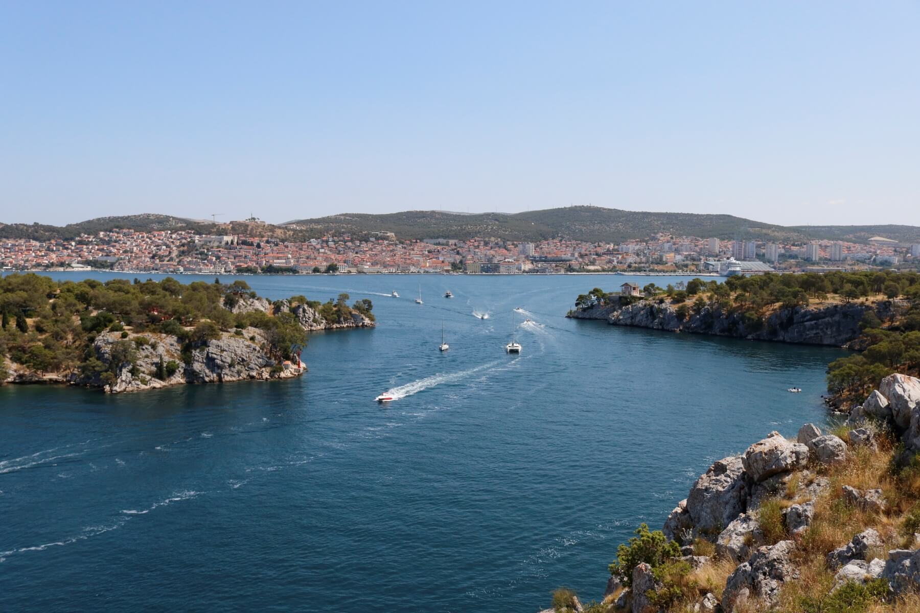
An epic 2000 metre long waterway, St Anthony's Channel is both a gateway to the open sea and the entrance to the city for anyone sailing into Šibenik. It is 140 – 220 metres wide and is bordered on each side by near untouched Dalmatian nature. On one side, sheer cliffs for one wall of the channel. At the top, dense pine forests, walking, hiking and cycling trails. Also, the famous recreation site of Martinska.
 Cycle paths of Šibenik © Marc Rowlands
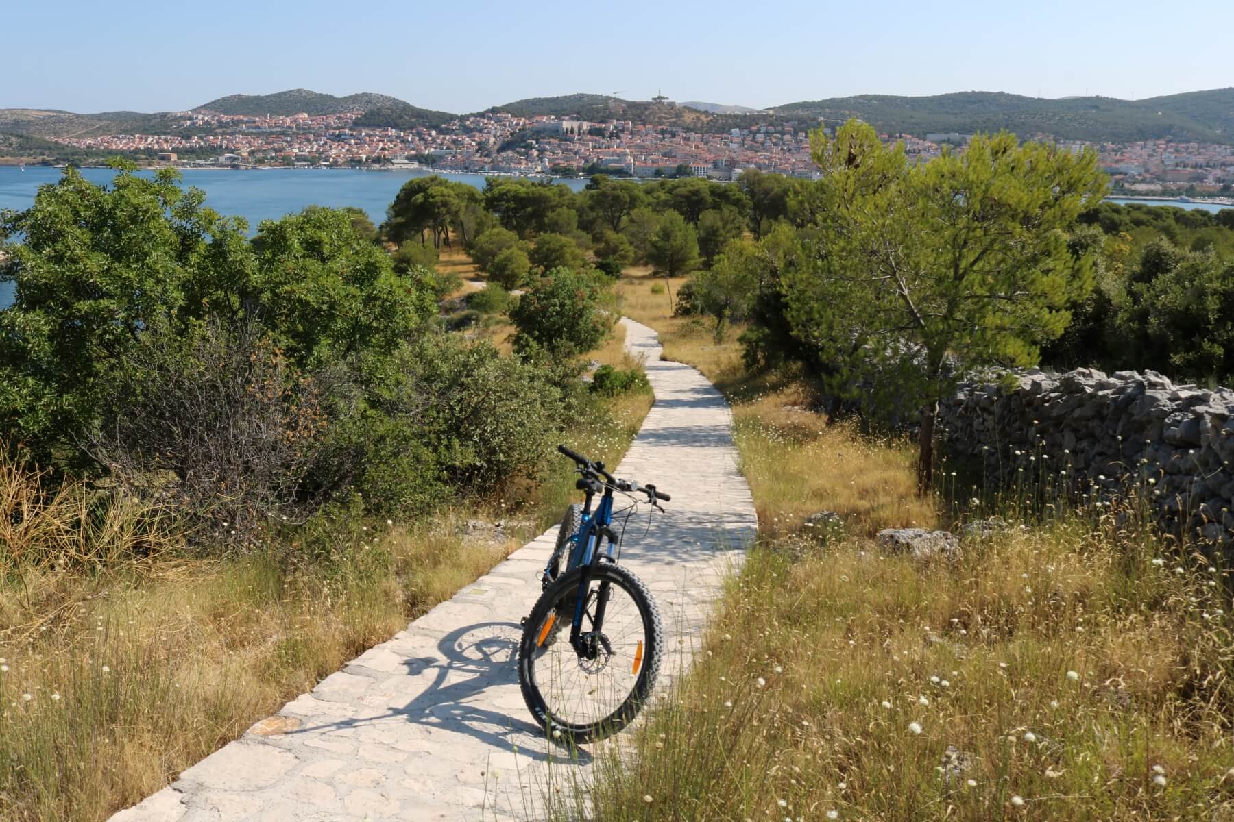
On the opposite side of the channel, a very different layout of the land. Here, the pines are much lower and closer to the channel. Between the two, idyllic beaches - the best in Šibenik – line a pathway designated for running, walking and cycling. Those on bicycles drop down from small hills on the interior. After following the path at the side of the water, their ultimate reward is the spectacular St Nicholas' Fortress. On both sides of St Anthony's Channel you'll see incredible views of Šibenik, its harbour and the side opposite.
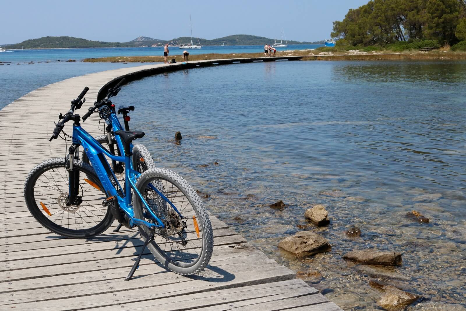 Cycling across a section of St Anthony's channel © Marc Rowlands
For those who prefer recreation on the water, St Anthony's Channel is perfect to explore by kayak. It's also one of the easiest ways to discover all of Šibenik's best beaches. Sticking close to the pine-sheltered coast, beautiful sailboats pass you in the centre of the channel, on their way to or from the city.
Active Šibenik: Šubićevac Forest Park
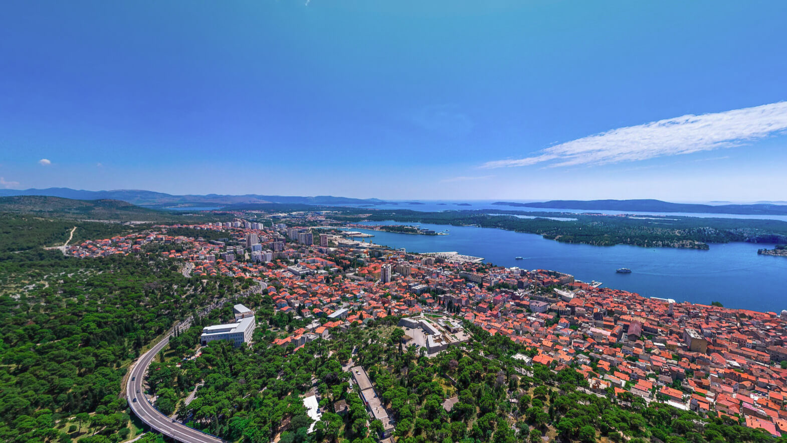 View over Šibenik, with Šubićevac Forest Park at the rear of the city © Šibenik Tourist Board
To visitors, Šubićevac Forest Park is the least famous of all Šibenik's recreational areas. A huge stretch of forestland, much loved by city residents, it rises above the city near Barone Fortress. The section of forest closest to the Šubićevac is designated as a city park. Within this part, you'll find a children's playground, specially designed to be accessible to all, including children with special needs.
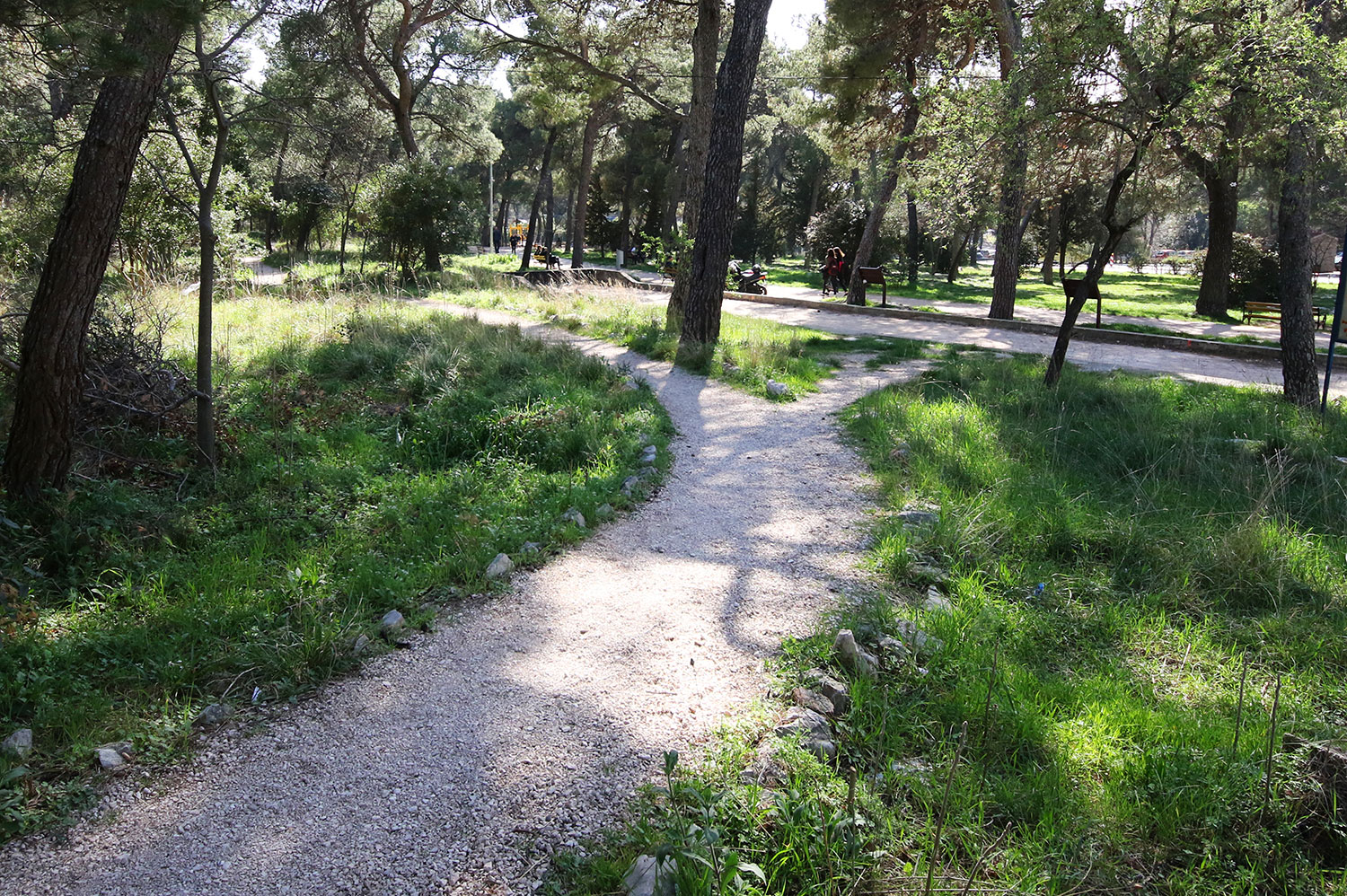 Easily accessible section of Šubićevac Forest Park © Javna ustanova Športski objekti Šibenik
Throughout this section, designated paths for cycling and walking. Running to the southeast, a much larger area of near untouched forest. Here, a wilderness ripe for runners or hikers to explore. It's worth seeking out the tiny Church of St Michael here.
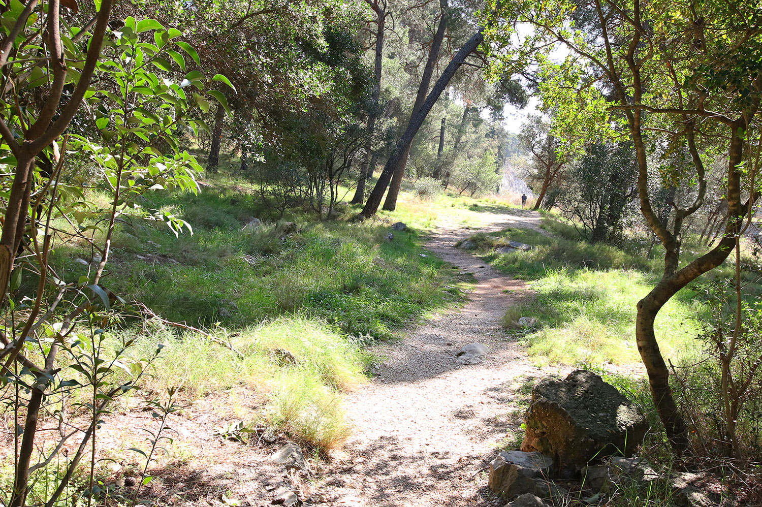 Paths through forest wilderness © Javna ustanova Športski objekti Šibenik
Residents say the very best views of Šibenik come from Šubićevac Forest Park. Certainly, they are breathtaking.
 The best views over the city? It's a tough one to call - Šibenik has many contenders © Javna ustanova Športski objekti Šibenik
Active Šibenik: Krka National Park
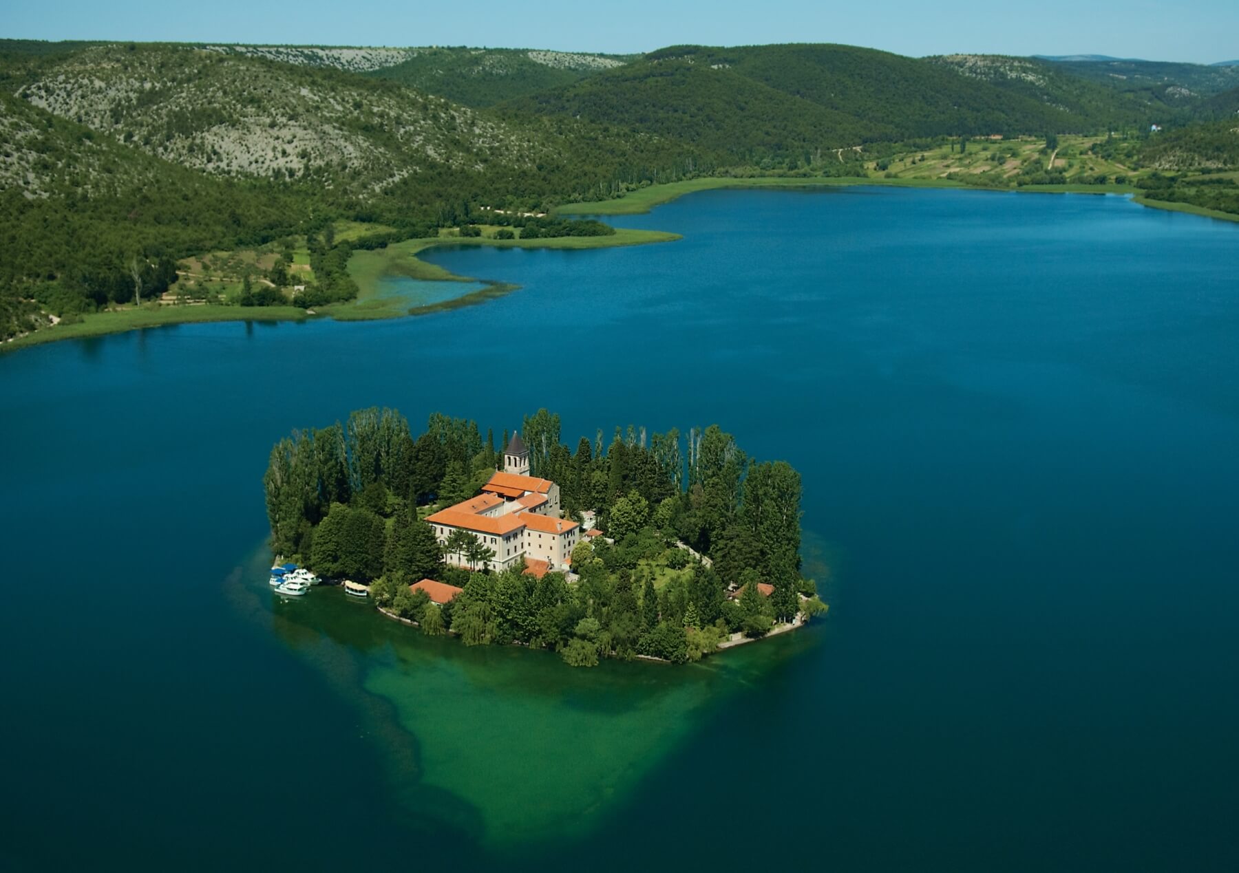 Island in Krka National Park © Šibenik Tourist Board
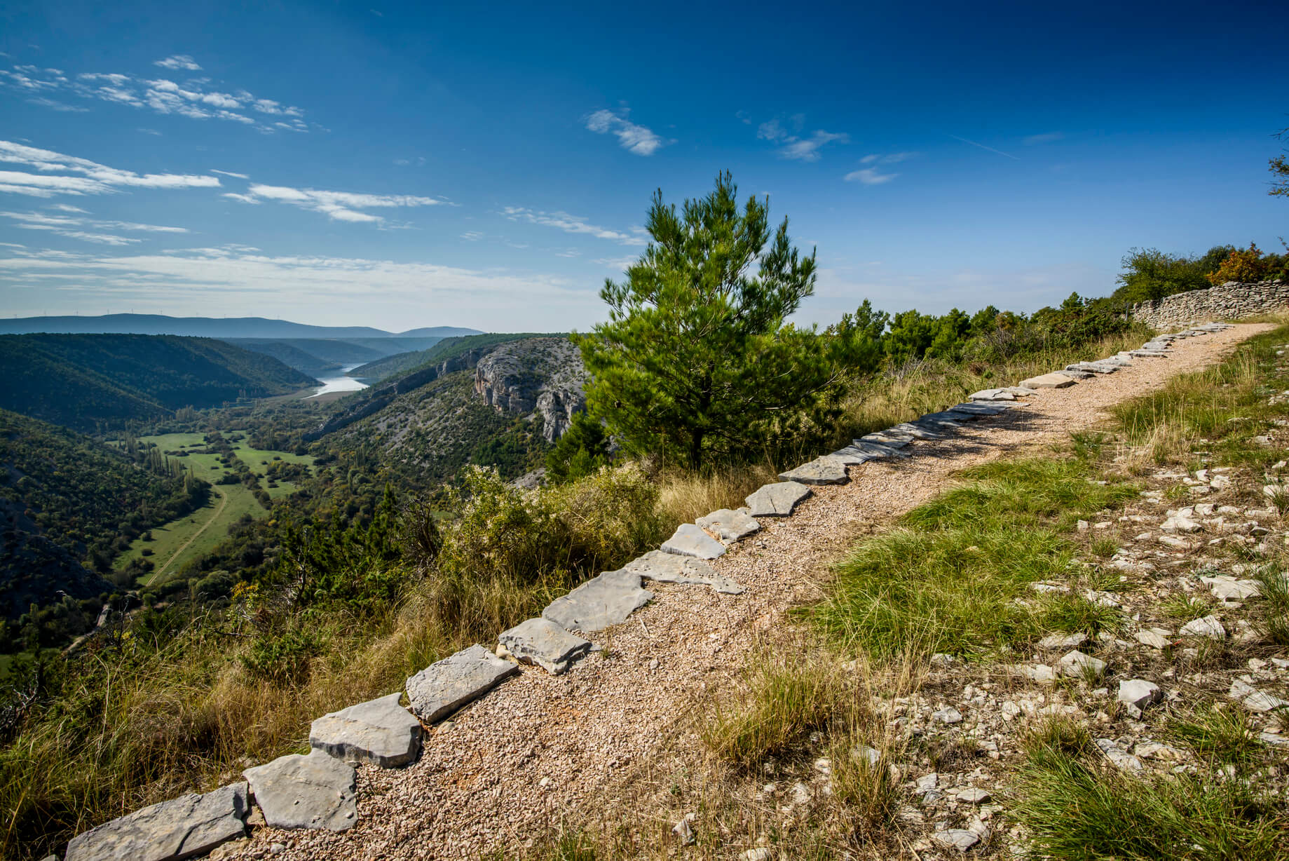
A series of wide pools, fed by cascading waterfalls, Krka is one of Croatia’s best known and most spectacular National Parks. Famous water features like the unforgettable Skradinski Buk dominate the park's postcard images. You'll find it near the park's most southerly entrance, very close to Šibenik. But, beyond this eye-catching introduction lies a further 109 square kilometers of spectacular National Park to discover. The best way to experience it is by walking, hiking or cycling.
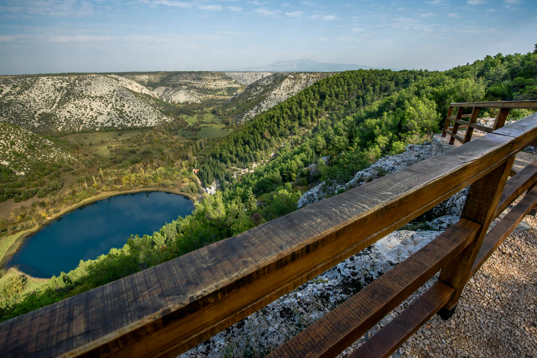 Countless captivating viewpoints © Krka National Park
Hiking and walking trails of Krka National Park
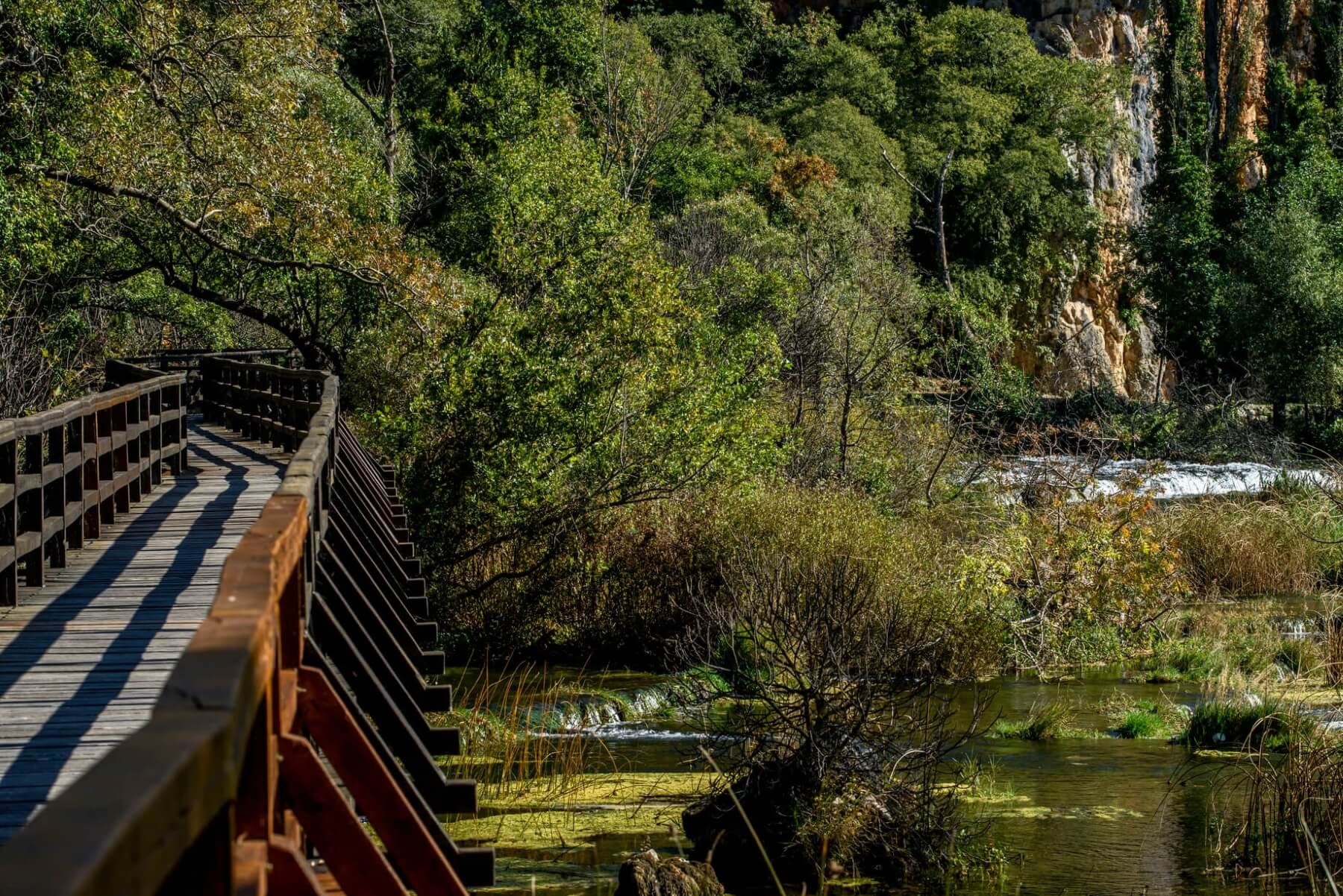
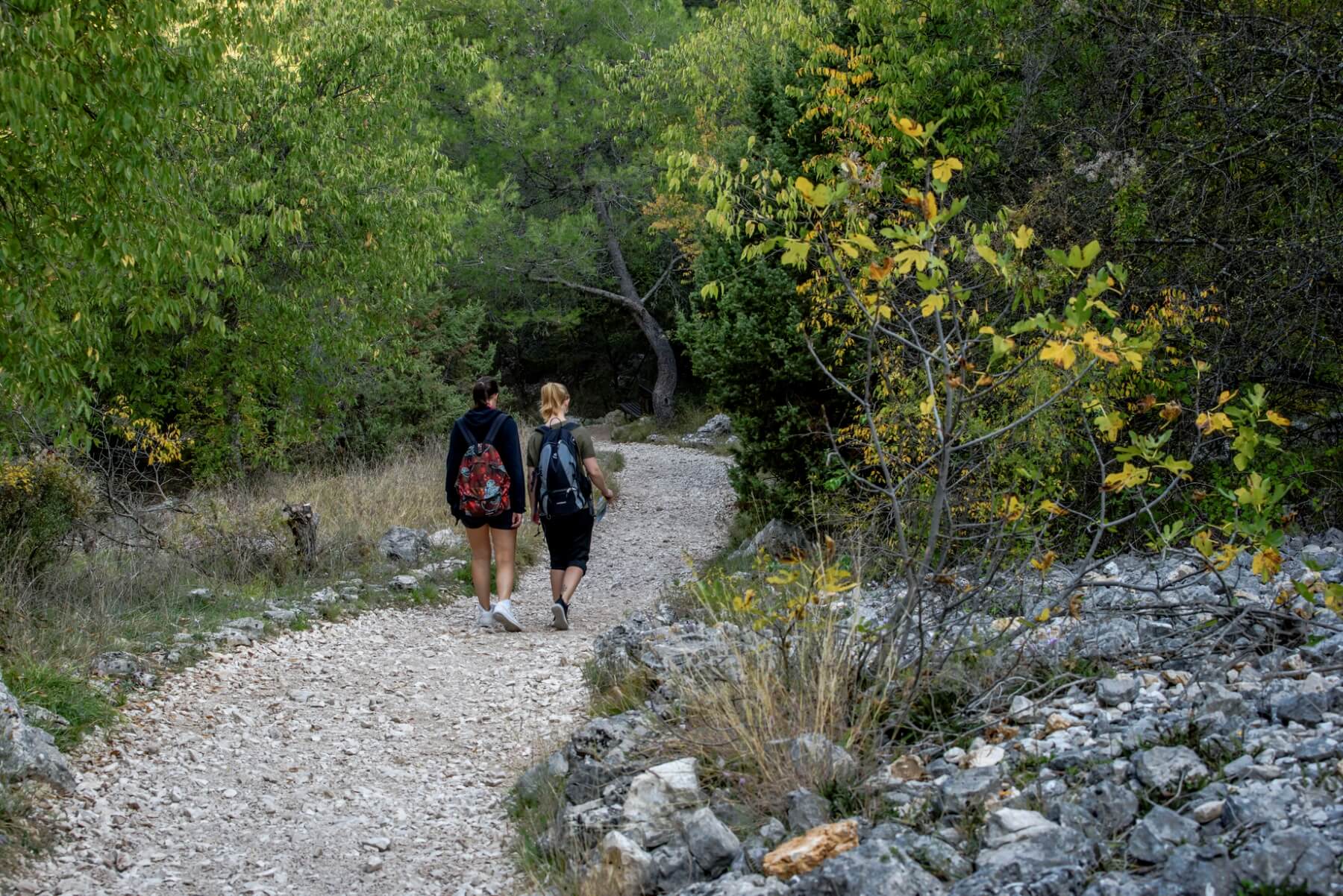 Walking and hiking trails © Krka National Park
The park's hiking and walking trails give you the most thrilling views of this epic landscape and its wealth of flora and fauna. At the side of the trails, educational panels detailing the plants and animals you pass.
 Epic landscape © Krka National Park
There are three circular trails: Skradinski buk (1900 m), Roški Slap (1360 m) and Krka Monastery (2100 m). A walking/cycling trail also leads to Skradinski buk from the Skradin bridge (3400 m), while from Lozovac, it is possible to take a forest trail (875 m) down to the park's longest waterfall.
 Walking over waterfalls © Krka National Park
The shortest trail is 300 m long and leads to Bilušića buk, while the longest trail is Stinice-Roški slap-Oziđana pećina and covers 8.5 kilometres. In total, there are 7 spectacular waterfalls to find as the river Krka descends through the park.
Cycling routes of Krka National Park
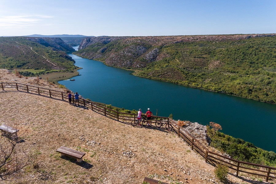 Breathtaking views on the cycling and walking routes © Krka National Park
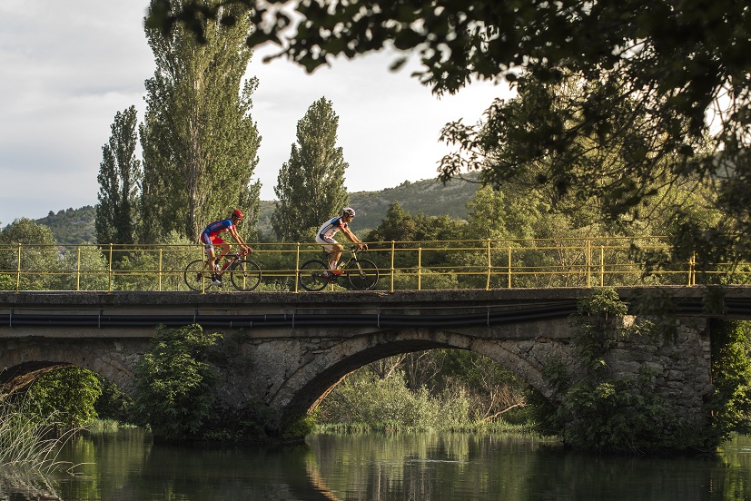
Bicycling through Krka National Park is a journey of endless enjoyment. If your perfect cycling route offers stunning landscapes, then this is the place for you. But, if you're curious to learn about the park's cultural and historical heritage, then cycling also helps you unlock these park secrets.
 Cycling © Krka National Park
No less than fourteen cycling routes crisscross the park. They are divided into three types:
Road route - perfect for racing bikes and dedicated cyclists
Trekking & family route - a mixture of paved roads and gravel paths, perfect for city bikes, mountain bikes, families with children and cyclists of any age and ability.
Mountain biking route – a mixture of gravel paths and unarranged forest paths, with sharp ascents and descents, designed for mountain bike enthusiasts in good physical condition and with advanced cycling skills.
 Cycling above Skradin © Krka National Park
Šibenik zipline
On the northeast corner of the park, stretching across an epic canyon, one of Croatia's most thrilling ziplines. Flying from cliffs hundreds of metres above, so vast is the canyon that you can barely see the thrillseekers at the end of the first line. And, after that, there are still another two to go!
For more information and/or booking any of these activities, visit/contact Šibenik Tourist Board here
For more on great things to do in Šibenik, be sure to check Total Croatia News's dedicated pages here
Pelješac Interactive Map with Cycling and Hiking Routes Available
May 26, 2021 - As part of an effort to strengthen adventure tourism on the peninsula, a Pelješac interactive map is available with five circular mountain biking routes and six hiking routes.
As stated by turistickeprice.hr, tourist communities from Pelješac united at the end of last year to develop tourist products of Pelješac. Specifically, they approached the development of outdoor offers through hiking, cycling, and windsurfing, and five thematic festivals are planned in which visitors would enjoy the flavors of Pelješac, traditional dishes, and the well-known Pelješac wine.
As part of the development of the Outdoor Program, an interactive map of mountain cycling and hiking routes in Pelješac was made. There are currently five circular mountain cycling and six hiking routes on the map. Additional route extensions are planned, as well as the addition of catering facilities and wineries to the map so that guests can easily find their way around the area and get to know the complete offer of Pelješac. Pelješac is rich in wineries and traditional taverns and restaurants, so the combination of outdoors and traditional flavors is quite natural.
On the map, you can see information about the difficulty of the route, the type of surface, description, photos and you can download the GPX track that can be used in various mobile applications and smartwatches. There is also a link to the OsmAnd mobile app on the map, as a suggestion. Otherwise, the app is free to download and works offline.
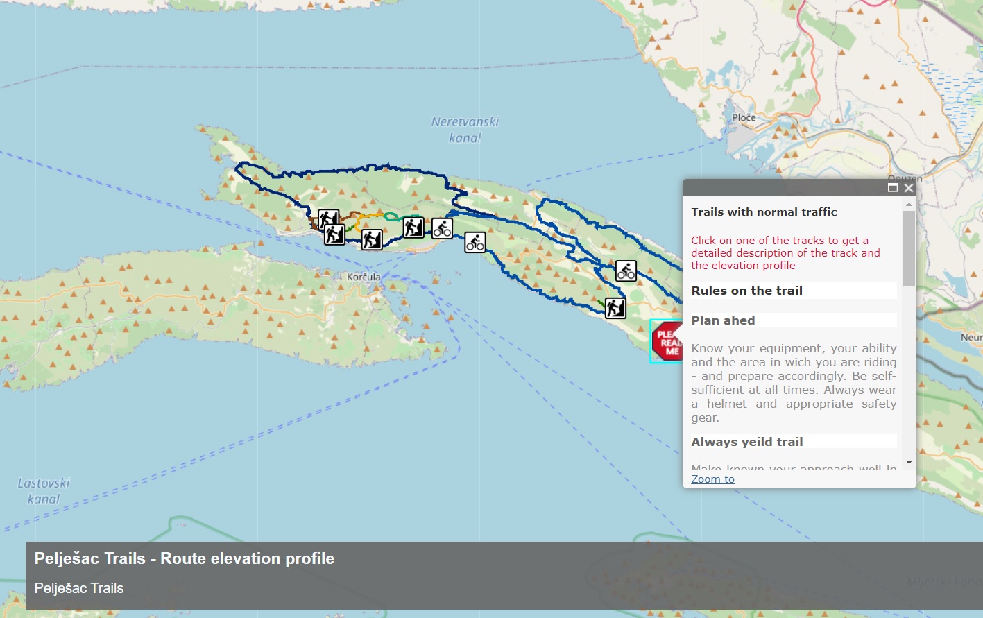
Pelješac Interactive Map with Cycling and Hiking Trails (Screenshot)
The map shows a total of five mountain bike circular routes with a length of 184 km and six hiking routes with a total length of 39 km. The Tourist Boards of Ston, Janjina, Trpanj, and Orebić note that they have developed an interactive map that cyclists and mountaineers can study without coming to the info center, or looking at the websites of tourist boards. In addition, the trails were made in collaboration with local cyclists who know the terrain best, and thus end-users will be able to discover the most interesting parts of Peljesac, which hides many natural beauties.
You can find the English version of the interactive map of Pelješac HERE, and the Croatian version HERE.
You can learn everything about what the Pelješac peninsula can offer you on your next trip, in Total Croatia’s Pelješac peninsula on a page, HERE. Total Croatia’s articles are now available in your language!
For more information about cycling in Croatia, go to Total Croatia's dedicated page.
For more on travel in Croatia, follow TCN's dedicated page.
Croatian Couple Completed Via Adriatica Trail in 54 Days, Liked Dinara Most
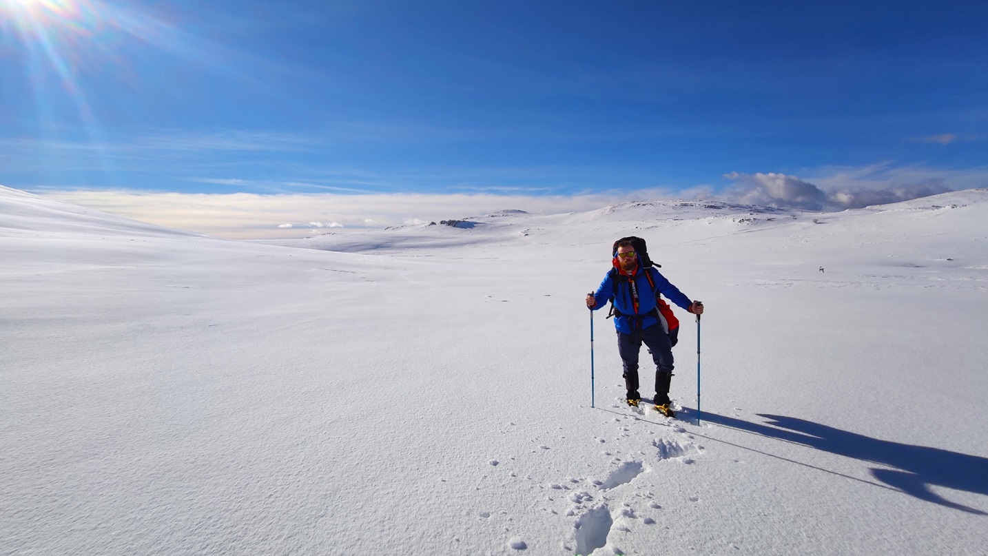
February 24, 2021 – TCN recently interviewed Josipa and Matija on their 1,100 kilometers long journey, and now this Croatian couple completed the Via Adriatica trail with success... but not without the headache of the demanding Croatian mountain regions and changeable and unpredictable weather conditions.
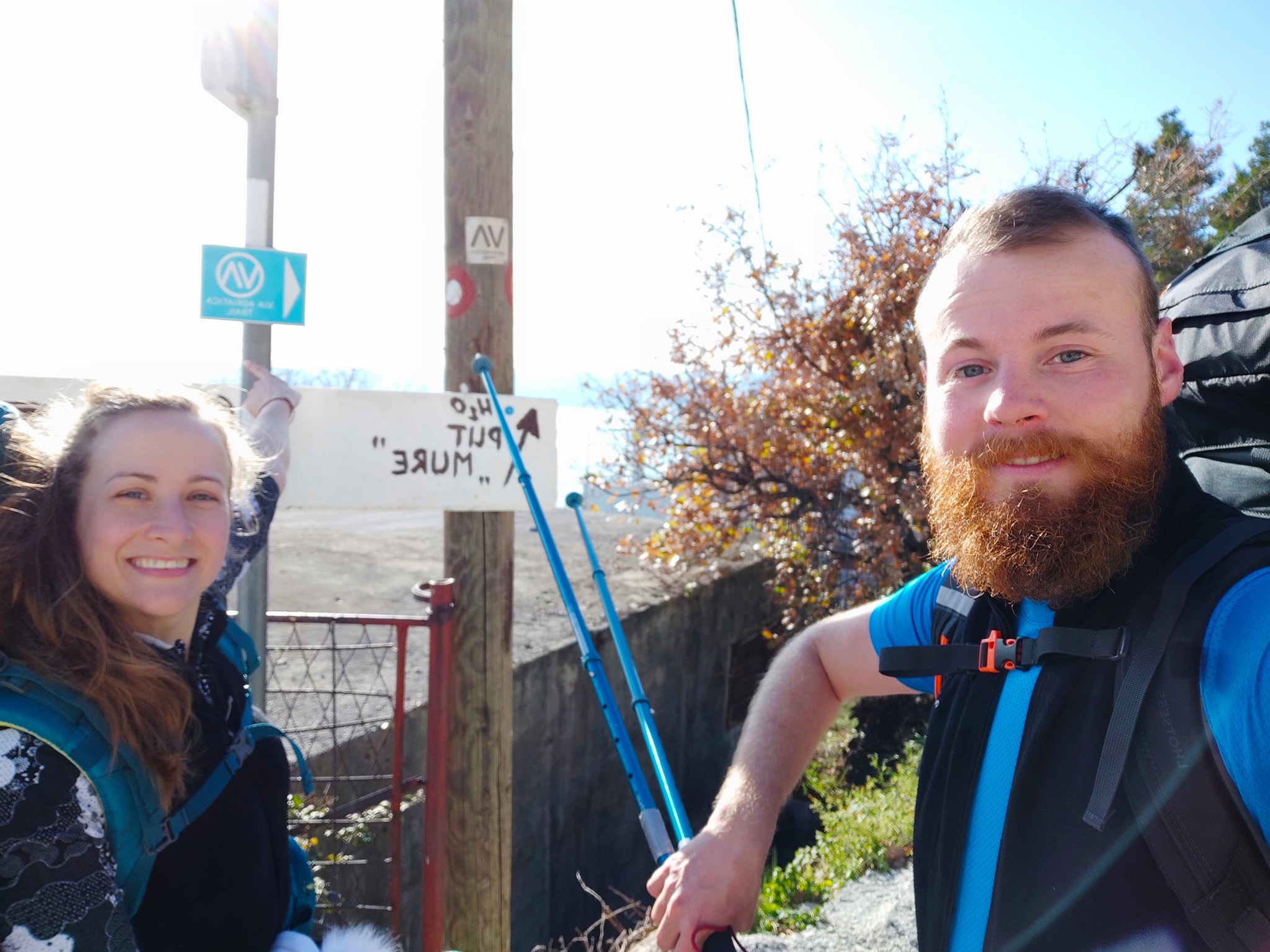
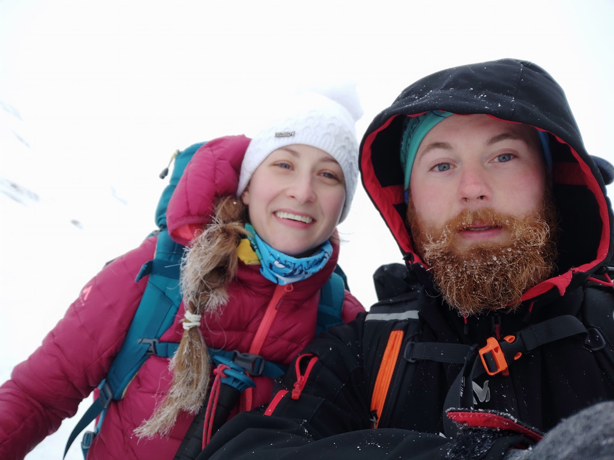
Josipa and Matija set off on the Via Adriatica trail on January 1, 2021, starting from Prevlaka, the southermost peninsula in Croatia. The last time we talked to them was one month ago when they were at Svilaja mountain, not even half of their journey. Yesterday, after 54 sunny, rainy, snowy, foggy, and windy days, this Croatian couple completed the Via Adriatica trail.
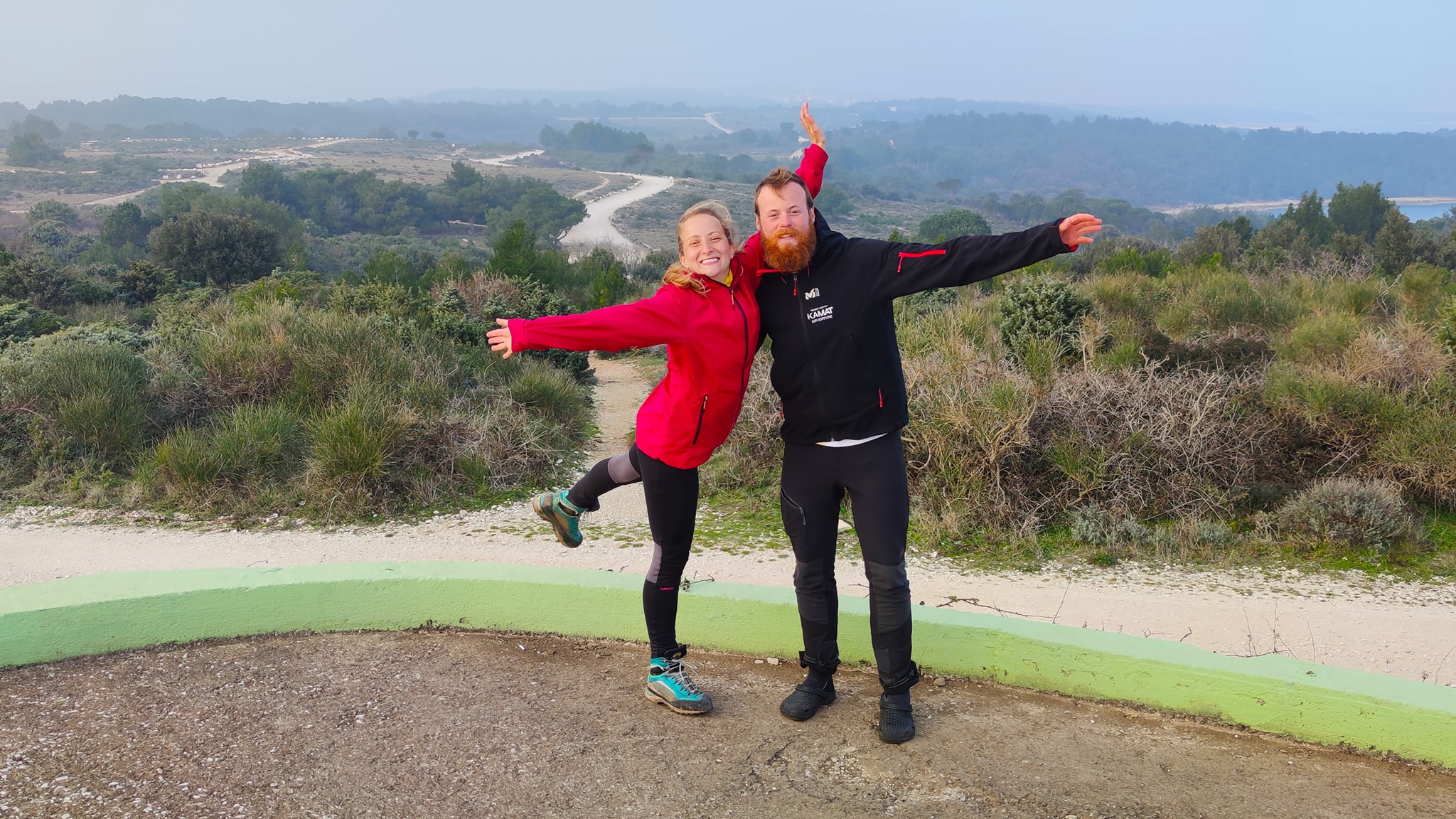
In the meantime, the Dinara mountain, a newly declared Croatian 12th National Park, amazed them the most, while Velebit mountain showed all of its natural power and broke them with snowstorms. However, after successfully overcoming all the climbs, peaks, sections, weather troubles, they finished their journey at Cape Kamenjak in Istria.
Lost in a minefield
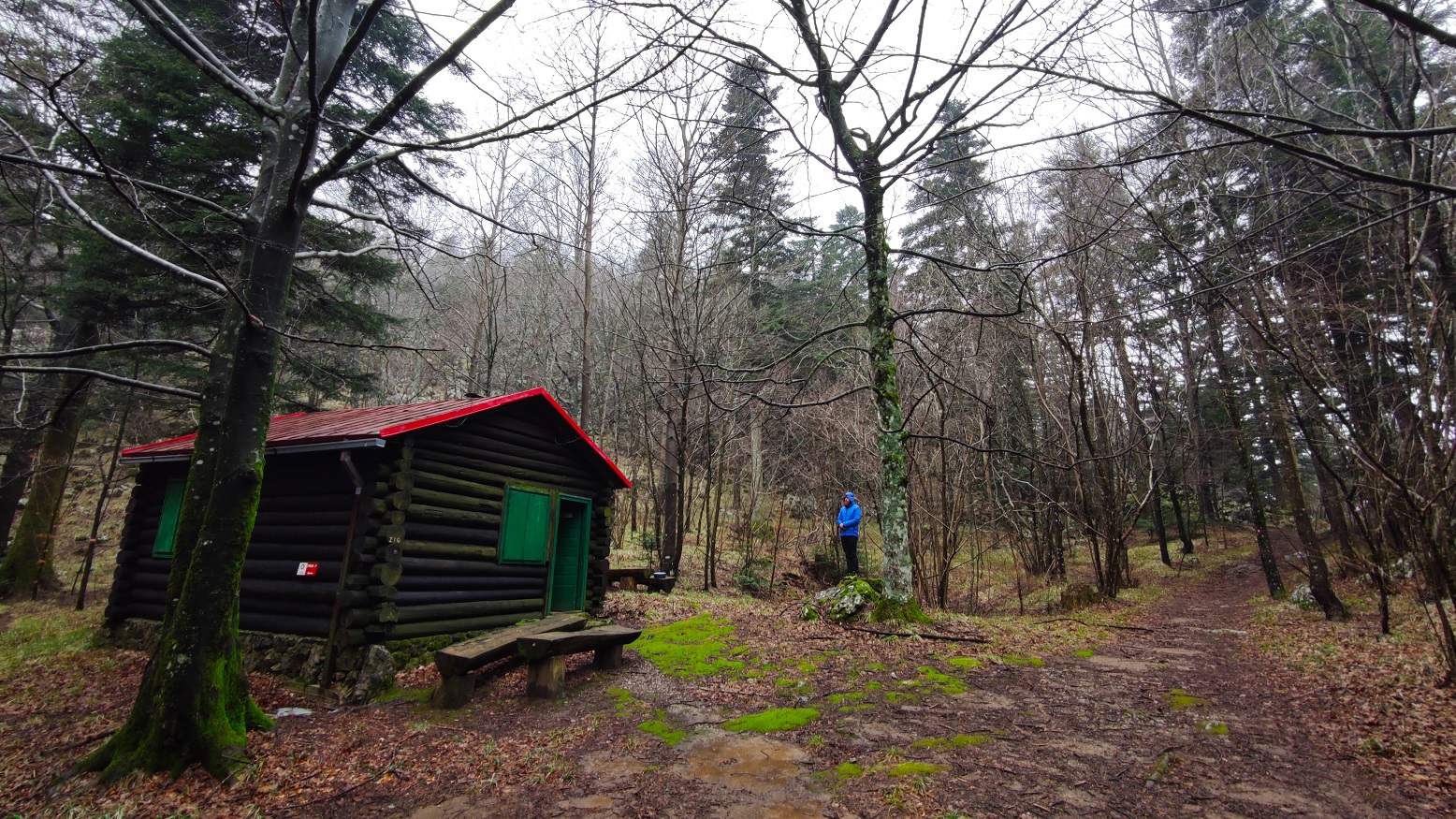
Since Svilaja mountain, when we last heard from each other, the weather conditions created many problems for Josipa and Matija. First, due to the heavy rain, they could not move from the shelter for three days, and the weather forecast was getting worse and worse. They had to move on because there was no point in waiting anymore.
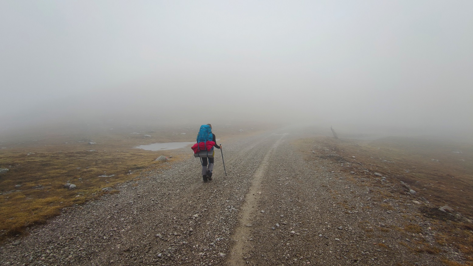
On the Dinara mountain, on the way to a shelter called "Vjetre s Dinare" ("Wind from Dinara" meaning Croatian stormy wind bura), they went through the fog, rain, icy rain, wind, and finally – through a minefield.
"We followed the markings, which at one point got lost because there was snow. It was a thick fog. We didn't see anything; the GPS didn't work either. So we went on our own about 200 meters. We saw a board in the distance, turned backward on us. We thought we would see something written on it, some marking! We climbed up, turned, and looked – 'caution, minefield, please don't pass this way.' I can't describe how we felt at that moment, without a trace, in the middle of nowhere. Besides, we were followed by a dog, a Turkish Kangal, which normally eats wolves," describes Josipa the moment when her whole life passed before her eyes.
Still, they somehow managed to get to that "Wind from Dinara" shelter, apparently so named for a reason. However, that's where another struggle started – lighting a fire.
Real Himalayan conditions on Dinara
All the wood was wet, and Matthias struggled to light the stove. Due to the rain falling for the previous three days and over which the snow was falling, their boots were completely wet. Wood splitting and lighting a fire caused them many problems on the way, which, they admit, took a lot of energy and nerves.
"This whole heating situation was forcing us day after day to pick up bags and warm-up, so we went to bed around 7 pm every day," says Josipa.
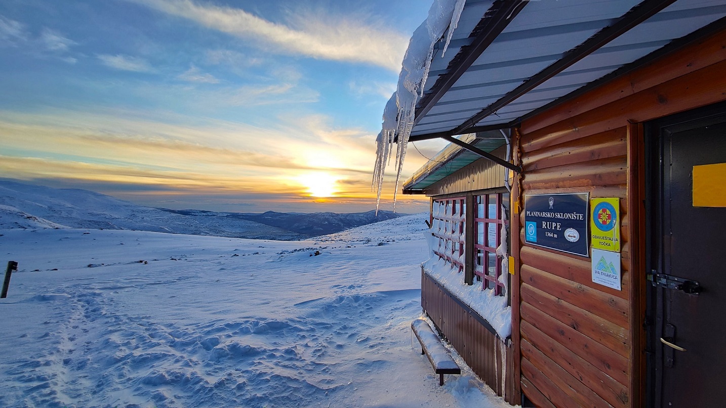
Mountain lodging Rupe on Dinara
On Dinara, they felt the power of the bura wind for the first time, which even extinguished the fire during one night in the shelter. All the smoke entered the small house, and all attempts to ignite the stove failed.
"It was freezing, minus 10 degrees Celsius, and the feeling reached minus 20 degrees with 110 km/h of gusts of wind. We experienced real Himalayan conditions on the Dinara," says Josipa.
Fortunately, they had warm sleeping bags with them – that were even too hot! Josipa and Matija couldn't believe that they were lying in a room while it's minus degrees while being hot in feathered bags. That's what it means for a mountaineer to have the right equipment. Still, they took advantage of those windy days to take photos and enjoy.
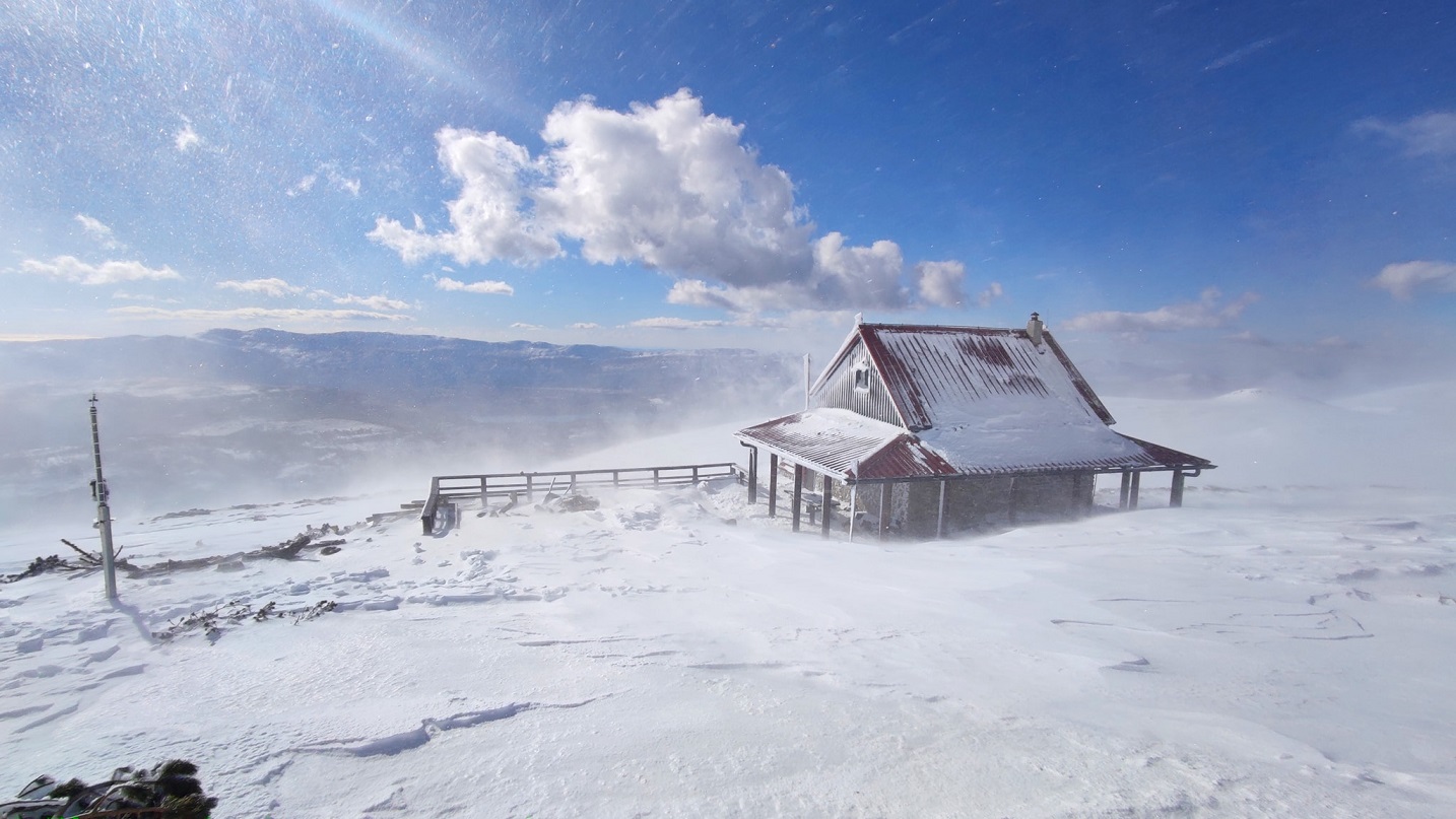
Mountain lodging Pume on Dinara
In the end, they had to leave the shelter and, despite a strong bura wind on which was difficult even to stand, let alone walk, they moved on. As the sun always comes after a storm, the weather finally calmed down, and it was beautiful.
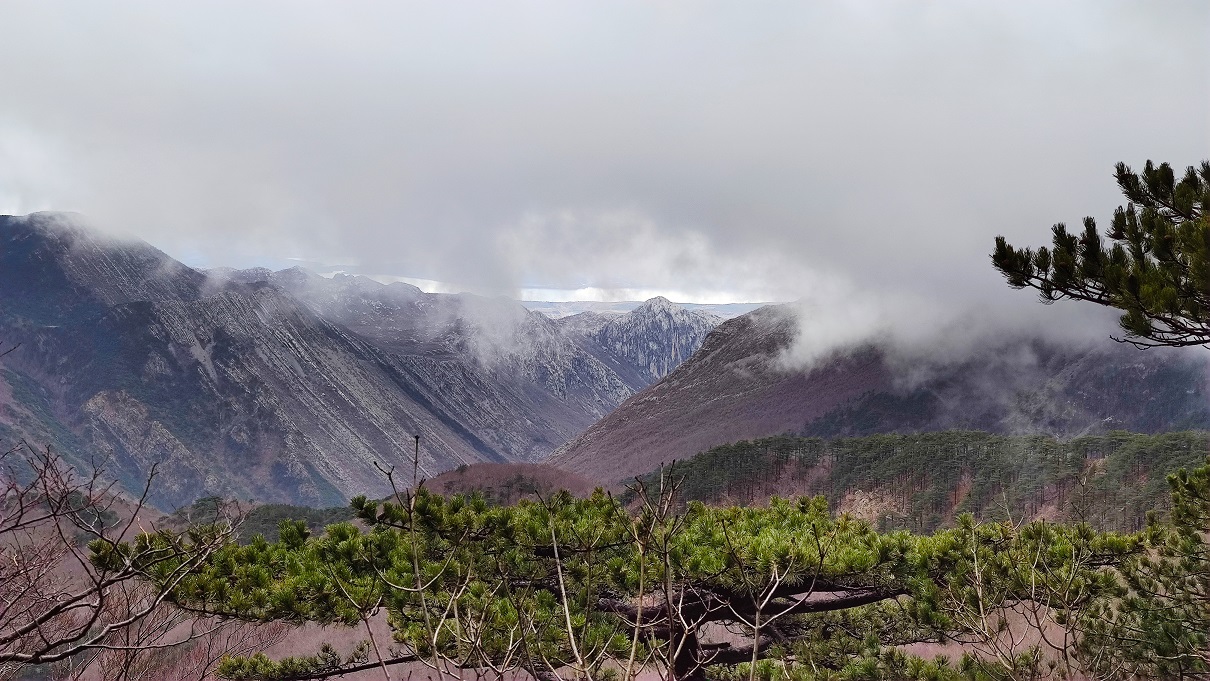
Dinara – idyllic, fascinating, special, spacious, beautiful
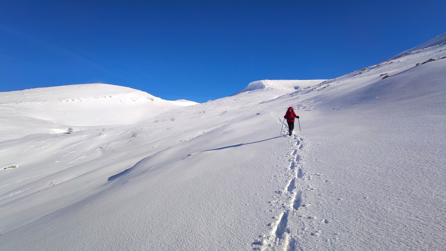
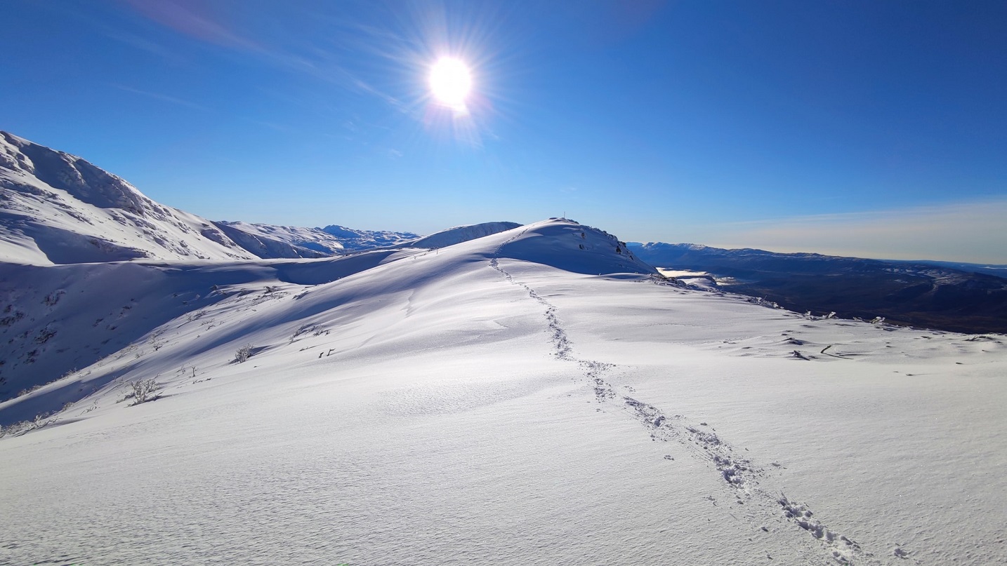
The path towards Lišanjski Peak, the highest peak of the southern Dinara, they say, is a magical place that cannot be described but must be experienced. It is also the furthest point from civilization on the entire route.
"You are in the middle of nowhere. There is nothing in sight, no city, no roads, and everything around you is white. Everything is full of white peaks and hills. Idyllic. If someone threw me here and asked where I was, I would certainly not say that I was in Croatia," says Josipa.
Josipa on Dinara
Matija on Dinara
And Lišanjski Peak itself is fascinating – you can see Bosnia, Dinara, the Cetina River source. In those hours and 15 minutes of climbing, they saw many fresh traces of bears, but (fortunately) no bear jumped out in front of them.
That part of the trip was the most beautiful, they agree. The weather was good. They even walked in short sleeves, though the snow had not yet completely melted. This incredible experience will remain in their memory forever. And when they descended to the source of the Cetina, Lišanjski Peak seemed so far away. An exceptional experience, unique energy, and a special ambiance, they say.
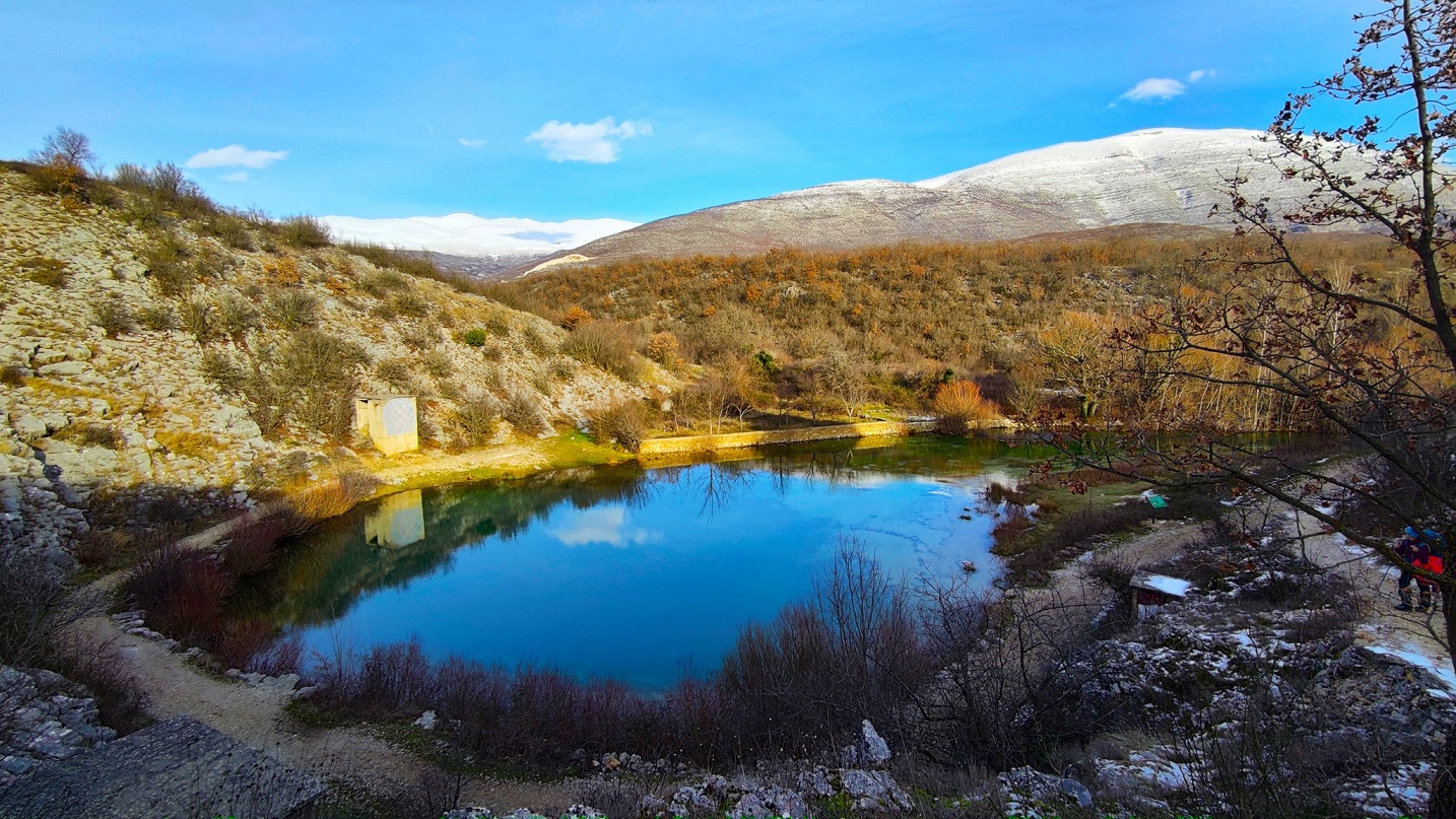
The source of Cetina River
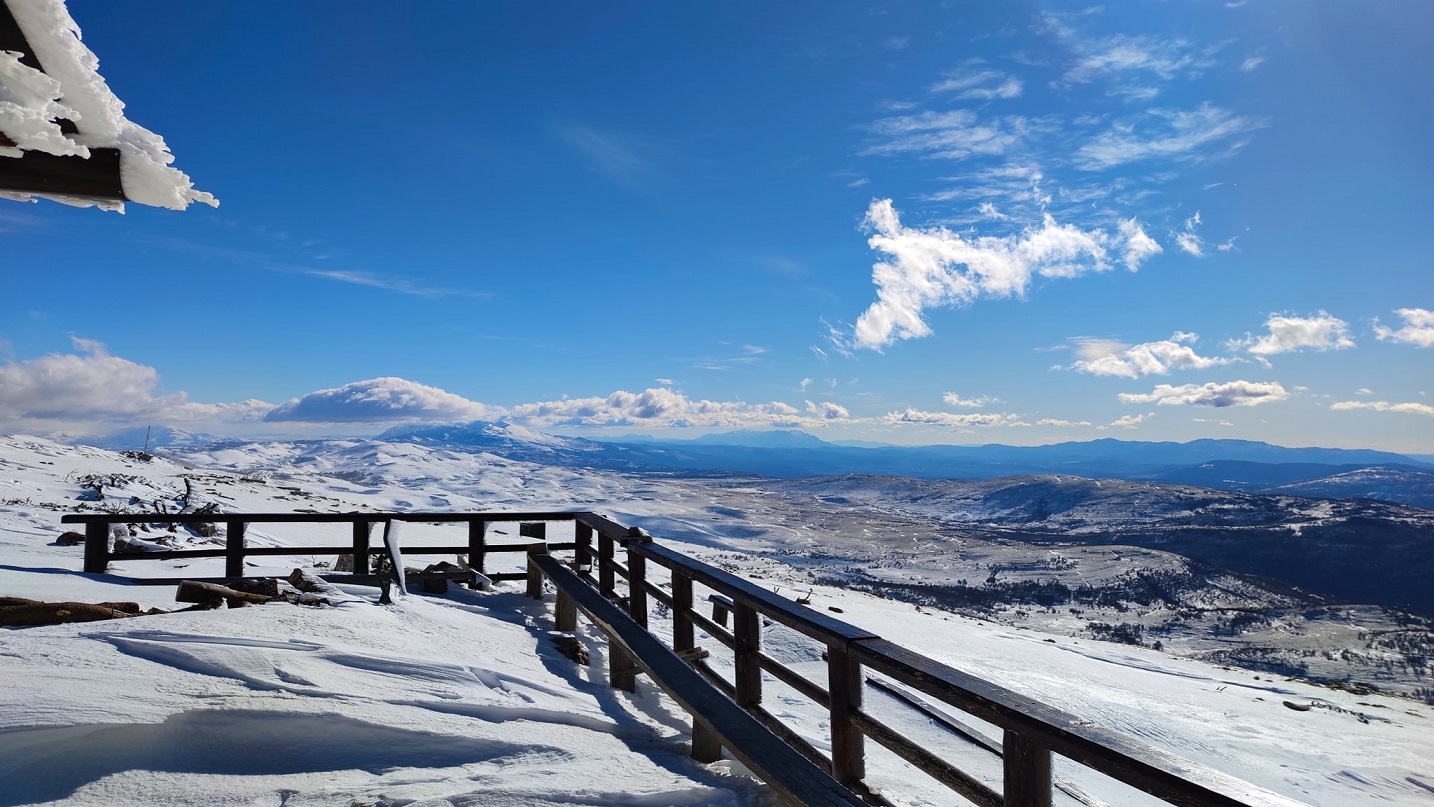
For Sinjal, the highest peak of Dinara and Croatia, they have no words. Now that they saw it under the snow, it seemed ten times more magical than in September when they first experienced it.
"We were standing up at the top, watching, and we couldn't believe where we had come. On one side, you see Biokovo that we passed. On the other side, you see Velebit that's waiting for us. We were proud of each other and ourselves. I get little chills when I think of that part," admits Josipa.
Dinara
Dinara
"Dinara is so spacious, so beautiful. Of all the mountains on this road, the Dinara has remained most etched in my heart and memory," says Josipa.
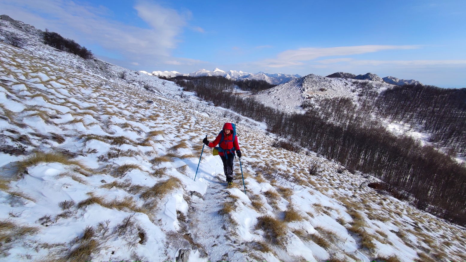
Velebit – almost giving up
They walked an average of 25 to 30 kilometers a day to the Dinara, and since they came to Velebit, they had been moving like snails. The weather conditions did not allow them to move faster than 10 kilometers a day.
On Velebit, they again got in a minefield, more precisely a demined area, also due to fog. The fear from Dinara returned. Everything around them was white – down because of the snow, up because of the mist, or clouds in which they were. They were disoriented. Then they realized that it was too dangerous to continue the journey.
Apart from the weather – alternating rain, south wind, bura, minus – their problem was every arrival at the next shelter. There were tears in those moments, they admit.
Šugarska Duliba on Velebit
There were some challenging days along the via Via Adriatica trail for this Croatian couple
They could not continue in the rain, especially in the thunder, because it is common knowledge that many mountaineers die due to thunder. However, luck was on their side. One friend drew their attention to a shelter that was not marked on the map, making their journey and planning easier.
On Velebit, they experienced a storm of all storms, with bura gusts of 150 km/h. In places where it pounded them, they barely adhered to sticks, arms, and legs. In one part, the bura even lifted them off the ground.
Josipa on Velebit
"Right in front of Baške Oštarije, where a warm bed and meal was waiting for us, the bura was blowing so much that it lifted us off the ground. If we were a pound lighter, we would probably fly into the air," says Josipa, adding that bura and cold take the most energy.
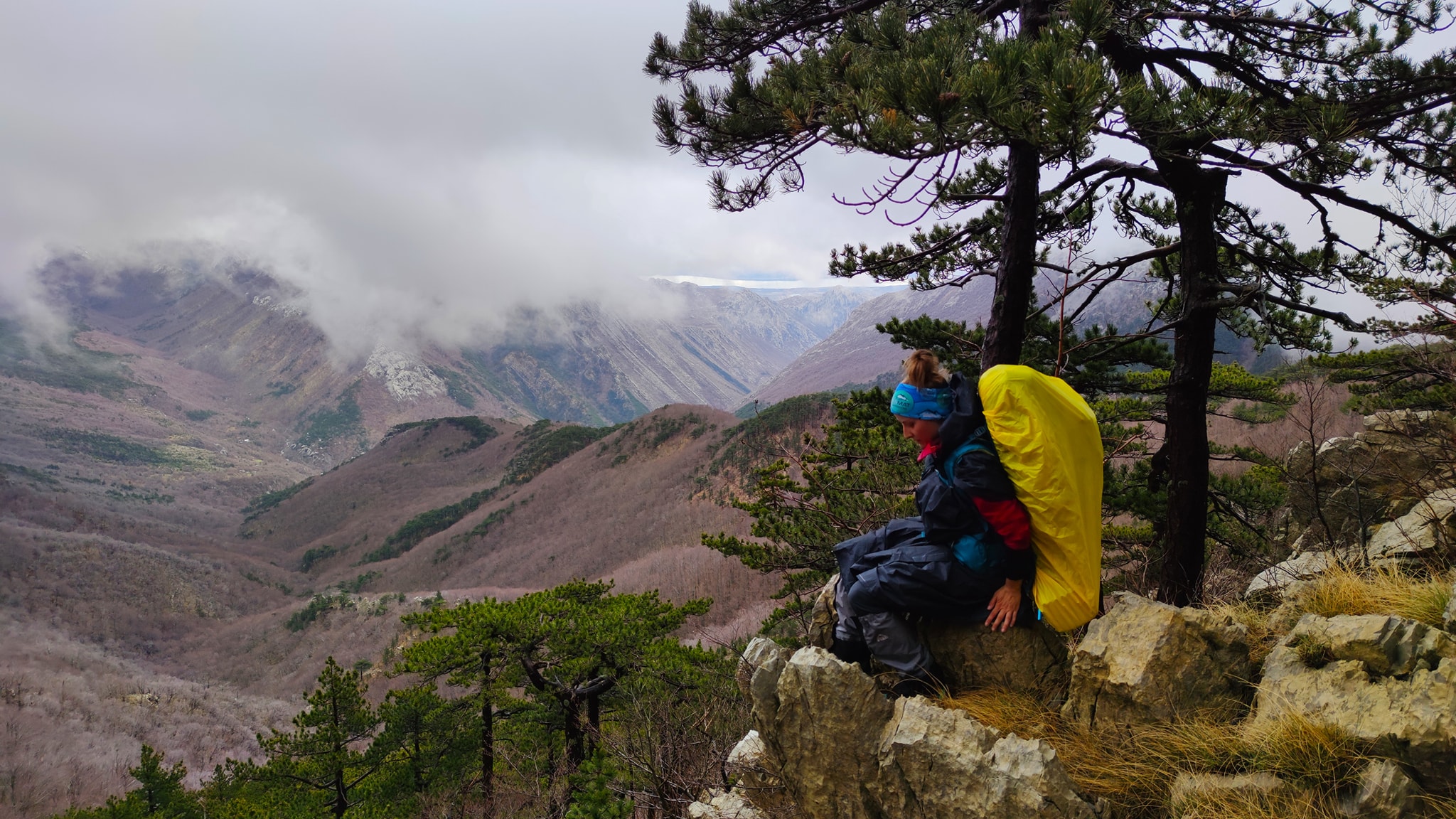
On the famous Premužić trail, cut into the slope, they thought it would be easy. However, when the snow fell, everything froze, and the track did not exist. It cost them time, energy, and nerves. It was a mental and physical breakdown, a difficult period.
"When the weather is great, the terrain is a disaster, and when the terrain is great, the weather is a disaster. Eternal struggle on our path. We were both sad and disappointed after Velebit because of that. Biokovo and Dinara got along so well, then we came to Velebit, and we thought it would be great because it's familiar to us," says Josipa.
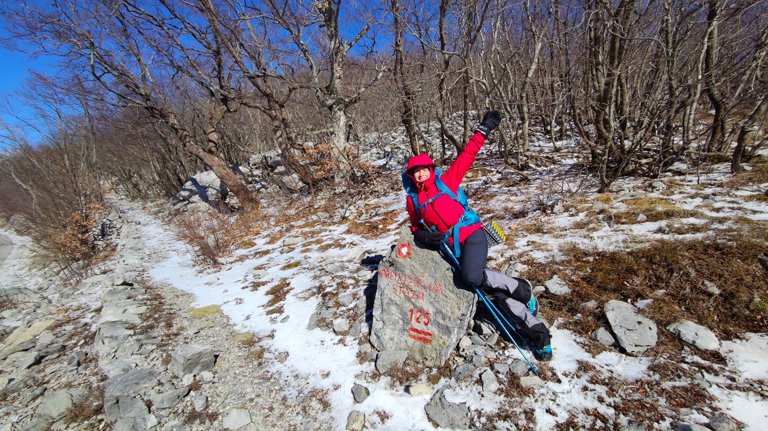
Josipa on Premužić trail on Velebit
Generous help from friends, family, and even strangers
Just before the end of the Via Adriatica trail, in Gorski Kotar, they could barely make their way through the fog, which is why they could not even enjoy the beautiful views. By then, they were slowly fed up, on the verge of giving up, but then, as always in life, friends jumped in. Unselfish support from friends, colleagues, but also strangers came from all sides and gave them extra wind in their backs so that they would not give up when there are already so many successfully traversed sections behind them.
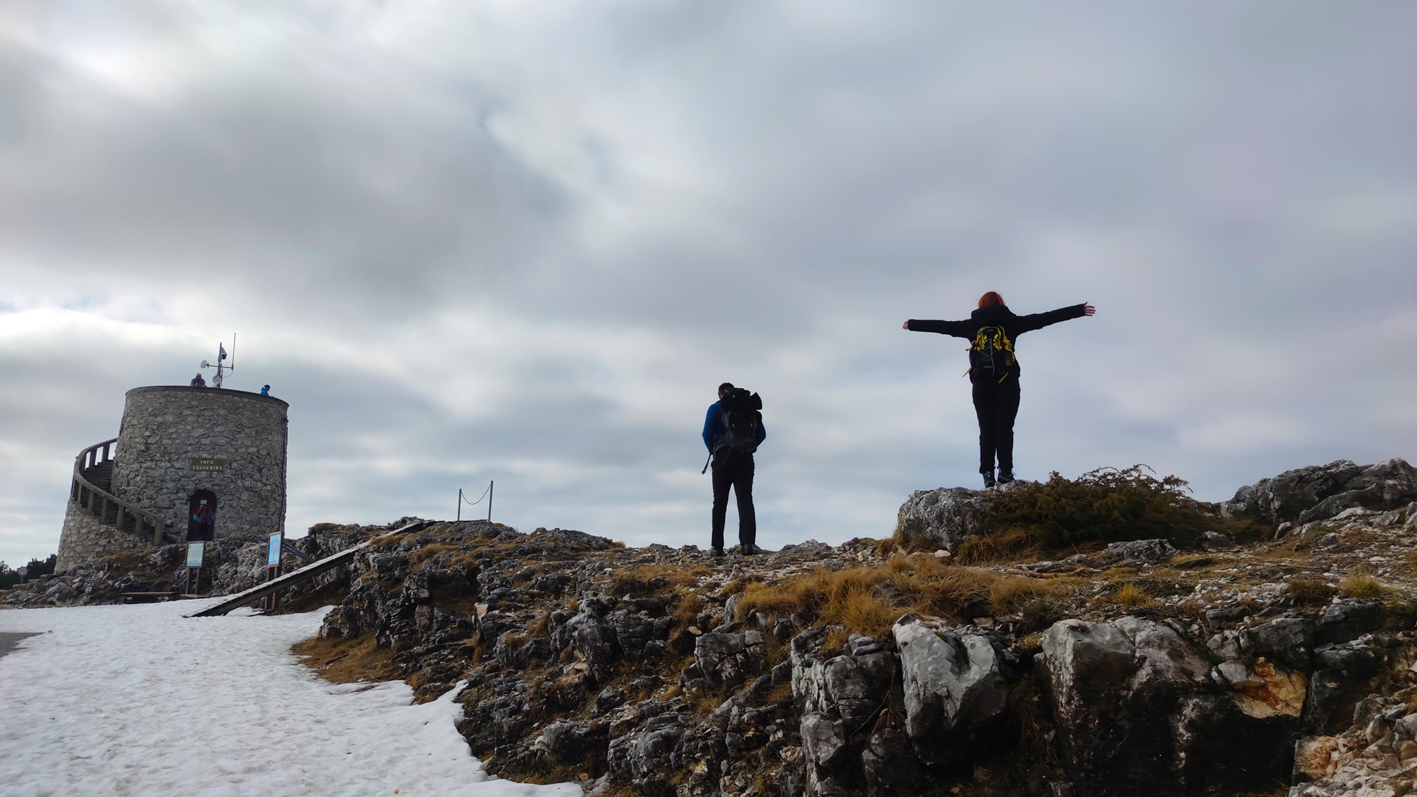
Josipa and Matija on Vojak – the highest peak of Učka mountain in Istria, at the very end of their journey
At Cape Kamenjak, their final destination, they were greeted by family but also by a few unknown people who were supporting them online. Friends couldn't welcome them because of work, but they're preparing a party on Saturday to frame and mark this whole story.
Although they hoped to finish the trail in mid-February, the weather proved to them to be patient and that sometimes things had to go according to nature's plan, not human's. They became patient with each other as well.
"When you spend so much time together, 0-24, you have to make some compromises. As a couple, we function very well, and we support each other when it is hardest," says Josipa.
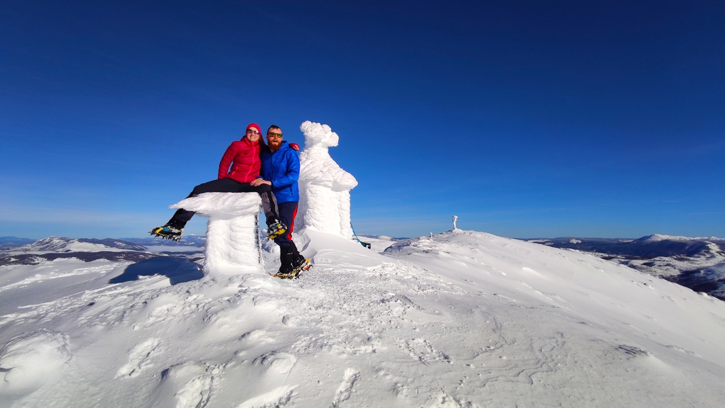
Josipa and Matija on the Sinjal Peak – highest peak of Dinara and whole of Croatia
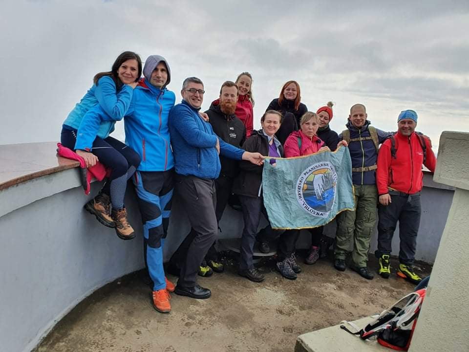
Except for roe deers and a few lynxes, they didn't see any wild animals along the way, only a multitude of wolves' and bears' traces, small and large. Also, they were mostly alone along the way, occasionally accompanied by a group of other mountaineers, as well as some beautiful and lovely dogs. However, as they say, they would not survive this trip without the generous help of their friends from Mountaineering Association Vrlovka, who would come and wait for them along the path to give them food and equipment. The fearless team of that mountaineering association even walked with them on Velebit's part while a strong bura wind was blowing, providing Josipa and Matija immense support.
'We wanted to promote the beauty of Croatia, Via Adriatica trail, and active lifestyle'
When asked whether they would dare to retake this path, they agree they wouldn't after all the troubles they faced along the way. But, if asked that question in a week or two, they would definitely say yes, but only under better weather conditions.
Winter has its charms, but it is also exhausting. It requires a lot of hiking equipment, and it is much more dangerous to go in winter than at any other time of year. If Josipa and Matija could choose, they would go in the spring or late fall. When in the mountains in Croatia, one should be humble and patient.
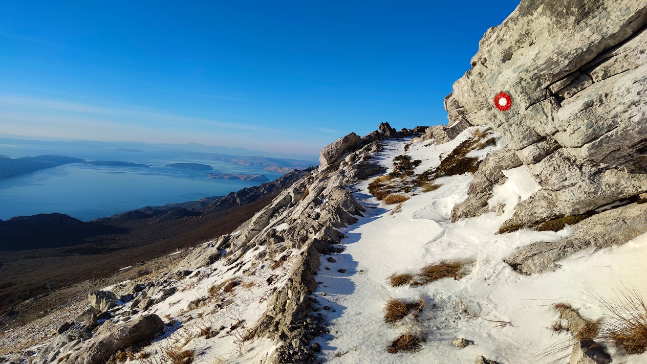
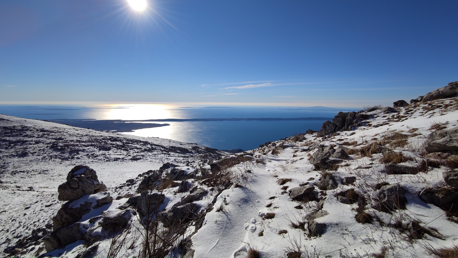
View of Croatian islands from Velebit
"Our goal was to promote the beauty of Croatia, to promote Via Adriatica, and to promote an active lifestyle, especially now at this time of the corona when we are all locked in our homes. I think that hiking is a wonderful hobby, both for the body and for the mind, whether in a company, in a couple, or alone," says Josipa.
Although Josipa and Matija are experienced mountaineers (Matija is even a member of the Croatian Mountain Rescue Service – HGSS), the tour was very demanding for them, both physically and mentally. Considering that they only got a chance to set off on Via Adriatica now, during winter, because Matija's work has been banned and Josipa is having a vacation, the winter conditions did not favor them. But regardless, they enjoyed the inexplicable natural beauties of Croatia and met many generous life-long acquaintances along the way.
"It's hard to describe all those feelings that go through your mind and heart along the way. To understand what we are talking about, it is the best to set out on such a journey on your own," advise Josipa and Matija.
All the photos are from interlocutors' private archives.
You can follow Josipa and Matija and their other hiking journeys on their Facebook page.
For the latest travel info, bookmark our main travel info article, which is updated daily.
Read the Croatian Travel Update in your language - now available in 24 languages.
Croatian Couple Set Off on 1,100 km Via Adriatica Trail to Promote Croatian Beauty
January 22, 2021 – As a New Year's resolution, the Croatian couple decided to set off on one of the longest and most demanding mountaineering ventures in Croatia – the Via Adriatica trail. Starting at Prevlaka, this is their 21st day of walking towards Cape Kamenjak in Istria. Delighted by Croatia's views and the hospitality of the people they met along the way, Josipa and Matija happily make their way through the first long-distance trail in Croatia.
The Via Adriatica trail combines existing hiking trails, forest roads, macadam, and roads in a total of 1,100 kilometers with 41,000 meters of altitude difference. The trail connects Croatia's most beautiful mountain massifs, peaks, and landscapes, stretching from the Istrian peninsula across the Croatian mountain threshold all the way to the Prevlaka peninsula.
As its name suggests, it connects the most attractive Croatian mountain massifs, peaks, and regions along the Adriatic coast. It passes through three national parks, three nature parks, six significant landscapes, three special reserves, and many protected areas.
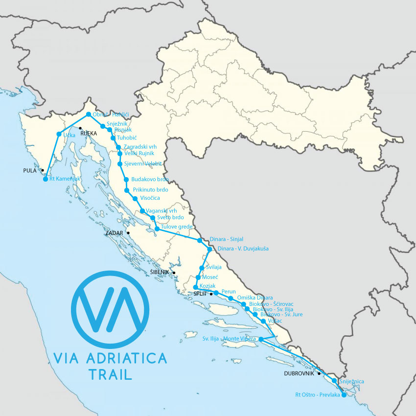
Via Adriatica trail
If we go in concrete figures, Via Adriatica goes along 14 mountains, 12 rivers, two lakes, 18 protected areas, seven counties, and 52 municipalities. What makes this trail attractive and popular among Croatian and foreign hikers are the sea and island views wherever it is possible.
Josipa and Matija, a young romantic couple from Croatia, are now on the way to Svilaja, a mountain in the Dalmatian hinterland. Although sighing from the constant walking with heavy backpacks on their backs, they tell their story of how, when, and why they decided to head to this fantastic Croatian long-distance trail right now, in January.
'We got in the car and left'
Both Josipa and Matija are natives of Karlovac and hiking enthusiasts, chasing each their careers, which allowed them two months of a completely new mountaineering experience due to a combination of circumstances. Josipa (27) has a master's degree in economics, works as a reception manager in one Zagreb hotel, while Matija (25) runs his own business in an adventure travel agency in Karlovac.
In mid-November last year, they discussed what they would do in January and February since there is not much in Zagreb hotels at that time of the year. When Matija was banned from working on December 1, they decided to go on the Via Adriatica trail to promote Croatia, its beauties, Matija's company, but also – themselves.
Josipa and Matija, Kozjak mountain
"We have time until the end of February, but we took more time than the average time needed to pass Via Adriatica because we took into account winter and unforeseen circumstances. We already know that we will have to take a three-day break this week due to heavy rain and stormy jugo wind," Matija told the Dalmacija danas portal, which caught up with them in Žrnovnica. They were hosted by the Association Žrvanj, which makes its premises available to all hikers who decide to cross the entire Via Adriatica.
For Josipa, as she says, Via Adriatica was a great idea, but it never crossed her mind to set off on this, not at all simple, but beautiful trail. However, she took advantage of this unique opportunity and, together with her beloved Matija, a member of the Croatian Mountain Rescue Service (HGSS), set off on an adventure.
"In December, we didn't know if we were going to leave or not. There was quarantine, bans, passes. Until the last three days, we didn't know if we were going. Then the earthquake happened, and again it was a question of whether I would go to the rescue or not. Given the time invested in preparation and all the equipment, we said we were going. We got in the car and left," says Matija.
Kozjak mountain
'People make the whole trail special'
Although Via Adriatica starts in Cape Kamenjak in Istria, Josipa and Matija decided to start from the last destination in Prevlaka, to be closer to home in Karlovac at the end of the trail.
"The idea was to be in Dalmatia for the first few weeks, while we have supplies of food and then start getting closer to home. It's more natural to get closer to home than the other way around. We celebrated the New Year, and in the morning, we left Prevlaka," says Josipa.
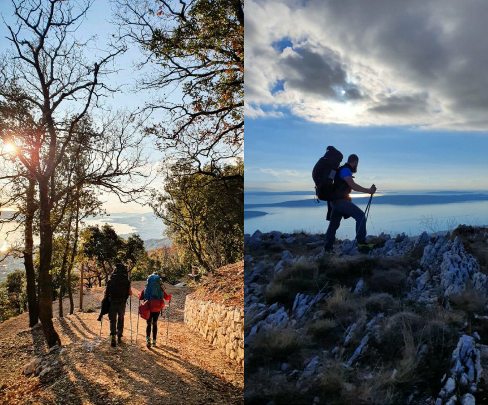
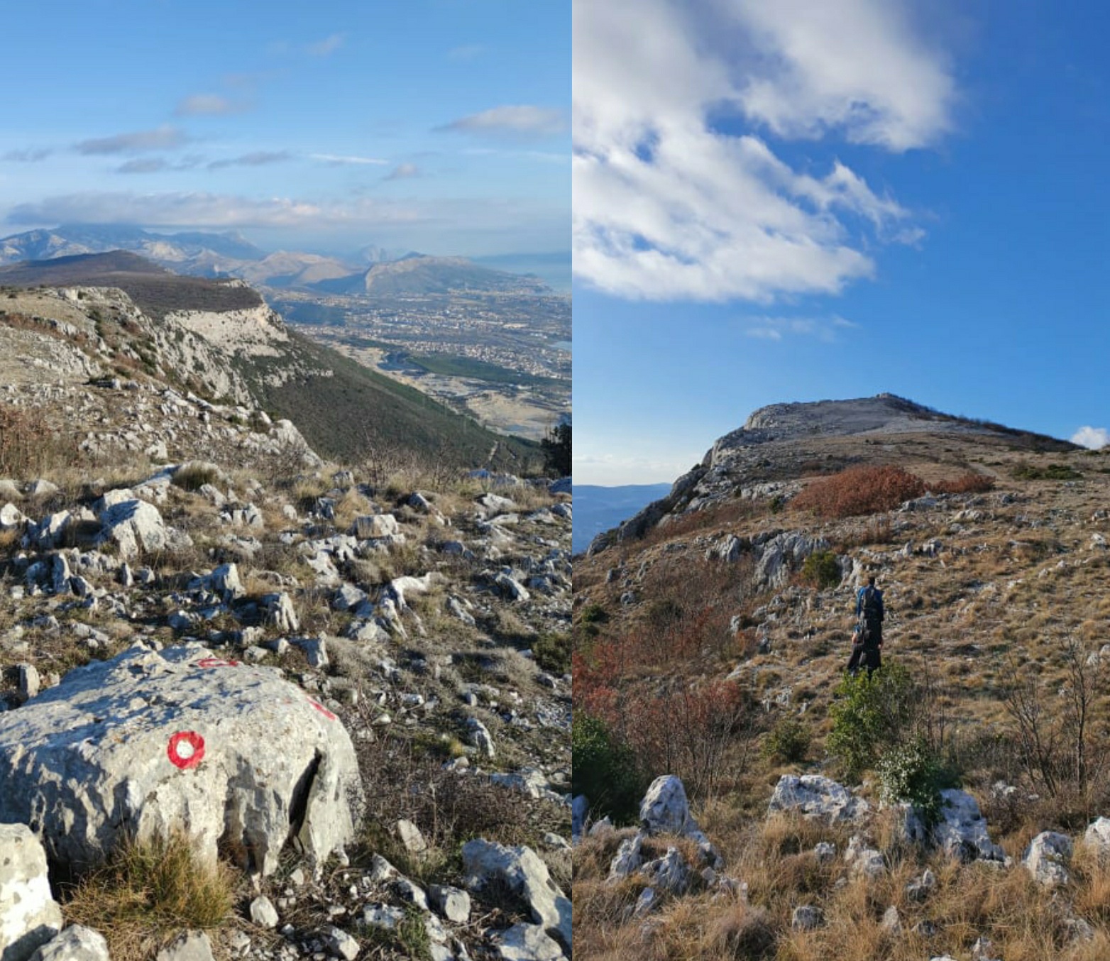
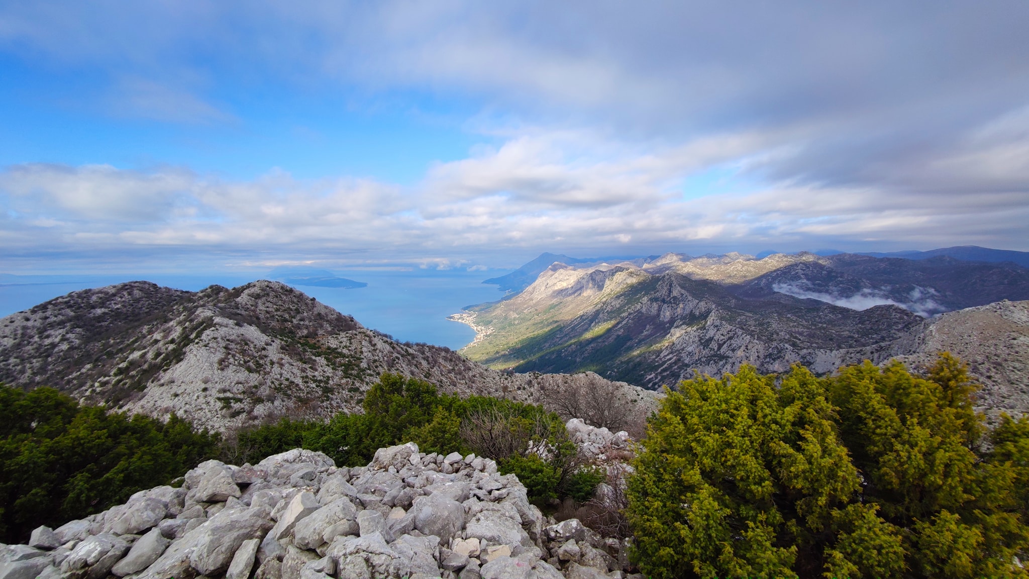
"The first two or three Via Adriatica's sections are quite flat. When you walk on the flat for a long time, you get bored. Pelješac is beautiful, the view from Sveti Ilija, the highest peak of the Pelješac peninsula, is magnificent, but it takes so long to get there! We only reached the 'real' mountains after Pelješac – Biokovo, Omiška Dinara… Perun has beautiful views," says Matija, emphasizing that the most beautiful parts of the trail are – the people.
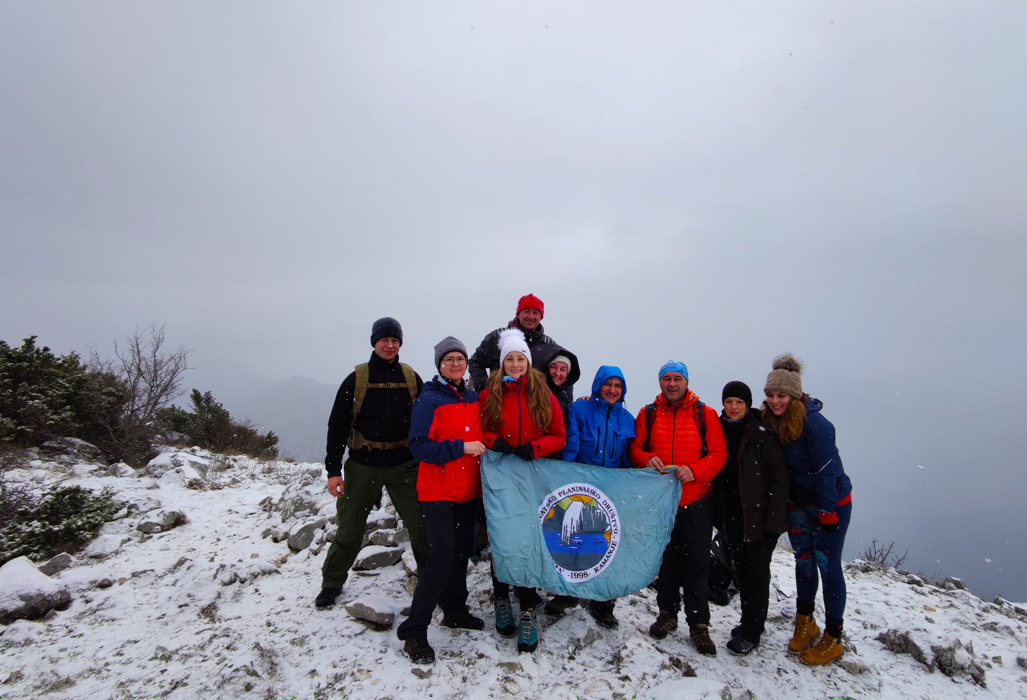
On the fifth section, Josip and Matija had good company - members of a mountaineering association
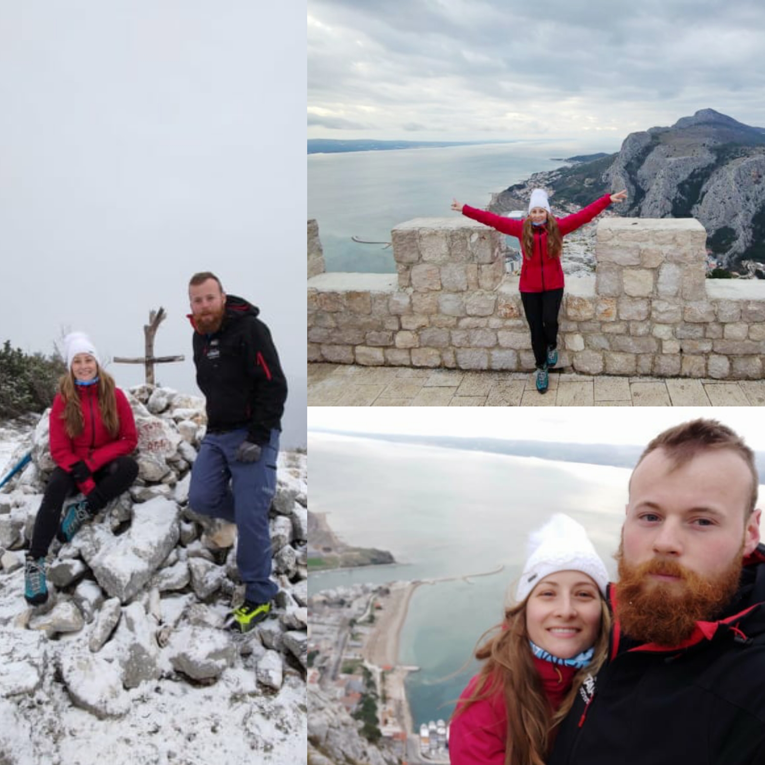
Josipa and Matija at Omiška Dinara
"People make the whole trail special. People selflessly give you their home, food, hospitality. There is no doubt that this path would be five times harder if people did not help. It wouldn't be impossible, but it would be a lot harder. If we had to sleep in the winter in a tent every night, it would not be easy. This way, when you know that warm accommodation awaits you in the evening, you are mentally better prepared. People feed us and take care of us," says Matija.
As they talk to us, they are on the sixth section of Via Adriatica, out of 13. Another 600 kilometers is still in front of them, but they are satisfied with their pace. With a laugh, Josipa says they are breaking through the thorns.
Best views they've ever seen
Before Via Adriatica, they visited Biokovo several times, but always during summer when everything is "stone and heat." They experienced it for the first time in the winter, and they say it was impressive.
"We imagined Biokovo white with huge vastness. And it greeted us exactly like that; icy, white. The weather was perfect; the snow was perfect for walking. We walked in crampons because everything was frozen. Although it was icy and cold, it was sunny, like in a movie. It was snowing on the Omiš Dinara, the large snowflakes falling," describes Josipa.
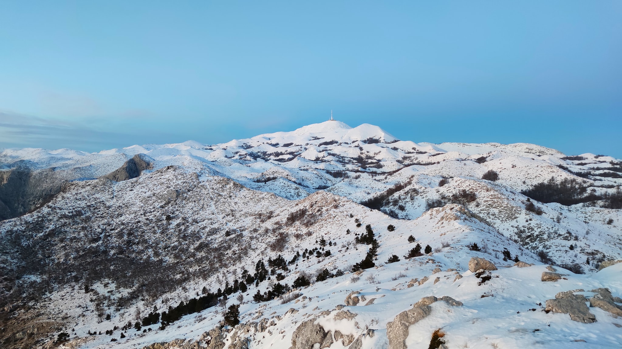
Snowy Biokovo
View from Biokovo
Then followed Perun or Poljička mountain. Perun, says Matija, is not Biokovo, but it has its charms.
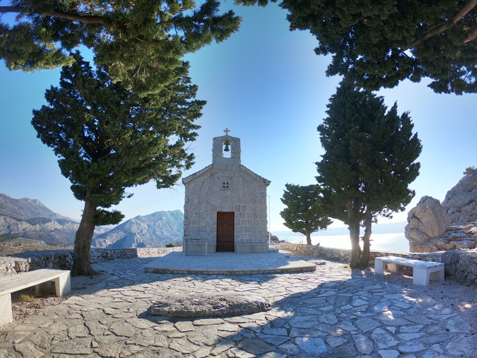
Capturing beautiful moments on their way to Perun
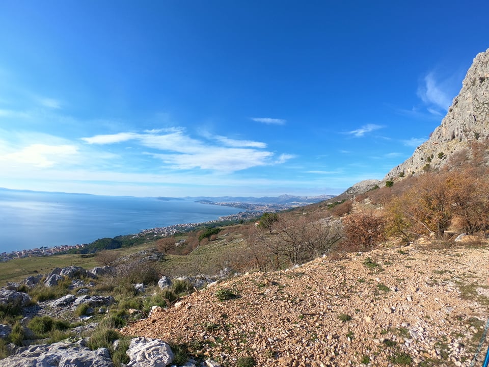
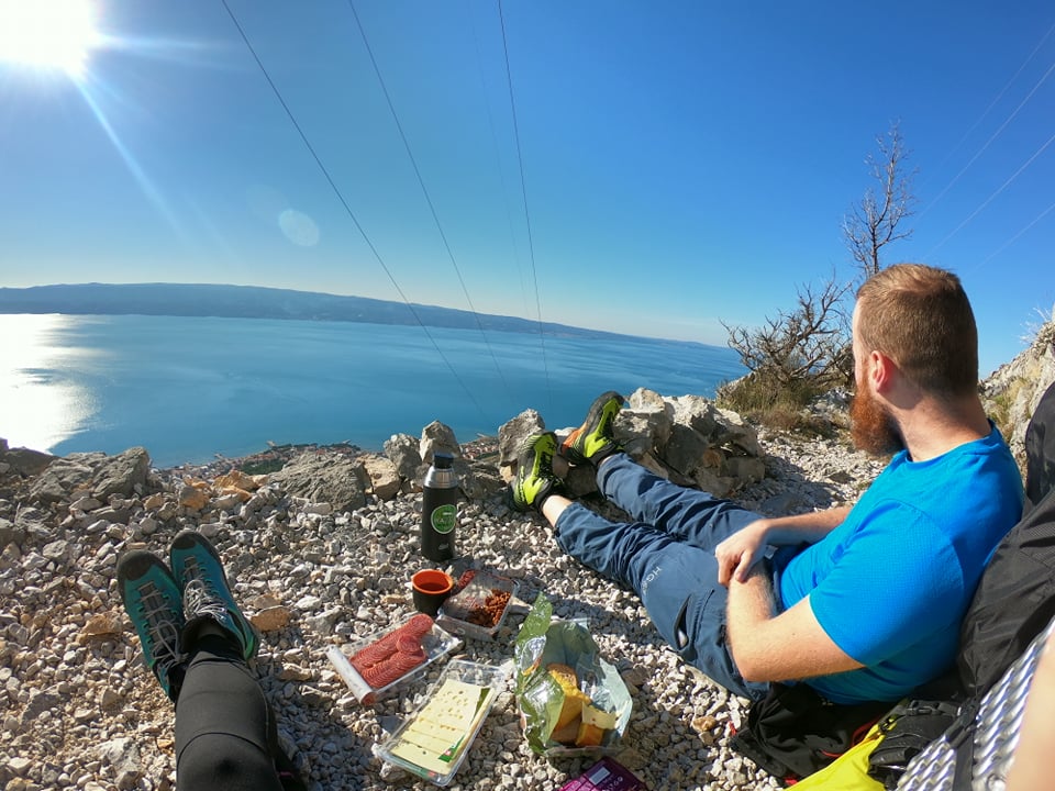
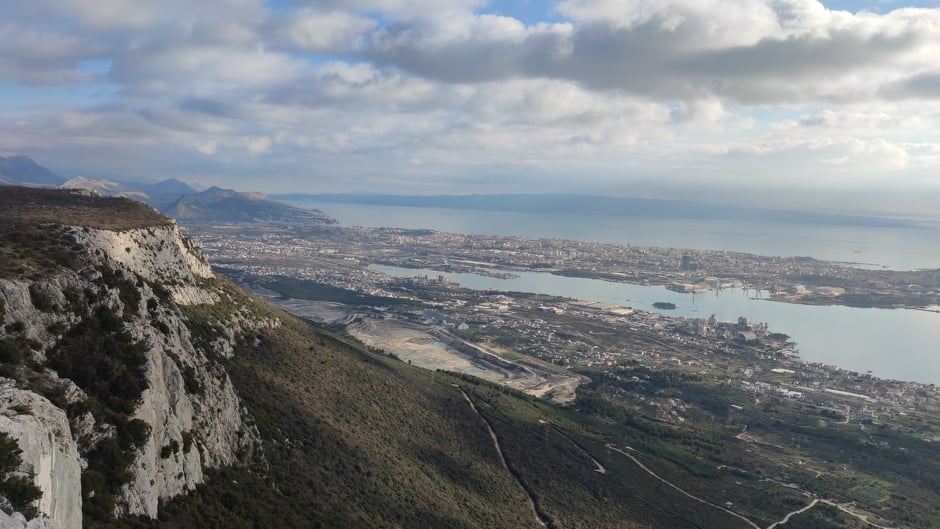
"From Omiš, you go a little towards the village of Gata, so the ascent to the chapels begins, and then descends to the seaside, which is beautiful, with a view of the islands. The moment when Split appears in front of you is especially impressive. So far, I've seen Split from all sides, even from a helicopter, but this is the best view of Split I have ever seen. Brutal," says Matija.
The northern part of Dalmatia - the Dinara mountain, the Lika region, and Velebit mountain - are still waiting for them. The journey is challenging but also exciting.
"Dinara and Velebit are our next challenges. Dinara is quite laid, and I think it will be relatively easy. We know it will all be covered in snow. On Velebit, Vaganski Vrh and Sveto Brdo, two highest Velebit peaks can be quite tricky, especially if those huge cliffs freeze," says Matija, but points out that they are well prepared.
Good equipment is the key
So far, they have not even used all the equipment they brought with them, and they were at a temperature of -15 degrees Celsius with a strong wind. They have high-altitude hiking boots, sleeping bags that can withstand -20 degrees. They also have a real expeditionary Himalayan tent for two, weighing a little less than 4 kilos, wind-resistant over 150 km / h.
"We mostly relied on obtaining quality and safety equipment. Since we travel in the winter, we needed good winter equipment that can withstand low temperatures. I think we did our best in researching for good equipment. We have quality equipment, and we are ready to sleep in winter conditions," says Josipa.
She doesn't check her phone very often, and the signal is lost every now and then, so it's harder to communicate. However, that doesn't bother them – they have each other.
Josipa and Matija
When asked how much it took them physically to prepare for such an endeavor, they say that they are in the mountains every weekend and spend all their spare time in the mountains, so they do not physically prepare too much.
"As for mountaineering life, we are very active. We crossed both easier and harder climbs, both in summer and winter, so we are well prepared. And mentally... I don't think you can mentally prepare for that until you face the path itself. You have some idea what it might look like, but until you find yourself there, you don't know," says Josipa.
Prepare, don't rush, and enjoy the fantastic scenes
And that hiking is becoming a popular hobby in these new circumstances is confirmed by the story of Marin Zovko, who, combining Via Adriatica with the Croatia Long Distance trail, recently walked the whole of Croatia in just 100 days. He decided to embark on his adventure alone and later admitted that loneliness had fallen hardest on him.
Josipa and Matija, more or less, always hike together and often mountaineer in larger groups since they are active members of the mountaineering society. Apart from the company that the hiking companions provide, Josipa says that it is good to hike in the company for safety reasons.
View from Kozjak
"Honestly, I would never dare to undertake such an endeavor alone. Matija knows a lot about the mountains, and since he is a member of the HGSS, we are in safe hands," says Josipa happily.
They recommend people to enjoy the trail, not to rush, but to prepare.
"It takes a lot of courage and a lot of madness to set out on a journey like this, but the trail takes back everything a hundredfold. We watch amazing scenes, and we get to know our country even better. Whoever is interested in something like this, I would recommend it from the bottom of my heart, "says Josipa.
We now let them continue their journey in peace, enjoying all the natural beauties surrounding them because they are quite exhausted due to the Via Adriatica venture's daily demands.
All the photos are from interlocutors' private archives.
To follow more news from their Via Adriatica adventure, you can find them on Facebook.
For the latest travel info, bookmark our main travel info article, which is updated daily.
Read the Croatian Travel Update in your language - now available in 24 languages.
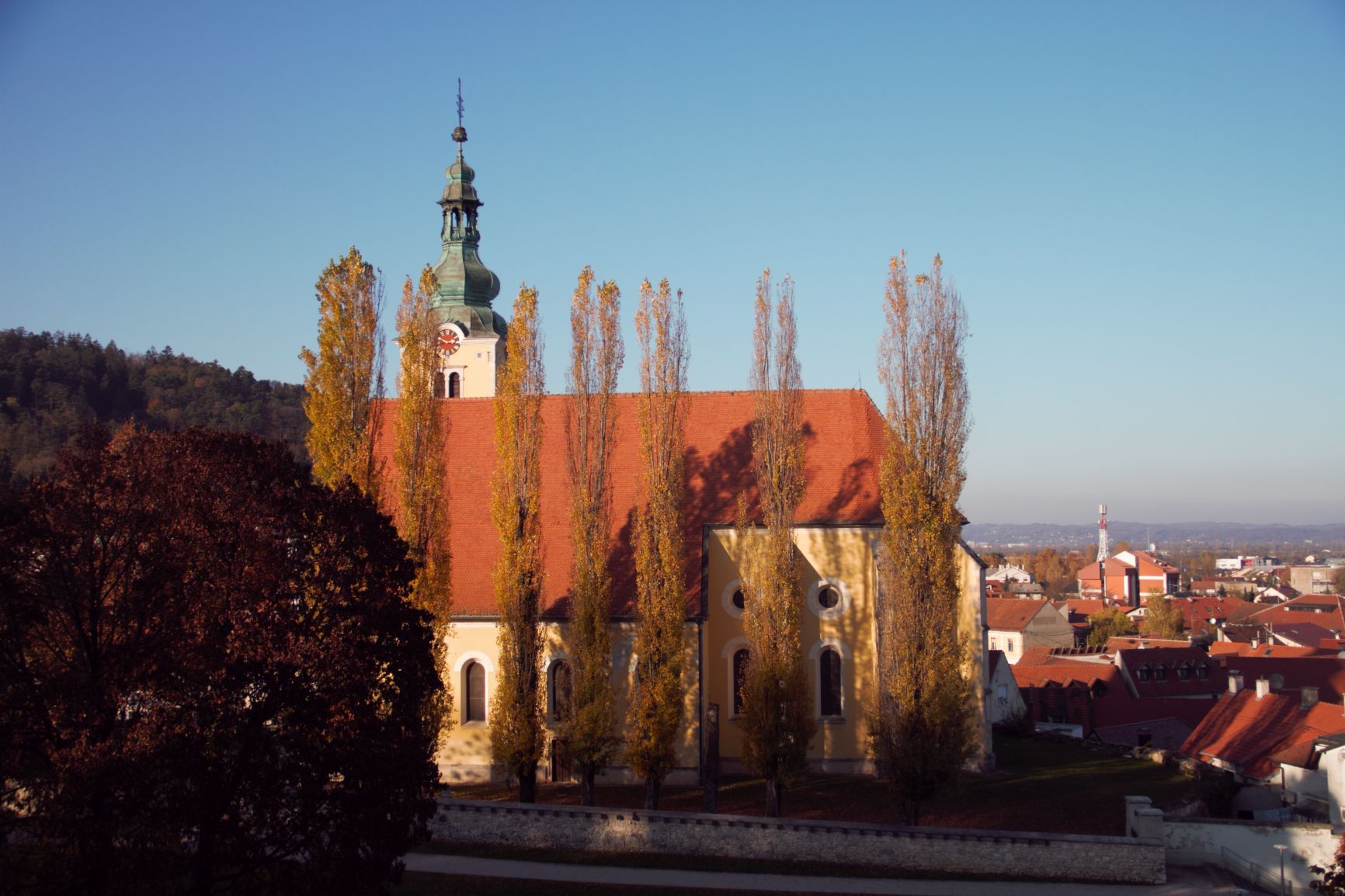
PHOTOS: A Walk through Samobor, Small Medieval Town Near Zagreb
November 08, 2020 - Samobor is a small medieval town of Baroque architecture located only thirty kilometers away from Zagreb. This popular excursion destination situated on the slopes of the Samobor hills is an amazing weekend getaway for all who enjoy the good combination of nature, history and gastronomy.
Although everyone associates Samobor with its most famous tourist attraction, the Samobor Fašnik, this charming town attracts all lovers of cycling, hiking, fishing and even paragliding. This cradle of mountaineering abounds in numerous groomed trails that lead you to beautiful mountain peaks, waterfalls and hidden caves. From there you can reach Japetić, Oštrc or Plešivica or you can just take a chill walk to the old town of Samobor.
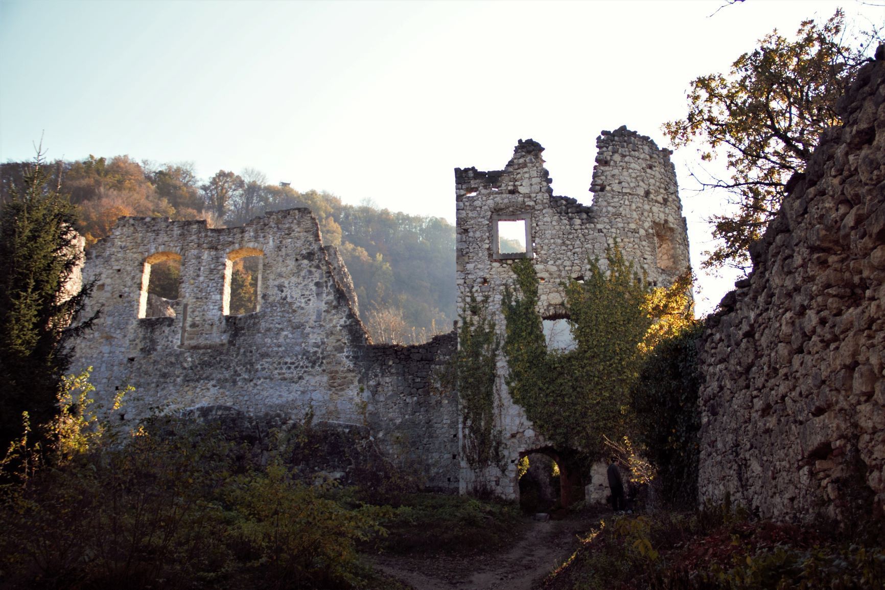
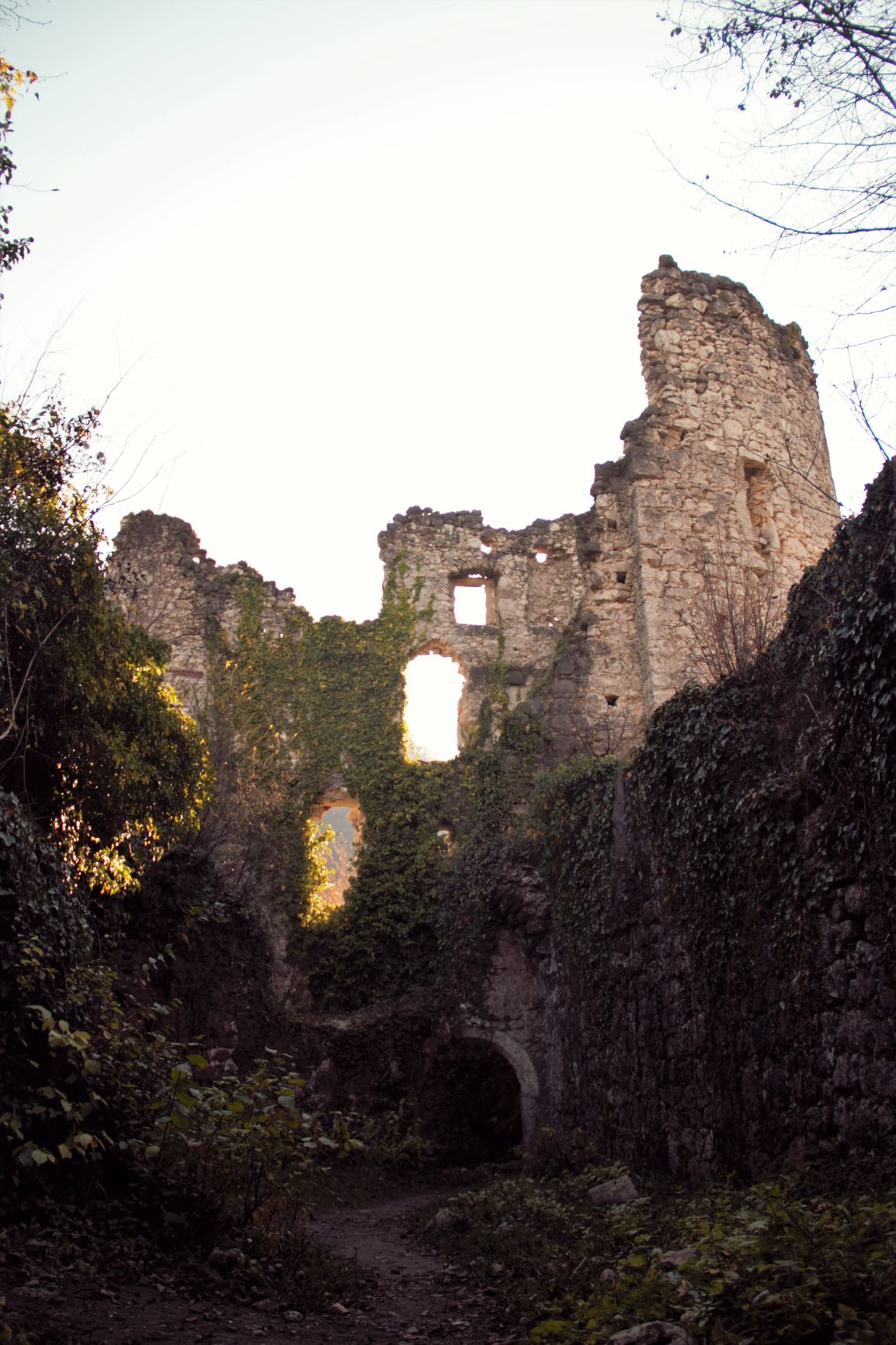
The old town of Samobor was built in the 13th century by the Czech king Otokar, and later numerous noble families, such as Arpadović and Anžuvinac, upgraded and lived there. In addition to being used as a castle to lords, it also served as a location for the filming of Jackie Chan’s movie Armour of God.
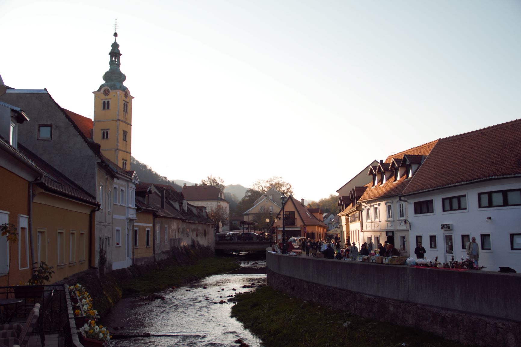
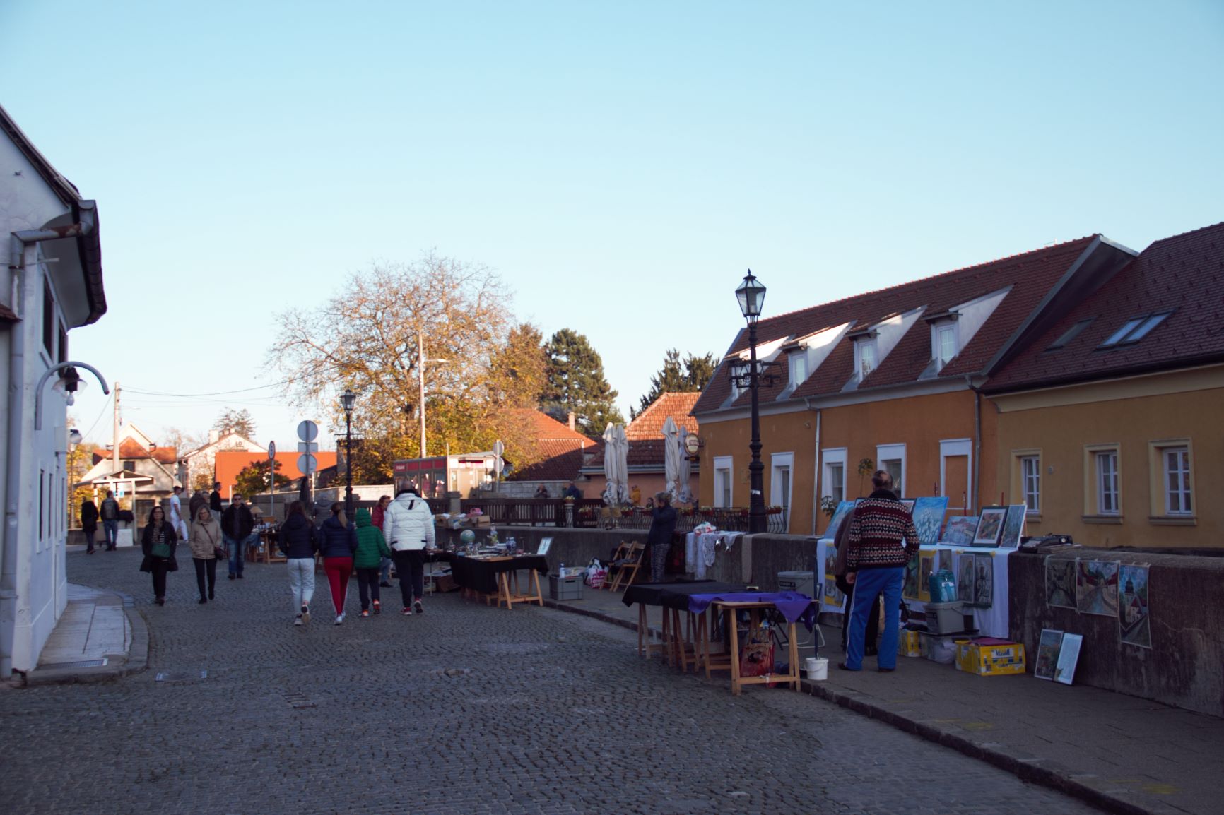
Samobor is ideal for sightseeing on foot. Everything is about fifteen minutes away from King Tomislav Square and the Church of St. Anastasia. In the square, each building tells its own story. On the balcony of house number 13, the Illyrian poet Stanko Vraz saw his muse Juliana Cantilly for the first time, and at number 14, the great writer Antun Gustav Matoš spent his days. In the middle of the square, there is an old well with drinking water and a legend that says that whoever drinks water from it always returns to Samobor. If you are lucky, on weekends you can see interesting antiques at the city flea market.
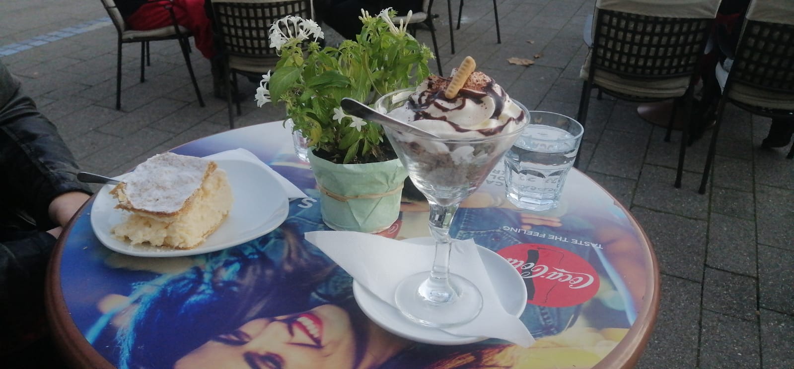
If you are not a fan of sports and recreation, Samobor offers a rich and varied gourmet offer, but the trademark of this city is certainly - kremšnite! This world-famous puff pastry and cream cake can be reason enough to visit Samobor, believe me.
All photos © Sara Alduk
For the latest travel info, bookmark our main travel info article, which is updated daily.
Read the Croatian Travel Update in your language - now available in 24 languages.
Mljet Visit Hiking Trip to Celebrate Island's Thru-Hiking Trail
The traditional "Mljet Visit" (Pohod na Mljet) for numerous Croatian hikers is organized again this year. This will be the 14th time the trip is planned for hikers to visit the Dalmatian island with a long tradition of mountain hiking.
This year the theme of the Mljet Visit will be the celebration of the final extension of the hiking trail on Mljet, called the Mljet Thru-hiking Trail (Mljetska planinarska obilaznica). The trail was opened in 2012, and up until this year, it was 40 kilometres long, connecting Pomena at the western-most tip of the long Mljet island with Sobra, a village in the central part of the island. This year, another 22 kilometres were added to the trail, which now connects Sobra with Saplunara, located at the eastern-most tip of the island. So, while hiking is probably not the first thing that comes to most minds when Dalmatian islands are mentioned, the island of Mljet hopes to attract many hikers, interested in seeing a completely different side of a sunny island.
A detailed map of the trail, as well as the GPS trail and extensive photo documentation of the trail have been created, and you can get the trail journal and guide for the entire length of the island. There are over 20 controls on the trail, and the people who worked on it say that it took around 20 hours of hiking for the Pomena-Sobra trail, so probably a bit over 30 hours for the entire length of the island.
Mljet Hiking Club as well as several hiking clubs from Zagreb (Vihor, Željezničar, Zagreb-Matica), eco-associations from Mljet and local community worked together to finish the trail, so in late April and early May they're all celebrating with two group hiking visits to Mljet. The groups will be based in Pomena, in Odisej Hotel, and will be hiking and visiting as much of the island as possible during their 5 days on Mljet.
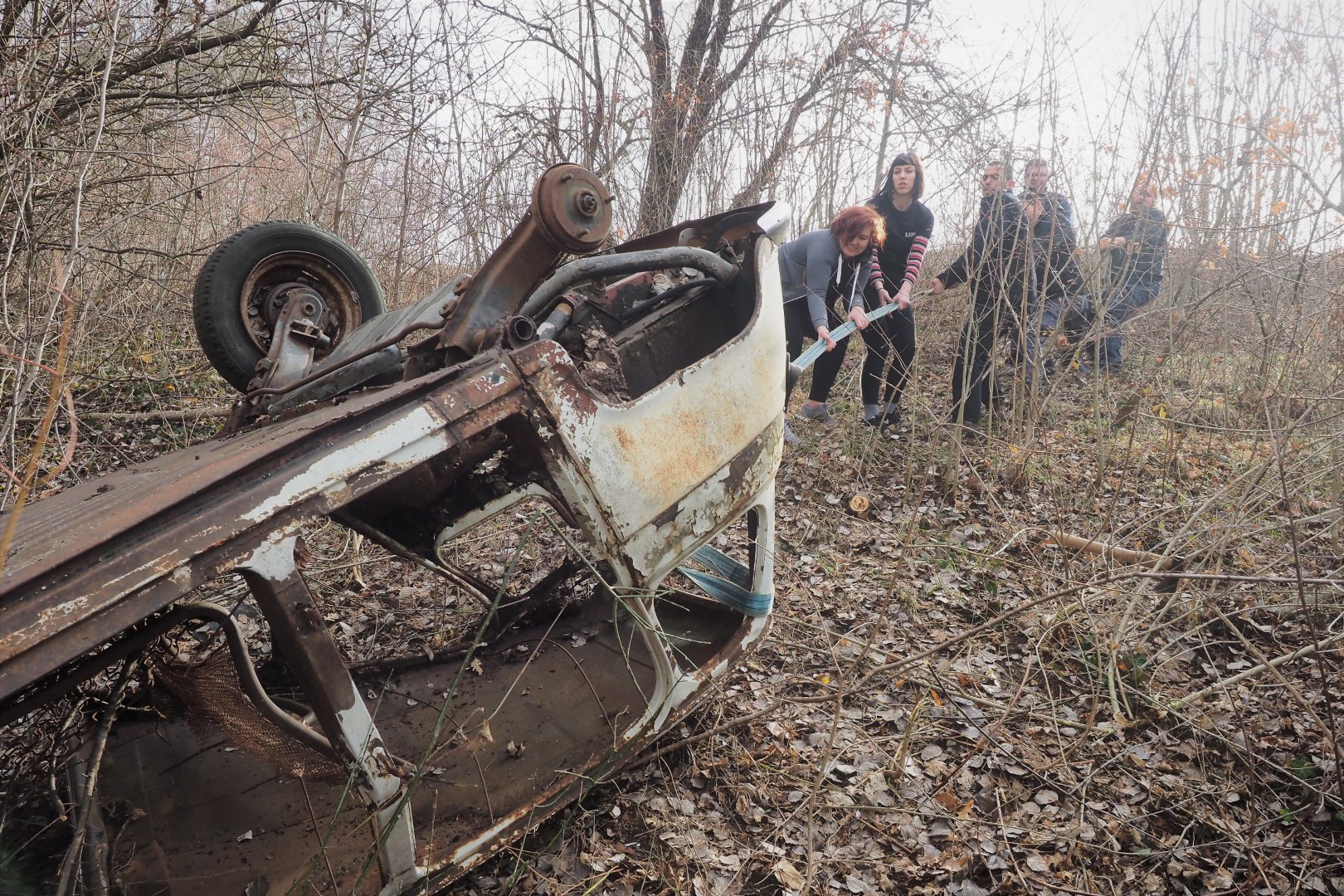
During that period another interesting activity will take place on Mljet: Lush, a global eco-friendly cosmetics giant, is taking their Croatian employees to Mljet, where they will team-build by cleaning the beaches of Saplunara and Velike and Male Blace. Lush has been supporting the great #PočistiDalje action by the Zelene Stope Association, which has been removing car wrecks from nature all over Croatia, and have removed over 15,000 of those in the past 10 years. You can even help by reporting a car wreck if you find one yourself here.
Hiking Dubrovnik's Mount Srdj - Do or Don't?
To take the cable car, or not to take the cable car? That, is the question.
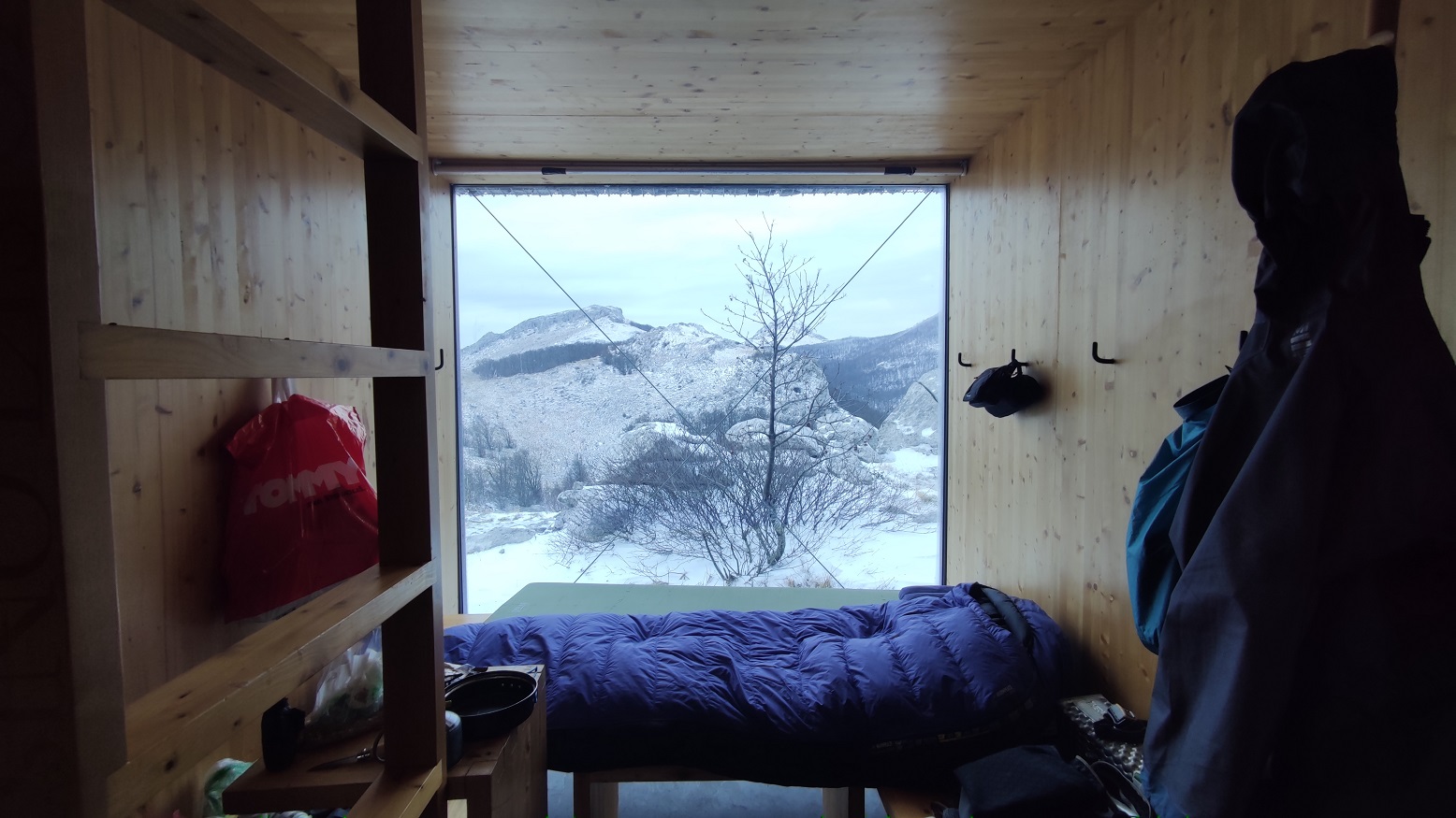
Hiking the Velebit: New, Gorgeous Eco-Friendly Shelter
Nature lovers, get ready to swoon. As if climbing the Velebit mountain isn’t enough, how about staying in a gorgeous, modern, eco-friendly container house and getting a “first row to the stars”?