Papuk Nature Park has UNESCO Status Extended for Four Years
March 26, 2020 - Papuk Nature Park, the first UNESCO Geopark in the Republic of Croatia, has retained its status as one of the world’s geoparks.
Namely, HRTurizam reports that part of the regular revalidation process, a two-member UNESCO Geoparks Commission visited in July 2019. During their four-day visit to the Papuk Geopark, they were presented the progress made in the past two years, from infrastructure to new projects, and met with stakeholders and representatives of local government.
The UNESCO World Geoparks Council, based on the report of the revalidation, has decided to extend its status in the UNESCO World Geoparks by four years, with recommendations for future work.
“We base the entire future of the Park on the signature of UNESCO. And our biggest project, Geostories, bears its name. Therefore, the whole progress of the Park's tourism offer, carried out for the benefit of the local community, is also due in large part to the status of a UNESCO geopark. We are thrilled and proud that our membership in the World Geoparks Community has been extended for another four years,” said Alen Jurenac, the Papuk Nature Park Director.
Thanks to its lowland plains with large cultivated areas, Papuk Nature Park is one of the main features of Slavonia. The Papuk Nature Park is located in the mountain forest areas of Papuk and was declared a nature park on April 23, 1999. Its exceptional natural value encompasses a great diversity of habitats and species of plants and animals, but also geological diversity represented in numerous geological formations created in different periods of Earth's past.
Of particular value are the numerous fossil finds of organisms that lived 16 million years ago in the "Pannonian Sea".
The Papuk Nature Park, near Vocin, houses the first geological nature monument in the Republic of Croatia, protected in 1948 because of its unique morphological occurrence in Croatia - the columnar secretion of volcanic rocks.
To read more about lifestyle in Croatia, follow TCN's dedicated page.
Trogir Flooded Twice in 2019: Seaboard Repairs Not Enough
In ten days, repairs will begin on a damaged section of the Čiovo seaboard in Trogir. Therefore, Čiovo residents will finally have seventy meters of their damaged and destroyed seaboard repaired, but repairs won't be enough, the city's mayor warns.
Trogir is a historic town and harbor on the Adriatic coast in Split-Dalmatia County, Croatia, and has a total municipal population of 13,260. The historic city of Trogir is situated on a small island between the Croatian mainland and the island of Čiovo. It is located 27 kilometers west of the city of Split.
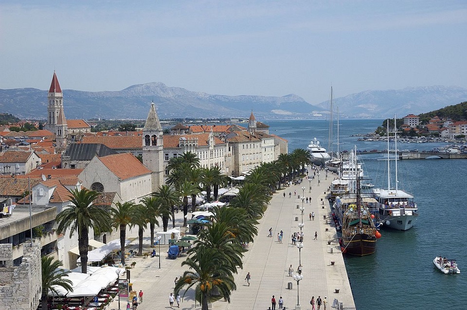
Trogir | Wikimedia Commons
The historic center of Trogir has been included in the UNESCO list of World Heritage Sites for its Venetian architecture since 1997.
“This investment is worth around 500,000 HRK (67,100 EUR). We had a problem with a ship which was illegally docked, but we have resolved it and the project should be finished in three months. In addition, we plan to make additional improvements the seaboard, port authority and town square,” said Ante Bilić, the mayor of Trogir.
Both the Čiovo and Trogir shorelines ended up underwater twice last year, in November and December. Many other Dalmatian cities have been experiencing similar fates according to HRT on January 9, 2020. Extreme windstorms (Bora), heavy rainfall and a sudden rise in sea level could be disastrous for coastal areas.
“It has happened in the past, but not as frequently. This can hardly be solved by raising the seaboard level because flooding also occurs from catchment and stormwater. We need to discuss these issues at the state level and with ministry of the environment, because this is everyone’s problem,” explained Mayor Bilić.
Scientists have been warning that sea levels could rise from 40 to 120 centimeters in the next hundred years. Without serious investment into preventative projects, the question is who will end up in the "front row to the sea."
Follow our Lifestyle page for updates on environmental concerns and the effects of climate change in Croatia.
Meet Croatia's UNESCO World Heritage Sites: Stari Grad Plain on Hvar
November 27, 2019 - Filipa Marusic continues her look at the considerable UNESCO heritage in Croatia. Next up, World Heritage Site the Stari Grad Plain on Hvar.
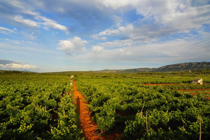
The Stari Grad Plain is a cultural landscape that has remained almost the same since the Ionian Greeks came from Pharos in the 4th century BC. This heritage has been part of the UNESCO World Heritage list since 2008. It showcases the ancient geometrical system of land division used by the ancient Greeks called the “chora” which has remained intact over 24 centuries.
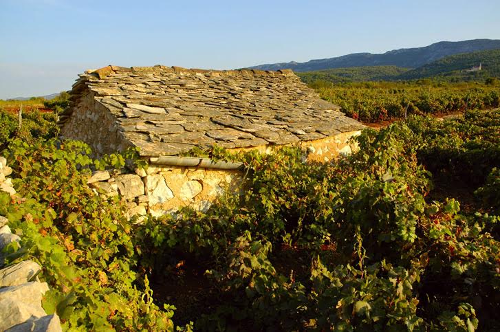
The agricultural activity in the chora was always here and based on grapes and olives the same as it was set up by the ancient Greeks 2400 years ago. The shape of the land division is the same, and the structures built by dry stone walling are authentic and reused throughout time. Additionally, this is a unique example of the land parcel system introduced by the Greeks. The cadastral division of the Stari Grad Plain is one of the best-preserved examples of Greek ancient culture in the entire Mediterranean. Despite all the historical and political changes over the centuries and multiple divisions of the plain, the Greeks set the structure. The Greek chora is embodied in the dry stone wall, which marks the land division. All later divisions of the land – Roman, medieval, or newer were always respecting the Greek shape and had the same dry stone walling technique. There is evidence of all different cultures who used the plain throughout time. The evidence is different archaeological findings dating all periods, from pre-history to medieval times.
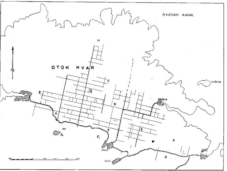
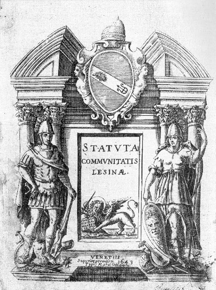
The Stari Grad Plain is the biggest and the most fertile plain on the Adriatic islands. It had and still has its agricultural use, and local people grow the same cultures – olives and grapes. Archaeological findings prove the local inhabitants had their faith in the fruitfulness of the plain. In medieval times the plain was under the protection of the patron saint of Hvar diocese St. Stephen. The Hvar statute from 1331 mentioned the plain, and it listed roads and borders of the plain and several place names for places with later discovered archaeological evidence. The Stari Grad Plain changed its names according to how its owners changed. Different names include Greek Xωpa Φapoυ, Roman Ager Pharensis, medieval Campus Sancti Stephani, or today Stari Grad Plain.
The precise boundaries set by the Greeks in the plain are the work of villagers who used dry stone walling techniques even in ancient times. Some are just a barrier between two different lands, while others are quite wide and were in use as paths. Around the plain, there are circular stone houses called “trimi” or “bunje” used in the past as storage and shelter during bad weather. While the land here is fertile, the Mediterranean climate often has dry weather, so the plain has several reservoirs for collecting and saving the rainwater. All the different buildings located in the Stari Grad Plain range from the remains of farmhouses and drystone shelters to churches and chapels are there to prove the reusability of all the elements through centuries.
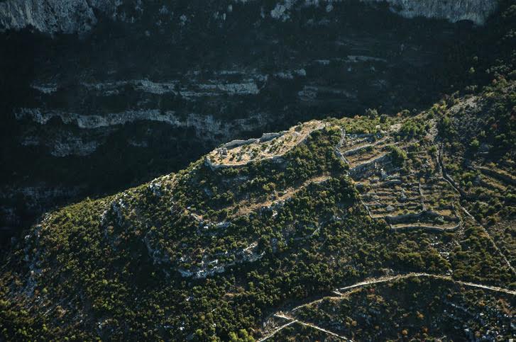
The Greek origin is visible in the very island name coming from Greek word Pharos (Faros), which ancient Greeks from Pharos island in the Aegean Sea gave when they arrived at where is now Stari Grad in 4 century BC. There were about 1000 inhabitants sent to colonise Hvar island. When Pharos became an independent Greek town polis in the 1st century BC, the Romans named the island Faria. In early medieval times, when Croatians came to the islands, they took over the names which locals used and adapted it to the Slavic language – this is how we have Hvar island name. Most Greek colonisations happened from 8th to 5th century BC, and there were about 700 colonies in the Mediterranean and Black Sea. At that time, there were just a few Greek colonies in the Adriatic Sea, so Adriatic islands were the only uncolonised part of the west from Greece in the 4th century BC.
There is some prehistoric evidence dating back to Neolithic times (6000-3000 BC), which proved this fruitful area was inhabited much earlier than the Greeks. Additionally, there are findings from the Bronze and Iron Age as evidence the Greeks found native inhabitants on Hvar when they first came. Also, at the time, Illyrian tribes lived in this area, and islanders cooperated with Illyrian tribes on the mainland. When Greeks from Pharos came to Hvar, apparently, there was at first peaceful agreement with local inhabitants. Later on, this agreement wasn’t respected, so local natives decided to attack the colony. As the land division was one of the main tasks of colonisation, this was probably one of the reasons for the conflict. We also know that the Greeks built the town on the coast with fortifications. This fact, along with the land division, meant then needed a lot of money at the time to do that.
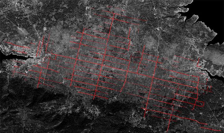
The cadastral plan and air image of the plain show that the border around the land has a size of about 180x900 m, no matter the division within this land part. The ancient Greek measuring system contains the measures that were in use. 180 m was the length of the Greek stadium while 900 m have five stadia. The average width of the roads was 10 Greek feet or about 3 meters. The Greeks used different sizes for this measure, but here research discovered it was 0,3026 m, and it was probably a standard measure in 4th century BC for some Greek towns. All the divided land in the direction east-west are parallel and break in one central point in the direction north-south. In ancient Greece, this point was called “omfalos” and represented the central unit where different paths meet. The land measure excluded the connecting roads. The base for the plain is karst terrain with several slopes where the land can quickly erode, and this is why people built so-called terraces or support walls. The terraces and dry stone walling is a valuable heritage people nurtured for years.
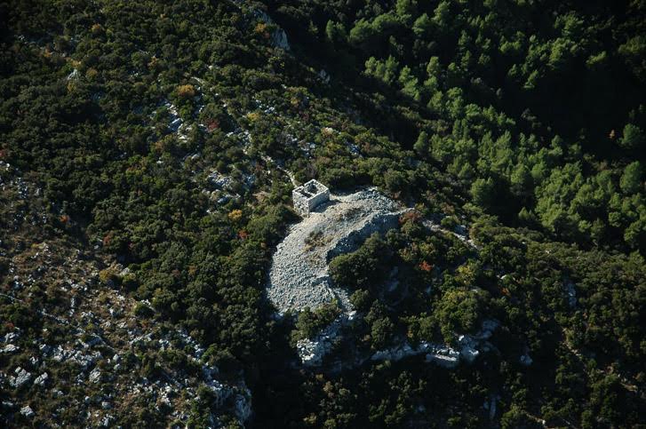
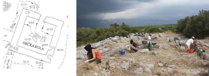
The chora had farmhouses, but there are just a few found as they were probably the foundation for Roman villa rustica. In the area, two guard towers protected the land. Additionally, there were perhaps temples dedicated to gods of fertility. There weren’t many Greek inscriptions in the area, but there is a stone fragment where it said “Border of the land of Matija, son of Piteja” which meant people of the time respected their land borders. Another larger inscription is evidence that local people of Pharos set three members to Greek Pharos to ask for money to renew the city, which proves they had a democratic setup. The local Greeks also were equal in terms of land amount and had similar housing.
The ancient Pharos even had its mint, but as Greek Paros didn’t have their own money, they used money from Greeks on Syracuse as inspiration. There are numerous versions of money from this area, as well as coins from different regions proving there were plenty of trades going on in ancient times. The ancient vessels and vases from the area show they were imported from Greece or locally made. The end of Pharos ancient Greek town is not known, but there is evidence of Roman building activity from 1st century BC.
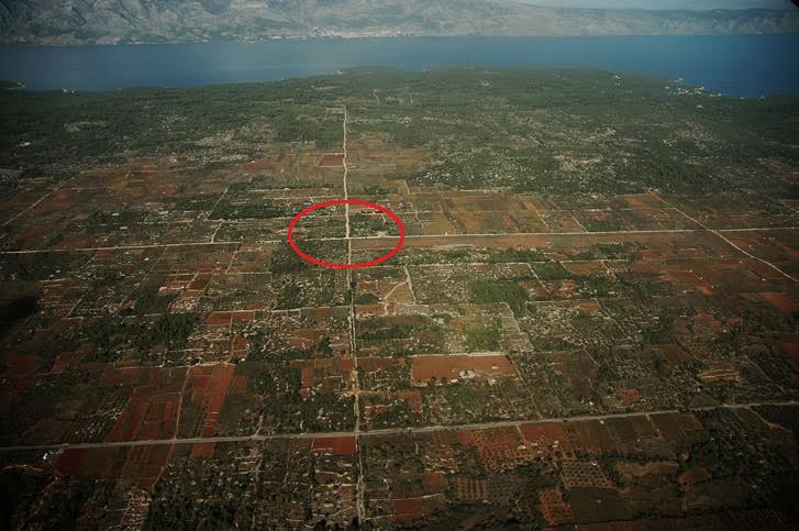
In ancient times the most important agricultural products were wheat and olives. The plain area divided this way gave good income to people – if they grew just wheat, the market surplus was between 41000 and 157000 silver drachma (one drachma was the daily income of the worker and its equivalent of approximately 30 EUR). The Greeks planted olive trees and produced wine, figs, rosehip, almonds, carob, and other cultures. They went fishing, hunting, and were beekeepers. They also had cattle for food and for towing and carrying loads. The different amphora remains proved there was active production of wines and olive oil. The ancient Greeks probably had food supplies and stored the food for the time of war and as protection against robberies.
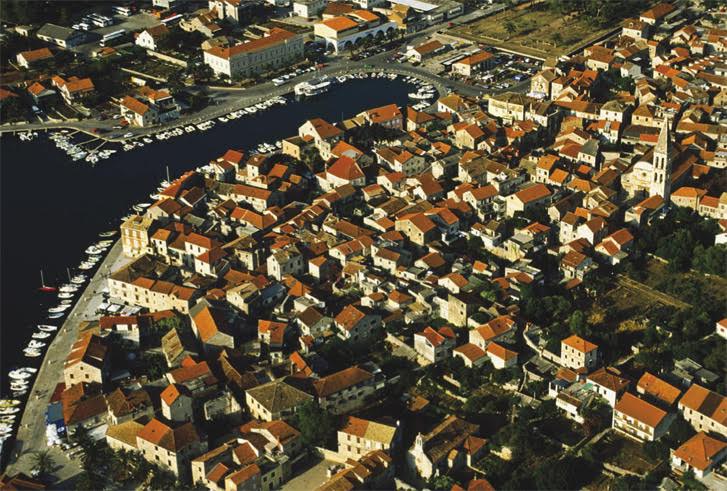
Toward the end of ancient times, Hvar island was quite well inhabited, especially the Stari Grad Plain area. As already mentioned, there are some early Christian churches which have medieval artifacts as well as circular dry stone shelter buildings from different periods. The Stari Grad itself has a range of different structures from the late ancient period to the end of the 19th century, which together create urban complex. From medieval times the bigger ancient lands were divided into smaller parts, and they reflect the changes through centuries.

When it comes to everyday life around Stari Grad plain was always connected to agricultural works depending on the season. The Hvar statute from 1331 gives the oldest written advice on agricultural work. Even today, the same rules are used in agriculture – the first warmer days after winter are for work, and this is the hardest part, and then summer is to keep the vineyard from any diseases. September is the month of harvest, followed by winemaking in October. November is olive picking, and December and January are for rest. From all the agricultural cultures, there are mostly grapes and olives but also lavender and rosemary, as well as other fruits grown here from ancient times. When some of the vineyards were destroyed at the beginning of the 20th century, lavender became part of Hvar's agricultural heritage. Rosemary is another aromatic herb growing on Hvar and other parts of the Adriatic coast. The vineyards and winemaking heritage are part of local identity for centuries. The authentic Dalmatian variety plavac mali grows here as well as indigenous Hvar variety of white wine bogdanuša and prč and red wine drnekuša. Olive trees were probably on Hvar even before the arrival of Greeks, but their arrival meant the beginning of cultivated olive groves.
The religious celebrations set the time for the biggest local festivities. At Easter time, there is a unique procession Za Križem during the night from Maundy Thursday to Good Friday, which has been the same for more than 500 years going from different villages and towns around the Stari Grad Plain. TCN wrote about this unique UNESCO protected heritage in several pieces. At Christmas time there is kolendanje – groups of children or adults sing old songs with good wishes for the year that is to come in front of the houses of friends or neighbours. The special occasions ask for special meals such as starogrojski paprenjok – a pastry made from honey, flour, olive oil, prošek and different spices. It represents local traditions and uses locally produced ingredients.
If local people didn’t use the Stari Grad Plain, the valuable heritage wouldn’t be at such a good level of preservation. The Stari Grad Plain is the best-preserved example of the Greek land division, and it stayed that way as locals continuously used the land throughout the centuries. The dry stone walls which were built and rebuilt saving the shape of the parcels. The value of the Stari Grad Plain encouraged local and state authorities to work on the revitalisation of old parts of the plain with planting traditional agricultural varieties and promoting this heritage in the cultural aspect of Hvar tourism. The idea is to keep the same shape and land parcel system set by the Greeks and keep all the paths and routes around the lands the same without the use of any modern building techniques. The idea is to renovate all the buildings according to the traditional way and reuse them for tourism purposes and keep archaeological researches active.
For more information about the Stari Grad Plain, visit the official website.
To learn more about Stari Grad, here are 25 things to know.
UNESCO World Heritage Site – Cathedral of St. James in Šibenik
July the 19th, 2019 - A look at yet another valuable piece of UNESCO heritage – the Cathedral of St. James in Šibenik. The cathedral was constructed between 1431 to 1535, works that lasted for almost 105 years, and it represents one of the greatest examples of monumental arts in Northern Italy, Dalmatia, and Tuscany from the 15th and 16th centuries.
The cathedral was inscribed on the UNESCO World Heritage list back in 2000, and the criteria for its inscription were the structural characteristics of the cathedral which make it unique.
The cathedral of St. James is considered one of the most valuable architectural work for the aforementioned period in Croatia, and it represents the most significant monument in Šibenik.
UNESCO/YouTube
The cathedral is a unique example of European sacral architecture based on its beauty, construction technique, and style characteristics. The three architects responsible for its construction were Francesco di Giacomo, Georgius Mathei Dalmaticus, locally known as Juraj Dalmatinac, and Niccolo di Giovanni Fiorention, locally known as Nikola Firentinac.
The cathedral has successfully blended both Gothic and Renaissance forms.
It is the only cathedral in Europe made entirely of stone, as no wooden architectural elements were used for its construction. It is also the first building in Europe where its construction was based on the unique system of inter grooved stone plates. A structure like this didn't exist before the 19th century, in addition to all of that, it is the only structure with an outside volume which corresponds entirely with the shape of its interior.
St. James' Cathedral is well known for its iconographic innovation, and what is uniquely recognisable are its outdoor decorations, with 74 head sculptures from the then contemporaries of Juraj Dalmatinac. This is the biggest and the best quality gallery of portraits displayed in the form of a public monument on a sacral object in Europe.
The dome, formed in a semi-circular shape, was built entirely from stone by the montage way of building. The front of the cathedral has Renaissance and Gothic elements made both by Juraj Dalmatinac and Bonino da Milano.
The cathedral is built on the south side of the central city square in the old town centre on the location of then Romanesque church of St. James. The idea of creating a large cathedral first began in the 13th century, when Šibenik got its bishop's residence and earned its city status. Construction then began in 1431, lasting for 105 years until 1536.
REDERLights/YouTube
The construction began in Venetian Gothic style and finished in Tuscan Renaissance style. This Šibenik cathedral boasts a three-nave basilica and is 38 metres long and 14 metres wide. Its highest point is the top of the dome.
The architects in charge of construction during the first decades of the 15th century were Venetians Francesco Giacomo, Antonio Busato and Lorenzo Pincino. They worked on the cathedral together with Šibenik stonemasons Andrija Budčić and Grubiša Statčić. In 1441. Juraj Dalmatinac was appointed as proto-master and worked on the construction of the cathedral until his death in 1475. As the master of the late Gothic flower style and a pioneer of Gothic-Renaissance style in Dalmatia, Juraj Dalmatinac changed the initial plan for the church and gave it monumental importance.
After the death of Juraj Dalmatinac, Nikola Firentinac continued the construction in Renaissance style. Due to the fact that the cathedral wasn't finished, Venetian architects Bartol and Jakov from Mestre and Mestičević from Zadar took over the construction.
The central part of the cathedral is the baptistery, which represents the creative synthesis of two different art styles of the first half of the 15th century – the Late Gothic and the Early Renaissance periods. The cathedral represents the first finished work of architecture in Renaissance style, constructed only twenty years after the real beginning of the Renaissance in Tuscany.
The baptistery has many decorations, mostly of human images. Juraj Dalmatinac made four sculptures, of which just two have remained preserved. The baptistery has reliefs with angels, cherubs' heads, the image of Father God and the dove that represents the Holy Spirit. The centre of the baptistery has sculptures of three naked boys in movement.
From the 16th century onwards, after the end of the cathedral's construction, there have been continuous reconstruction and renovation works, mostly for leaking issues. In the second half of the 19th century, there was more significant reconstruction, and then after the Second World War came to a close, another reconstruction began.
During the Homeland War during the 1990's, the dome was damaged and reconstructed in 1997, but there is a constant need for restoration even today.
St. James' Cathedral is a masterpiece made during times when the art was flourishing in Europe, and it has remained until this very day as a piece of priceless heritage for the world to come and admire.
Cities in 4K/YouTube
Follow our dedicated lifestyle page for much more on Croatia's UNESCO heritage.
SOURCE(S): UNESCO, TZ Šibenik-Knin County, TZ Šibenik, Šibenska biskupija
St. Nicholas Fortress in Šibenik to Open for Visitors After Two Years
The city of Šibenik is one of the few towns in the world with two cultural monuments listed on UNESCO's cultural heritage list - the St. James Cathedral and the St. Nicholas Fortress, reports HRTurizam on June 1, 2019.
The St. Nicholas Fortress will again welcome visitors from June 15, after nearly two years of being closed to the public.
During this off period, construction works were carried out to clean the building, with necessary restoration and measures for the safety of visitors. The boat dock at the main entrance was restored and provided secure and organized access to the site. These were the necessary preconditions for reopening of the fort, though the real job of its restoration lies ahead.
"Our ultimate goal is to completely revitalize, decorate and renew the St. Nicholas Fortress, which will be open to visitors during the season. This requires tremendous efforts, painstaking work, and continued efforts in securing financial resources. But once we complete this lifelong project, we will leave a restored, originally preserved and magnificent UNESCO monument for future generations whereby the city of Šibenik and Šibenik-Knin County will be recognizable throughout the world,” said Goran Pauk, Prefect of Šibenik-Knin County.
Opening the St. Nicholas Fortress in the St. Anthony Channel is the result of a series of projects funded by the European Union, the Šibenik-Knin County and the Ministry of Culture of the Government of the Republic of Croatia. The first significant step was made in 2013 when, through the valorization project of the St. Anthony Channel, they organized the promenade and access road to the fortress. In May last year, the second phase of this project was contracted, which saw a value of 26 million kuna, and which envisions a visitor center and supporting infrastructure. In cooperation with the Ministry of Culture and the Conservation Department in Šibenik, a great deal was done, which resulted in a spot on the UNESCO World Heritage list. After that, an additional 2.6 million kuna was provided for the project documentation to complete the reconstruction of the facility, and the State Property Ministry allocated the area of the former barracks in the Minerska cove for 50 years.
“We are happy that the fortress, which has a special significance for all of us, will open its doors. I thank our fellow citizens who have recognized the complexity of the project and have shown great patience all this time. I can now be pleased to announce that during the first working day we will provide free tickets for all visitors and from June 17 to June 25, we will provide free tickets for half of the capacity of the ships for the inhabitants of Šibenik-Knin County to get acquainted with the offer but also experience the fortress in a whole new way. Also, I would like to thank the Ministry of Culture, the Conservation Department in Sibenik, the employees of Šibenik-Knin County and everyone who helped open the doors of this proud guard of Šibenik,” said Anita Babačić Ajduk, Director of the Public Institution of Nature in Šibenik-Knin County, which manages the fortress.
This season, you can visit the fortress only by the official boats departing from Šibenik.
A two-hour visit will include an attractive boat ride through the Šibenik channel and tour of the fort, accompanied by expert staff and the use of a multimedia guide. The maximum daily visit capacity is limited due to the limited number of places on board, the security conditions, and the protection of the monuments, as well as the quality of the visitors' experience.
Tickets will be available at a sales outlet on the Šibenik Riva and online.
To read more about travel in Croatia, follow TCN’s dedicated page.
UNESCO Heritage of Croatia - Vis Archipelago UNESCO Global Geopark Croatia
May the 27th, 2019 - taking a closer look at beautiful Vis and its UNESCO heritage.
On the 17th of April, 2019, the UNESCO Executive Board approved the designation of eight new Global Geoparks which demonstrate the diversity of the planet’s geology. Croatia's Vis archipelago got this recognition. This article will take a closer look into some natural heritage from the stunning Vis archipelago.
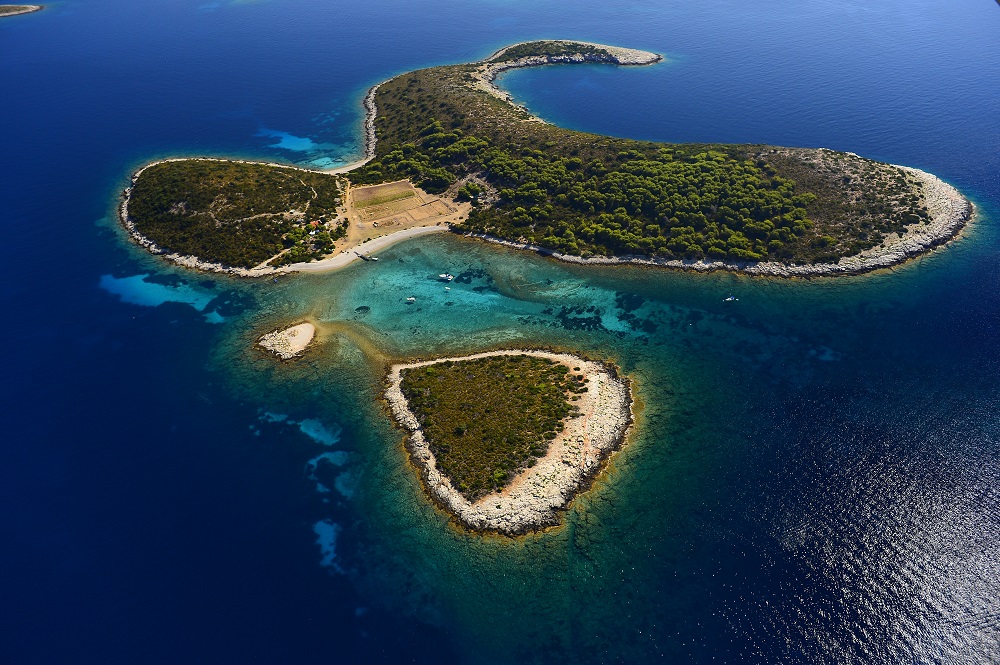
The Vis archipelago covers the island Vis and the surrounding islands and islets Biševo, Sveti Andrija, Brusnik, Jabuka, and Palagruža. The archipelago is the area that has the oldest and youngest geological formations.
Some parts of the archipelago are made from volcanic rocks while most of the Adriatic islands are made from sedimentary rocks. Sailors and fishermen were always aware of this specific geological area. They knew when they would sail close to volcanic islets of Jabuka and Brusnik as their compass would divert from the north, potentially putting them in danger. Vis island has parts where the foundation is volcanic rock, which created several water springs. These springs created fertile conditions, so it's no wonder the ancient Greeks chose Vis about 2,400 years ago as the place to found their first colony on the Adriatic.
The Vis archipelago is located off the coast of Croatia, and there some of the oldest rocks in the Adriatic sea, formed 220 million years ago, can be found. Sedimentary rocks are the base for most of the Vis archipelago. The origin of these rocks comes from the lithification process of sand, mud, and sea organisms.
The north-eastern region of the archipelago includes large sand deposits formed in the Ice Age which created unique forms and caves. Before the sudden rise of the sea level 12000 years ago, these islands were much larger and extended more than twenty miles. In this extended area called Mala Palagruža, an archaeologist discovered flint quarries that served for the production of early tolls believed to have been made by the islands' first inhabitants.
The Vis archipelago is formed around Vis island and includes a number of nearby uninhabited islets: Ravnik, Budihovac, Veli Paržanj, Mali Paržanj, Greben, Host, Veli Barjak and Mali Barjak and the open sea islands among which the most remote are the island of Palagruža, inhabited only by lighthouse keepers, and the magmatic island of Jabuka, some 30 nautical miles west of Vis. The surface of this maritime area covers almost 6000km2 and also includes Sveti Andrija, Brusnik and the island of Biševo which, is the only inhabited island.
In this area, the largest number of ''monuments of nature'' in Europe can be found – Blue Cave, Monk Seal Cave, the volcanic islets of Jabuka and Brusnik, Stiniva Cove, and the Green Cave on the islet of Ravnik.
The Vis archipelago is a small area, but it boasts a wide range of significant landscapes and protected monuments of nature, some of which attract a lot of visitors.
The Blue Cave
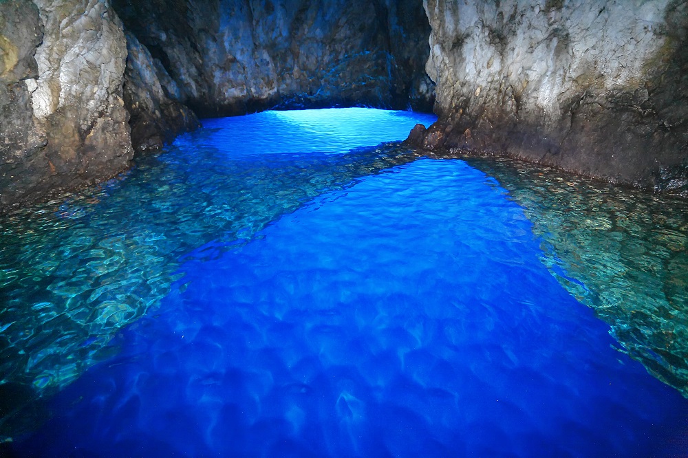
In 1884, the Viennese painter baron Ugen Ransonnet introduced the Blue Cave on the island of Biševo to the world. His discovery marked the beginning of tourism in Dalmatia, and the Blue Cave has since become a must-see tourist spot in the Adriatic. The Blue Cave has been a protected geomorphological monument of nature since 1951. Visitors can go to the cave from Biševo Mezoporat. There are people all over the world visiting this unique cave every summer.
The Monk Seal Cave
The Monk Seal Cave is the longest sea cave in the Adriatic – 160 metres. It is a protected geomorphological monument of nature from 1967. The name comes from the Mediterranean monk seal which once lived here.
Jabuka islet
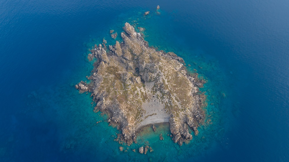
Rising above the sea like a black pyramid, the island is 30 nautical miles from Komiža, is 97 metres high, and is a protected geomorphological monument of nature from 1958. The island is composed of deep crust magmatic rocks, the magnetite of which interferes with seafarers’ compasses making navigation in conditions of poor visibility extremely difficult when near it. The underwater area is rich in fish and crabs, which is why fishermen from Komiža go to Jabuka in winter and risk their lives going to the island, which has no docks.
Jabuka doesn’t have a natural bay and doesn’t provide shelter from the wind. Anchoring a boat is a difficult task due to the deep sea around the island, and its smooth rocks polished by the sea make it impossible to tie the ship around them. There are as many as twenty toponyms here, and these are the only human traces on this further insular frontier of the eastern Adriatic. The island is made from volcanic diabase rocks and is home to the endemic black karst lizard and two endemic plants.
The Green Cave on the islet of Ravnik
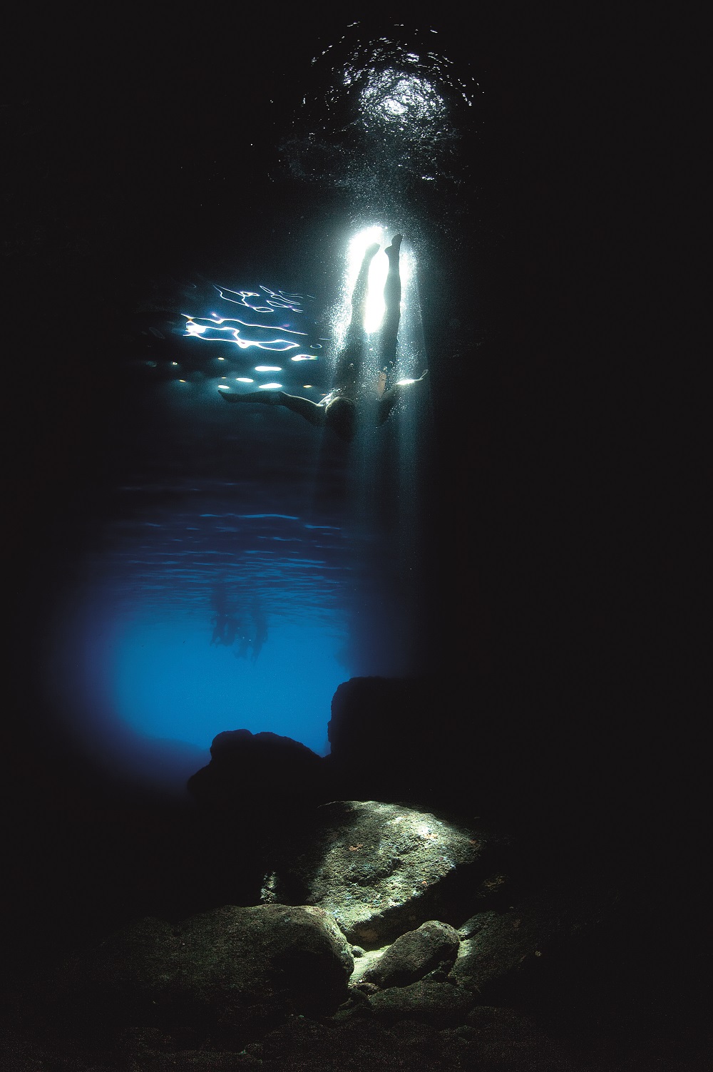
This cave is a protected geomorphological monument of nature from 1967, and the islet itself is a significant landscape. The Green Cave has two large openings to it and it doesn’t give the same type of blue light effect as the Blue Cave, but it's entirely unique because it has a small opening in the middle from where sunlight breaks into the cave and lights up the sea bottom like a spotlight in the darkness. The blackness of this cave enhances the intensity of this miraculous spotlight.
Stiniva bay
Stiniva bay has been classed as a significant landscape since 1967. This narrow and long bay ends with a stone ''gate'' leading into a small cove with a pebble beach surrounded by layered rock walls. Once, Stiniva was a karst cave and it probably collapsed several thousand years ago. In 2016, Stiniva was named the most beautiful beach in Europe.
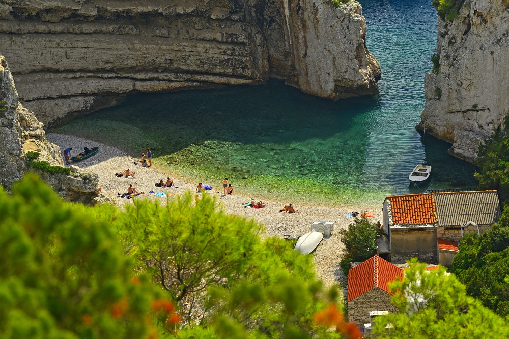
Ravnik islet
Ravnik islet is a significant landscape of nature and is located off the eastern coast of Vis, boasting its green cave.
Brusnik
Brusnik is the protected geomorphological monument of nature and is located thirteen nautical miles from Komiža. Brusnik and Jabuka are the only islands in the Adriatic formed from igneous rocks. It is 23 meters high, and both Brusnik and Jabuka are made of subvolcanic diabase formed by the crystallisation of magma on its way from the deep magmatic core up to the surface. Brusnik island is far more complex than Jabuka, however. Brusnik has paleo beach pebble conglomerates which can be found on the top of the island.
In the middle of the island, there is a ravine with a depression filled with seawater used by fishermen from Komiža, in which they made larger pools to keep their captured lobsters. There are also the remains of fishermens' cottages built from large rocks. These small homes were in use for salting fish in barrels and to keep the fishermen safe from the wind and sun. Brusnik has been a protected area since 1951 and it boasts a special structure – as most of the islands have a limestone base.
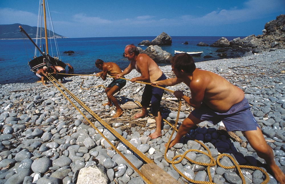
There are several geo-trails in Vis archipelago, here are a few handy links to them:
Geo trail Komiža: https://geopark-vis.com/en/geology/geo-trails
Geo trail Biševo: https://geopark-vis.com/en/geo-trail-bisevo
Geo trail Vis Rukavac: https://geopark-vis.com/en/geostaza-vis-rukavac
A list of geological locations can be found here: https://geopark-vis.com/en/geostaza-vis-rukavac
With this geological area, there are naturally a lot of local traditions and pieces of heritage worth knowing about. Some of the most valuable are Gajeta Falkuša, Suhozid – dry stone walling (another piece of Croatia's intangible UNESCO heritage), The local Vis dialect, Gajeta Falkuša, which is a traditional historical fishing boat. Fishing has been the traditional main occupation of local men from Komiža for centuries. Komiža fishermen are well known as the first to catch fish on the open sea and to face a lot of dangers due to poor weather conditions and pirate attacks.
Local inhabitants lived off the sea and were facing different threats. To fight the open sea and the risks that faced them, fishermen needed to have small and quick boats which could carry a lot in them too. To survive these rough conditions, they made falkuša – a unique traditional fishing boat from Komiža. It is made for fishing, sailing and cargo carrying. The name comes from the word falka, or the sideboards of the ship which enabled the boat to be used for different purposes.
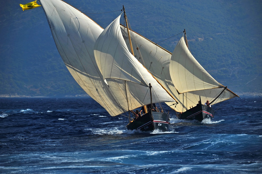
The people of Komiža are proud of Gajeta Falkuša, but it almost disappeared as the storm on Biševo island wrecked the last Gajeta Falkuša named Cicibela.
This terrible damage was repaired by professor Joško Božanić and Velmir Salamon who carried out research on Falkuša for eleven years and all of the aspects essential for this boat, including halieutic, cultural and anthropological interpretation, which included language, lexicon, literature, fishing history, toponymy and anthroponymy, shipbuilding, the art of sailing, traditional weather forecasting, the art of fishing, and even gastronomy.
In 1997 this traditional boat was saved in the form of ''Comeza-Lisboa'', the first falkuša built after many years, as part of the research project of the Cultural Association Ars Halieutica from Komiža. ''Comeza- Lisboa'' was presented at the world expo in Lisbon, Portugal. This launching was a historical moment for Komiža, where old fishing traditions, knowledge and skills were revitalised and presented to locals. Today we have four Gajeta Falkuša boats: Comeza-Lisboa, Mikula, Palagruža and Molo.
Molo is a smaller variant of Falkuša on which children used to learn fishing skills.
Dry stone walling
This piece of UNESCO heritage is an art of its own and is an old tradition which continues to be nurtured on numerous islands and in coastal Croatia, but it's especially interesting on the island of Vis. This type of rural architecture is part of the Vis landscape and has a different form than the rest. The story of dry stone walling is a story about survival, where peasants used their skills in rocky landscapes and securing smaller fertile areas to grow their vineyards and deal with other types of agriculture.
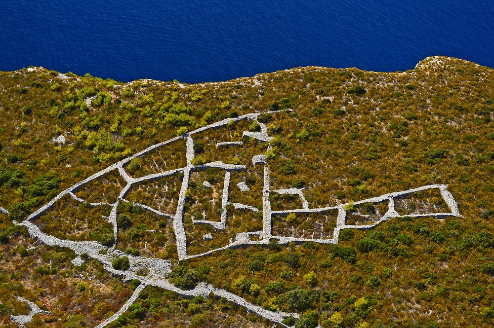
On Vis, the village of Dragodid near Komiža is very well known for its dry stone walling heritage and remains a place for dry stone workshops to this very day.
.jpg)
The Cokavian dialect of Vis
This is another piece of intangible heritage of Croatia and the oldest Slavic dialect in the Eastern Adriatic. It is unique in the fact that it preserves the lexicon from the lingua franca idiom, which is characteristic for the maritime and fishing world. Here is an example of the traditional cokavian dialect of Vis:
U śpȍmen nȍni Juvãni
Śvãku jȕtro
cîn bi źorâ źarudȉla
cîn bi źvȍna źaźvonȉla
ol śnâ bi śe vãrgla
pôk bi źavōpȉla
Ôva Marȉja
śvãki dôn źa pūlnê
kal bi śûnca grûźd śaźrîl
a iź kanpanȅla śe źvûn jōvîl
ol śtolâ bi śe dvȉgla
pôk bi źlãmen
krīźâ ucinȉla
Ôva Marȉja
ondâ jȍpet u śutûn
źajȅcol bi źvûn
a nâ bi pośôl dofinȉla
pôk bi śȅla u kantûn
krȕnicu molȉla
glōvûn obandovãla
kriźȉć buśivãla
i źãrno po źãrno
prȉko pãrśta voltovãla
Ôva Marȉja
i ȍto tãko je nȍna
iś Gūśpûn cavarjãla
trî pūtâ nã don
na plãc źvȍna
molȉtve olpivãla
i da śe nî śvȁ
u molȉtvu pritumbãla
do glũhe źemjê
da nî prĩgla śȉju
śigûr śon
jȍś bi vãvik
naźdrovjãla
Ôvu Marȉju
- Vinko Kalinić (From the collection of songs)
SOURCE(S) (text and photos): UNESCO, Geopark Vis
Find out more about Croatia's incredible UNESCO heritage by following our dedicated lifestyle page.
UNESCO Traditions on Hvar (VIDEO): 'Za Krizen' Procession Underway in Jelsa
April 18, 2019 - A religious spectacle is underway on Hvar, as 6 simultaneous 'Za Krizen' processions through the night uphold a UNESCO tradition dating back 500 years.
Known for its endless sunshine, great beaches and nightlife, the island of Hvar shows another side to its multi-faceted personality on Maundy Thursday each year with the annual 'Za Krizen' (Behind the Cross) procession in 6 towns and villages.
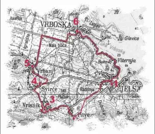
At 22:00 on Maundy Thursday, six simultaneous processions set off from Jelsa, Pitve, Vrisnik, Svirce, Vrbanj and Vrboska. They are led by barefoot cross bearers carrying ancient crosses weighing between 10 and 18 kg, walking through the night along a 22-kilometre route for a night of contemplation and prayer through the other five settlements. Finally, the processions complete their circular route, arriving back where they started about 07:00 on Good Friday.
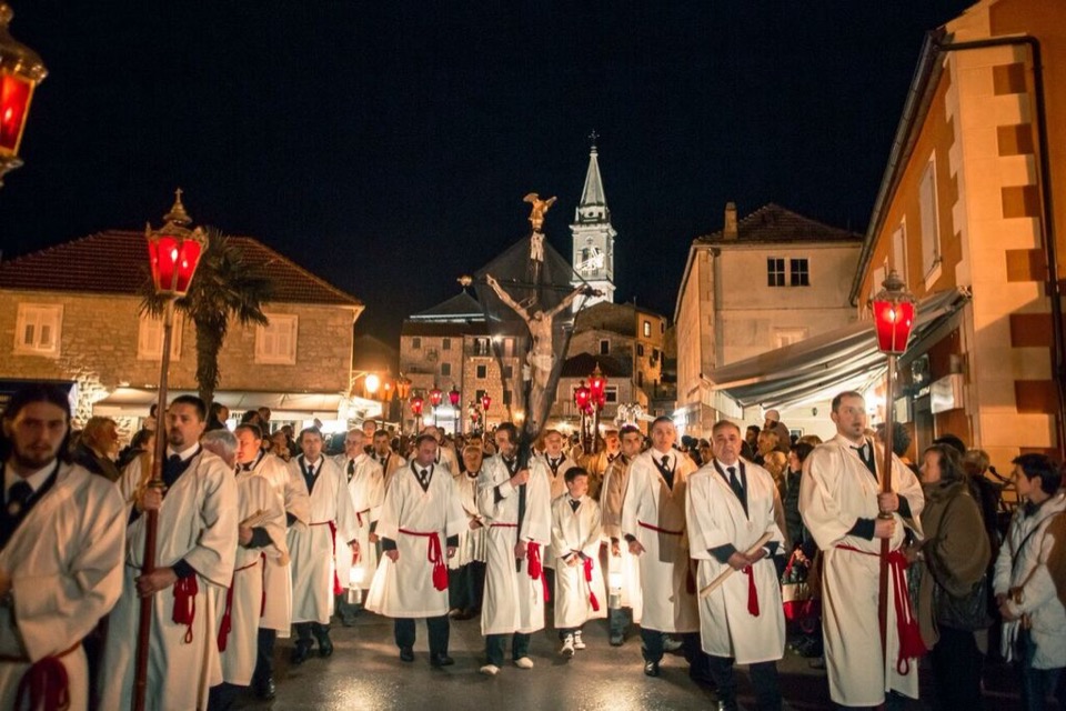
The cross bearer is followed by his acolytes wearing white robes and carrying candles. Behind the acolytes, more than a thousand pilgrims walk through the night following the procession, which was awarded Intangible UNESCO Heritage status back in 2009. You can read more about the heritage in the TCN UNESCO heritage series.
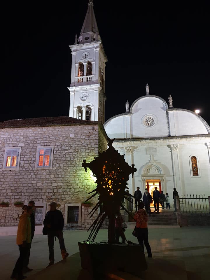
Each procession has its own uniqueness, but the biggest one in Jelsa has a very dramatic ending, as the exhausted cross bearer and his main acolyte run the final metres on Jelsa's packed main square, before kneeling in front of the awaiting priest. While there is an understandable tourist impulse to applaud the achievement, it should be borne in mind that this is a very religious experience, and applause is not welcome. To learn more about the procession through the eyes of a cross bearer, learn more through this interview with a former cross bearer from Jelsa.
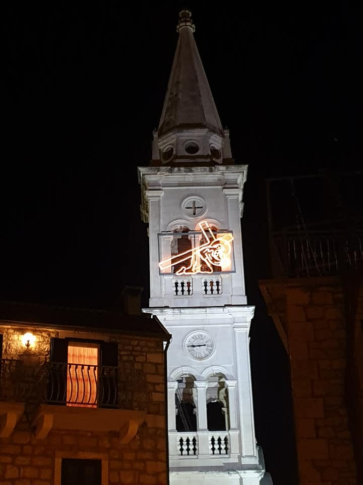
There are other traditions associated with the procession. One is that an illuminated image of Jesus falling with the cross is displayed in the main church tower.
And locals add to the light by keeping their lights on all night.
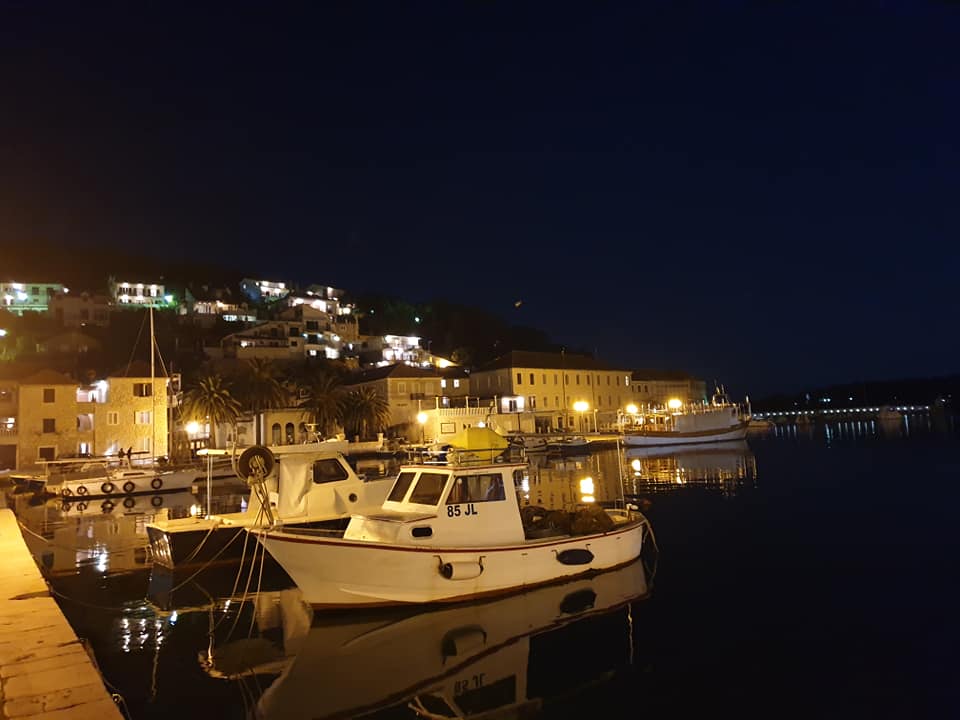
TCN will be up all night recording each procession as it comes through Jelsa.
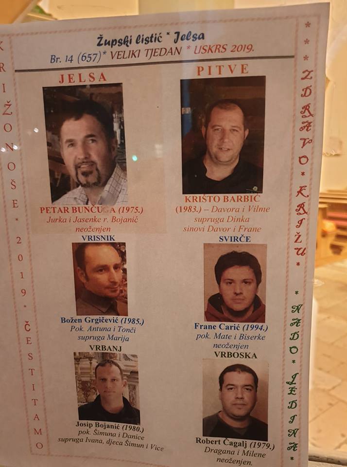
The procession has just got underway for 2019. Check out the first moments from the video below.
UNESCO World Heritage – Episcopal Complex of the Euphrasian Basilica in the Historic Centre of Poreč
This article will take a look at the Euphrasian Basilica in beautiful Poreč, which is listed on the prestigious UNESCO World Heritage List.
This basilica is extraordinary because it is a truly unique example of early Christian and Byzantine architecture and boasts some spectacular mosaics from that time. This is a complete surviving complex of this type, and this episcopal complex consists of the basilica, the atrium, the baptistery and the episcopal palace, which is an impressive example of religious architecture.
Poreč has a very long history and was initially the Roman town of Paretinum. The Euphrasian basilica is from the 6th century, and it remains one of the landmarks that makes Poreč recognisable to the world. It’s been on the UNESCO World Heritage List since back in 1997 based on its level of preservation and sheer beauty.
.jpg)
The history of Christianity in Poreč dates back to the 1st century after Christ (AD). At the end of the 2nd century, there was a Christian community under the bishop Mauro – they gathered secretly in his house which actually became the first church in the town. There lay a decorative fish mosaic which was an early Christian symbol.
.jpg)
The first bishop and clergy in Poreč all suffered martyrdom in the middle of the 3rd century, while in the year 313, the Christians were granted the freedom to worship in the Roman Empire. The former secret gathering place then became the very first public church.
At the same location, the first basilica was built during the second half of the 4th century, and that remains that of bishop Mauro and the other martyrs who moved to the early Christian cemetery. A larger basilica was constructed in the first half of the 5th century next to the existing basilica, and it was known as the Pre-Euphrasian basilica.
The floor mosaic of the temple area of the Pre-Euphrasian basilica was placed in the former sacristy. When Euphrasius first came to Poreč, he almost destroyed the old basilica in the mid-6th century, and built a magnificent three-nave basilica which still stands in Poreč today. At that time (543-554), the entire complex was made – the atrium, the bishops palace and the old baptistery.
The influence of Constantinople, the very centre of early Byzantine culture, is visible in the art and mosaics used in the construction and the decoration of the basilica. The floor of the basilica was covered with mosaics, and there were two layers of floor mosaics – the lower level belongs to the basilica from the fifth century, while the upper level is from the Euphrasian basilica of the sixth century.
.jpg)
The mosaics which decorated the interior are a valuable piece of heritage from the Byzantine era's art, and thanks to the floor mosaic and its preserved inscriptions, we can witness all the periods of its building and restoration even in the modern day. The basilica was built on an already existing Roman heritage site, meaning that various Roman artefacts can be found there, too.
The first church had three parallel rooms, and the central one was used as a basilica and even then, it enjoyed the status of a cathedral. In the 5th century, there were two basilicas in the south which were placed in front of the current Euphrasian basilica, while in the north, the walls and columns were kept standing. There was also a baptistery which remained in use, followed by another which came later on.
To understand why the Euphrasisus wanted to build such a spectacular basilica, it is essential to understand the fact that in the 6th century, Poreč was a small town in the then dying Roman Empire, and the emperor Justinian wanted to restore the Roman Empire's old glory. This is the time in which bishop Euphrasius started to build on the location of the ancient basilica and make this one of the biggest episcopal complexes of that time.
Shiny ''new'' Byzantine art created a unique piece of heritage on the Roman foundation. When Euphrasius came to Poreč, he found a town boasting a very long history, and he became the head of the well established Christian community which already had a few martyrs like St Mauro and St Eleturis under its belt by then.
Euphrasius began construction on the foundation of the previous church where he found early Christian mosaics decorated with images of fish with the mosaic donators' names inscribed on them, which helped in tracing the early Christian community in Poreč. There is one stone panel with an instruction written on it, from which we've been able to learn about the transfer of the body of St Mauro from a cemetery outside the town, to the place where the very first church originally once stood.
.jpg)
The new basilica, which was large in size, grew along with existing church objects. The construction of the basilica, the organisation of interior spaces, elements and ornaments, images on mosaics were all representing essential steps in the development of western art, influenced heavily by art from the east.
The entrance was formed one street before, and opposite the entrance, lies the baptistery – eight angles are from Pre-Euphrasian times, and the base is antiquity-era architecture. The structure of the wall and the wooden constructions of the roof are the work of local builders.
.jpg)
On the north-east angle of the basilica, there is a memorial chapel in which the layout is a bit different. The chapel, which was home to the relics of martyrs, has an oval atrium in front. The whole building underwent much needed restoration work in the 19th century.
The previous buildings on the site were construction material for the atrium, baptistery, and some parts of the basilica's walls. The organisational structure of the complex is confirmation of the whole concept which bishop Euphrasius initially had in mind, and this highlights just revolutionary his ideas really were for that time period. The rich decorations of the interior are additional evidence of the advanced ideas Euphrasius had, and represented Byzantine influence.
In front of the entrance to the basilica lies an atrium formed in the shape of a square, while the middle part of the atrium is an open space surrounded by arches - three arches on each side to be more specific. The eastern side of the atrium leads to the basilica and the western side to the baptistery. The central arch of these sides is elevated.
.jpg)
The arched-on columns and capitals were brought from Constantinople, just like with the one from the basilica. In the 16th and 17th centuries, during the great plague, the atrium and area around the church were used as a cemetery, with the atrium being rebuilt in the second half of the 19th century. Fragments of stone monuments from different periods of the Episcopal complex are displayed on its walls.
The baptistery is located in the western part of the Episcopal complex with the entrance facing the basilica. It was built in the 5th century and bishop Euphrasius had it restored and decorated in the 6th century. It was largely reconstructed in 1881 and then once again after the turn of the century, in 1935. The baptistery is an octagonal building with a hexagonal baptismal pool in the middle. It was surrounded with a sixteen-sided ambulatory, a sloping roof and three entrances.
The bell tower next to the Euphrasian basilica was built on the western side of the baptistery in 1522. Its 35 metres in height and provides a stunning view of the area. The bishops place is an integral part of the Episcopal complex, it is located in the northwestern part of the complex. On the first floor, there is a large ceremonial hall with a semi-circular apse on the northern side, it once used to be the audience hall, where the bishop received guests. Rights next to it on the left and the right sides there were once small chapels.
.jpg)
On the porch in front of the bishop’s palace lie some stone exhibits, capitals and various fragments of inscriptions in stone from previous basilicas in the area. The most important part of this lapidary is placed on the ground floor of the bishop’s palace. On the premises of the bishop’s palace, visitors can see different objects used by the church which span entire centuries.
The later built ciborium is part of the basilica from the 13th century, it presents as a masterpiece created seven centuries after Euphrasius' initial work. In 1277, a large marble ciborium was made, and its canopy was set on four columns which were taken from the original ciborium. The new canopy was covered with mosaics and displayed an image of the Annunciation. From this time, visitors are able to see visible differences in the composition and design when it comes to iconography and images of the Virgin Mary and the angels.
In the 13th century, the process of cultivating various pieces of cultural heritage one after the other took place once again – older pieces of heritage was blended into newer pieces. Early Byzantine capitals and columns hold the construction of the new gothic canopy covered with mosaics which clearly mark the end of one era and the beginning of a new one, a process which slowly removed the characteristics of Byzantine art and shows the turn towards the Venetian influence.
The Venetian influence can be seen at the basilica by turning to western cultural influence - this is noticeable in all the future interventions and additional work on the basilica and in Poreč.
.jpg)
The naves of the basilica share two rows of nine arcades and are connected to their pillars on the wall at their western and eastern ends. The arcade consists of gray marble poles that are based on well-shaped bases, and in the upper part, they end with the capitals over which they are imposed on round medals, in which there are embellished Euphrasius monograms.
The basilica and the whole complex have various capitals, rich perforations, and ornaments. There are several marble panels decorated with reliefs with different symbols like crosses, monograms, birds, deer, stylised horns...
.jpg)
In the arcades on the north side, the stucco was also painted in its original form. This visual glitter should also add the incrustations in the lower part of the apse. The pieces of multi-coloured marble and nacre are placed on the walls and make for creative ornaments. In the apse, there are also marble seats for the priests who close the marble slabs with dolphin reliefs on the side, while the centre of the semicircle is the place for the bishop's chair.
The walls of the Euphrasian basilica are one of the most valuable pieces of heritage as they boast various mosaics. Additionally, this is the place where iconographic innovation was applied for the very first time in the West. In the central part of the apse one can see the image of the Virgin Mary, which usually was the place for the image of Christ. The image shows the Virgin Mary sitting on the throne holding baby Jesus, who is wearing festive Roman clothes. On each side sit angels who are leading the groups coming to greet her. On the left side, three unnamed martyrs with wreaths in their hands and halos above their heads approach Mary, they appear like angels dressed in festive Roman clothes.
.jpg)
On the other side, behind the angel, stands St Mauro, depicted in the same way as the previous three martyrs, but with a printed name and a halo. This bishop and the saint of Poreč is leading a group of the contemporary people: the bishop Euphrasius holding the model of his basilica, the archdeacon Claudio (Euphrasius' brother) and the archdeacons son named Euphrasius, as well. Euphrasius had written his desire to renew the old basilica there.
The angels and the holy martyrs of the parade surround the Virgin Mary on the throne. Opposite to them, the living characters without halos are depicted in an individualised manner, as if they were portraits.
.jpg)
Other mosaics depict a strong Christian iconography too. The image of the Virgin Mary is the central point of Euphrasius basilica. She is of course holding baby Jesus, and this image presents two of the unarguably central figures in Christianity. The image of Annunciation in Christian iconography is the connection between Jesus and Mary. The image of Annunciation is based on Luke’s gospel, and such images can be traced as far back as the 4th century in catacombs, while this iconography became more developed in the 5th century, as is visible in the Poreč basilica.
In the 6th century, in the time of Justinian and Byzantine-influenced art, the Virgin Mary wore the veil which symbolised her virginity. The Virgin Mary is pictured sitting on the throne whose columns blend with the basilica's columns, which signifies the connection of the Virgin Mary to the church.
.jpg)
Mary holds a rove while an angel greets her. The angel is turned in a manner where half of its profile can be seen, which was specific for the art of the time, shown as if in movement, wearing bright clothes. Opposite to the image of the Annunciation sits the image of the visit of the Virgin Mary to her cousin Elizabeth. In the middle part of the apse between these two images from the Virgin Mary's life, there is an image of Saint Zachary, an angel, and John the Baptist. In the lower part of the triumphal arch, there are thirteen round medallions.
In the middle section, there is the image of Christ shown as Agnus Dei, while on each side there are six saints pictured, along with their respective names. On the top part of the apse, there is an image of the apostles with Christ in the middle – Christ is presented as a young ruler who rules over the world. The Apostles are surrounding Christ in this image, and have their names written around their halos. In the higher parts of the side apse, there are fragments of mosaics boasting almost identical images – the large figure of Christ comes down from the clouds and is seen placing bay leaves on the heads of two martyrs.
Mosaics of the sort weren’t just placed in the interior of the basilica, but were placed on the outside too. Unfortunately, they weren’t preserved and were covered over when restoration work took place periodically. They originally showcased an image of Christ sitting on the globe, along with his Apostles.
With this extremely rich array of well preserved heritage, the Euphrasian Basilica is somewhere you must visit! Until you manage to pay it a visit, you can check out a virtual tour by clicking here (make sure you have Flash enabled!).
.jpg)
SOURCE(S) (text and photos): Tourist Board Poreč, Istra Culture, UNESCO
UNESCO and Croatia: World Heritage Site – Dubrovnik Old City
Let's take a look into one of the best-known heritage sites in Croatia and the city that attracts millions of visitors each year. This in-depth article about Dubrovnik comes at about the same time as the 40th anniversary of the inscription of Dubrovnik's old city on UNESCO's World Heritage list, and the 10th anniversary of inscribing Festivity of St. Blaise onto UNESCO's List of the Intangible Cultural Heritage of Humanity.
Conveniently enough, we're at the beginning of a very special month for Dubrovnik, for an event which has been happening each year on February the 3rd.
Well known as the ''Pearl of the Adriatic'' or more recently as the popular Game of Thrones filming location (Kings Landing), Dubrovnik has been one of the historically most important Mediterranean ports since the thirteenth century. Dubrovnik has numerous preserved Gothic, Renaissance and Baroque churches, monasteries, palaces, and fountains. It did get damaged during the earthquake in 1667, and more recently during the Homeland War, but it still kept its beauty.
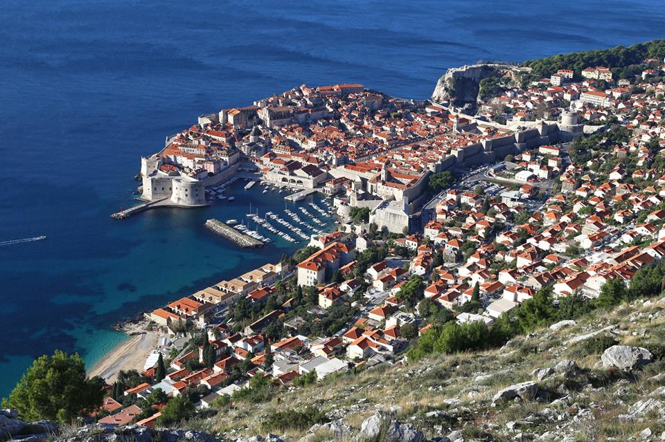
TZ Dubrovnik
To understand just why Dubrovnik has so much heritage and how it has been so well preserved, let’s take a look into this remarkable city's very long history.
The Dubrovnik Republic, which represents the golden period of Dubrovnik's history, perfectly regulated the city and life within it through its statute and other historic documents. This well-preserved city has been able to afford to lie on its Laurels owing to this, as well as its good geographic location and economy which was for centuries based on maritime and merchant activities.
The latest archaeological research discovered that there was a settlement dating back to the sixth century at this location, and this expanded with the arrival of Croats in the seventh century.
Travel and traffic between east and west during and after the Crusades resulted in the development of maritime and merchant centres in the Mediterranean and Adriatic in the twelfth and the thirteenth centuries. Another important event in the history of Dubrovnik was the Zadar Treaty, which in 1358 liberated Dubrovnik from Venetian rule while other Dalmatian towns fell under Venetian rule in 1420 and remained under their control up until the end of 18th century.
This is the reason why Dubrovnik was able to develop much more quickly than the other Dalmatian towns.
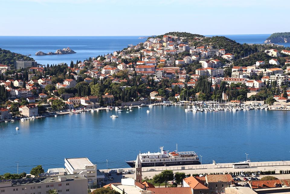
TZ Dubrovnik
In the fourteenth and fifteenth centuries, Dubrovnik was one of the most significant maritime and mercantile centres of Adriatic together with Venice and Ancona. Dubrovnik expanded its territory by using contracts and purchasing the land around the town including the islands, such as Mljet, Lastovo, the Elaphites, and of course Lokrum. The independence of the Dubrovnik Republic was completed by the fifteenth century when they had the independent election of the rector and council, and set their own currency, their own state flag with the image of St. Blaise, independent legislature and the right to establish consulates abroad.
The state authority was based on the great council which had members of aristocratic families in it. They appointed the members of the Senate and the small council which was the executive body of the great council. The rector was appointed on a monthly basis as a nominal symbol of authority.
In the fifteenth century, Dubrovnik had a well-organised transit trade route with the Balkan inland. In 1525, due to the Ottoman expansions in the area, the Dubrovnik Republic decided to pay tributes to the Ottomans and in return, they had the right to free trade throughout the growing Ottoman empire. The Dubrovnik Republic had no army on its own but managed to preserve its independence by being neutral in international conflicts and using the tutelage of powerful countries. The only rival of the Dubrovnik Republic was the envious Venetian republic.
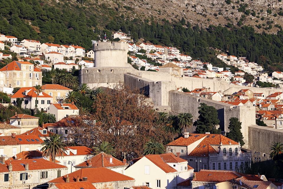
TZ Dubrovnik
The Dubrovnik Republic's golden age started in the sixteenth century – back then, Dubrovnik's merchant navy matched those across the rest of the globe with its quality fleet of 180 to 200 ships. These ships were used for long and dangerous journeys through the Mediterranean and the Black sea, as well as ocean journeys to northern ports in England and Germany, even going as far as India and the Americas. Material prosperity helped to shape a humanist culture and the Republic received a great level of achievement in its urban and architectural development that has been maintained to the present day in its literature and poetry, sciences, and in many other fields of art and culture.
In the seventeenth century, the general crisis of the Mediterranean maritime affair also affected Dubrovnik's maritime trade. The catastrophic earthquake in 1667 was another awful event for the Dubrovnik Republic. In the eighteenth century, Dubrovnik got another chance at the economic revival of maritime trade under a neutral flag. In 1815, Dubrovnik joined other parts of Dalmatia and Croatia. In more recent history, Dubrovnik was damaged during the Homeland War, with the worst attack happening on December the 6th, 1991.
Now, let's see what can be found in Dubrovnik when it comes to valuable heritage which has been recognised by UNESCO and numerous people who visit Dubrovnik each year.
Dubrovnik's City Walls
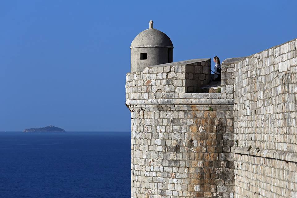
TZ Dubrovnik
Dubrovnik's city walls were established in the thirteenth century and were systematically and continuously perfected over several hundred years, until 1660, when the last tower, the St. Stephen’s Bastion, was finished. The walls stretch for over 1940 metres and consist of the main wall, sixteen towers, three forts, six bastions (bulwarks), two corner forts (cantonatas), three pre-walls with several turrets, three moats, two barbicans, two drawbridges, and one breakwater.
This is one of the best-preserved fortification systems in Europe with three forts: Minčeta, Bokar and St. John. The walls are up to 22 meters high in some places, with a thickness of between 4 to 6 meters from the mainland side, and from 1/5 to 3 metres on the seaside.
Among the many known and unknown builders of the wall and its construction, some of them are: Paskoje Miličević, Nicifor Ranjina, Marin Držić, Župan Bunić, Miho Hranjac, Juraj Dalmatinac, Michelozzo di Bartolomeo Michelozzi of Florence, Onofrio and Simeone Della Cava, Antonio Ferramolino of Bergamo, Giovanni da Siena, Bernardino di Parma, Marcantonio Bettaci of Florence, Seporoso Mateucci of Fermo and Giovanni Baptista Zanchi of Pesaro.
The shape of the walls was definitely defined by available weapons of the time and the various defence techniques of the past. The first walls were built when the first settlement was consctructed back in the eighth century, and Dubrovnik enjoyed the natural protection of the sea, with the walls acting as additional protection for Dubrovnik's citizens.
You can enter Dubrovnik's city walls next to Pile Gate, St. John's Fort and St. Luke's Fort.
Minčeta Fortress
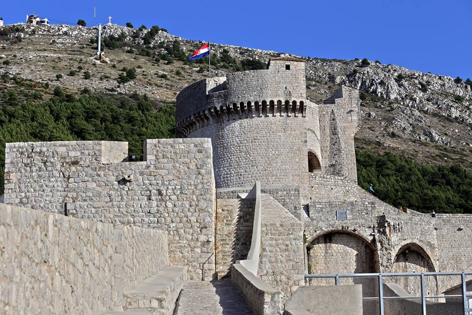
TZ Dubrovnik
Minčeta fortress is placed on the highest north-western part of the city. It is a large circular tower with a big battlement suspended by a stone support. The first quadrangular tower was constructed by Nikifor Ranjina in 1319, the architect Michelozzo Michelozzi gave it its present form and it was completed in 1464 based on the design of Juraj Dalmatinac, who was famous for numerous works in Dalmatia among which the best-known is the Šibenik cathedral, another UNESCO world heritage site.
St Luke’s Tower
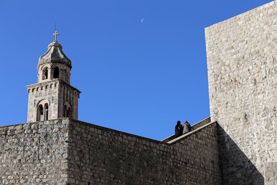
TZ Dubrovnik
If you walk eastward along the city walls towards Ploče gate, you will get to St. Luke’s tower. In 1467. Paskoje Miličević designed the bulwark for the old St. Luke’s tower with openings for cannons. The tower controlled the access to the harbour.
St John's Fort
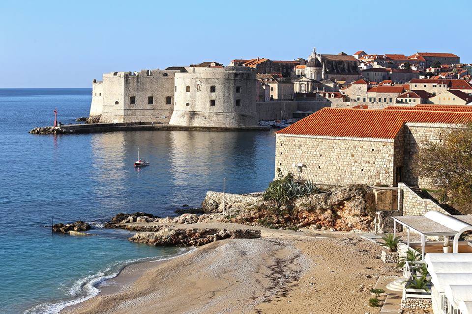
TZ Dubrovnik
This is the first quadrangular pier tower and it was constructed back in 1346 in order to protect the city harbour in the southeast, and its outlines are still visible on the western wall. The shape of the fort we know today was completed in the sixteenth century when the whole complex got bigger and outer wall was extended.
Bokar Fort
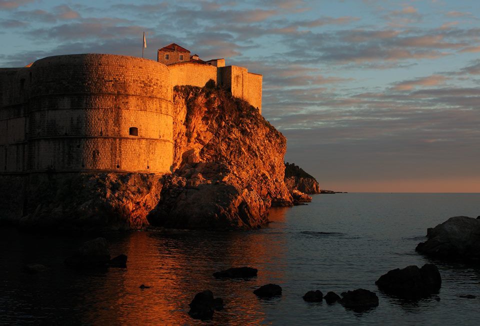
TZ Dubrovnik
This fort was important for defending the city. The gate and the bridge, as well as the moat are located at Pile. The semi-circular tower was designed by Florentine architect Michelozzi in the fifteenth century.
Lovrijenac
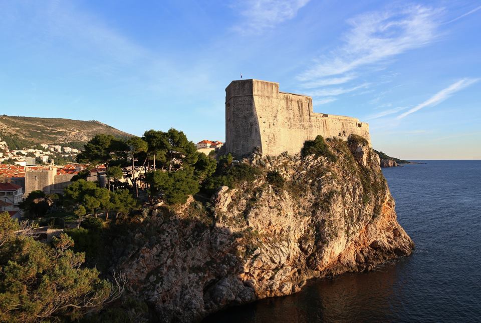
TZ Dubrovnik
This fort is set on the 37-metre-high cliffs outside of the city walls. You can reach it by walking along Pile bay and climbing the steep, stone stairs. This fort was built to protect the entrance to the city from the west. The fort's construction began in 1018 and it was completed in the sixteenth century. The walls are 4 to 12 metres thick. The entrance door boasts the Latin inscription: Non bene pro toto libertas venditur auro (Freedom is not sold for all the gold in the world). There lies the chapel of St. Lawrence and its courtyard where occasional performances and plays are held today.
Revelin Fort
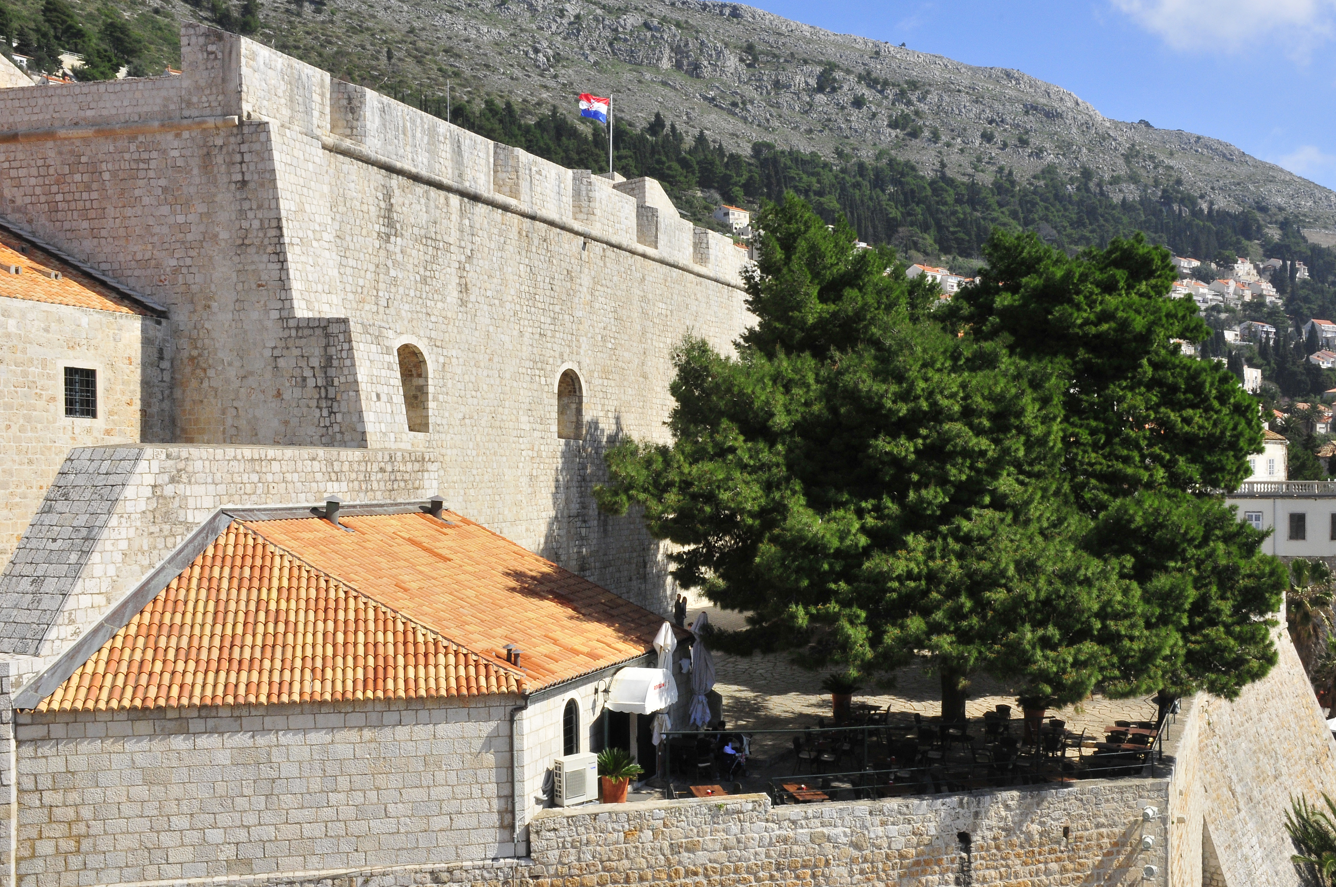
LBM1948
Revelin fort was built outside of the city walls and it was once part of the defence complex of Ploče Gate. The lower part of the fort was built in 1463, and was then rebuilt in 1538. The fort protected the eastern part of the city and the entrance to the city harbour. It has three entrances and is surrounded by a moat and the sea on three sides. Ivan Rabljanin kept the foundries for casting cannons and bells in the large interior. Now it is used as a place for Dubrovnik summer festival plays.
Pile Gate
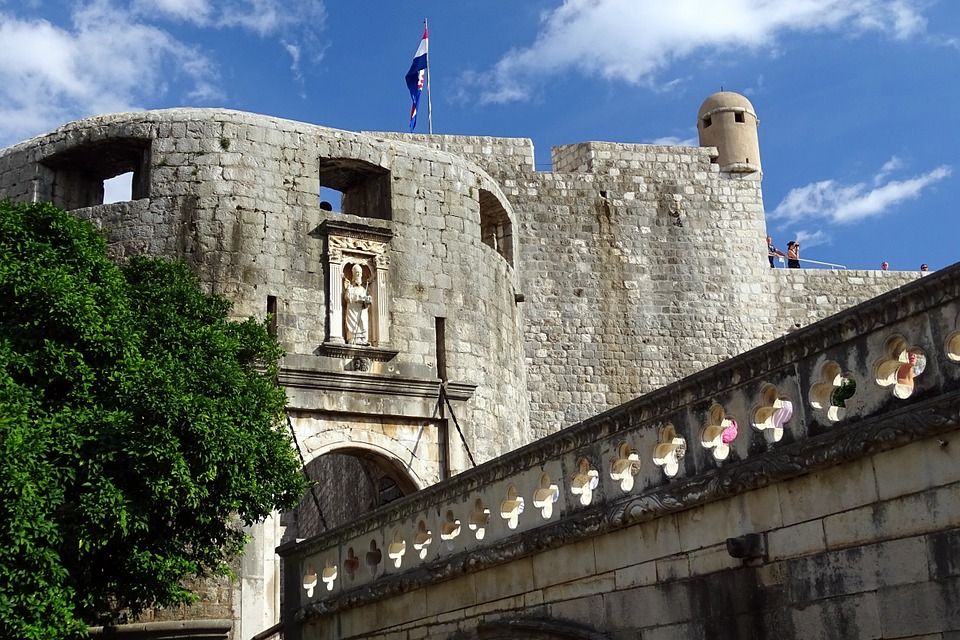
Pixabay
Just outside the city walls lies Pile – here, you first have the seaside promenade constructed outside of the walls. Here you enjoy an amazing view of the city walls and of Lovrijenac fort. If you enter the city through Pile Gate, the first thing you will see is the stone statue of St. Blaise. There is a stone bridge and a wooden bridge which lead to the outer gate, then to the renaissance semi-circular tower. When you pass through the inner gate, you enter Dubrovnik's main street – Placa or Stradun.
Stradun
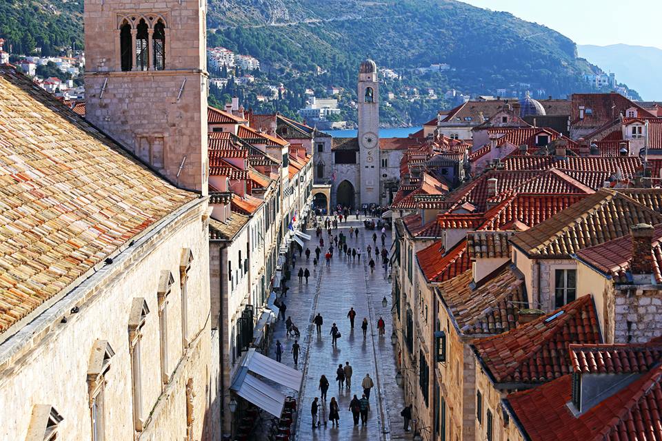
TZ Dubrovnik
Placa or Stradun is the main street in Dubrovnik. Stradun is 298 metres long and the statute of the city from 1272 determined the final plan for the city and its main street. The houses on Stradun are built in baroque-style architecture with shops on the street level. Stradun has its modern-day shape after the earthquake in 1667, when a large number of gothic and renaissance palaces were sadly destroyed. Even today, Stradun is the main centre for all the events in the town.
Large Onofrio's Fountain
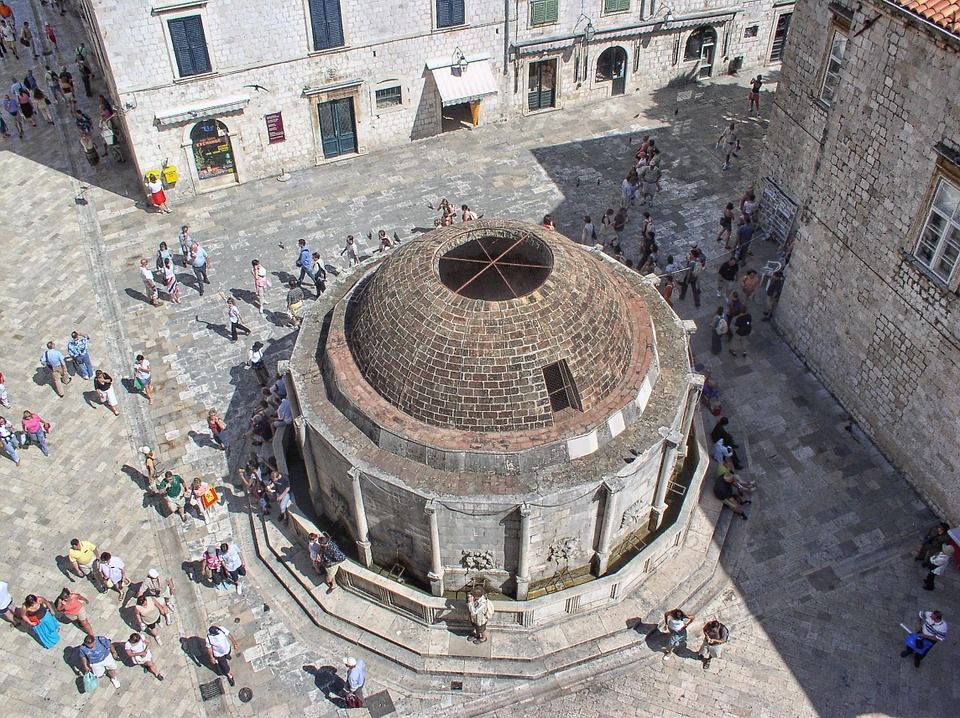
Pixabay
When on Stradun, one of the main sights is the large Onofrio's fountain. This is a large polygonal fountain with sixteen stone carved maskerons which provide running water. The fountain was designed by Onofrio Della Cava who also designed the small fountain at the other end of Stradun – the fountains were built for public use in 1438 when fresh water was brought to the city from Rijeka Dubrovačka. The fountain is now connected to the new waterworks system. The cupola was damaged during the 1667 earthquake and later reconstructions sadly failed to restore it.
Small Onofrio's Fountain
Sailko
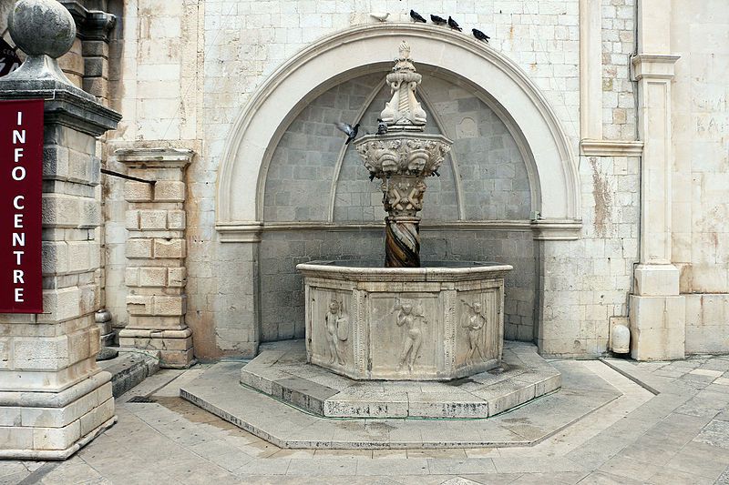
Small Onofrio's fountain was designed in 1446 and the stone mason work was handled by Pietro di Martino di Milan. Located in a niche to the city guard building, it is part of the original setting for the carnival play “The tale of Stanac” by the famous Dubrovnik playwriter Marin Držić.
City Guard Building
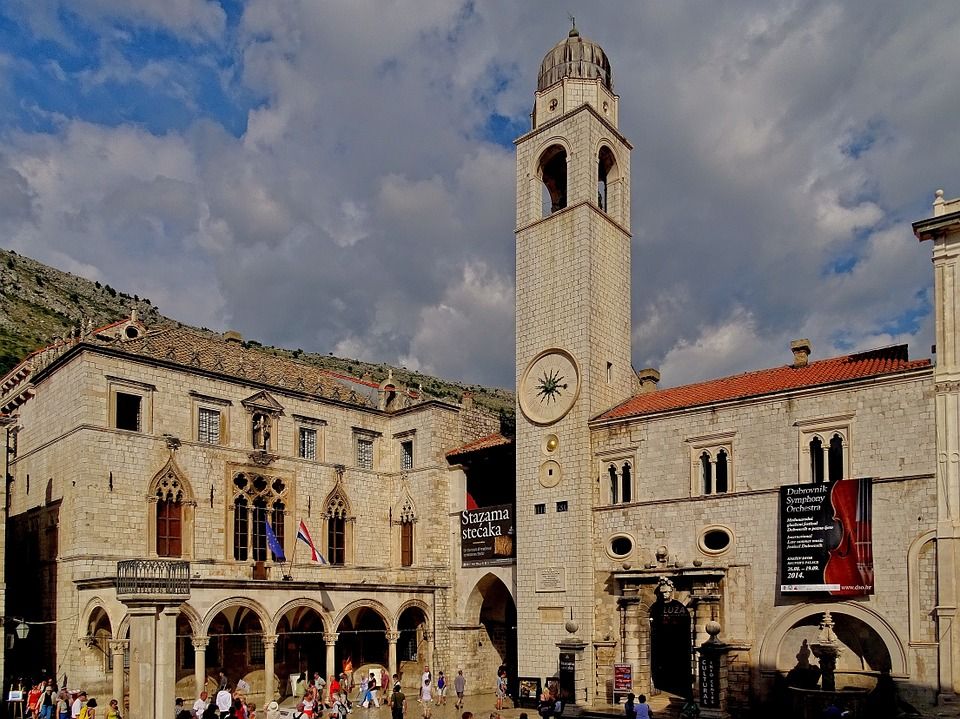
Pixabay
The City Guard building was the admiral’s residence during the fifteeth century. It was restored in the twentieth century and it is now the entrance to the cinema.
Rector's Palace
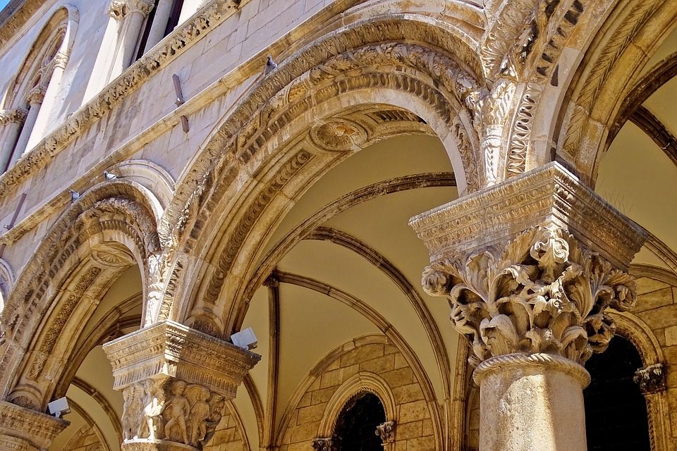
Pixabay
The Rector's Palace is one of the most important pieces of heritage on the Croatian coast – this was the administrative centre of the Dubrovnik Republic – it is built in a gothic style with reconstructions in renaissance and baroque style. It was damaged in the fifteenth century by gunpowder explosions and restored by Onofrio Della Cava in late gothic style in 1435. The second gunpowder explosion in 1463 destroyed the western facade
and the two famous architects Juraj Dalmatinac and Michelozzo worked on reconstruction. After the earthquake, the atrium was partially reconstructed with a baroque staircase. During his one month mandate, the rector lived in the palace which was the place of both the minor and major council hall, the rector’s residence, the city's courtroom, the administration office(s), the prison, and even for arsenal and gunpowder storage.
Above the entrance door lies the inscription: Obliti privatoru publica curate (Forget your private business, concern yourselves with public affairs).
In the atrium sits the bust of a rich sea captain and benefactor, Miho Pracat, this work was done by P. Giacommetti in 1628. The Miho Pracat statue is the only statue in the city for the common people – The former Dubrovnik Senate decided to do this 1638. The bust is placed between two columns in the eastern wing of the Rector's palace atrium. He was not only a rich seaman who left his wealth to the Republic, but a ship owner and a very skilled merchant. This was an enormous honour as the Dubrovnik Republic never built statues for its contemporaries, and found it inappropriate to have statues in public places. Today, the Rector's Palace is the home of the Dubrovnik museum.
Ploče Gate
TZ Dubrovnik
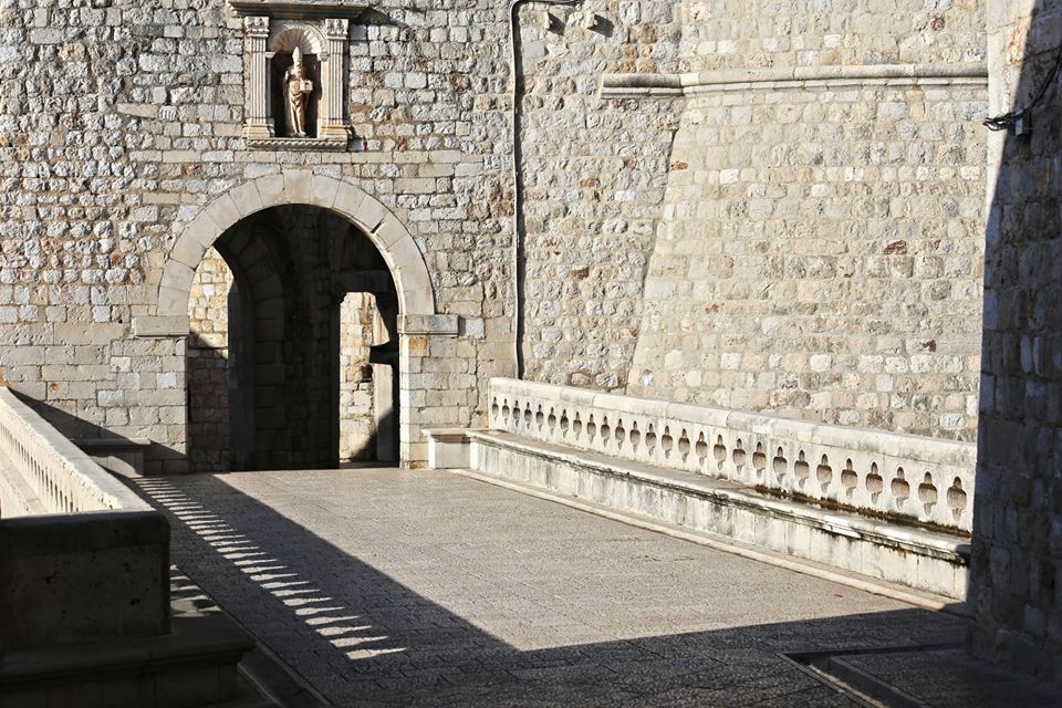
Ploče gate is the eastern entrance to the city. When you pass through this gate, you will see two small churches. This entrance is fortified and had inner and outer gates with stone bridges from the fifteenth century onwards, and there lies a statue of St. Blaise, the city's patron saint.
Luža and the City Bell Tower
Pixabay
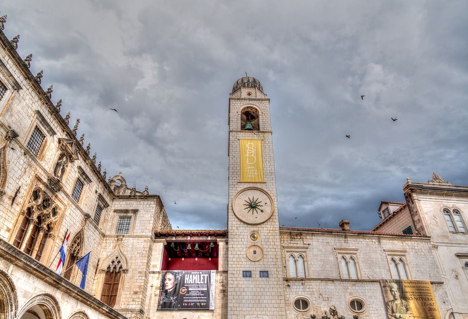
After passing through Ploče gate, you will end up in front of Luža and the City Bell Tower. The bell tower, built in 1444, once had figures called Zelenci who struck each hour with their hammer. The bell tower was damaged in the earthquake and it was rebuilt in 1929, while the Zelenci figures were replaced with replicas.
Sponza Palace
Pixabay
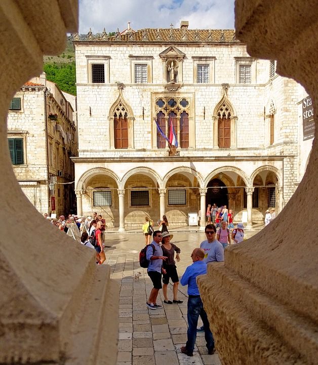
Right next to the bell tower lies Sponza Palace. This building is the best example of Dubrovnik's highly specific gothic-renaissance style. It was constructed in the sixteenth century based on the design of Paskoje Miličević. It was built in a rectangular shape and has a portico and an atrium. On the main wall lies the inscription: Fallere nostravetant, et fall pondere, meqve pondero cvm merces ponderat ipse deus (We are forbidden to cheat or falsify measures and when I weigh goods, God himself is weighing them with me).
This was the liveliest commercial centre of the city and in the seventeenth century, it became the meeting point for members of the Academy who discussed literature, the arts, and science. Today, it’s the home of the Dubrovnik archives.
Church of St Blaise
TZ Dubrovnik
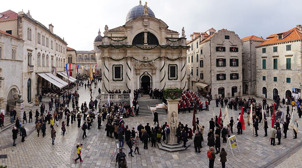
The Church of St. Blaise is one of the most important buildings in Dubrovnik. St. Blaise is the patron saint of Dubrovnik who has been celebrated every year on February the 3rd, and this festivity is part of the city's UNESCO intangible heritage. The church got its present form is from 1715 and is a shining example of Venetian Baroque. It was built by Marino Gropelli upon the request of the Dubrovnik Senate. It was damaged in the earthquake, and then again in the fire in 1706.
In that fire, everything was destroyed except the silver statue of St. Blaise. This statue was then kept in the small church of St Nicholas on Prijeko before being brought back to its original place in 1715. This statue is one of the most valuable sculptures in Dubrovnik and the saint holds the city model, from which one can see how Dubrovnik once looked long ago. St Blaise has been being celebrated in Dubrovnik from the tenth century onwards, when he saved the people of Dubrovnik from a surprise Venetian attack with a solemn warning.
Orlando’s Column
Pixabay
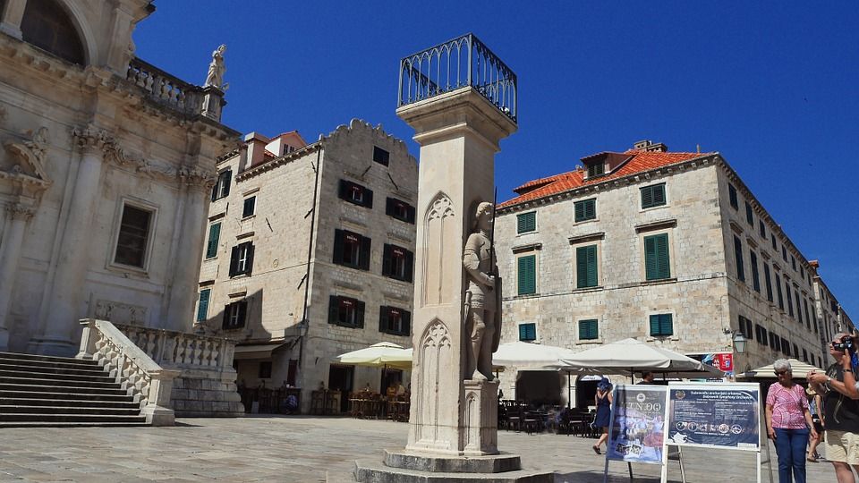
In front of the Church of St. Blaise lies the most important symbol of statehood and freedom for Dubrovnik – Orlando’s column. Orlando’s column was constructed by Bonino di Jakopo and Antun Raguso. Erected in 1419, Orlando’s column, with the statue of a medieval knight, stands in the square and presents Roland, the eighth-century knight from the Chanson de Roland. The reason this statue is in Dubrovnik is probably because it was brought by King Sigismund, a Hungarian and Bohemian king who was the patron of Dubrovnik Republic.
Additionally, there is a legend that says Roland saved Dubrovnik from Saracens and defeated them near the island of Lokrum. Senate decisions were announced in front of it. This statue was also a punishment spot and a pillar of shame. The white flag of the Dubrovnik Republic with the image of St. Blaise remained on the column until the abolition of the Republic in 1808. Now the Croatian flag flies there, and the flag is changed only during the Festivity of St. Blaise and during the Dubrovnik summer festival. This year, Dubrovnik is marking the 600th anniversary of the construction of Orlando’s column, and therefore 2019 is considered to be the year of Orlando.
Buža Gate
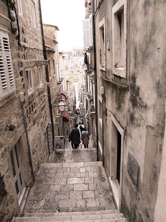
From Prijeko to Ruđer Bošković street (the place where the famed eighteenth century Croatian scientist, physicist, astronomer, and poet was born) stands the gate that was built back in 1907.
Gundulić Square
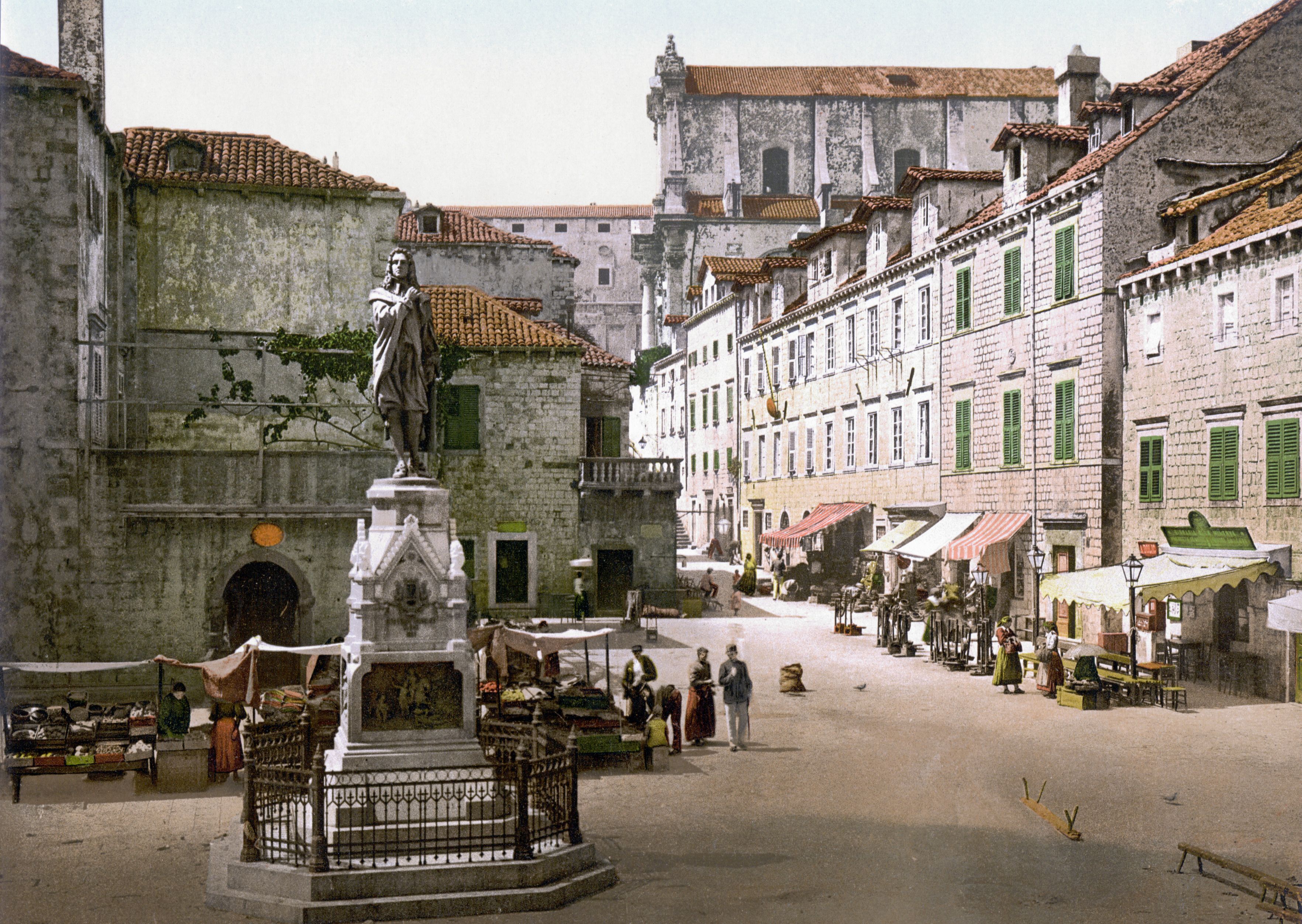
Behind the cathedral lies Gundulić square which is home to the statue of Ivan Gundulić, one of Dubrovnik's best eighteenth-century poets – this statue is the work of Ivan Rendić, and on the base of the statue there are bronze relives with scenes from Gundulić's epic poem - Osman. Ivan Gundulić was born in 1589 to an old and respectable aristocrat family. He later became famous on his own merit for his valuable works. This is the place where the green market in the morning sets up. What is interesting is that in front of the statue there are hundreds of pigeons waiting for their meal every single day – the city funds ten kilos of corn to feed the pigeons.
Jesuit Church
Pixabay
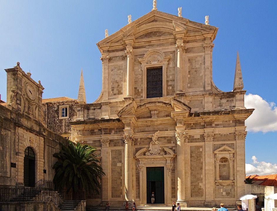
From there, if you go up the baroque stairs you will reach the Church of St. Ignatius or Jesuit church which is the home of Dubrovnik's most beautiful baroque complex. This church is the work of Ignazio Pozzo and right next to it is Collegium Ragusinum, the famous Jesuit school. Collegium Ragusinum was initially founded because the people of Dubrovnik were dissatisfied with their Italian teachers. The first steps for this to happen were initiated in the sixteenth century but it wasn't until the end of seventeenth and the beginning of the eighteenth century that works started. Collegium Ragusinum hosts a massive 10,000 volumes with incunabula and manuscripts by Dubrovnik's numerous writers.
City Harbour
TZ Dubrovnik
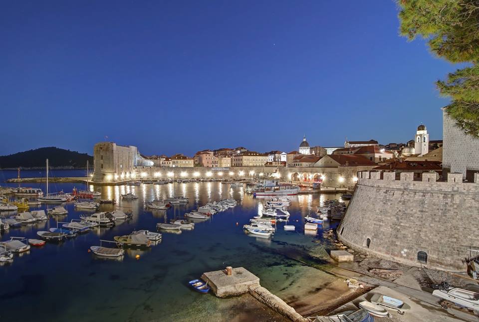
The city harbour got its look back in the fifteenth century - the most recognisable part of it is the three arches of the large arsenal. East from the large arsenal there is the fish market gate and then three arches of small
arsenals where smaller ships were repaired. At the location of the large arsenal today lie the city cafe and the theatre.
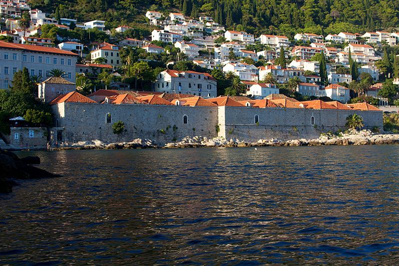
Lazarettos
Ramon
Lazarettos (Lazaretti)
This was the place for the first quarantine built in the fourteenth century in order to isolate travellers and goods from eastern countries. There were eight buildings and five courtyards which were renovated in the sixteenth century. This complex included large warehouses and lodging for the extended stay of merchants and travellers. In the seventeenth century, this was the largest merchant transit centre on the Adriatic and one of
the best-organised quarantines in the entire Mediterranean.
With this sheer amount of invaluable heritage that is still standing today after all these centuries, Dubrovnik definitely deserves to be considered one of the greatest towns in the world, and its popularity in terms of tourist visits and global interest is very much understandable.
UNESCO Intangible Heritage of Croatia – The Art of Dry Stone Walling
December the 1st, 2018 - Dry stone walling can be seen all along the Adriatic coast as well as in the Dalmatian hinterland and beyond. Now inscribed onto UNESCO's list, let's take a deeper look into this piece of the intangible heritage of Croatia.
On November the 28th, 2018, UNESCO inscribed two more pieces of intangible heritage from Croatia made UNESCO's prestigious list. The first one was Medjimurska popevka, a type of traditional singing, and the second was the art of dry stone walling.
This article will look into the art of dry stone walling and the traditions related to it. This piece of heritage is already on the list of the intangible heritage of Croatia, and in 2015 and 2016 an international effort to nominate this heritage for the UNESCO Representative list of the Intangible Cultural Heritage of Humanity was made. The main coordinators for the nomination from Croatia were the Ministry of Culture and the 4 Grada Dragodid association.
.jpg)
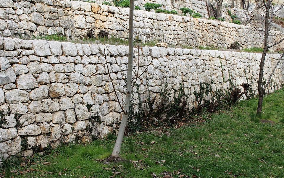
Dry walling is the construction of a stone wall by stacking stones upon each other without the use of any connection material like cement, except sometimes dry soil. The stone used is usually not processed. Its product is “suhozid” or dry wall (other names for it depending on the region are gromača, međa, mocira, mocir, masiera, redina, prizida, zid, mrtvi zid, mrtvi mir etc) which can be often found along entire Adriatic coast as well as in the Dalmatian inland area.
Another characteristic product of this way of this type of building are smaller objects made completely of dry stone, which were used for different purposes. The stability of the dry stone structures is ensured by selecting and properly placing the stones. These dry stone structures are an example of a type of construction which lives in harmony with nature and this inscription aims to preserve the know-how of building it. The practice is usually passed down with practical application adapted to the specific conditions of different areas in which it is typically made.
.jpg)
Dry stone walls are spread along the Adriatic coast, as well as inland, and the walls created via this technique resist the test of time. Their self-preservation is good example on how we can learn more and cherish such a sustainable way of building. There are different types of construction – from dry stone walls around houses, gardens, vineyards to shelter buildings or even actual houses and their elements. These buildings can act as the inspiration for a new period of dry stone construction, and the people still building in this manner could be a valuable source of information.
.jpg)
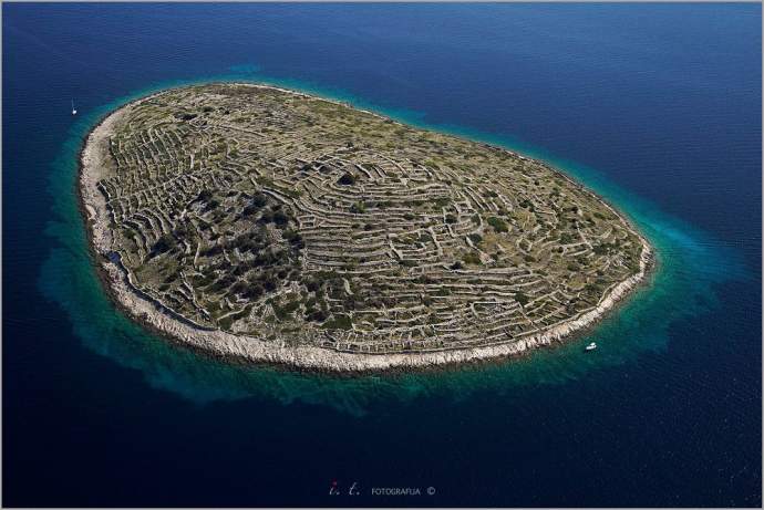
One incredible example of preserved dry stone walls is Croatia's very own ''fingerprint island'' – Baljenac, with 23,35 km of dry stone walls on the island. The organisation 4 Grada Dragodid, whose website is filled with information about this piece of heritage was founded in 2007, but its very first beginnings are from 2002. Back then, the first international dry stone workshop in the village of Dragodid, close to Komiža on Vis, was held.
The main activities of the Dragodid association include organising and managing dry stone workshops, and researching dry stone heritage with local partners and those who still use this method of construction in the modern day. Another international organisation was founded recently and its goal is to form a cultural route of European dry stone heritage as part of the wider cultural routes programme.
There is even a website, which is the open public inventory of the Croatian dry stone heritage where anyone can add a contribution in order to broaden public knowledge on dry stone wall construction and its distribution along the Adriatic coast and in the hinterland.
A contribution can be added by sending in a photo and all the available information on the dry stone building, structure or ambient, accompanied by the accurate location information. They even have a mobile app which makes the whole process even easier. With activities like this and the welcome recent UNESCO recognition, dry stone walling heritage will definitely remain an essential part of local traditions and the intangible heritage of Croatia.
SOURCE(S) (text and photos): UNESCO, Ministry of Culture, Dragodid, Suhozid.hr, Total Croatia News, Jagul Wine Cellar
Make sure to follow our dedicated lifestyle page for more information on the intangible heritage of Croatia and much more.

.JPG)
