Construction Permit for Ucka Cable Car Expected by End of 2022
June the 11th, 2022 - The construction permit for the Ucka cable car should be obtained by the end of this year, and a brand new tourist attraction should provide a boost to the Ucka area.
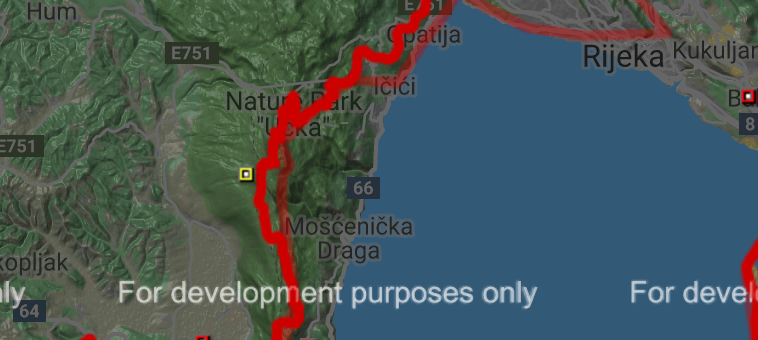
As Morski writes, the total investment in the Ucka cable car is now estimated at around 35 million euros, representatives of the project's expert team said recently. Members of the team, Mladen Blazevic, Milorad Stanic, Zeljko Kuis and Ingo Kamenar spoke at a recently held press conference about the state and future of the Ucka cable car project, which should be operational in five years at the most and have the longest route among all European cable cars.
As they pointed out, it is likely that by the end of the year, a building permit could be obtained for all elements of the future Ucka cable car - a departure station at the bottom of Camp Medveja, the final station below the top of Vojak, the route and pillars with all of the accompanying access roads, an access road to the departure station and a water supply and drainage.
According to the data, the total investment is now estimated to stand at around 35 million euros, of which the value of access roads is estimated at five million euros, and the construction of a panoramic restaurant within the Ucka cable car peak station is estimated at 1.5 million euros, according to a report from HRT.
More will be known about potential investors after obtaining a building permit. European Union (EU) funds have been mentioned as one of the financing options, with the additional participation of businessmen, local communities and individuals also expected.
The Ucka cable car will be 4696 metres long from the departure to the final station, with a height difference of 1310 metres, and the arrival station will be located at a height of at 1355 metres. It will have five pillars, the maximum driving speed will be 10 metres per second, and the road speed will be seven metres per second. The ride will take eight and a half minutes, and the cabin capacity will be 60 people, ie 310 passengers per hour.
The feasibility study predicts about 320,000 visitors per year, so it is expected that the tourism sector will have an economic interest in this project, especially in the pre- and post-season expansion, and they're as such likely to participate in co-financing the project. The idea of the Ucka cable car was conceived a whole 139 years ago, it was updated in the 1970s, and the current project was launched about 10 years ago.
In more recent years, there have been delays, mostly due to amendments to the project documentation, the preparation of a study of the main assessment of the acceptability of the project for the ecological network and amendments to the cableway route itself.
For more, make sure to check out our dedicated lifestyle section.
5 Ways to Explore Istria Off the Beaten Path
March 12th, 2022 - There’s so much more to Istria beyond the famous Rovinj landscape or the olive oil and truffle fame. The region is full of treasures to discover, and we're happy to help you plan your visit with five unique ideas for things to do in Istria
And then go ahead and have those truffles anyway - we’d never think to suggest otherwise.
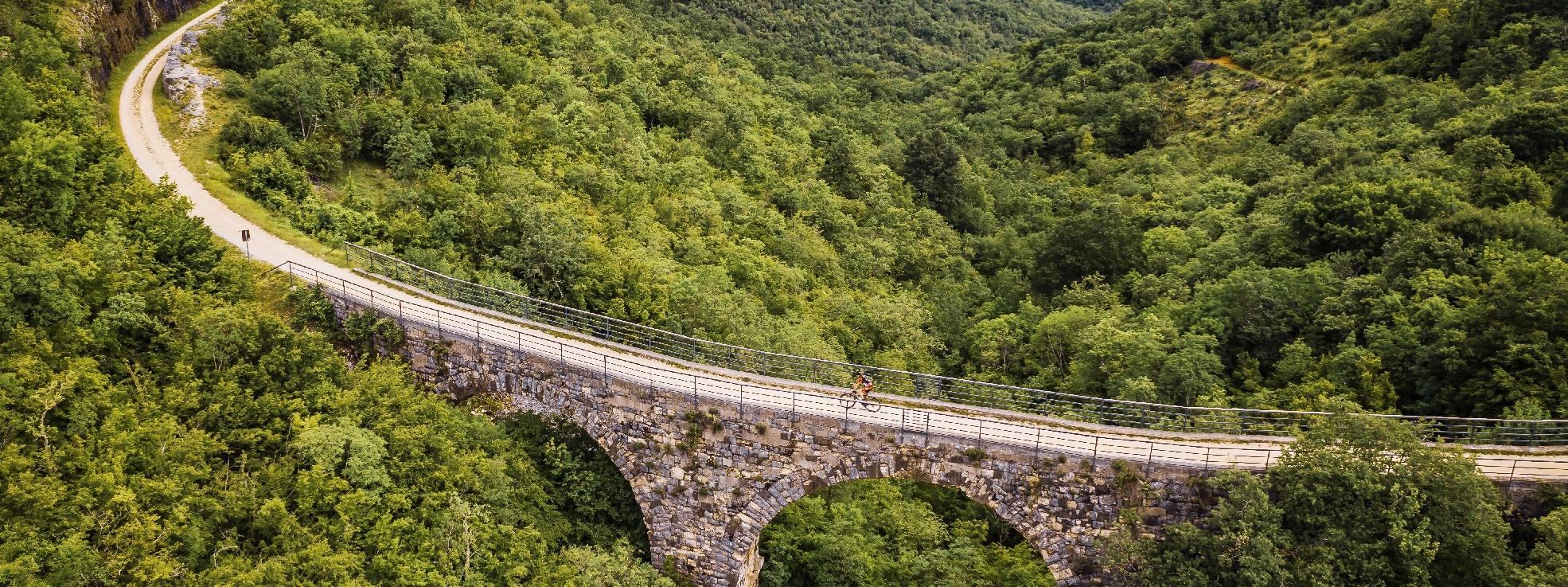
Walk the Parenzana trail
Not necessarily the whole thing, of course: running through three countries, the Parenzana trail is 123 kilometres long in total, and it's perfectly fine to only walk or cycle a part of it. Historically, Parenzana was known as the narrow-gauge railway which connected the Italian port city of Trieste with Poreč in Istria, passing through many inland villages and smaller towns along the way.
Fun fact: as the inauguration of the Parenzana line in Trieste was delayed several times due to various issues, the locals got skeptical after a while. When the first train ceremonially arrived in Trieste on April 1st, 1902, almost no one showed up at the railway station because people were convinced the announcement was an April Fools’ joke.
 Parenzana trail / parenzana.net
But it wasn’t, and the railway soon made it possible for agricultural produce to be distributed all over the region, stimulating Istria’s economic progress and becoming somewhat of a lifeline for the local population. Although the railway line ceased operation in 1935, it certainly left a mark on the region, and so it was decided to revive the route as a hiking and cycling trail.
Parenzana will take you over bridges and viaducts, now secured by guard rails; it runs through well-lit tunnels and snakes through the lush landscape. The entire trail is well-marked and is split into shorter routes - a comprehensive guide is available on parenzana.net, in several languages.
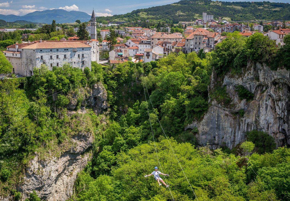
Ride the zipline over the Pazin abyss
Although Pula is the biggest town in Istria, the county’s administrative seat is actually Pazin, a town located in the very centre of the region.
Pazin boasts a medieval castle that was once a residence of Istrian margraves and hasn’t lost any of its grandeur with time. Perched on top of a tall cliff plummeting into the Pazin abyss, the castle dominates the majestic landscape which inspired literary giants of the likes of Dante Alighieri and Jules Verne.
 Pazin / Central Istria Tourist Board, photo by Julien Duval
And what better way to take in the impressive sights than flying over the natural attraction? The Pazin zipline runs over the abyss in two stages: the first cable is 220m long and the second 280m, giving adrenaline lovers plenty of time to admire the historic landscape, as well as the karst phenomenon down below.
The zipline operates regularly from May 1st, but can be visited in the off-season as well upon request, provided you’re visiting with a group - contact info is available on their Facebook page.
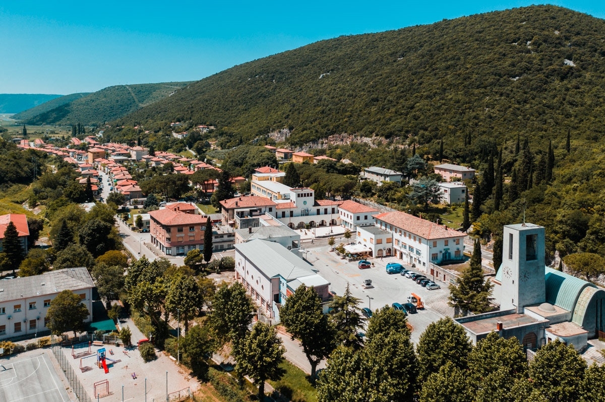
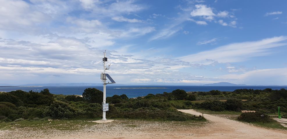
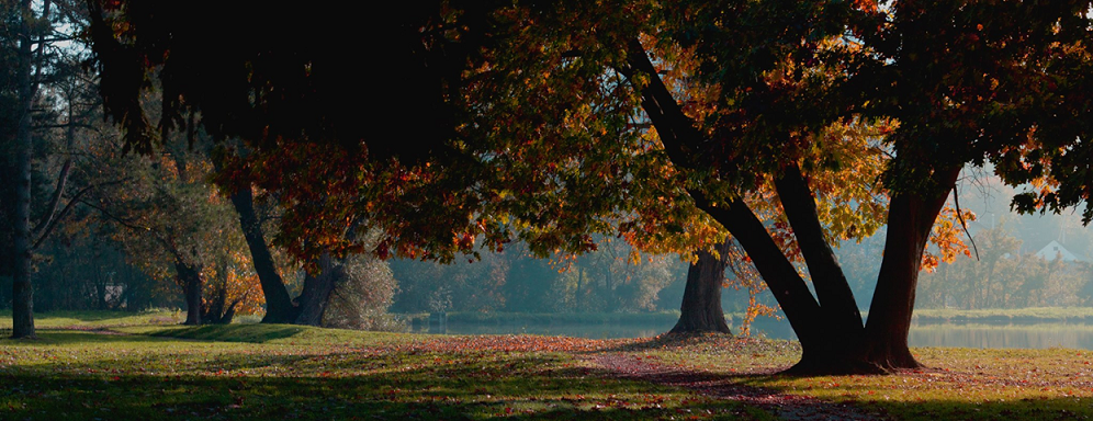
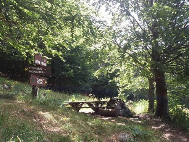
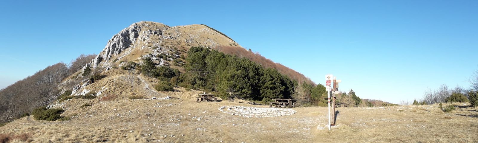
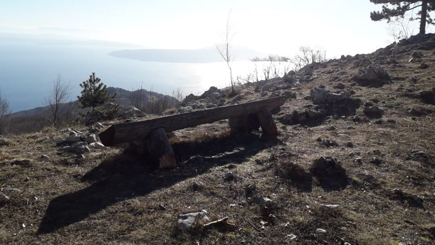
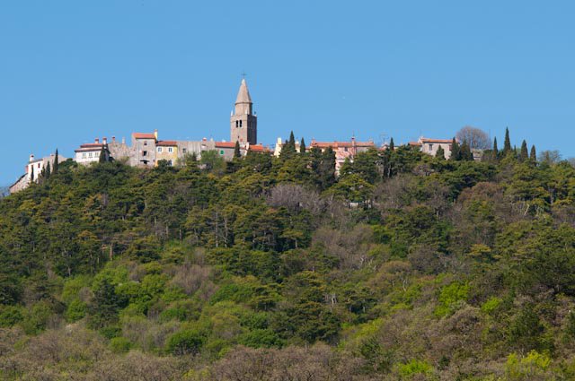
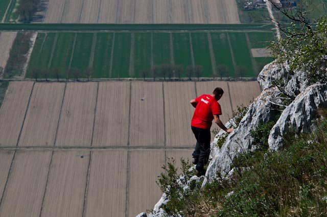
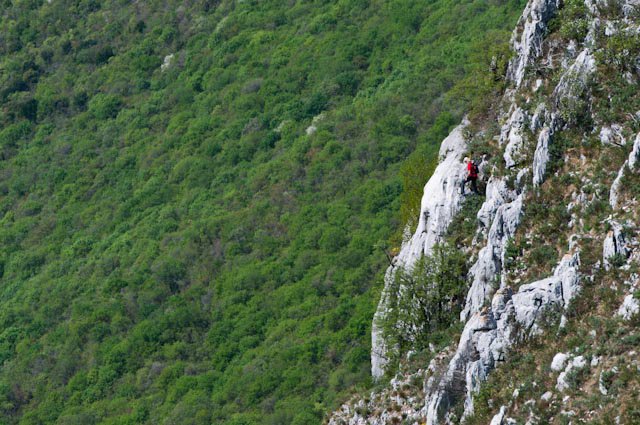
Hike the contraband trails of Učka mountain
Have you ever had a chance to retrace the steps of smugglers of the past? A few years ago, three unique hiking trails were established on the Učka mountain, the natural border between Kvarner and Istria, introducing hikers to the history of contraband activity in the area.
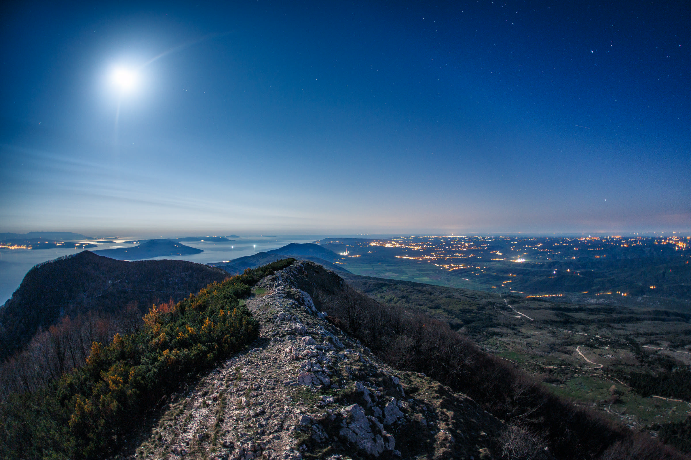 Učka mountain © Mario Romulić
In the 1930s, a duty-free zone was established on the coastline around Rijeka to stimulate tourism and the local economy. Overnight, consumer goods became much cheaper, and the struggling population soon started to smuggle products such as sugar and petroleum out of the duty-free zone and over the Učka mountain on foot. They sold the goods for profit in the rest of the region as a way to survive in times of scarcity - check out this TCN feature for the full story.
You can find detailed information about the hiking routes in a dedicated mobile app, along with a list of accommodation providers and restaurants in the area. It’s available to download on GooglePlay and AppStore - search for 'Kontraband thematic trails'.
Discover the history of mining in Raša
Istria has a long history of coal mining, specifically in the area around Labin town located off the eastern coast of the peninsula. Arguably the most unique place in the mining landscape is Raša, known as Istria's youngest town which was purposefully built in the 1930s to house miners and their families.
 Raša town / Raša Tourist Board
Two pairs of streets lined with former miners’ houses meet at the central square in Raša, crowned with a church built in the shape of an overturned mining cart and dedicated to the patron saint of miners, St Barbara.
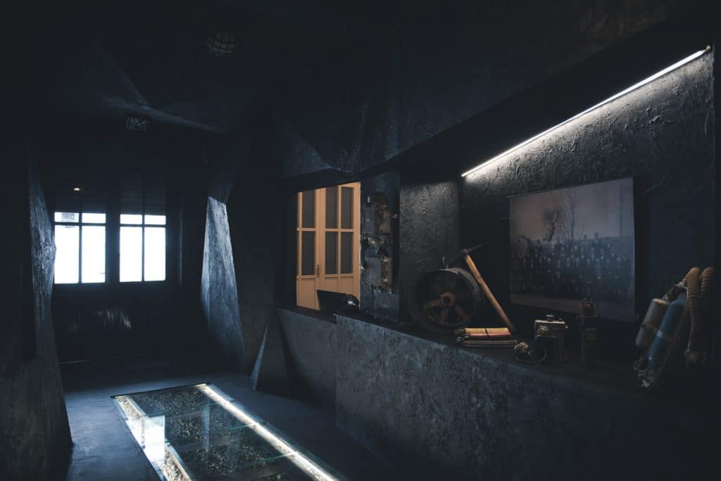
Even though the mines closed a long time ago, you can experience what it was like to spend your days in the dark underworld. Located on the main square in Raša, the Miners House Arsia tells the story of Istrian miners and provides insight into their lives both above and below ground.
 Miners' House Arsia / Raša Tourist Board
Starting from the entrance built like a mining shaft, the museum evokes the atmosphere of a mine - you can walk on the original railroad tracks surrounded by the sounds of coal digging and distant explosions, watch archival films to learn the stories of real miners who once inhabited the town, but also step into their homes thanks to a perfect recreation of a typical miner’s apartment.
Learn more about the Miners’ House over at the Raša Tourist Board.
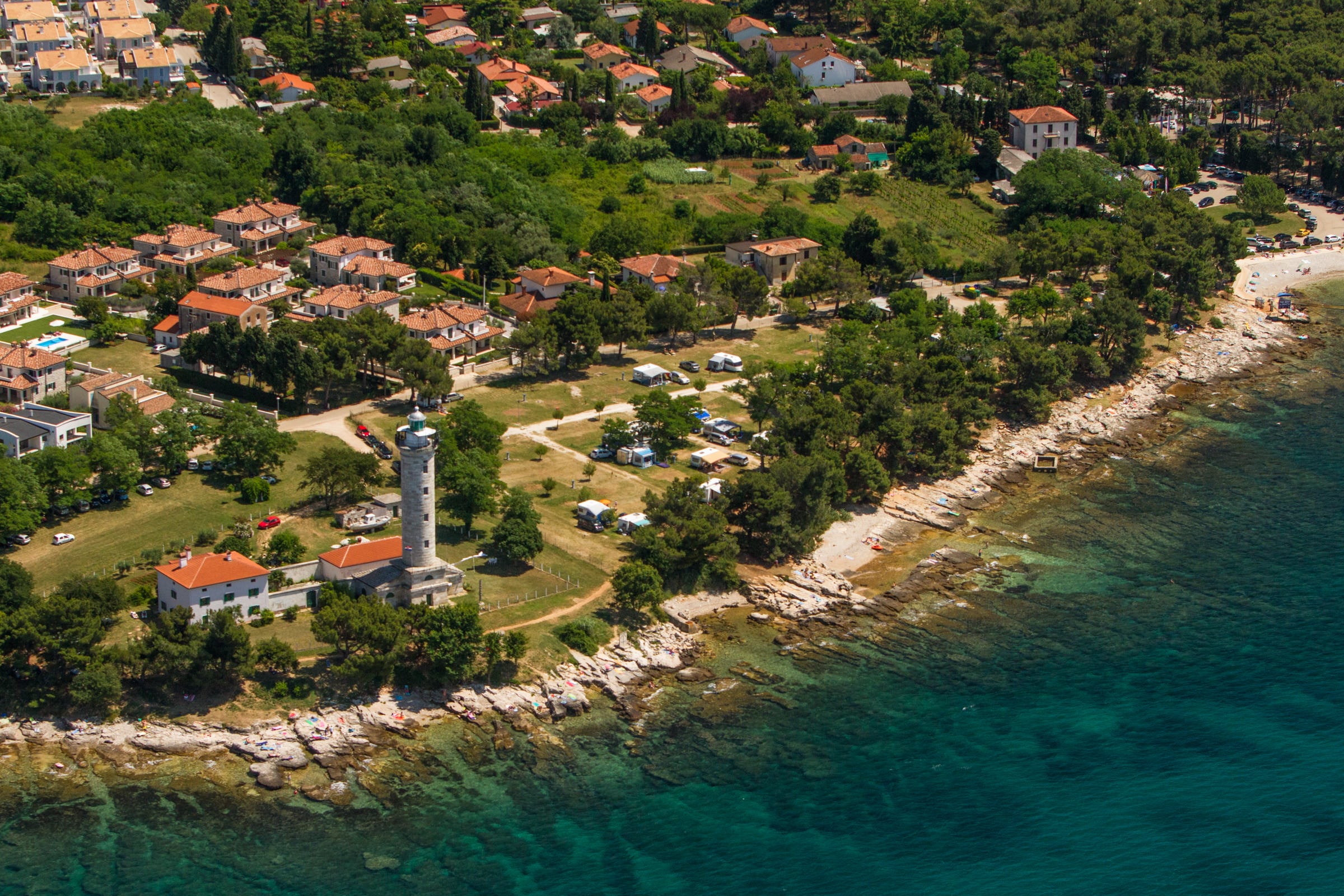
Visit Croatia’s oldest lighthouse in Savudrija
The Adriatic coast is dotted with numerous historic lighthouses, most of them built in the 19th century. The one in Savudrija, the northwestern tip of Istria, boasts two champion titles: it’s the oldest active lighthouse in Croatia, and the world’s first lighthouse powered by coal gas.
 Savudrija lighthouse © Mario Romulić
The lighthouse was built of white Istrian stone and powered by coal shipped in from the Labin mines. It was inaugurated in 1818 and became a local sensation overnight: people were so fascinated by the new structure, the lighthouse keepers were soon granted a licence to bear arms and were instructed to shoot any enthusiasts who attempted to scale the building and climb to the top.
 Savudrija © Mario Romulić
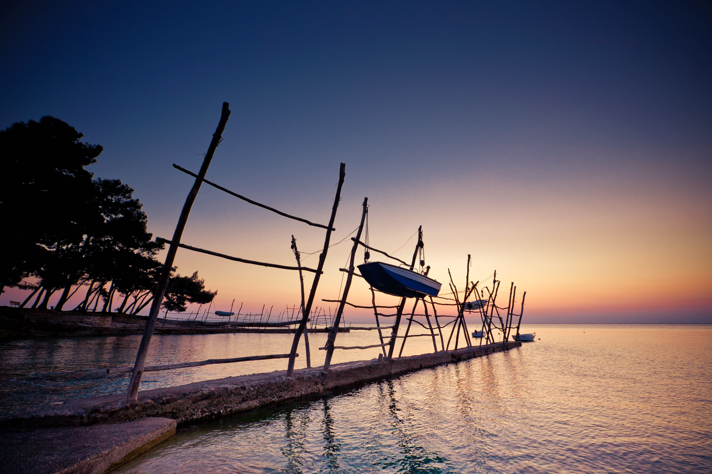
Nowadays fully automated and monitored by a single keeper, the lighthouse isn’t that much of a novelty anymore, but is still a beautiful landmark and in itself a good enough reason to visit Savudrija. Let it also be known that the place boasts a pretty spectacular coastline, lined with pines and traditional fishermen's boats. The waters around Cape Savudrija are favoured by surfers and divers alike.
Smuggling for Survival: Contraband Trails of Učka Mountain
February 19th, 2022 - In the 1930s, villages in northeastern Istria made a living running contraband over Učka mountain from a duty-free zone on the coast. The fascinating story of smuggling for survival is just part of the local history presented in the Ecomuseum Vlaški puti in Šušnjevica
At the foothill of Učka mountain in Istria lies the village of Šušnjevica. It’s not a destination to make headlines or get a mention on a must-see list. And yet, you’d be hard-pressed to find a better place to visit if you happen to like going off the beaten path.
Šušnjevica packs so much to discover, including a history of smuggling, stories of survival, and a dying language. The many facets of this incredible little place are presented in an interpretation centre named Vlaški puti (Vlach paths), introducing visitors to the social history and cultural heritage of the area.
Clandestine activities always seem to draw the most attention, so it only makes sense to start there: the unassuming village is located in the area where illicit trade thrived in the early 20th century.
For a bit of historical context, the Italian-ruled Kvarner Province at the time encompassed the wider Rijeka area, including a chunk of Slovenian territory in the north, and all the settlements lining the Opatija riviera in the south.
In 1930, the coastal part of the province was declared a duty-free zone by the Italian government (zona franca). The economic crisis left a mark on these parts as well, development of tourism was stalled, and so the decision to abolish customs was meant to shake things up a bit and give Rijeka and Opatija an edge over other popular destinations in the Northern Adriatic.
Naturally, consumer goods suddenly became much cheaper in the duty-free zone than in the rest of the province, and the local population was nothing if not resourceful. Living conditions were tough at the time, especially in rural areas, and any opportunity to make a living was seen as more than welcome.
And so the people of Šušnjevica and other villages in the area started running contraband, smuggling inexpensive goods out of the duty-free zone. They sold their produce and poultry in seaside towns, and in turn mostly purchased sugar, coffee, textile and petroleum. The illicit goods were transported on foot over Učka mountain and resold for profit in the rest of the region.
It was a dangerous business, both in terms of scaling rugged mountain slopes and avoiding the unforgiving customs officers who monitored the area. It should be mentioned that contraband goods were not smuggled out of greed for profit, but solely to ensure survival in times of scarcity.
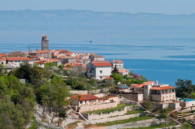
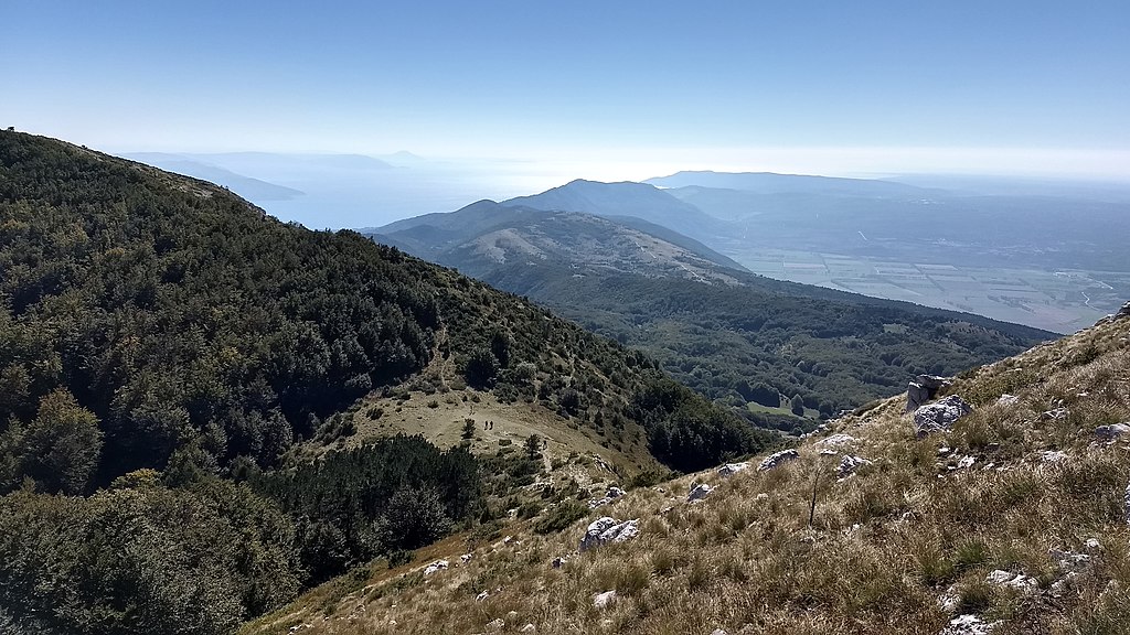 Učka mountain
If you’re up for a hiking adventure, you can now retrace the steps of smugglers past. Three hiking trails have been established in the territory of Učka Nature Park to introduce visitors to the lively history of contraband in the area. A mobile app was launched, containing detailed information about the hiking routes, along with a list of accommodation providers and restaurants in the area. It’s available to download on GooglePlay and AppStore - look for Kontraband thematic trails.
All three are demanding routes and vary from 6 to 10 kilometres in length, but are well worth the effort - the trails are scenic, feature wonderful views, and you’ll get to see a few historic sites along the way. Among them is the abandoned village Petrebišća, a place of importance in regards to Slavic mythology. Another stop commemorates a young smuggler who tragically died aged 12 when he got struck by lightning on Učka mountain; following his death, every smuggler in passing would lay a stone at the memorial site, which in time grew into a massive pile of stone, the so-called gromača.
The shortest trail (KB1) starts in Šušnjevica, and those who opt to take this route should really use the opportunity to discover more about this fascinating place at the Ecomuseum Vlaški Puti.
Director of the interpretation centre Viviana Brkarić is more than familiar with the subject, having had family members who dealt in the contraband trade. Viviana speaks of her grandmother, born in 1901; times were tough, she had to support her family, and was known to make the trip to the duty-free zone and back 3-4 times a week. She’d occasionally get caught smuggling goods over Učka which landed her in prison, but she didn’t mind as it meant ‘she’d get to rest for a while’.
The prison guards soon realised she knew how to sew, and would have her sew clothes and mend bedding. According to Viviana, grandma didn’t mind as they treated her as a guest and gave her better food than to an average prisoner. Apparently, the guards were quite happy to see it was her every time she was apprehended, and were known to say ‘she’s here, she’ll now mend everything that needs mending’. (Agroklub/Blanka Kufner)
These days, Šušnjevica is home to about 70 people, most of whom are Istro-Romanian in origin and are some of the last living speakers of Vlashki (vlaški), one of the two existing varieties of the Istro-Romanian language. The other variety is called Zheyanski (žejanski) and is spoken in the Žejane area on the northern side of Učka mountain.
Once spoken in a much larger part of northeastern Istria, Istro-Romanian is now listed as ‘severely endangered’ in the UNESCO Red Book of Endangered Languages, and is inscribed in the list of protected intangible cultural heritage of Croatia. In the mid-20th century, the language was reportedly spoken by up to 1500 people, but the numbers dwindled as the harsh living conditions drove people to move to bigger urban areas in the country or emigrate to the US and Australia.
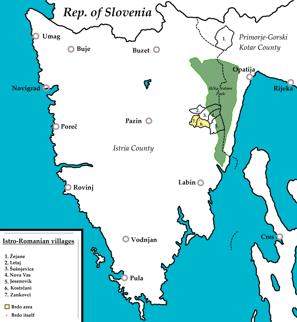
Interestingly, nowadays there are more native speakers of Istro-Romanian living in New York than in Croatia. It’s estimated there’s a community of some 300 people keeping the language alive in the diaspora, whereas the latest count from 2019 put the number of Vlashki speakers in Croatia at about 70.
The language is not passed from generation to generation anymore, and so the youngest people who actively speak Vlashki are about 50 years old.
Preserving this priceless heritage for future generations is one of the goals of the ecomuseum. The interpretation centre is designed to introduce visitors to the local history and traditions, while the media library contains materials in Vlashki and Zheyanski languages, as well as digitised publications about the language and other topics of regional importance.
Website: Ecomuseum Vlaški puti
Working hours: Monday to Saturday, 10 AM - 2 PM
Experience More With Top 10 Best Running Routes in Croatia
November 6, 2020 - Is there a better way to get to know the beauty of Croatia than with physical recreation? To help you successfully combine pleasure and exercise, we present a list of the top 10 best running routes in Croatia.
Whether you are a lover of tranquility, nature, and fresh air, or are amazed by the winding roads along the rivers or the beautiful views from the mountain tops, in these top 10 best running routes, everyone will find something for themselves. From Slavonia and Zagorje, through Istria, Kvarner, and Lika, all the way to Dalmatia, RunCroatia collected the top 10 running routes in Croatia, described and photographed by the running enthusiasts themselves.
1. Bošana, Pag
Running in the company of a flock of sheep
Text and photos: Alan Sinovčić
My favorite running track is on the island of Pag, on the old (mostly macadam) road from Pag to Novalja. The trail starts in Bošana, a part of the Pag town that is very easy to reach – you go north from the city and then take the road by the sea.
About a kilometer after the last houses in Pag begins Bošana, a small secluded place, special for the forest with which it is covered. After about another kilometer and a half, you will reach the end of Bošana where you will notice a sign indicating a special reserve of forest vegetation. There is a small parking lot where you can leave your car and go down a little lower along the way to see the beautiful beach Rozin bok.
The first kilometer and a half runs through the woods along the paved road to Sveta Marija, a place with several houses. After Sveta Marija, the path continues on the macadam. On the left side, there is a very steep path to the highest peak in Pag, Sveti Vid (351 m), and on the right side, there is a view of some wonderful beaches, among which is the beach Paška vrata, and Velebit mountain. After a little over two kilometers, on the right, there is a standard spot for photography and a sign for the 15th meridian that passes there.
Another place with just a few houses follows – Sveti Marko. The trail continues along with many coves and beaches, out of which the 750-meter-long Filino beach should be specially noted. Part of the road to Filino beach is the "hardest" - it is about 500 meters of an easy ascent. This is followed by a slight descent towards the Camp Sveti Duh.
On the left, you will pass an old pit for digging sand, and in that part, you can even expect frequent encounters with flocks of sheep. The end of this part of the trail is windy. First, there is an ascent (arrival at the paved part), and then a descent to the entrance to the camp.
The one-way trail is 7 km long. For those who want more length, I suggest that they run the road Pag – Novalja above the camp and continue on macadam roads to Gajec, an apartment complex near Novalja, which will add another 5 kilometers in one direction.

2. Dramalj, Crikvenica
For early morning lovers
Text and photo: Pero Petra
This trail goes by the sea without big ascents. The best time to go is in the morning because it's in the shade. After one kilometer, you come to Kačjak, a small peninsula that has a trim track and is designed as a sports complex. The view overlooks Krk, Klimno Bay, and the gently sunny completely calm sea in the early morning called „bonaca“. The circle along the peninsula can be extended. You can go back towards the beginning, towards Jadranovo along the new road or towards the beginning and along the coast to Selce.
This trail offers something for everyone. Whoever finds themselves in the Crikvenica town, this route is great. It’s best when you meet a team coming back from a night out!

3. Kamenjak Cape, Premantura, Istria
Where the dinosaurs walked
Text and photos: Domagoj Kranjčec
The Kamenjak peninsula is located in the southernmost part of Istria. The smell of medicinal herbs and salt, the buzzing of bees, and the murmur of the sea on Kamenjak can best be experienced in early spring and late summer. Almost 100 million years ago, dinosaurs walked through Kamenjak, and today in the summer months, it is full of walkers, runners, cyclists, and cars. Cape Kamenjak is full of macadam roads, narrow roads, and bike paths.
A circle of 15-20 kilometers from about 150 meters above sea level can be achieved by connecting Gornji and Donji Kamenjak. If your start is in the center of Premantura (near the church and the tower), head north in the direction of Pula. One hundred meters from the sign to leave Premantura, turn slightly to the left and continue along the macadam road, slowly ascending to the top of Gornji Kamenjak, where there is a large cross.
From this place, there is a beautiful view of Pula and Volme to the north, Pomer, and Medulin to the east and Cape Kamenjak to the south. Head back downhill 100 meters and turn right first to run with a view of the open sea on the west side, and again emerge on the famous path that takes you back to the very entrance to Premantura.
After the sports field, turn right onto the paved road that leads to the official entrance to Kamenjak (house with a ramp). Next, you have several trails to the cape, and my recommendation is to head towards the bay Polje and then along the narrow roads all the time running along the sea to visit the remaining bays to the Safari bar. Here you can share a gravel road with cars or cross the east side of Kamenjak to get back to the center of Premantura and your starting point.

4. Slavonski Brod, along the Sava River
Along the most beautiful Croatian river beach and square
Text and photos: Boris Predmerski
Polojska cesta (Poloj road) in Slavonski Brod, named after one of the most beautiful river beaches in Croatia – Poloj (eng. field), is an unavoidable route for all recreationists and runners. The informal start of the running route is at the Vijuš sports hall complex and the city swimming pools located right next to the Sava River. It has a large parking lot, as well as an excellent plateau for warming up.
The route starts from the pool and goes through the Polojska cesta. The entire length is paved (but you can also run on grassy terrain along the trail), runs along the entire length of the Sava River, more specifically along the beautiful rafting street. Along the route, there is exercise equipment and a skate park.
From the pool to Poloj, the length is 2.5 km. There is a turn on Poloj, with the remark that you can also extend the route (we call it pockets) by circling around the cottages right next to a large sandy river beach. For those who want to spend more time in nature, they can run part of the way through the forest and feel a little trail atmosphere.
On the trail, there are three replicas of old Slavonian backyard water pumps and you do not need to carry refreshments with you.
You return on the same route to the pools where you end up running 5 km. But that's not the end. If you want a longer length, continue along the Sava towards the bridge. Run along the beautiful Sava promenade (quay) to the bridge with a slightly shorter length of 2 km where you make a turn.
Along this part of the road, you will inevitably be accompanied by kayakers and walkers. You will run next to the baroque Franciscan monastery, next to Ivana Brlić Mažuranić Square, the main town square, which in 2006 received the Croatian National Tourist Board award for the most beautiful square in Croatia.
Under the bridge, you can turn back. You will be greeted by anchored riverboats and fishermen on one side, and on the other side by the baroque and magnificent Fortress ship. Going back, you will run less than 10km, but with the aforementioned pockets on the Poloj, you will have a dozen kilometers under your feet.
I mentioned the Fortress ship above – it is a racing story in itself. In the very center of the city, kilometers circle through the paths of the largest fortified baroque buildings in Croatia and one of the largest in Europe. Running through baroque casemates and fortress tunnels take you back to the 18th century when it was built. A unique "Cross in the Fortress", as well as the "Slavonian Race" which starts and ends in the Fortress, are organized here.

5. Šibenik, promenade Sveti Ante
Perfect surface
Text and photos. Ljiljana Šarić
The route is 5.6 km away from Šibenik and stretches along the seaside, where is the Channel of St. Anthony near the Fortress of St. Nicholas. The path or promenade is used by many, not only because of the beautiful view, but the surface is perfect for running or walking. The Šibenik Triathlon has been held on this track for two years and all participants are delighted.

6. Ludbreg, Crazy Hill Trail route
All the beauties of Ludbreg
Text and photo: Drazen Komes
One of the starting points is the Island of Youth - a small green oasis in the center of Ludbreg bordered by the Bednja River with many lakes, a paradise for animals and fishermen. After running around the Island, you pass by apple orchards, cornfields, and steep vineyards to the forest that abounds in many hidden ravines and streams, and at the last ascent and just before the last descent a view of the whole Ludbreg. The trail is an ideal opportunity to present widely all the beauties of our region, our people, and customs.
7. Mali Lošinj
Outdoor spa on the Island of Vitality
Text and photo: Goran Todorov
Some of the shots are from the trail where a large number of tourists run. In my opinion, that 10-13 km is certainly the most beautiful trail I have ever run, if not the most beautiful, and I have run a lot of them. The sound of the waves, the special scent of the forest, hidden coves, and the song of seagulls. Paradise!
Perhaps one of the most beautiful promenades in the world leads you about 3 km from the direction of Hotel Vespera, through the Camp Čikat, to the old resort of Petrokemija.
Lošinj is also known for its outdoor spa. When you are there and inhale that air, the smells are more special than ever, and the views that reopen after each new bend simply take your breath away.
The trail is arranged and relatively flat and leads you along the sea, next to camps and hotels. There’s a special view all the way and a special atmosphere in the race. After the old resort of Petrokemija, about 3 km away, the paved path ends, but it is possible to run below, but the path is of the lighter trail profile and goes about 2 km in the direction of the city.
8. Otočac
A circle along the Gacka River
Text and photo: Josip Loškarin
Gacka Valley, an hour and a half drive from Zagreb, Rijeka, or Zadar, known for its beautiful river and natural beauty, is an ideal place for walking, running, hiking, or cycling. Members of the racing section of the Otočac Sports Club have singled out an interesting 10 km long road track.
The trail is circular, starting and ending in the City Park in Otočac. It largely follows the river Gacka on both sides of the coast, passing through the mountainous but gentle landscapes of the Gacka Valley. The trail has a total elevation of 74 meters.
Detailed description:
The trail starts in the Otočac City Park (A) in a westerly direction and turns left towards Ban Josip Jelačić Street (B). Then continue straight through Luka Street (C) and further towards the village of Prozor (D) to Prozorski dom (E) where you turn first right and then at the next crossroads before the bridge turn left. You continue straight up a slight hill to Orešković bridge (F), after which you turn right towards Šatrići (G). At the next intersection, turn right up a slight hill to Obilje (H) and continue without turning to the Port Bridge (I). After the bridge, turn left and return through Luka (J) and Ban Josip Jelačić Street (K) to the Otočac City Park (L).
9. National Park Paklenica, Ivine vodice
Refreshment in the hot months
Text and photos: Andrija Savić
Among all the tracks of National Park Paklenica, this track stands out with its aesthetics and simplicity. The trail starts from the mountain lodge Paklenica and goes to the mountain shelter Ivine vodice. In one direction it is 5.5 km, and the slope is 12.2 percent. It is also one of the easiest trails since it has a slight slope (the last third is the steepest) and it is a trampled single-track.
At the mountain lodge, there is a pool where you can bathe and recover in the summer months, given that the water temperature is around 15 degrees. You can always catch axes and chop some wood on Ivine vodice and thus spice up your training. The trail runs through the forest all the time which is ideal for the hot months. All in all, a real treat for trail racers looking for clean air.

10. Učka
A view from the top of Istria
Text and photos: Marko Jelić
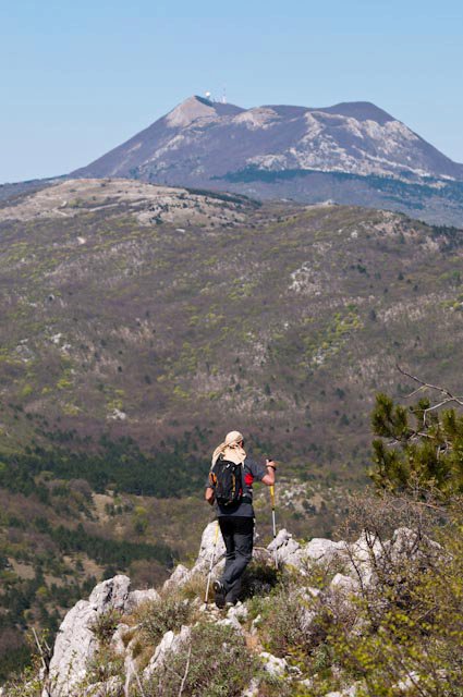
The route I usually take starts from Moščenička Draga. Along the coast, take the 750 steps to Moščenica, which overlooks Rijeka and Kvarner. From Moščenica, the road continues to Mala Učka. From Mala Učka, I head towards the beautiful Babin Grob lookout point, which houses a shelter and a lodge. Back from Mala Učka, sometimes I turn to Suhi Vrh.
I continue my journey to Vojak, the highest peak of Učka mountain, and therefore the whole Istrian peninsula. From there, there's a view of the whole of Istria, the islands, Risnjak, and Slovenian mountain peaks. The options are many but for me, this route is favorite!
For the latest travel info, bookmark our main travel info article, which is updated daily.
Read the Croatian Travel Update in your language - now available in 24 languages
Minister Says Istrian Y Motorway to Be Completed to Ucka Tunnel by 2021
ZAGREB, Aug 8, 2020 - Transport Minister Oleg Butkovic has said that the extension of the Istrian Y motorway concession agreement between Croatia and the company Bina-Istra until 2039 envisages €197 million worth of investments and that the motorway is expected to be completed to the Ucka tunnel by 2021.
The second tube to the Ucka tunnel and the full profile of the motorway should be completed by 2024, the minister said.
The concession agreement will be prolonged until 2039 even though we believe that the loans will be repaid somewhat sooner and the investment will be repaid by 2037, after which Croatia will become the owner of the motorway, Butkovic said.
This is the continuation of construction and investments in big infrastructure projects, notably transport, Butkovic said, stressing that currently around 25 billion kuna worth of investments, mostly financed with EU funds, was underway.
The European Commission on Friday approved, under EU State aid rules, Croatia's plan to prolong the Istrian Y motorway concession agreement with the company Bina-Istra. This will allow €197 million of new investments by the concession operator to go ahead while limiting distortions of competition, the EC said.
The EC said that the motorway is a 145 km long motorway linking the Istrian region with the rest of Croatia. The motorway is operated under a concession agreement from 1995, which was awarded to Bina-Istra until 2034.
The prolongation will allow Bina-Istra to finance the construction of a second carriageway (one more lane in each direction) between Vranja Interchange and the Ucka tunnel/Kvarner portal - an 8km stretch on the north-eastern side of the motorway.
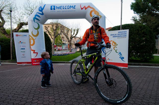
World's Biggest Welcome in Croatia: Day 5 - Labin to Opatija (Foot, Bike)
April 1, 2019 - Putting Croatian adventure tourism on the map, with the biggest welcome in the world. Day 5 of this incredible 2011 adrenaline trip covering 2,500 km along the Croatian coast.
The World's Biggest Welcome, an ambitious adventure tourism project in 2011 in Croatia enters Day 5 of this 2019 appreciation of one of the finest tourism promotion projects ever in Croatia.
The plan? To showcase the diversity and fabulous offer of adventure tourism in Croatia by following a GPS route the length of the Croatian coast in the shape of the word 'Welcome' - thereby creating the biggest welcome in the world from a hospitable tourism country.
Day 5 moved on foot and by bicycle from Labin to Opatija.
40 kilometres for the day: 10 km bicycle ride from Labin to Plomin, followed by 15 km on foot and cycling from Plomin to Učka, before heading north once more on the final part of the first letter (W of Welcome), with another 15 km of walking and cycling from Učka to Opatija.
This part of the journey began with an overnight stay in Nedeščina, at Villa Celeste.
Before arriving in the colorful Labin.
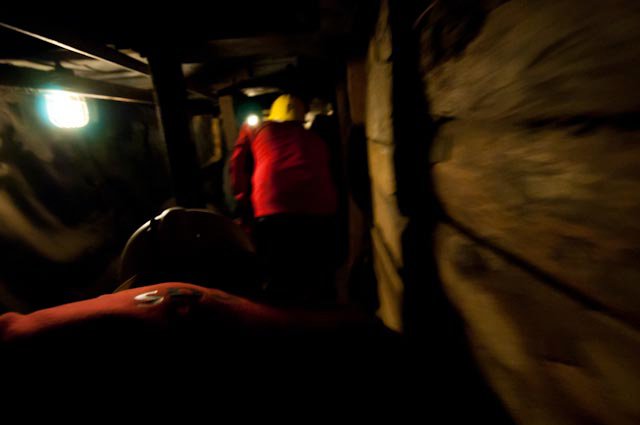
And adventuring through a mine there.
Labin in all of its glory.
And then onto Brseč, a small village on cliffs high above the Kvarner Gulf.
And into the stunning Učka Nature Park, made up of Mount Učka and part of the Ćićarija mountain range.
Daniel in action on the reefs in Učka.
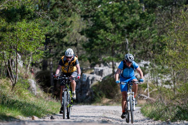
Ozren Renko and Daniel Lacko pedalling on demanding macadam in Učka.
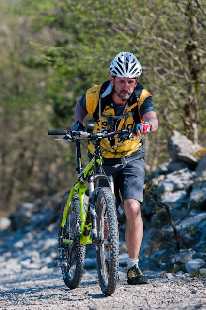
Daniel was even struggling a bit.
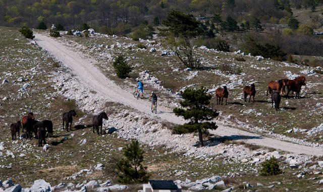
But then there were horses.
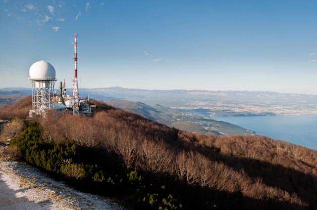
And a stunning view from Vojak.
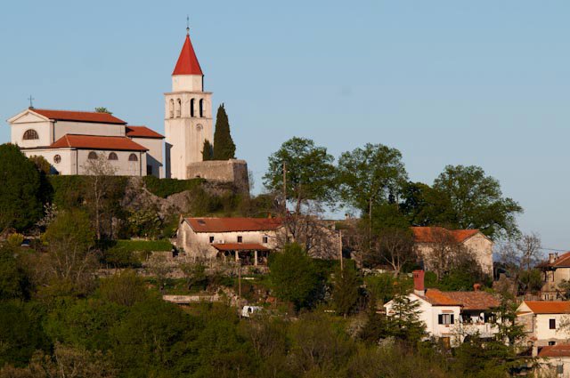
From Učka, they made their way to Veprinac, known to have the most beautiful view on Kvarner.
And finally arrived in Matulji, just five kilometers from the town of Opatija, before sundown.
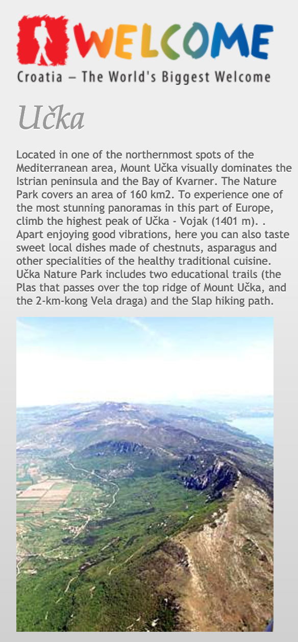
A key part of the project was promoting tourism, and the official website has details of the key places visited during the day. Učka.
You can see the entire project on the Welcome website, as well as much more of Luka Tambaca's stunning photography on the Welcome Facebook page.
Tune in tomorrow for Day 6, as Lacko moves from Opatija to Delnice by bike and on foot.
To follow the whole project from the start, follow the dedicated TCN page.
Učka Cable Car to Be Longest in Europe?
In the presence of the County Prefect Zlatko Komadina, the headquarters of Primorje-Gorski Kotar County hosted the signing ceremony for a contract for the drafting of the project for the construction of Učka cable car, reports Lokalni.hr on February 14, 2019.
The contract was signed by the CEO of the Učka Cable Car company Milorad Stanić, and CEO of the Dalekovod-Projekt company Davor Đurđević. Representatives of Opatija and Lovran also attended the ceremony.
“The time has come to sign this contract, which will create the preconditions for applying with the project for EU funds. I hope that the ministries will change the Competitiveness and Cohesion Operational Programme application so that that cable car projects could be submitted, which is currently not the case. What I want to say is that every dream and every idea can be realised if we have persistent people. The county has always welcomed and supported all projects that present our cultural and natural heritage,” said Komadina. “The Učka cable car is something that fits perfectly with our ideas, both in the tourist aspect and the environmental protection aspect.”
Stanić stressed the importance of the contract for the project implementation. “I am pleased that we have prepared this contract and signed it with Dalekovod – an experienced company that has fulfilled all of our requirements for this major project, especially since the project itself is technically very demanding.”
According to the planned technical characteristics and with the length of almost 4,700 metres, the Učka cable car would be the longest in Europe counting from the starting point to the final station, without any intermediate stations, with an exceptionally large distance between the first and the second pillar of up to 1.5 km, which is an extremely demanding feature.
“The 1500 metre distance will actually be a three-minute flight of future users at the height of over 100 metres, which will surely create a new tourist product and experience, which will further enable the rebranding of the whole Kvarner destination. We are confident that the cable car could become for the entire Primorje-Gorski Kotar County what is now Postojna for Slovenia or the Krka waterfalls for Šibenik-Knin County,” said Stanić.
The total value of the planning phase of the project is 2.5 million kuna. The deadline for the drafting of the plan and obtaining the building permit is 150 days, which means that the construction could be ready to be launched as early as this summer.
The Učka Cable Car company has 268 stakeholders, including two counties (Primorje-Gorski Kotar and Istria), nine local self-government units (towns of Opatija, Rijeka, Kastav, Krk and municipalities of Lovran, Matulji, Mošćenička Draga, Omišalj and Kršan), as well as 36 business entities, tourist agencies and hotels, and 220 individuals, mostly people from the Kvarner region who support the project.
Translated from Lokalni.hr.
More news about Primorje-Gorski Kotar County can be found in the Lifestyle section.
Demands for Abolition of Krk Bridge and Učka Tunnel Tolls Grow Louder
Citizens of Krk and Istria want the tolls to be discontinued.
Citizens Want Free Usage of Krk Bridge and Učka Tunnel
Citizens argue that if other bridges and tunnels are free, Krk bridge and Učka tunnel should be too,
Učka Company Impresses Europe With... Meat!
One family tradition has won over the hearts (and taste buds) of Europe.