An unexpected view of the history of the area that has now become part of Zagreb
I’ve recently come across a website that has kept me entertained for a while now, http://mapire.eu/en/. Mapire is the site created to enable the user to navigate historical maps of the Habsburg Empire, using state-of-the art technologies including Google Maps, Google Earth and OpenStreetMap. The main goal of the site is to create an international collaboration to make this content available to the world in a common interface using latest GIS features.
And, obviously, you can find Zagreb and other parts Croatia on those maps as well, not just on one, but on various versions, since Croatia has been part of Austro-Hungarian Empire during the period when these maps were created. The maps where you can see the development of Zagreb are the military surveys, the first one performed in the years 1764-1784, the second one later, 1806-1869 and the third one 1869-1887. The first two are in the scale of 1 to 28.800 and cover the entire Habsburg Empire. This magnificent archival content is world-wide unique in sense of antiqueness, resolution and artistic implementation. The 1:25.000 scale map sheets of the third military survey cover the territory of the Hungarian Kingdom while the ones scaled 1 to 75.000 cover all the empire. Also, there are cadastral maps of all of the territories of the Empire in 19th century, is done on a unified scale of 1:2.880 and is still a work in progress, as it is being updated with Hungarian and Croatian archival map sheets.
For the purposes of this article, we looked at some of those maps for you, to see what we can find of interest.
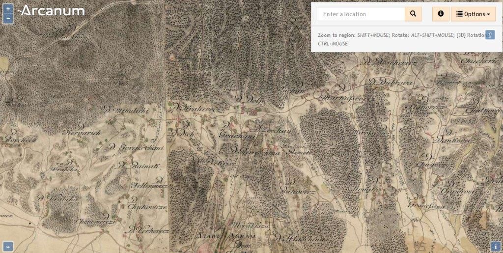
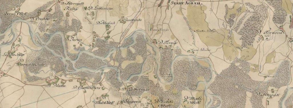
First we went as far as back in time as possible, almost 250 years back, to the time of the First military survey, and the map shows a very, very small region called “Stadt Agram”, a lot of forrest and suburbs around it, although some names of those suburbs do ring a bell: we have Bukovecz, Dubrava, Markuschevecz, D. Hlaschina, Grachani, Chernomereczi, Vrabcha, Mikuliczi, and finally Bainak on the map. Bainak is quite interesting, because there isn’t really a neighbourhood that’s called that today, however, there’s one called “Bijenik” right where Bainak is drawn to be in that first survey. Also, a weird thing about Zagreb is that there is a street called Bijenik and another one, called Bijenička (yes, it does cause confusion, as they are really not close to one another!), which I’ve always found odd: until now, but more on that later. Another interesting part of Zagreb to take a look at is around Sava River, which is of course meandering much more 250 years ago then it is now, and there isn’t much there except for some probably swamp-like green areas on the map, however, we see names such as Ternije, Remetniecze, Jarun (no lake, though!), Ternova, Sitniak, and Blatto (all neighbourhoods in contemporary Zagreb, and all located quite close to where today’s neighbourhoods are).
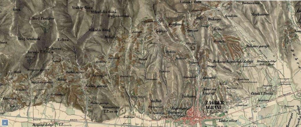
Moving on to Second military survey, a lot has changed, the maps seems somehow more “ordered”, names are much more “Croatian”, so we have Šestine, Vrabče, Markuševec, Tuškanac, Lukšići, Perjavica, Sv. Duh, and aforementioned Bienik is where it should be – but watch out, there’s another one! Written in small letters, between Laščina and Mirogoj, right where today’s Bijenička Street is located! So, obviously, there were two hills called the same at some point, which partially explains the situation today with two almost identically named streets. Another curious thing is that there is a hill called Rebro, which is also what one of the major hospitals in Zagreb is called now – but that hill on the map is nowhere near the location of the hospital today! One is due east from the main square, and the other is due west, and I have no explanation for that.
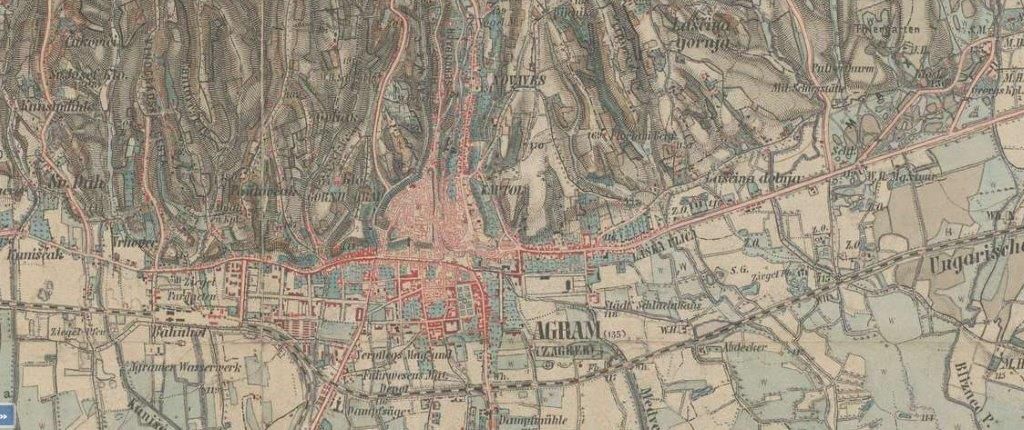
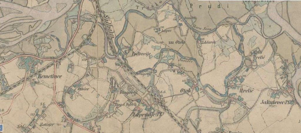
The third military survey is even more ordered, no major changes have happened except for the fact that the city has spread towards the south, and parts of the city which we call “Donji grad” today are already built. Changes are also happening around the Sava River, so we have Hrelić, Otok, Jakuševec, Botinec, Remetince and Zaprudje listed on the map, although Zaprudje is another one of those places that has moved quite a bit from the end of 19th century to what we know today.
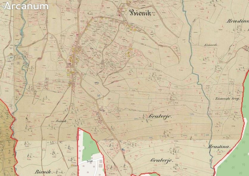
You can also browse the cadastral maps, although much of Zagreb has not been fully entered into the system yet, and overlay the maps of the 19th century situation with today’s maps, to see the differences of the ownership over the land, changing the opacity of the historical map to show you exactly where the plots were in the history as compared to where the various buildings, roads and other infrastructure is today.
You can have just as much fun looking into the history of any other part of Croatia covered in these maps!