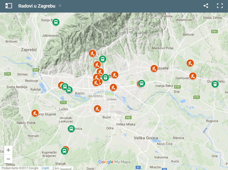
A student from Zagreb came up with a very useful map for everyone driving and using public transport in Zagreb these days.
Unlike the coast, where roadworks mostly happen before summer and in winter, all the works in Zagreb happen during summer. It’s hard to keep track of which roads are open and which aren’t, so a student from Zagreb’s Faculty of Transport and Traffic Sciences designed a map showing you areas closed off due to roadworks in real time, Večernji reports on July 26.
“The map is updated daily, using data from the Internet, from the official websites of the City of Zagreb, HAK (Croatia Traffic Info) and ZET. The map is mobile friendly, and, in addition to roadworks, it shows information on public transport changes. It was created in Google maps, so I’m very happy I was able to use something that has been free for quite some time now to help people,” Marin Dokoza explains, adding that you can access the map on student portal prom.com.hr.
Orange dots on the map show streets which are closed off due to traffic works, and clicking on them gives you more detailed information on the duration and temporary traffic regulation. Green dots give you information about public transport changes.
Screenshot
“I got the idea when I was doing an internship in Barcelona and my colleagues showed me all the various options Google Maps offered,” Marin says. He made his idea come true two weeks ago.
The map has got 4,000 views so far and Marin’s idea got great reviews from users. According to him, the lack of coordination among tram, railway, and bus transport is the City’s main issue and the main reason why most traffic jams occur.
“When people get off from work at 5 p.m., works at all construction sites come to a halt as well. I think that there should be shifts, so the job gets done sooner,” Marin concludes.
Translation from the original at Večernji.hr.


